July 3 – 8, 2018
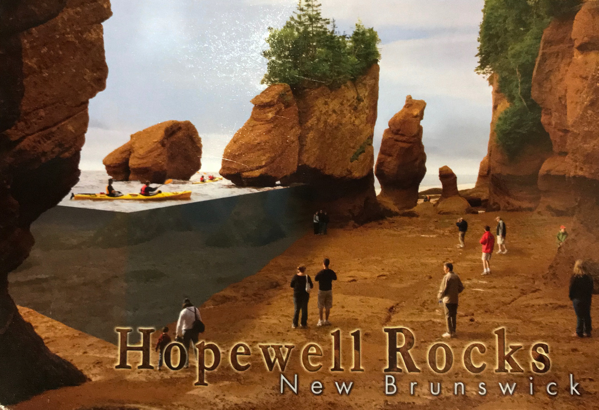
You may have guessed from the preceding post that our next destination was the area that experiences the largest tidal changes in the world, the Bay of Fundy. The height of the tides range from 11 feet along the southwest shore of Nova Scotia and steadily increase to the head of the bay where, in Minas Basin, the tidal change can reach 53 feet.
We left Quebec City early (for us) for the eight hour drive to Moncton. As we left Quebec province and entered New Brunswick province, we were glad to see the road signs change from French only to French and English. No more guesswork required. We later learned that New Brunswick is Canada’s only officially bi-lingual province.
Stonehurst Trailer Park and Golf Course
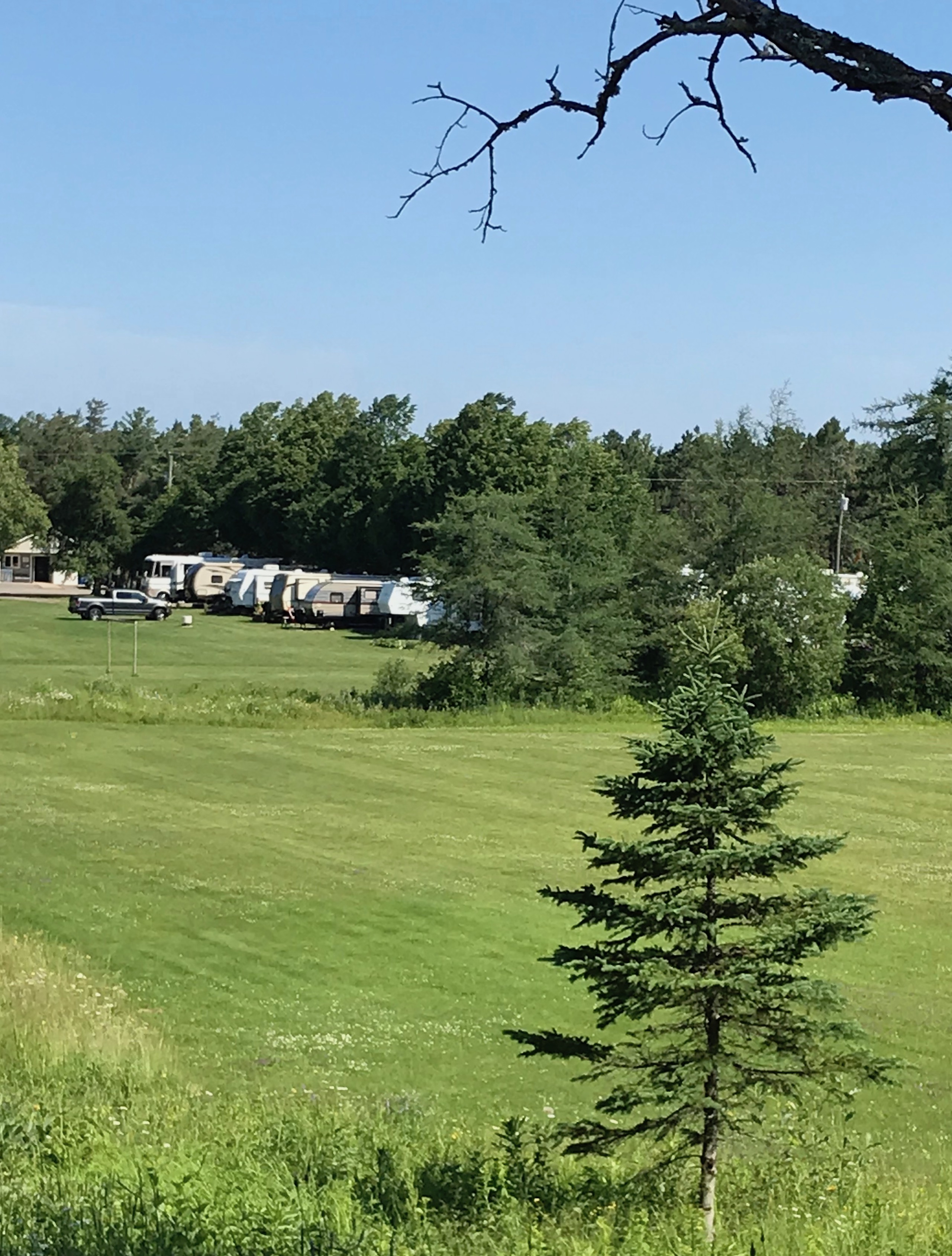
Our campground here was Stonehurst Trailer Park and Golf Course in Barry Mills. We were a bit worried as we drove into the campground as the narrow downhill road cut through a heavily wooded section where we saw only tent and small camper sites. Was our big rig going to fit here? Then, at the bottom of the hill the woods opened up into a grassy area with spacious campsites. One of the office workers met us near the office and directed us to our pull-thru site. We quickly set up camp and called it a night. Although just off Highway 2, the campground was very peaceful.
The Bay of Fundy
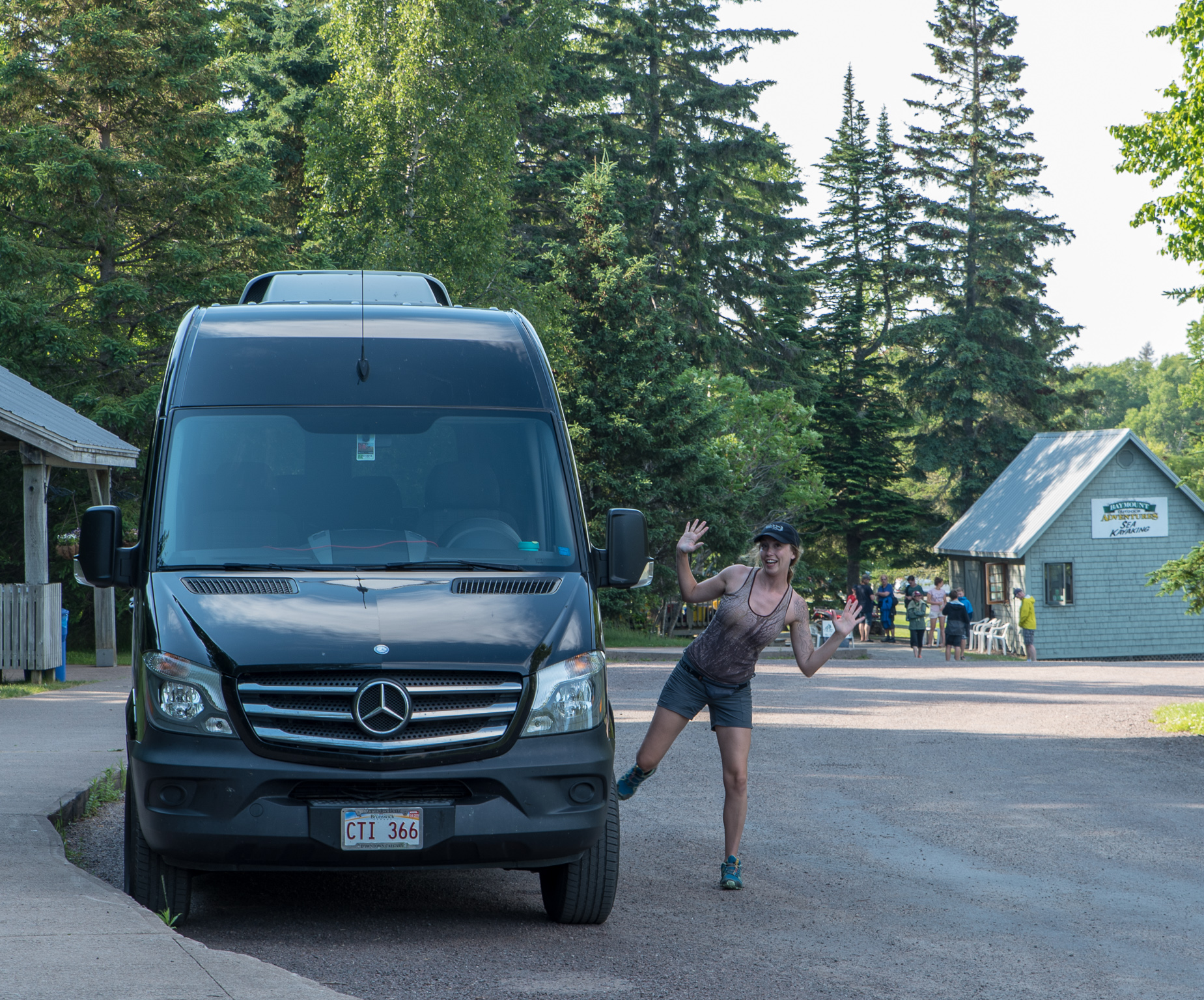
So, what’s the best way to experience the massive tides in the Bay of Fundy? For us, the answer was to take a tour. We chose the Hopewell Rocks and Bay of Fundy Tour with Roads to Sea Guided Tours. This was a small group (total of nine that day) guided tour in an eleven passenger Mercedes touring van. We met our guide, Margot, at a hotel in Moncton at 10 a.m.
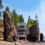
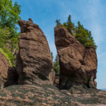
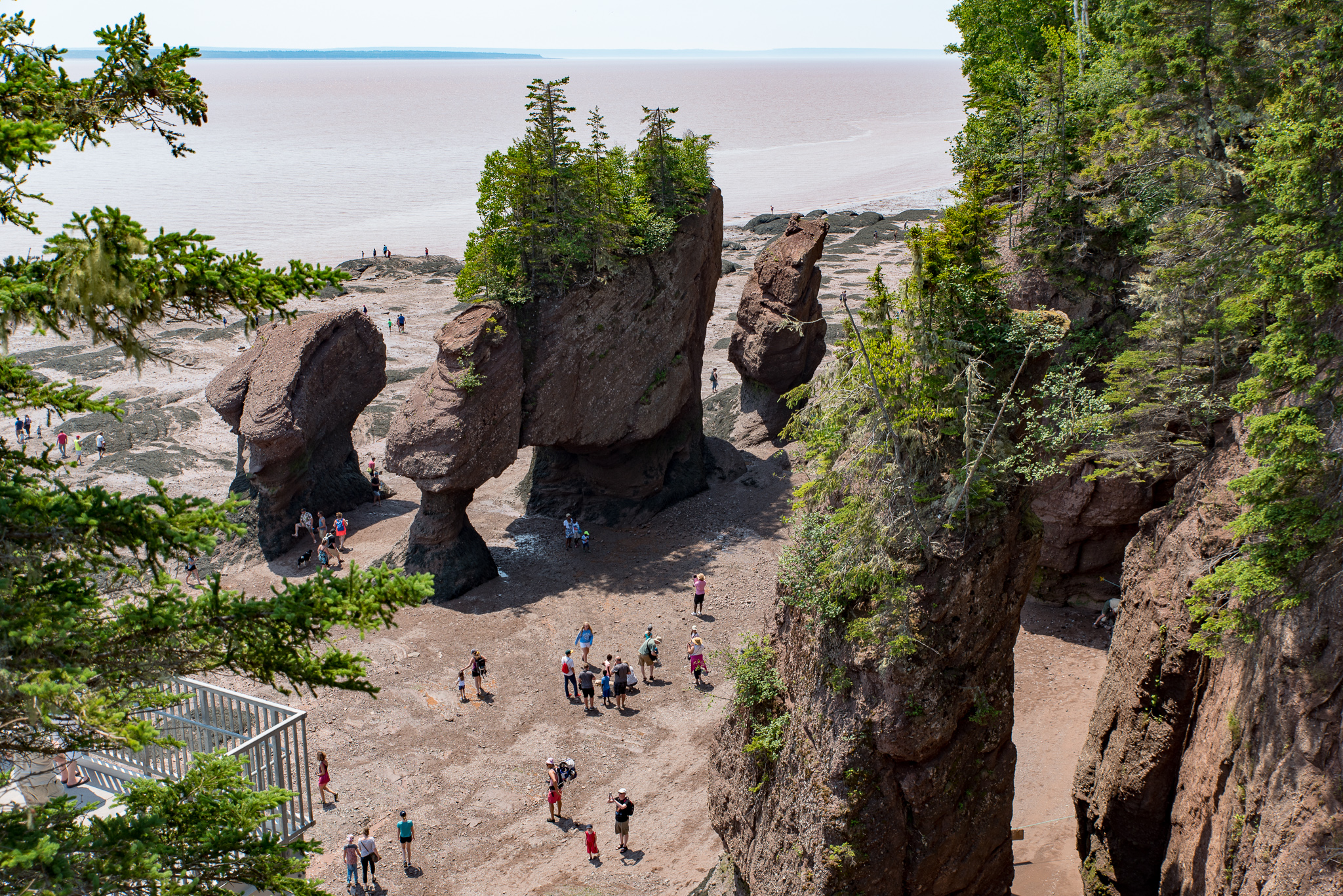
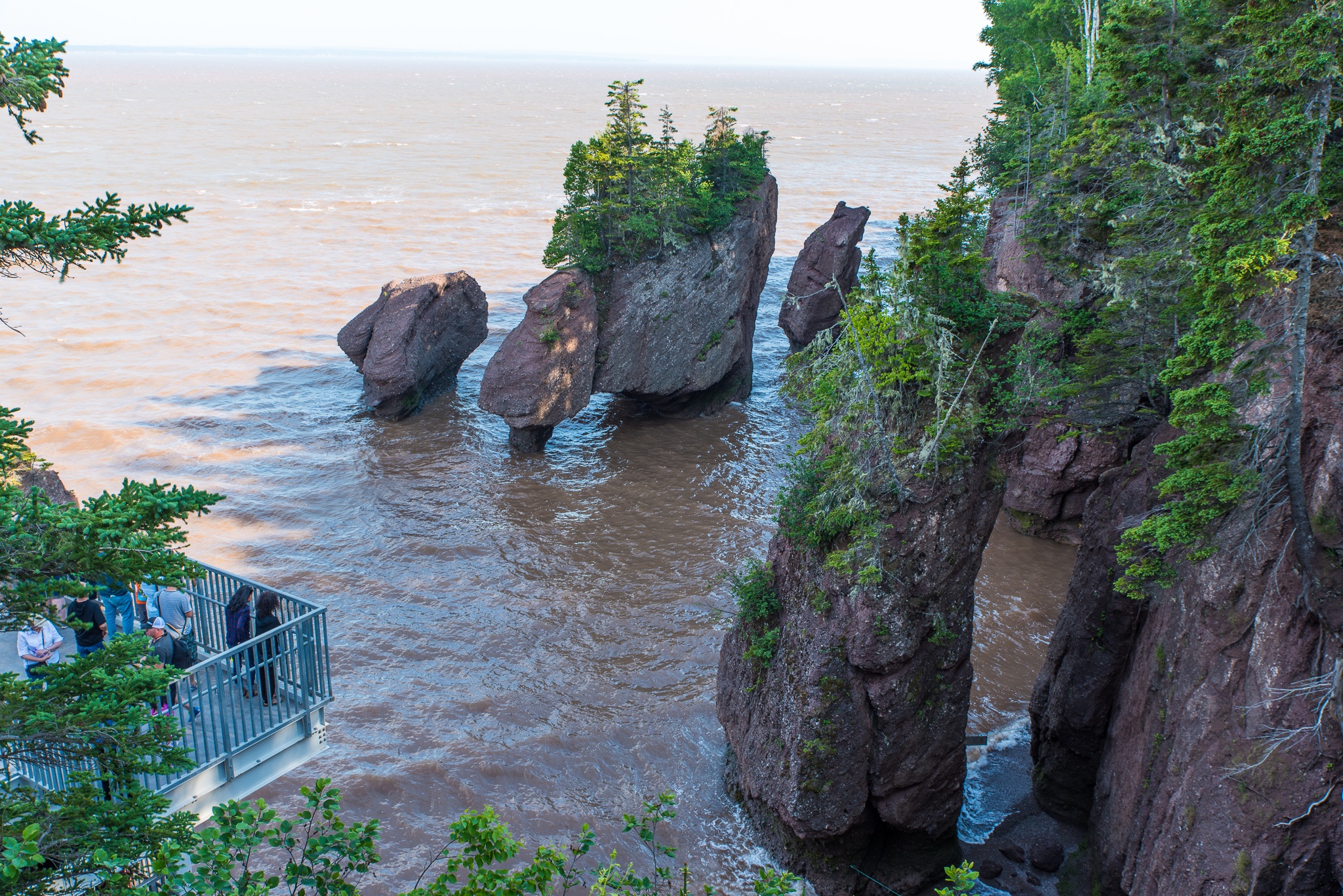
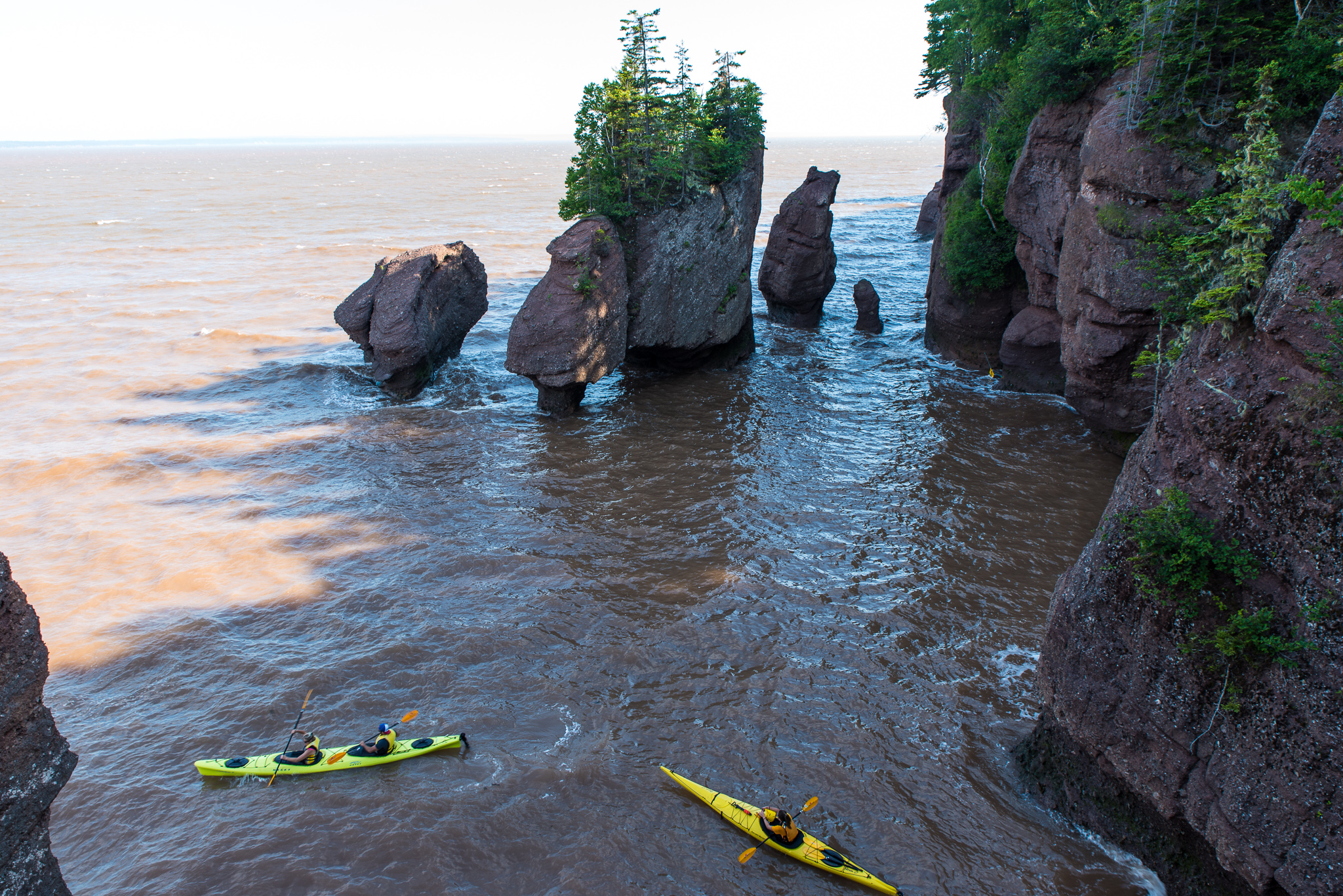
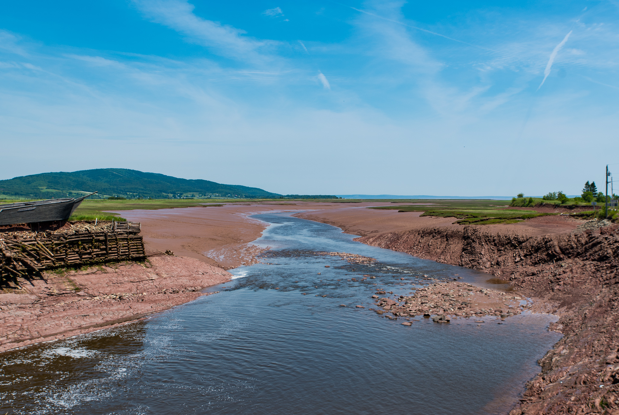
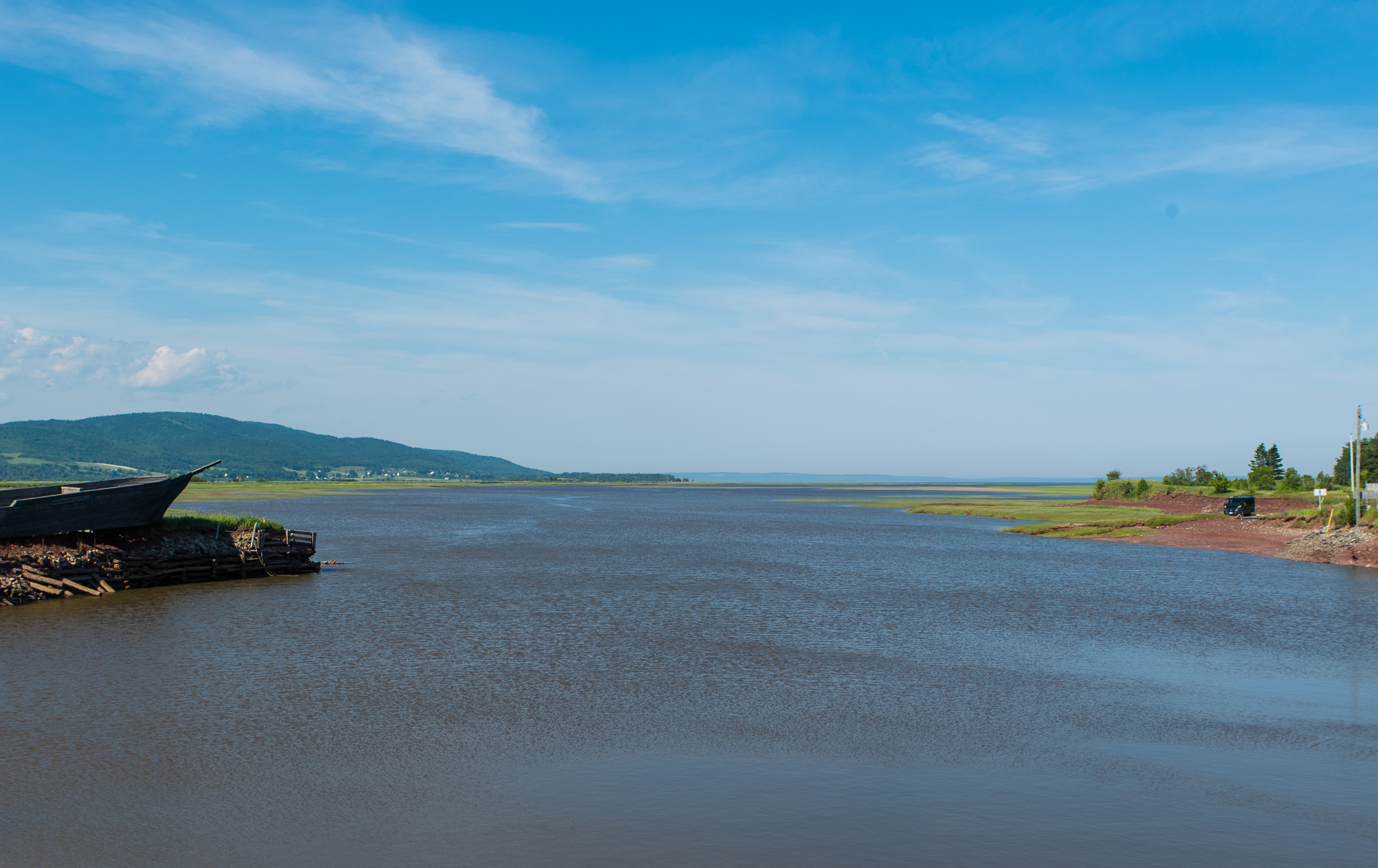
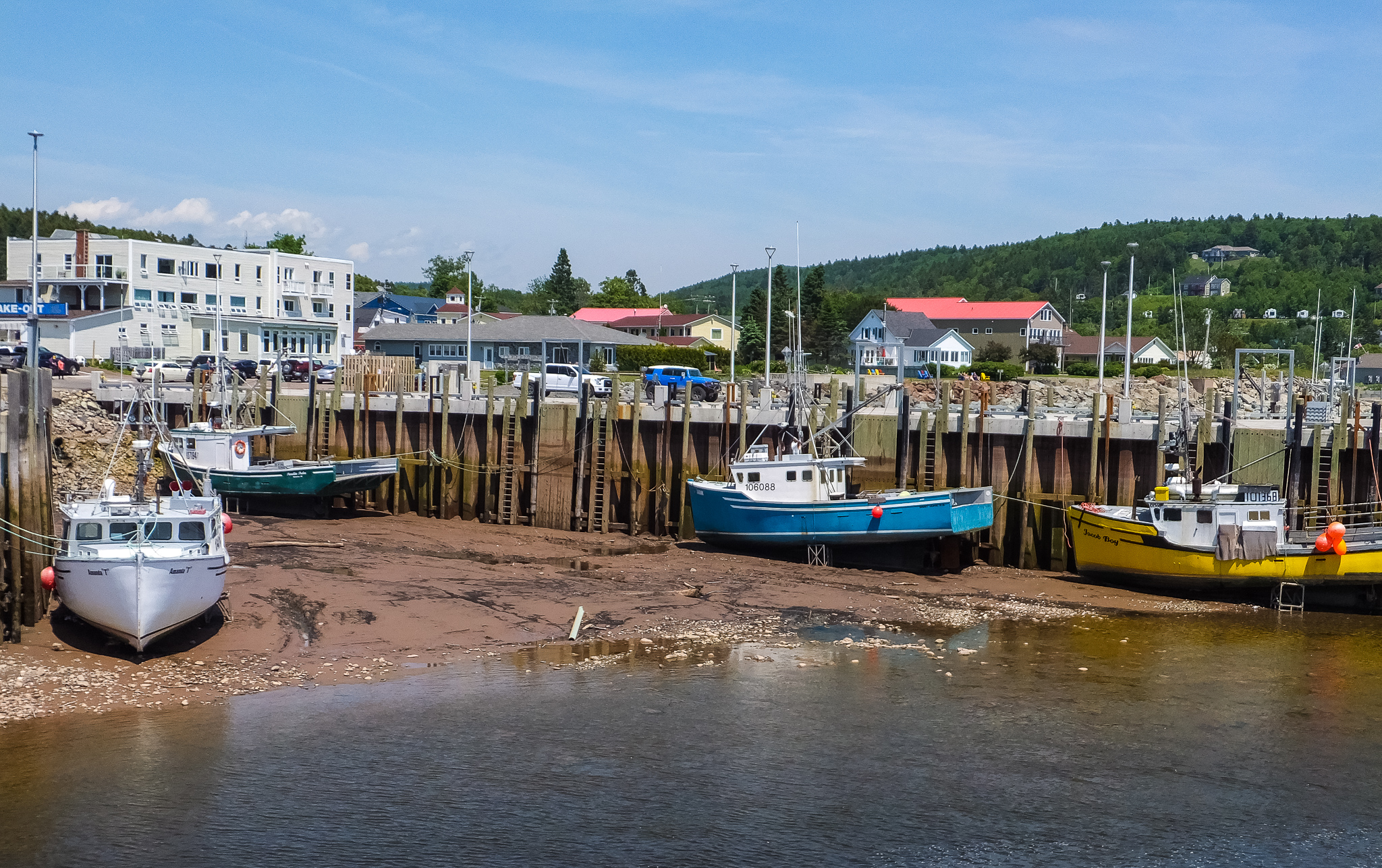
As soon as everyone was aboard, we set off for the Hopewell Rocks and our low-tide walk on the floor of the ocean. It was fascinating to check out the towering rocks, caves, and beach knowing that in a few hours the area would be underwater with a tidal difference of 36.4 feet.
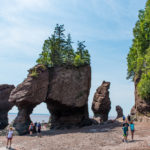
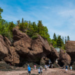
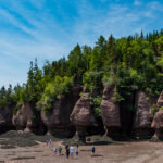
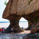
Here are some low versus high tide photos.
After our allotted time at the rocks, we headed for the Harvey Shipyard to witness the tidal difference there.
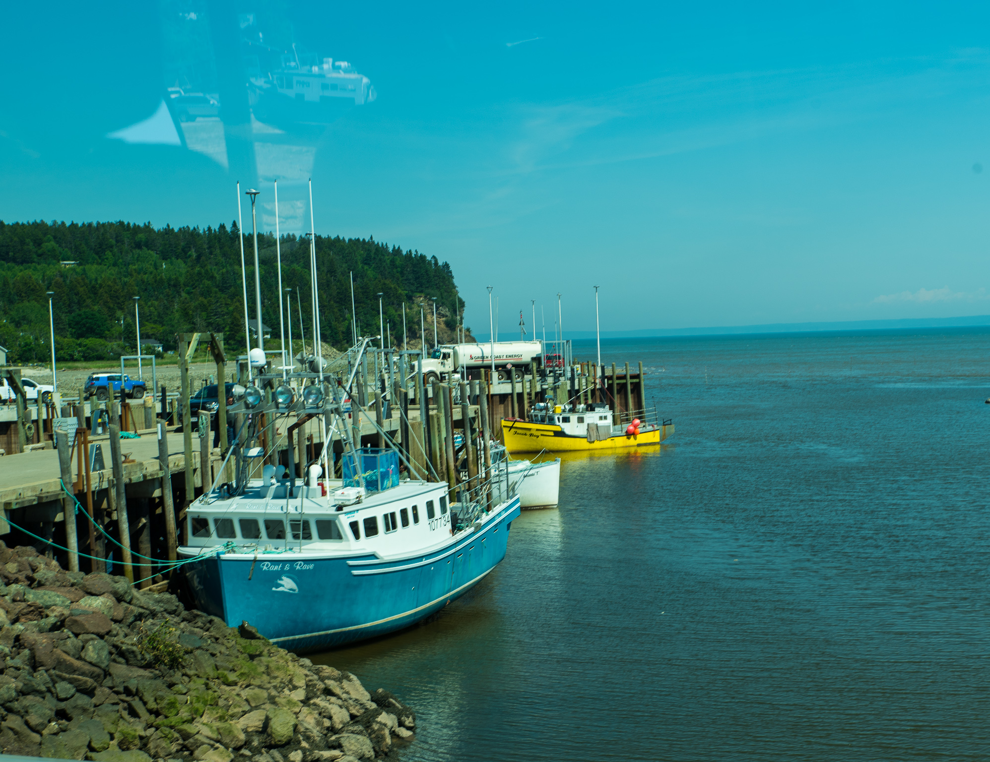
From the shipyard we continued on to Alma, where we had a look at the boats at the wharf and lunched as a group at the Harbor View Restaurant. Margot had called in our orders ahead of our arrival so we were quickly served.
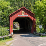
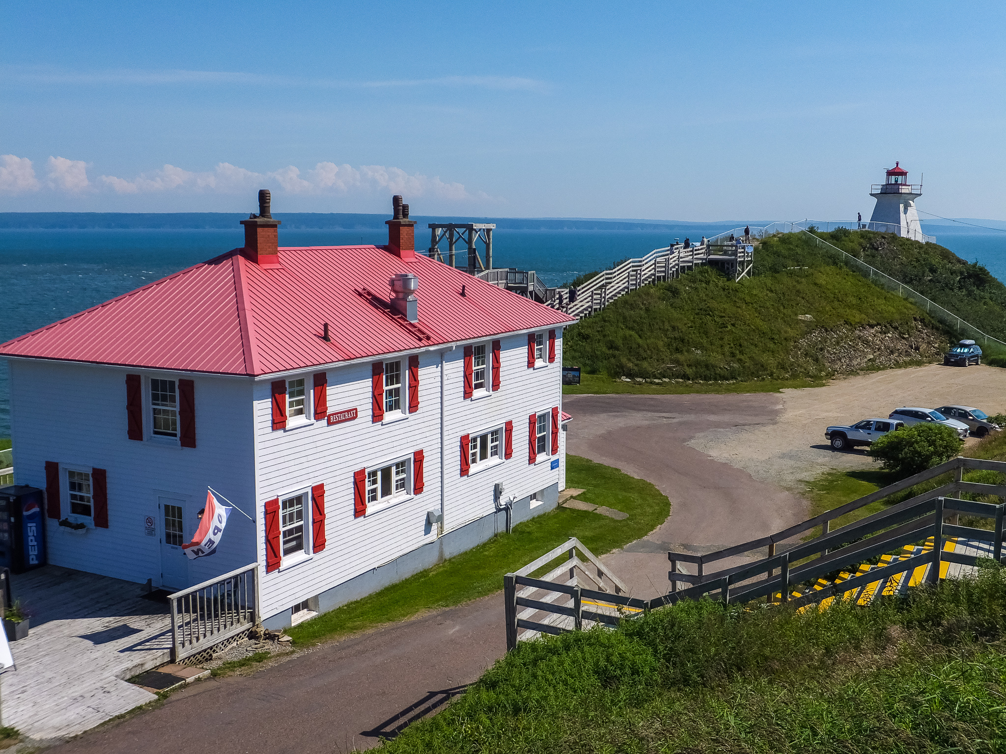
On our return trip, we stopped for some photos at one of New Brunswick’s many picturesque covered bridges and then continued on to Cape Enrage.
The length of the tour was nine hours during which time we not only became “Low and High Tide Same Day Certified”, we learned a lot about the history of the area. Our guide told us how the area was first settled by the French and then passed to the British after 1713. Tensions between the French and British grew until 1755 when Charles Lawrence, the Lieutenant-Governor of Nova Scotia (which included New Brunswick at the time) issued a decree to the French Acadians.
The decree stated in part:
“That your Land & Tennements, Cattle of all Kinds and Livestocks of all Sorts are forfeited to the Crown with all other your effects Savings your money and Household Goods, and you yourselves to be removed from this Province.”
Between 1755 and 1763, approximately 10,000 Acadians were deported. They were shipped to many points around the Atlantic. Large numbers were landed in the English colonies, others in France or the Caribbean. Thousands died of disease or starvation in the squalid conditions on board ship.
When the Acadians were finally allowed to return after 1764, they settled far from their old homes, in St Mary’s Bay, Chéticamp, Cape Breton, Prince Edward Island and the north and east of present-day New Brunswick.
Margot told us that the area around Moncton was divided by the river into predominately British descendants to the north and French Acadian descendants to the south. She was of both British (through her mother) and French (through her father) descent and although they lived north of the river, she and her brother had been sent to the French speaking school on the other side.
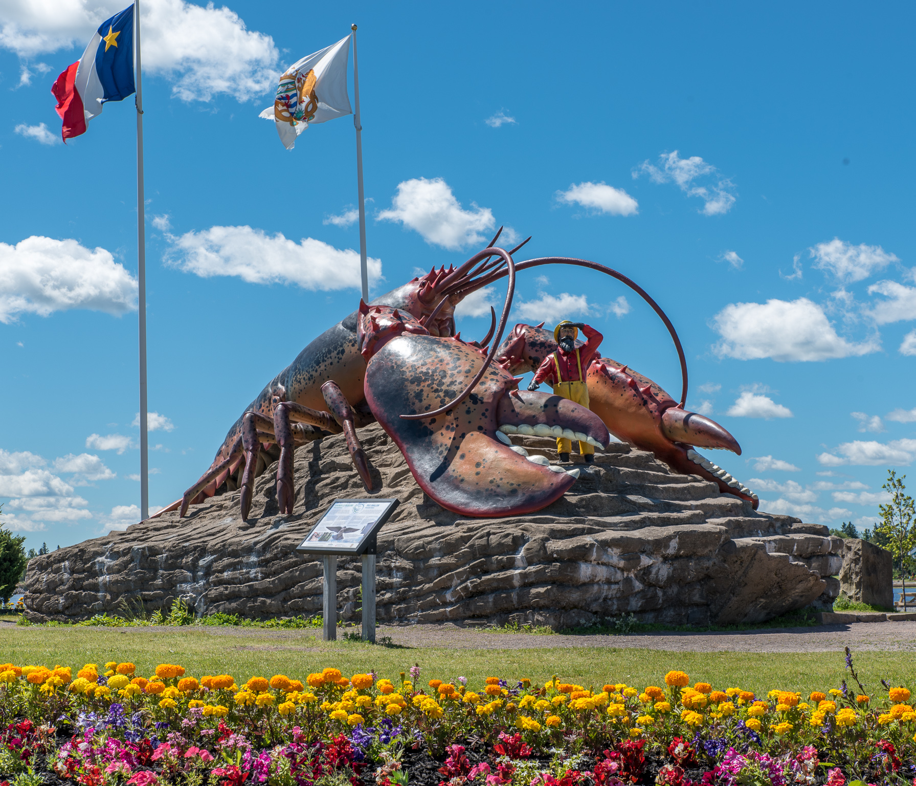
Largest Lobster in the World
One day we decided to explore Shediac – about 30 kilometers northeast of Moncton. The town was celebrating their Lobster Festival and we were curious. We stopped at the visitor center on the way in for information and couldn’t resist taking a photo of the giant lobster – the largest in the world they claim.
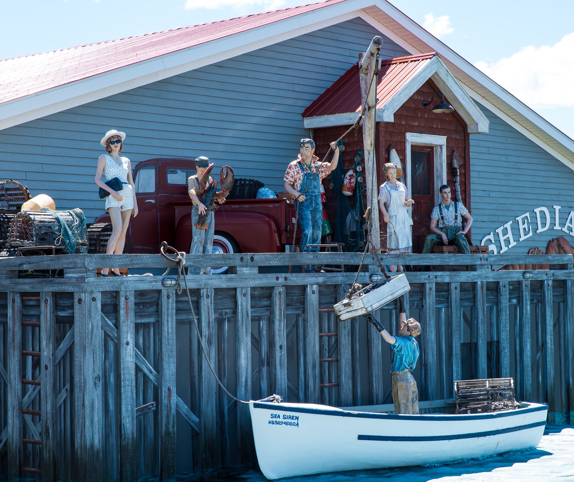
As it turned out, we were able to leave the truck at the visitor center and walk into town. We passed the Shediac Lobster Shop which has an interesting display on the side of the building but otherwise didn’t find much in town to draw us in.
We did find the location of the Lobster Festival and debated about entering but, after talking to a woman from the area, decided to bypass. It sounded more like a county fair with a small midway filled with rides for the kids and some food vendors but not much else (unless you really like lobster rolls).
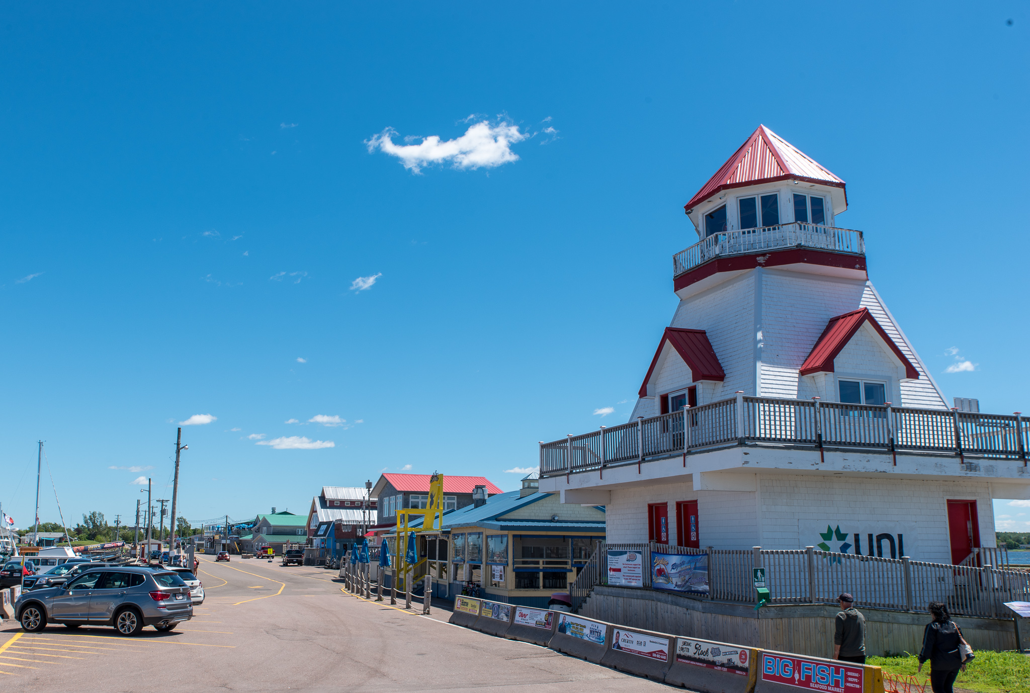
Leaving Shediac we drove out to Pointe-du-Chêne wharf where we found a few interesting shops and then had lunch on the deck at Captain Dan’s.
As you can tell, we’ve had a great time in the Moncton area but it’s time to move on. Next up – red cliffs and green gables. Care to guess?