July 16 – 26, 2018
What is the Cabot Trail?
The Cabot Trail is a 300 kilometer loop that winds through beautiful landscapes along the Margaree River and through the highlands of the Cape Breton Highlands National Park. Completed in 1932, it connects previously isolated communities including Acadian, Irish, and Scottish settlements.
The history of the Cabot Trail is a long and interesting one. The trail was named after Italian explorer John Cabot (Giovanni Caboto) who reached our shores in 1497, sailing on a mission for King Henry VII of England. The name also celebrates the meeting of Cabot and the Mi’kmaq people, the original inhabitants of Cape Breton Island, at Aspy Bay over 500 years ago. — cabottrail.travel
Exploring the Cabot Trail
We had been here five years ago on an 8 hour shore excursion from Sydney in early June. It was a dark and rainy day and consequently we didn’t see much. We’ve been planning to come back ever since. So, while camping in Baddeck, we took several days to drive different segments of the loop.
Chéticamp
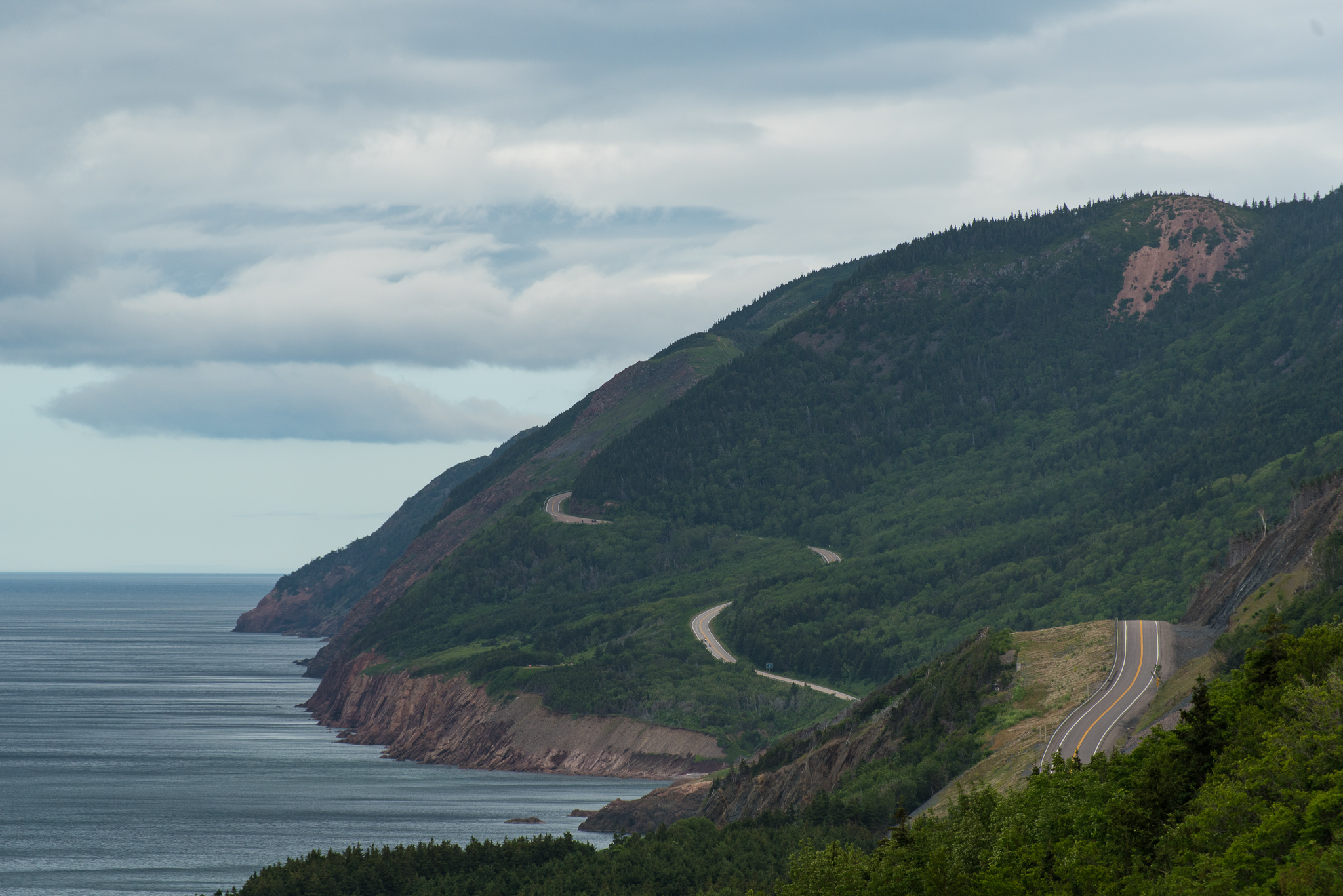
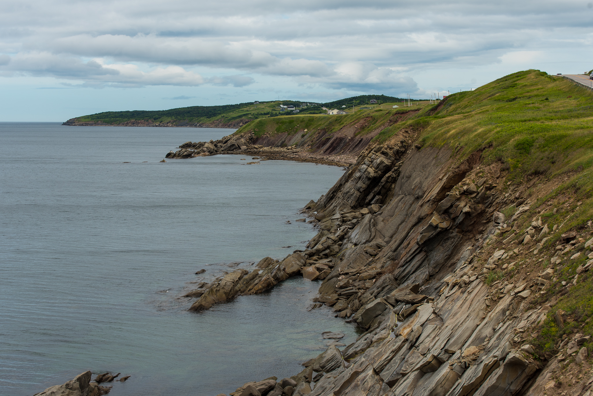
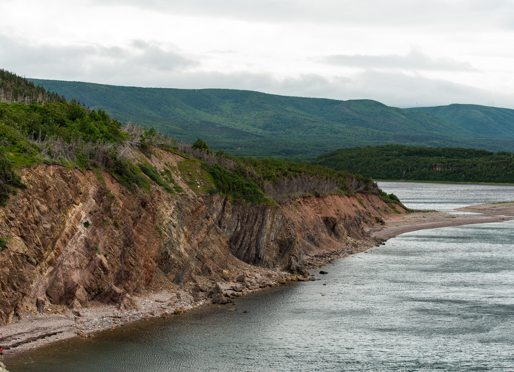
Our first day’s drive was from Baddeck to Chéticamp via Northeast Margaree where we took a small detour through the Margaree Valley.
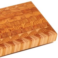
Our detour took us past the Larch Wood Canada workshop in East Margaree and, after rejoining the Cabot Trail, the Larch Wood kiosk in Margaree Harbor. Curious, we just had to stop. Here we were introduced to East Canadian Larch and end grain cutting boards. We didn’t buy one on this segment, but we did on a later segment. (Every great cook – Bill – should have a good cutting board.)
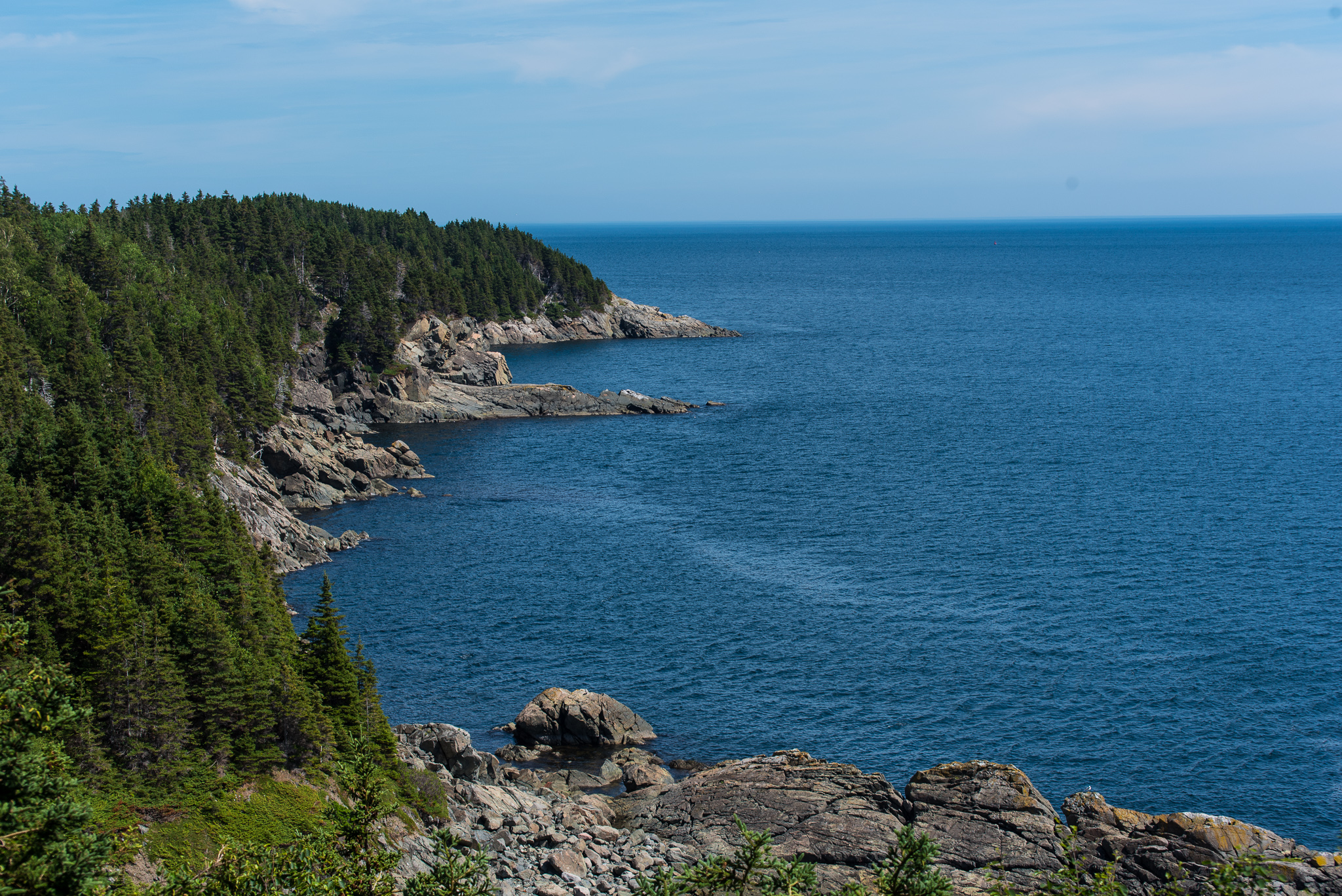
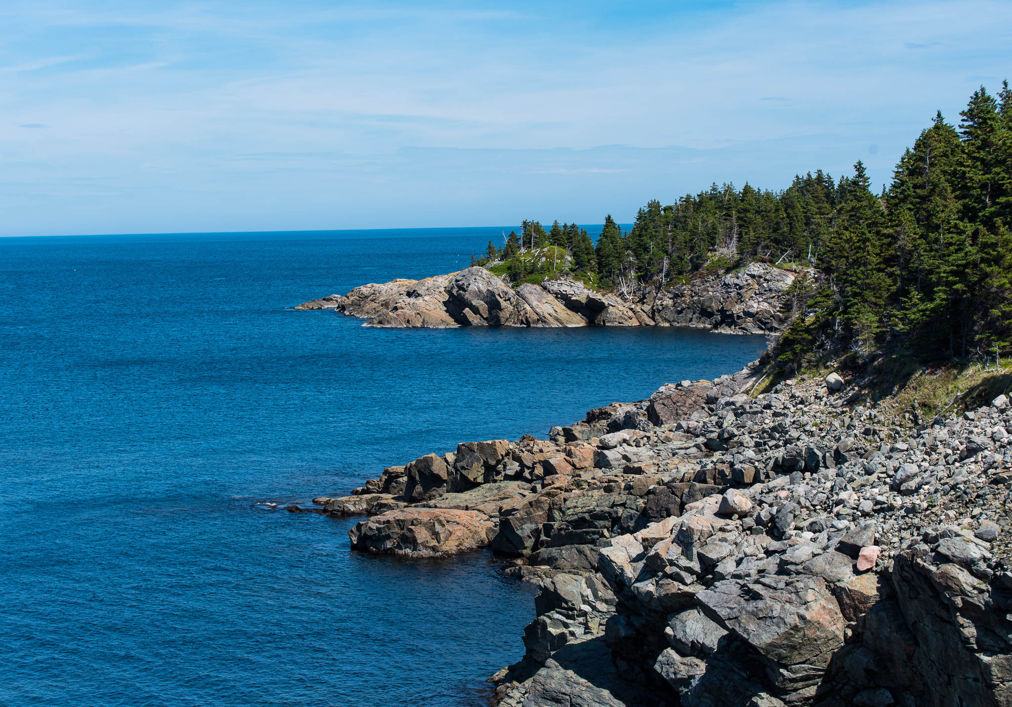
We enjoyed some marvelous views on our way to Margaree Harbor.
After Margaree Harbor, we continued to Grand Etang where we stopped at the Centre de la Mi-Carême to learn about the masks.
The essence of the carnival-like Mi-Carême is a spirit of joy, laughter and mockery that contrasts with the Lenten period of austerity, severity and penance leading up to Easter. Lent begins the day after Ash Wednesday and ends the day before Easter. Mi-Carême literally means the middle of Lent.
The Mi-Carême tradition crossed the Atlantic Ocean with the first French-speaking settlers to the New World.
During Mi-Carême many people, called les mi-carêmes, disguised from head to toe, visit their neighbours, who try to guess their identity. When the guessing game is over, the mi-carêmes unmask and enjoy a treat before heading to their next destination where the game begins again.
Although once practised in all Acadian communities, it is only still celebrated in the Acadian communities of Saint-Joseph-du-Moine, Magré and Chéticamp. — micareme.ca


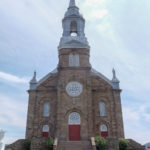
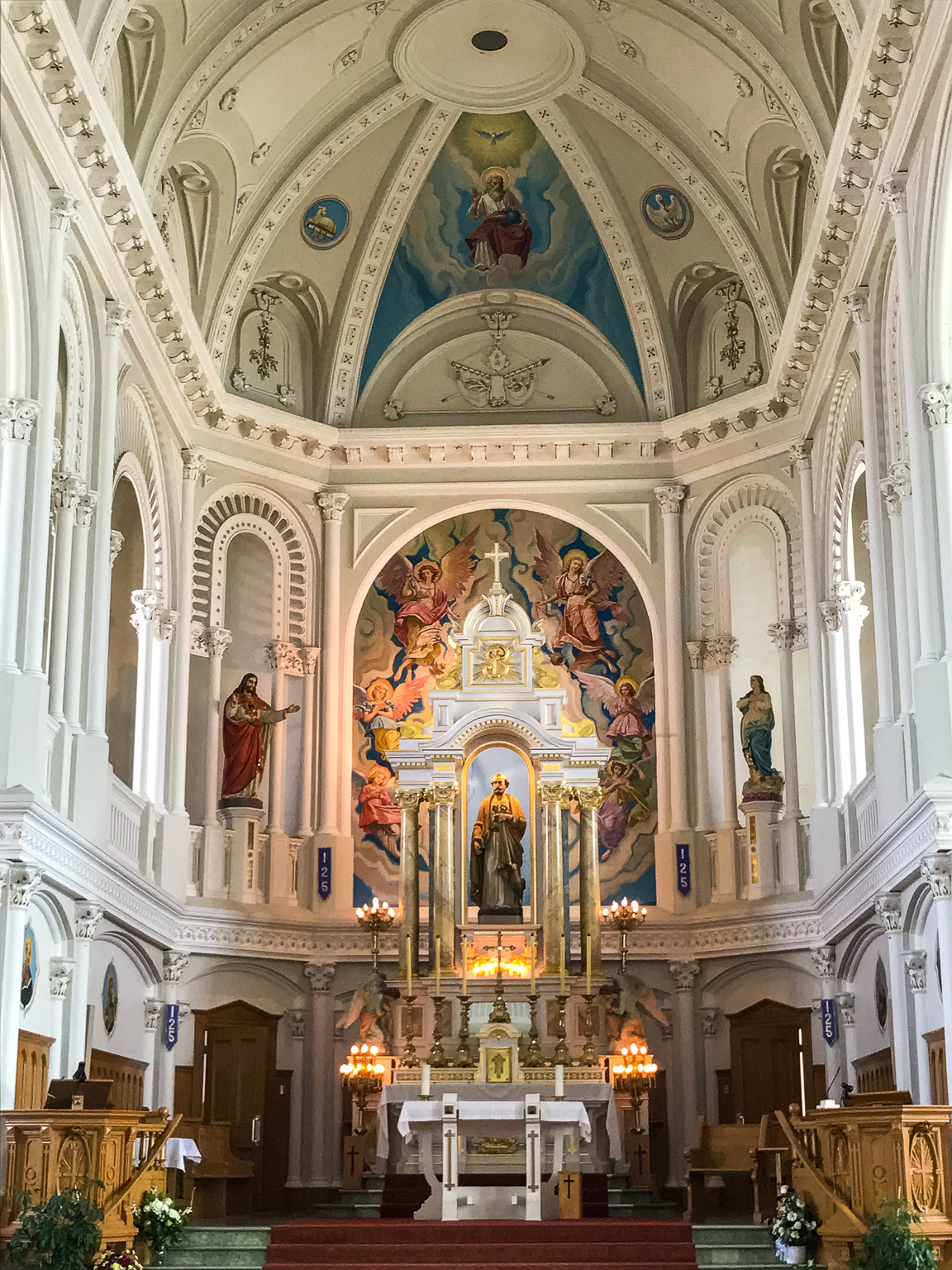
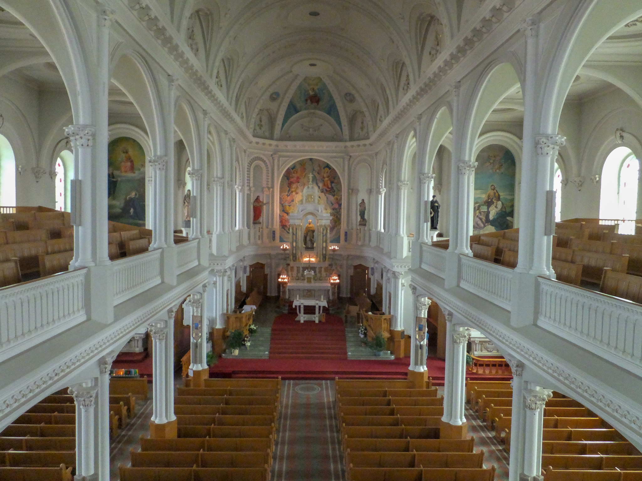
We finally reached Chéticamp where we stopped to admire the architecture of Paroisse Saint-Pierre (St. Peter’s Church).
Built in 1893, it was designed by David Ouellet (1844-1915), a Quebec City architect. Joseph-Hubert Morin, a contractor from Trois-Pistoles and the other tradesmen (including Jean Belzile et Fils) who worked on the church, were all from Quebec. With its tall silver spire and steeply pitched roof, it resembles many other Catholic churches built along the St. Lawrence River in Quebec.
The interior of the church is the most impressive aspect of architect Ouellet’s design. The barrel-vaulted nave with its two aisles and upper gallery leads the eye straight towards the main altar in the eastern apse. The ornate altar, built in 1912, has a Baroque-style baldacchino over the tabernacle. Two rows of nave piers with multiple Corinthian columns support an upper gallery and stop just one bay short of the chancel skilfully introducing the effect of a transept into the rectangular plan. The vault and ceilings, decorated with plasterwork and gold leaf, were completed by 1900. — historicplaces.ca

Pleasant Bay
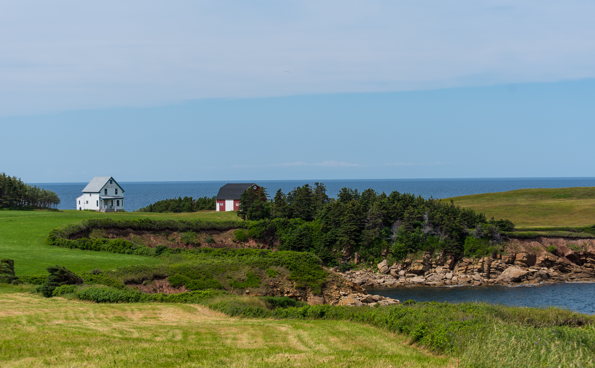
Our next segment of the trail was to explore from Chéticamp to Pleasant Bay. The weather for this day’s segment was very windy with clouds and rain – not conducive to photography at all. We stopped for a late lunch at the Rusty Anchor in Pleasant Bay before attempting to find Captain Mark’s Whale and Seal Cruise. We had reservations on the 4:00 p.m. whale watching tour. After a couple of wrong turns we found the appropriate marina only to discover that Captain Mark’s kiosk was closed. On the kiosk was a sign stating that all boat tours had been cancelled. They had left a message on Bill’s cellphone but since coverage is spotty (actually verging more on nonexistent) on the trail we didn’t receive it in time. Bummer – Cape Breton is one of the best spots for whale watching.
Our original plan was to continue from Pleasant Bay to the top of the island but due to the time and distance we decided against it. Instead we continued on the trail until South Harbor where we took a side road to Neil’s Harbor by way of White Point. We rejoined the Cabot Trail in Neil’s Harbor and continued back to the campground.
Ingonish
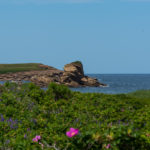
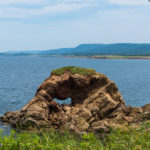
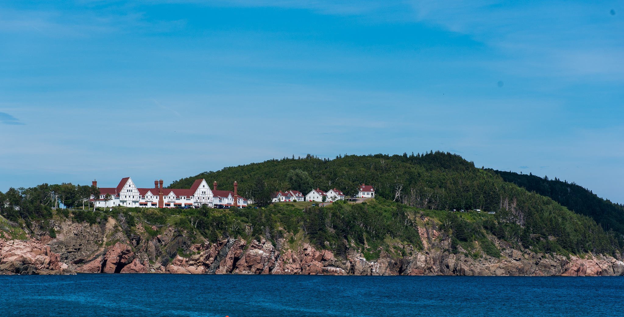
Our final day’s drive was along the eastern side of Cape Breton to Ingonish where we stopped at the Keltic Lodge (built by rubber industrialist Henry Clay Corson of Akron, Ohio) to walk the Middle Head Trail.
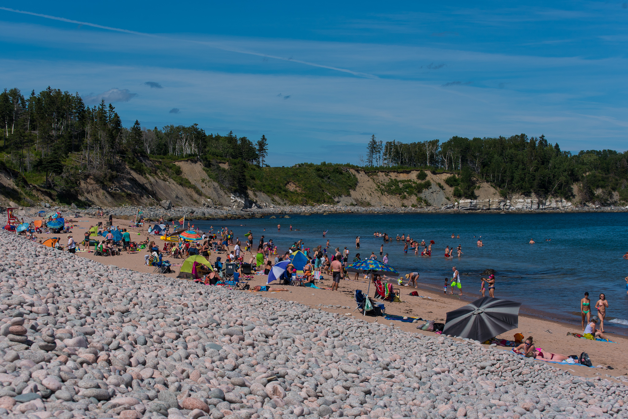
Just south of the Middle Head Peninsula is Ingonish Beach where we stopped to take some photos of the Keltic Lodge. The beach offers a choice of salt water or fresh water swimming – how’s that for convenience?
Wow – we did it – drove the entire Cabot Trail. It’s a long drive broken up over 3 days but definitely worth it.
Beyond Baddeck
The Canadian portion of our summer is almost complete. There’s only one more location on our plan which I’ll tell you about in the next post. Stay tuned.