August 2 – 17, 2018
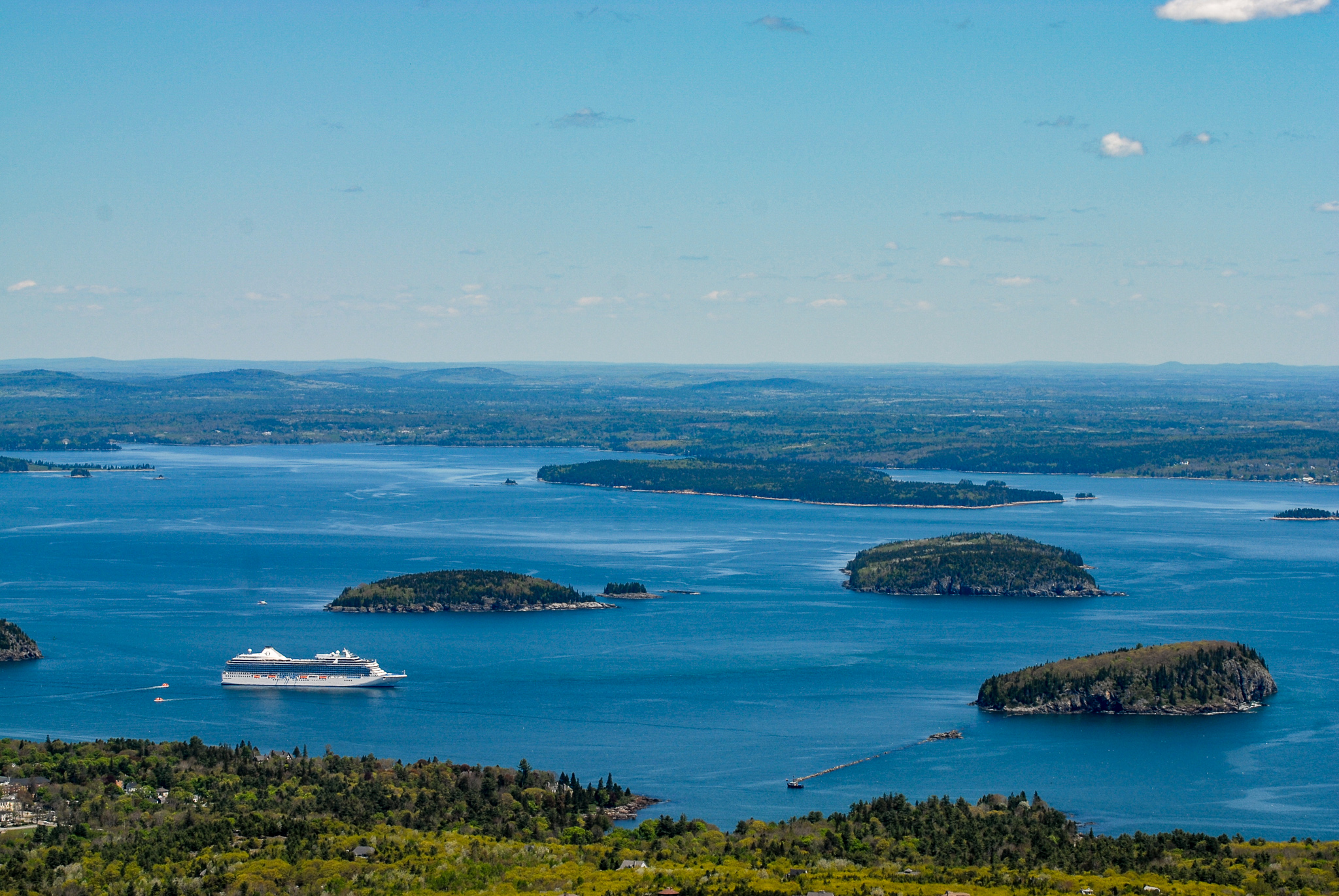
Mount Desert Island in Maine owes its name to French Explorer Samuel de Champlain, who reflected on the island’s treeless mountain summits and named it “Ile de Monts Deserts,” which means “island of the bare mountains”. Cadillac Mountain at 1,532 feet is the island’s highest point and the first place on the continental US to greet the sunrise.
Mount Desert Island is the sixth-largest island in the contiguous United States, and the third-largest on the Eastern Seaboard. It is home to Acadia National Park and several small towns including Bar Harbor, Northeast Harbor, Southwest Harbor, and Bass Harbor.
One last overnight in Canada
Due to the driving distance between Wayside Campground and our next scheduled campground, we elected to leave Nova Scotia a day early. We found a convenient provincial park in Kingsclear, New Brunswick called Woolastook where we spent the night. From Woolastook we continued on Highway 2 and turned onto Route 95. We stopped at the US Customs and Border Protection – Houlton Port of Entry where the agent asked us a few questions, opened the camper, and inspected our refrigerator. Satisfied, he waved us through.
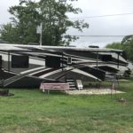
Mt. Desert Narrows Camping Resort
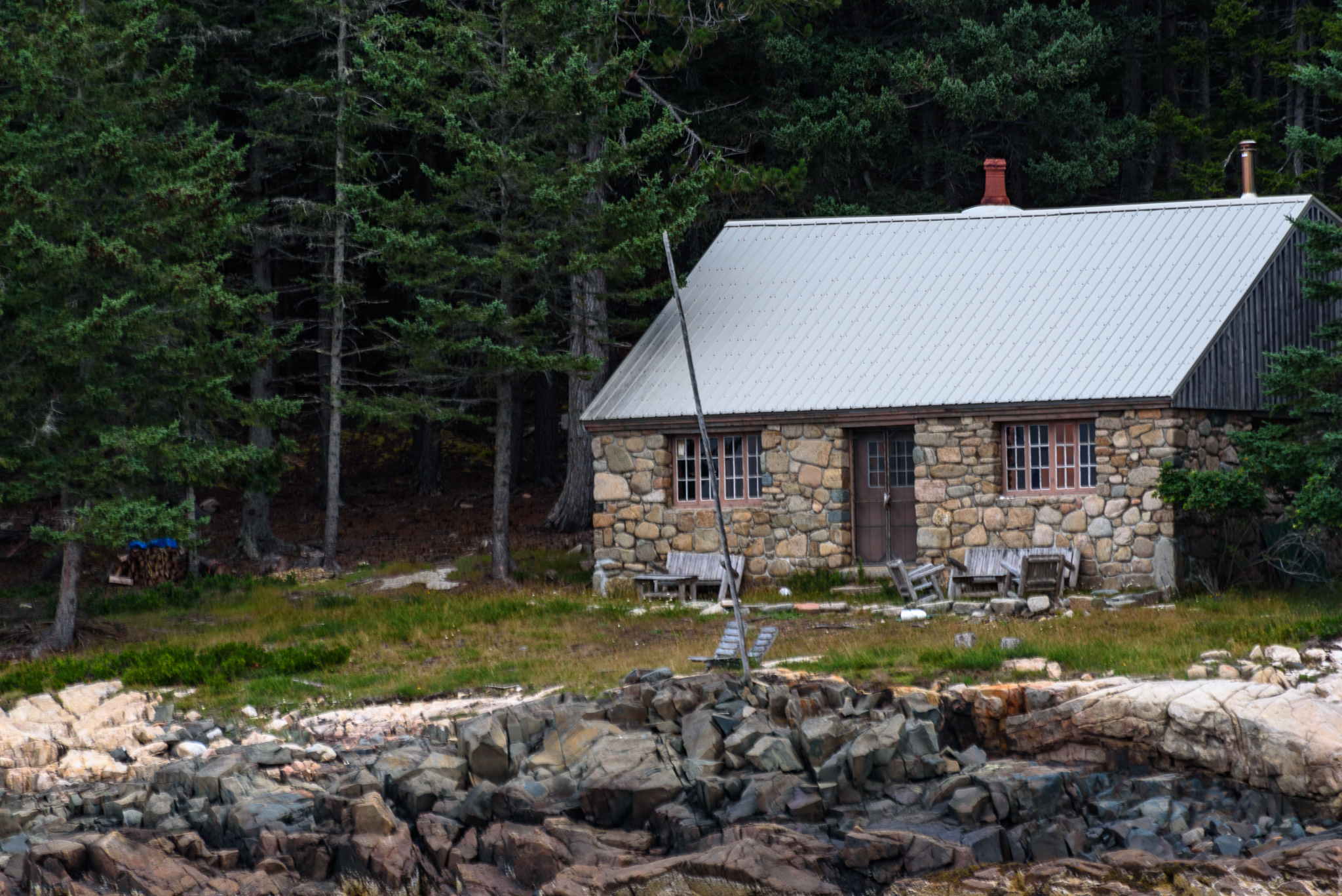
Although there are a number of campgrounds on Mount Desert Island, many do not offer full hook-ups. This narrowed our campground options considerably. After considerable research we settled on Mount Desert Narrows Camping Resort. The campground is off of Route 3 shortly after arriving on the island. Our site was a premium full-service pull-thru site with a gravel parking area and grass living space. Unfortunately the site was not very level and contained big tree roots from a tree that had been cut down. There was only one spot level enough for the picnic table and our mat covered some of the large roots so we had to step carefully. There were several sites along the waterfront but they did not provide a full hookup. This was a very busy campground with a steady stream of rigs coming and going.
Acadia National Park
“This is the forest primeval. The murmuring pines and the hemlocks,
Bearded with moss, and in garments green, indistinct in the twilight,
Stand like Druids of eld, with voices sad and prophetic,
Stand like harpers hoar, with beards that rest on their bosoms.
Loud from its rocky caverns, the deep-voiced neighboring ocean
Speaks, and in accents disconsolate answers the wail of the forest.” — Henry Wadsworth Longfellow, from “Evangeline”
Although the poem takes place on Grand Pre Island Nova Scotia, it could easily describe Acadia National Park.
Acadia National Park was first established as Sieur de Monts National Monument on July 8, 1916 by President Woodrow Wilson. The name was changed to Lafayette National Park in February, 1919 when it became the first national park east of the Mississippi. In January, 1929 the name was changed again to Acadia National Park. Acadia was the first national park whose land was entirely donated by private individuals. These private citizens anticipated the dangers that over-development would bring to this beautiful coastal area. John D. Rockefeller, Jr., played a critical role by building the now famous carriage roads (1915 – 1933) and by donating over 11,000 acres of land. Today, the park encompasses approximately 49,052 acres of dense forests, deep lakes, soaring granite cliffs standing beside sand and cobblestone beaches, and glacier-carved mountains.
The Quiet Side
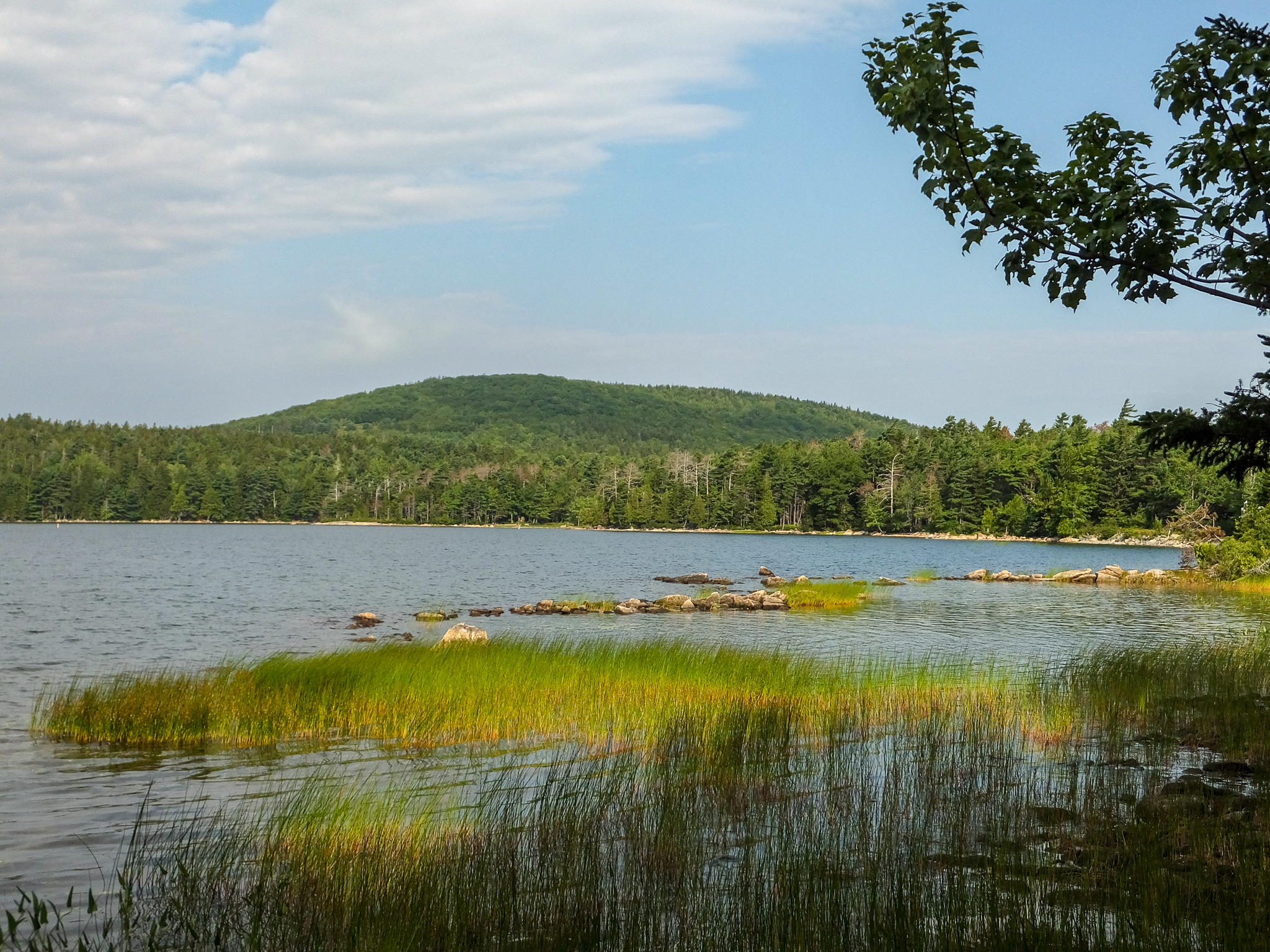
For our first outing in this beautiful area we decided to visit the less crowded quiet western side of Mount Desert Island. We stopped to hike the Beech Mountain Trail – a moderate 1.2 mile hike with a good view of Great Long Pond. The route also included the Beech Mountain Fire Tower which was open that morning.
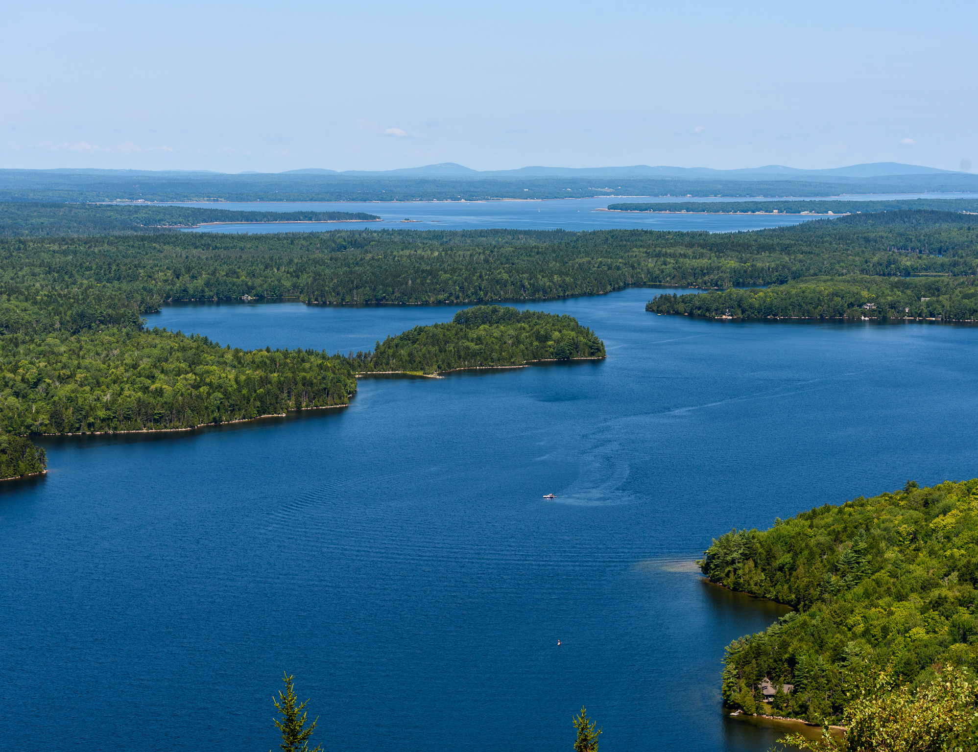
After Beech Mountain Trail we drove to the trailhead for Wonderland Trail – an easy 1.5 mile roundtrip that leads from forest to shore.
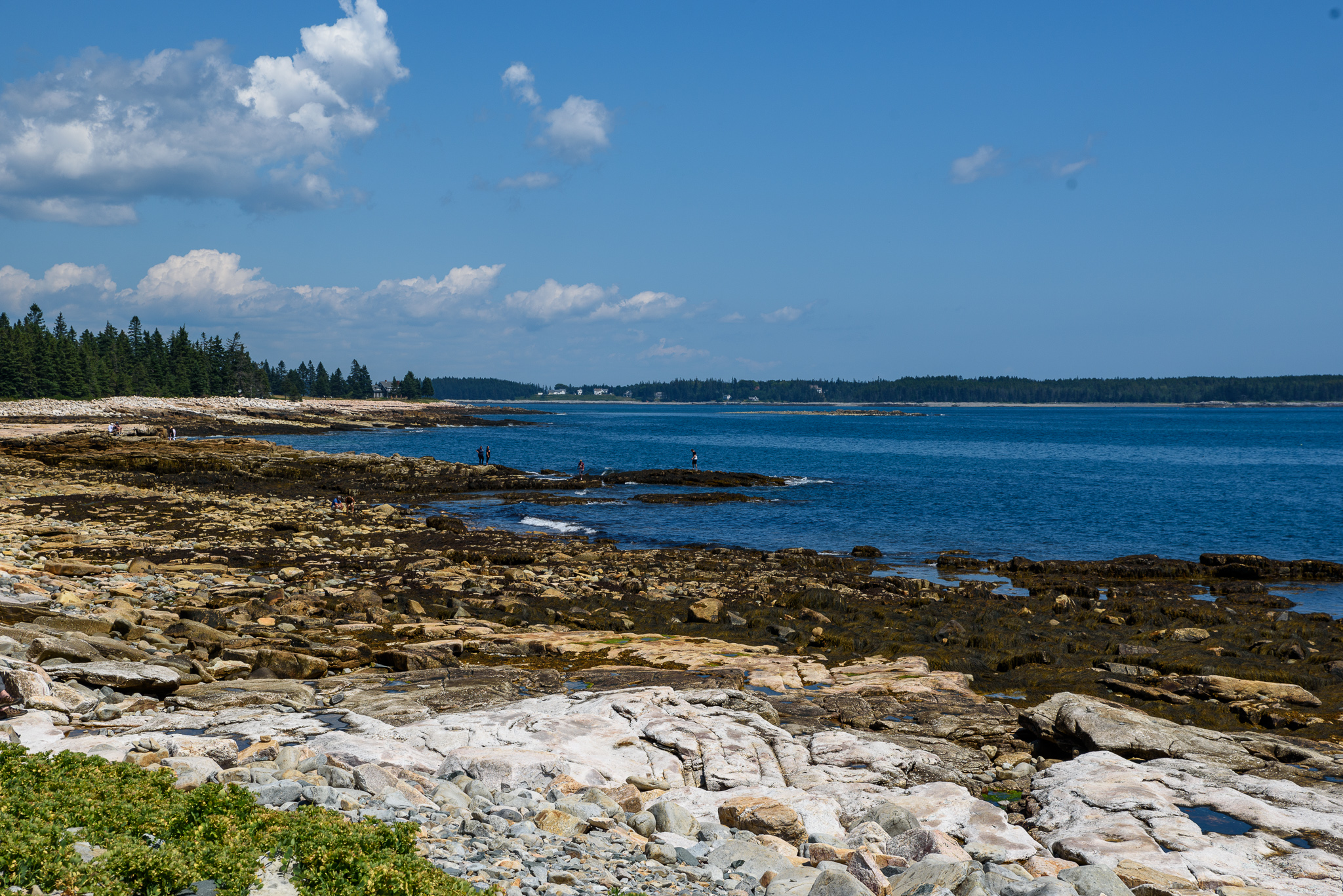
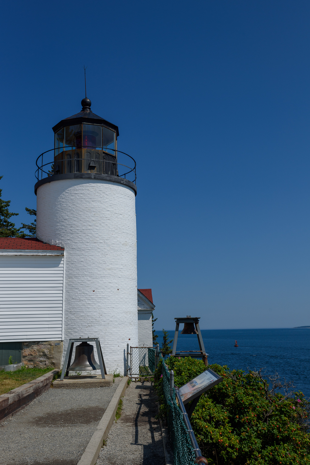
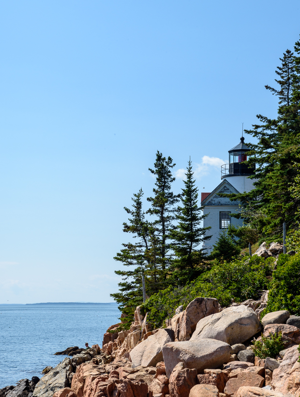
We continued our drive through Southwest Harbor and on to the Bass Harbor Head Lighthouse where, although there is a path leading to a scenic view of the Lighthouse, you really need to be on a boat to truly see it.
From Bass Harbor we continued to circumnavigate this portion of the island until our route rejoined Route 102. After a quick stop at Mainly Meat for some take-out BBQ, we headed back to base camp.
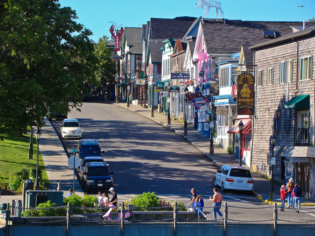
Bar Harbor and Bus Tour
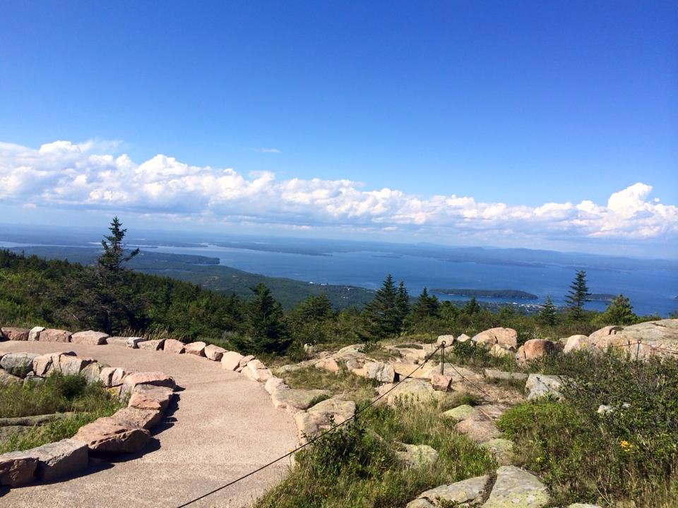
For an overview of the incredibly busy eastern section of the park, we opted to take the Acadia Bus Tour. The bus took us to the top of Cadillac Mountain to enjoy the view.
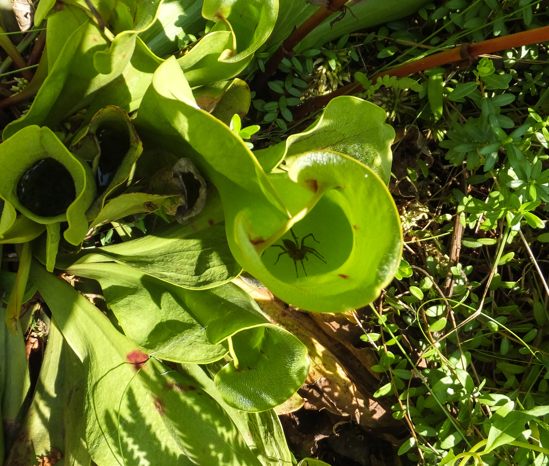
Our next stop was a walk through the Sieur De Monts Spring (Wild Gardens of Acadia) with more than 300 native plant species. One species is a prehistoric carnivorous plant that traps and dissolves its victims.
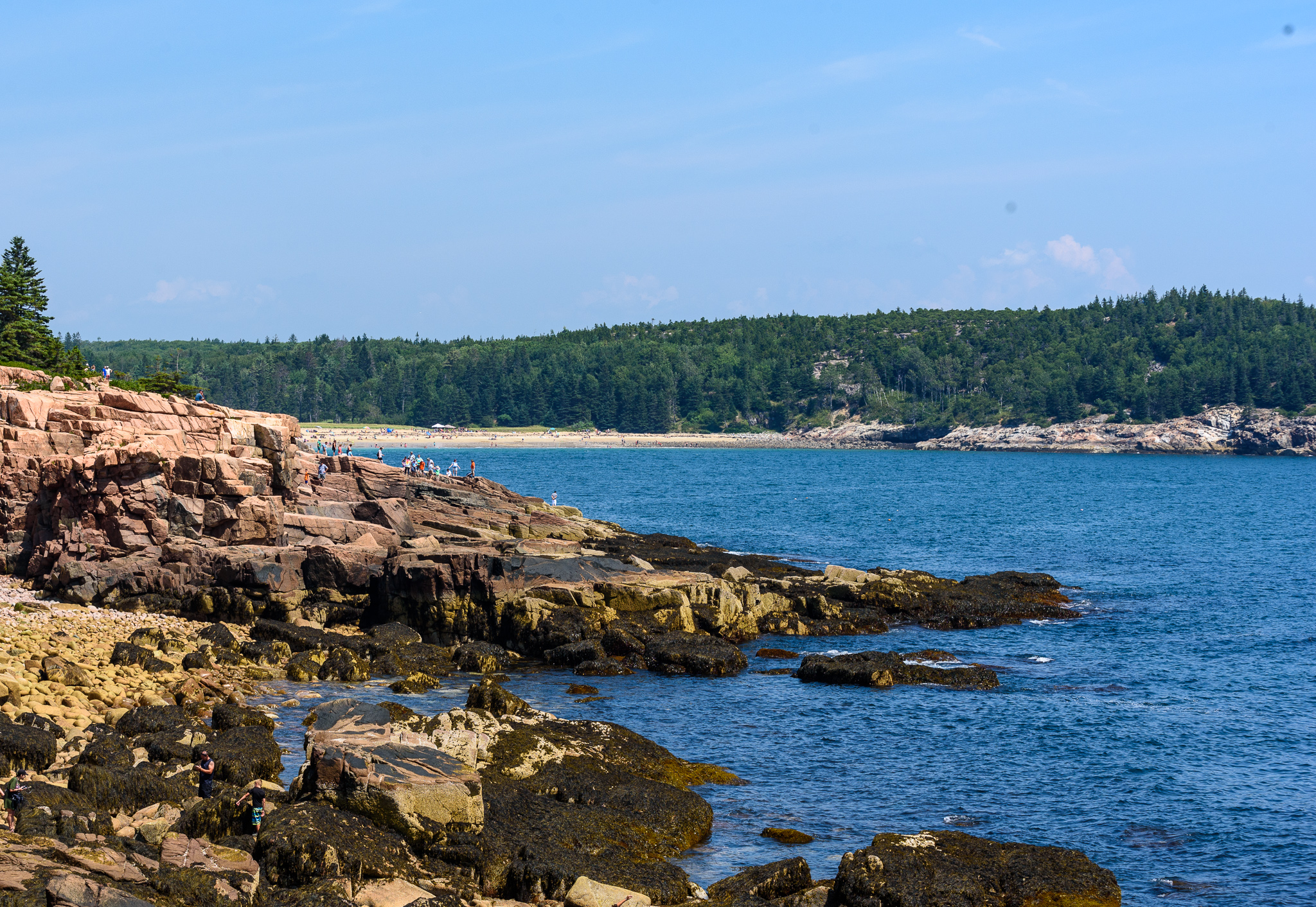
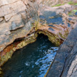
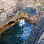
The final stop was at Thunder Hole, a small naturally carved inlet where the waves rush in. At the bottom of the inlet is a small cave where air and water are forced out like a clap of thunder when a wave arrives. The best time to visit is about an hour before high tide on a day when the waves are high. Unfortunately, our timing was off on this visit but the view was great.
The 2.5 – 3 hour bus tour was OK but not as enjoyable as the one we remembered from five years ago. This bus was fully occupied and, without air-conditioning in 90+ degree heat, like a sauna.
After returning to Bar Harbor we spent some time walking around the bustling small town with tons of shops and restaurants.
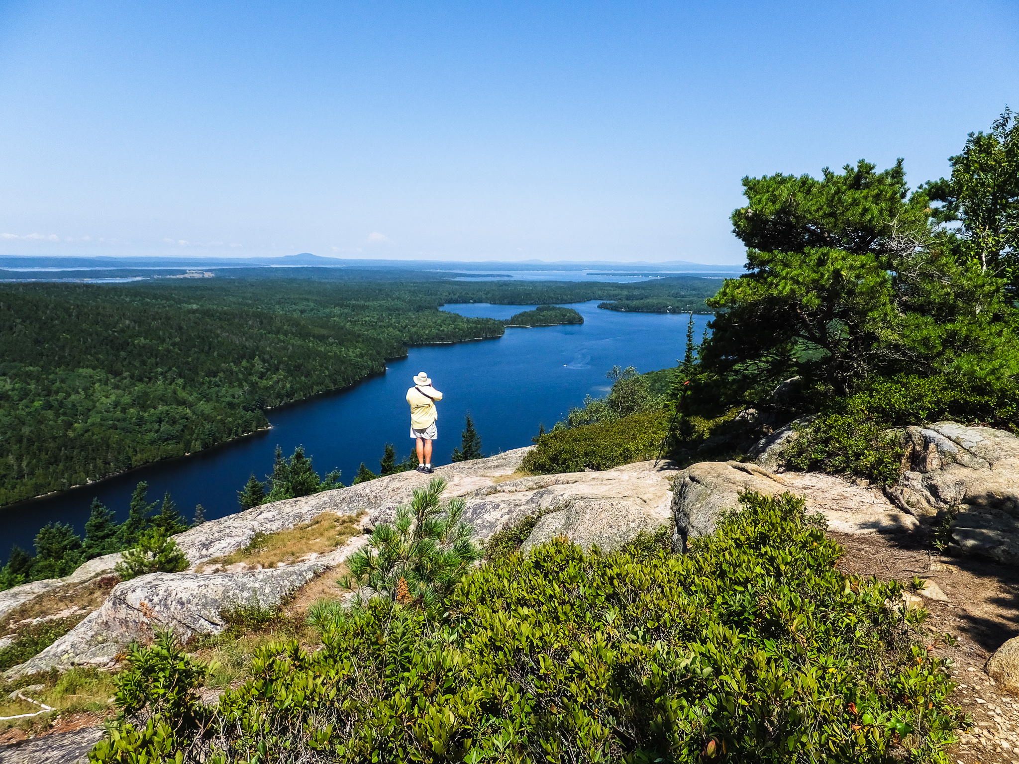
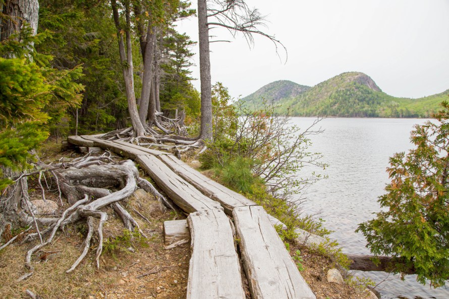
Jordan Pond
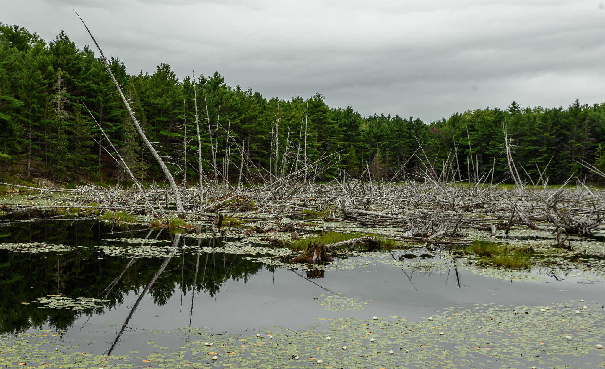
For our next adventure we decided to hike the Jordan Pond Loop, an “easy” 3.5 mile hike along the shore of Jordan Pond. Since this is a popular hike and the park was extremely crowded (like all of the national parks during the summer) we targeted an early arrival at the parking lot. We easily found a parking place, put on our packs, and took off. The hike was easy going at first as the path on the east side is a well-groomed, level gravel path following the shoreline of the pond. Along the north side we encountered a couple of rustic bridges over the streams flowing into the pond. As we continued around to the west side suddenly we were confronted with two areas of big boulders that we had to scramble over. Beyond the boulders, the gravel path turned into an elevated log boardwalk over the wetlands for the final mile. Eventually the trail returned us to the parking lot and we made our way to Jordan Pond Restaurant for some of their famous popovers. Without a reservation we had to wait 45 minutes for a table.

Thunder Hole and Northeast Harbor
Later in the week we drove back to Thunder Hole in an attempt to catch the famous sound. We waited for a while to see if we could experience the “thunder” but finally determined that the waves were not angry enough.
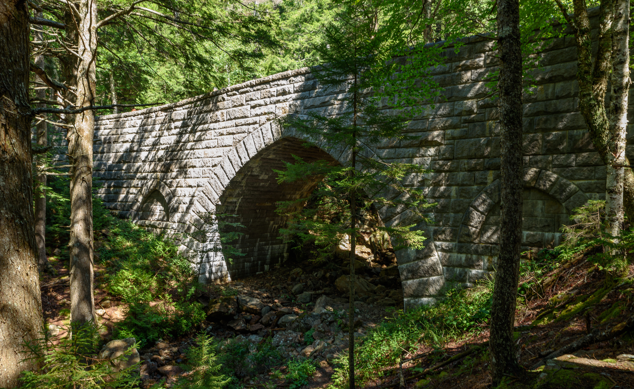
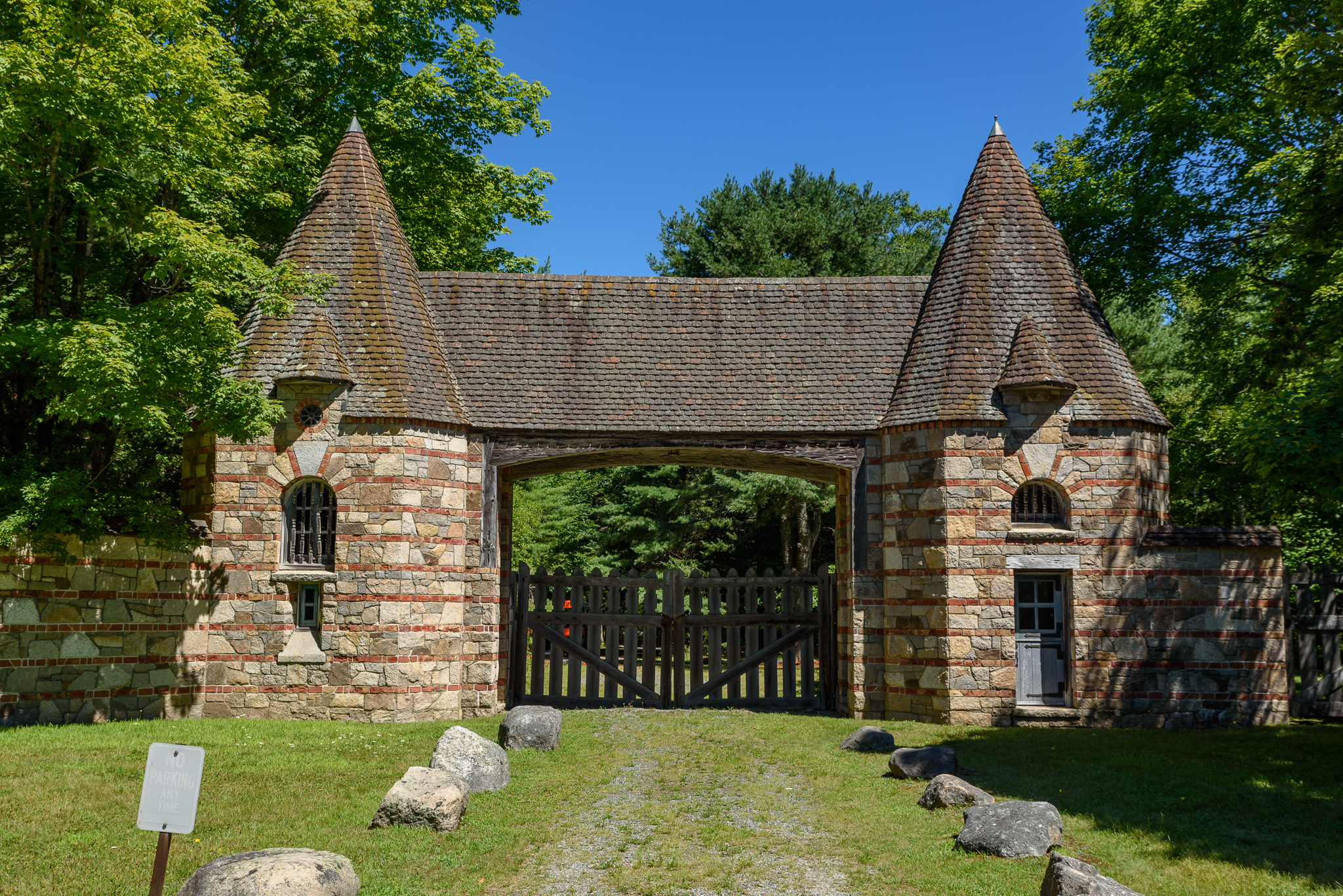
Following our visit to Thunder Hole we drove to Northeast Harbor to hike the Hadlock carriage road loop. The trail goes under one of the stone bridges and is near the Brown Mountain Gate originally built to protect the carriage roads from automobiles.
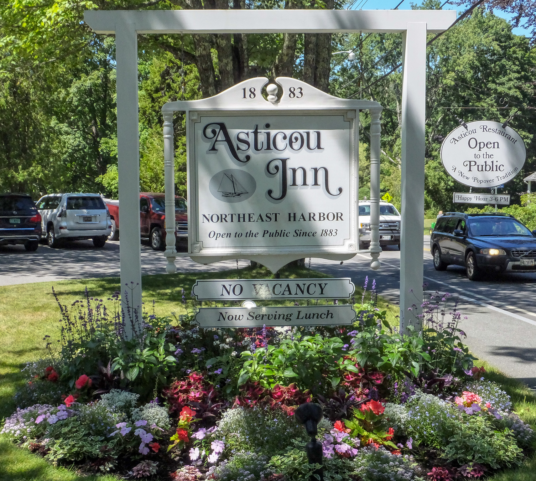
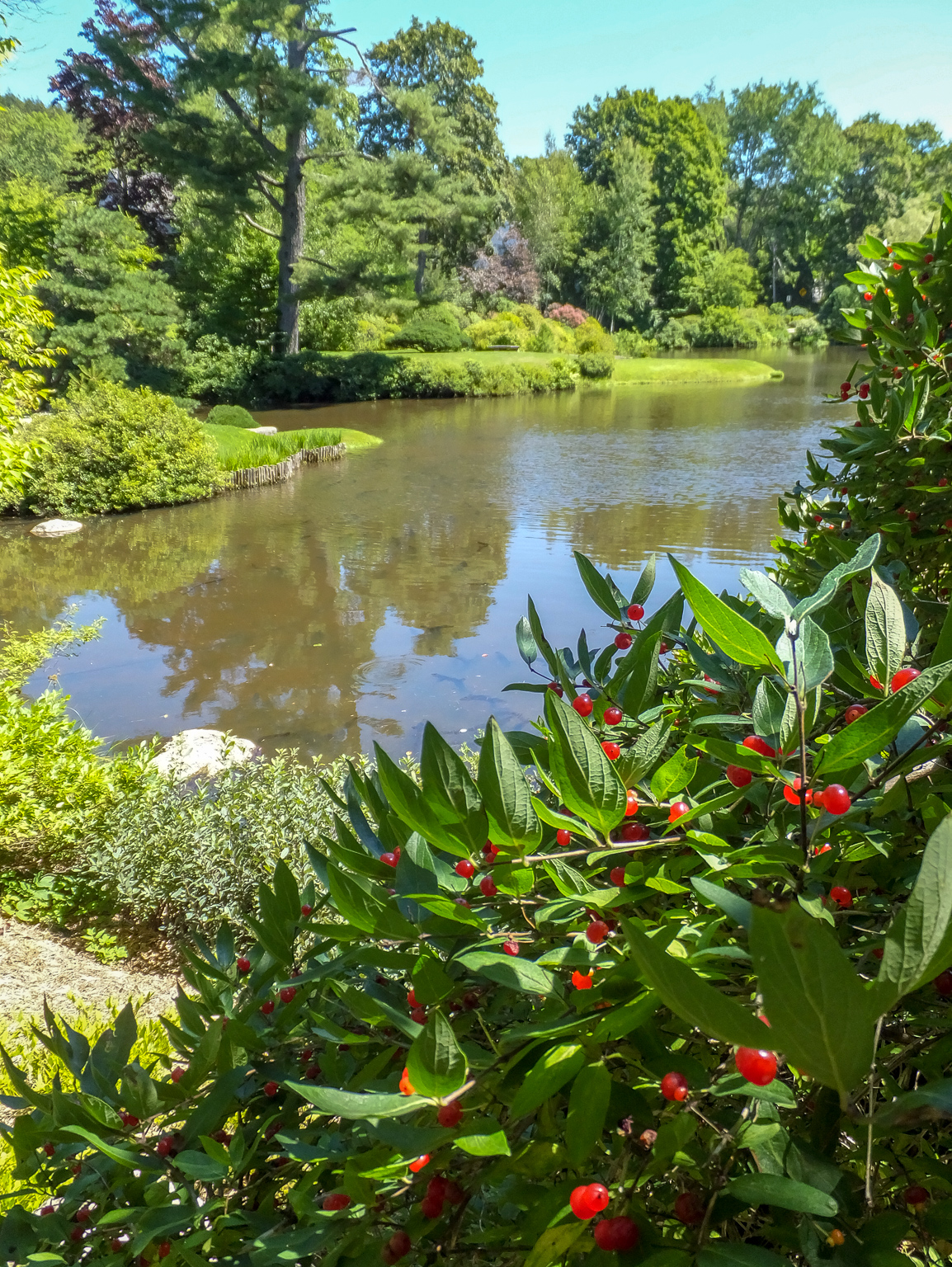
After the hike we had lunch at Asticou Inn (more popovers) and then toured the lovely Asticou Azalea Gardens.
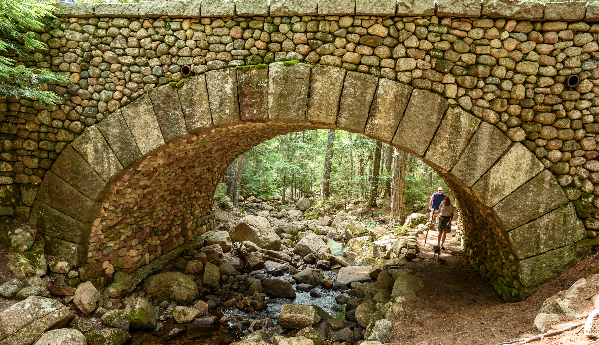
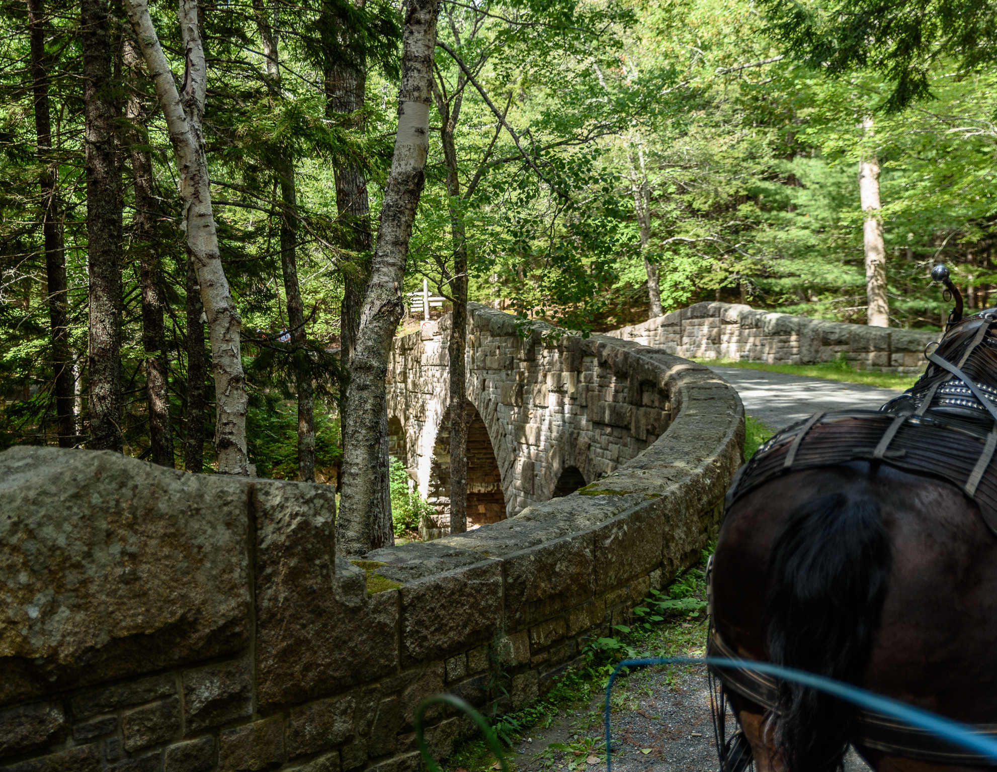
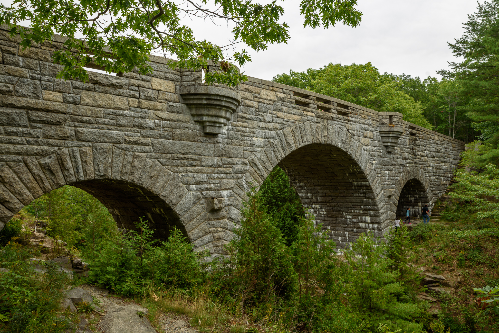
The Carriage Roads
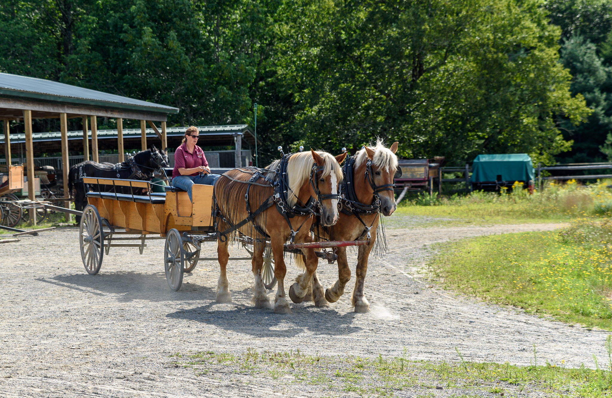
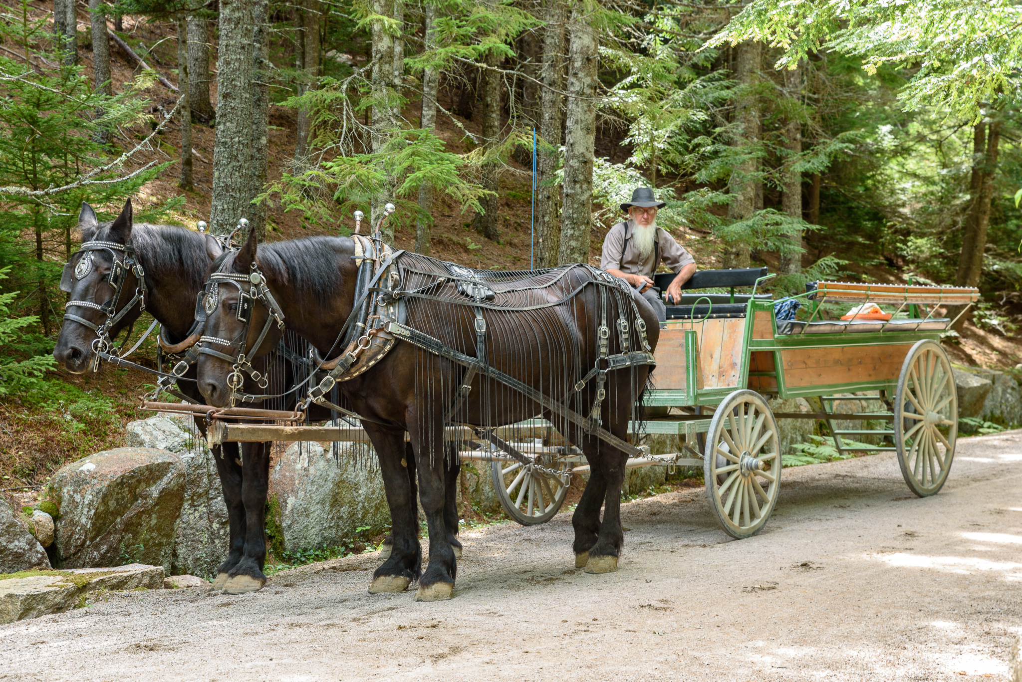
I’ve mentioned the carriage roads already so allow me to elaborate on their history and importance. There are over 45 miles of carriage roads built by John. D. Rockefeller Jr. between 1913 and 1940. Originally Intended for use by horse-drawn carriages, the goal of these immaculately-constructed roads was to give city folk an easy taste of the natural world. Like Acadia’s trails, the carriage roads were deliberately engineered to cut through some of the best scenery, mostly in the forested areas of the park. Elaborate and majestic stone bridges were built at several stream and valley crossings and each one is a unique work of art. Today, hikers, bikers, and horse-drawn carriages alike share the carriage roads.
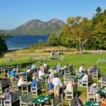
On Saturday we took the morning Rockefeller Bridge Tour with Carriages of Acadia. This was a two hour narrated horse and buggy ride along the carriage roads with close up views of three of the unique granite Rockefeller bridges.
Harbor Cruise
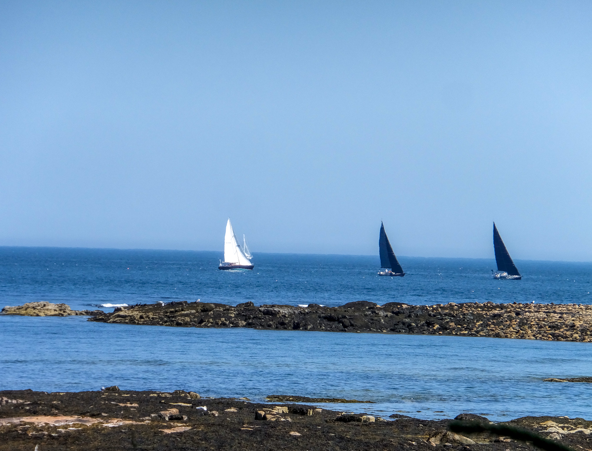
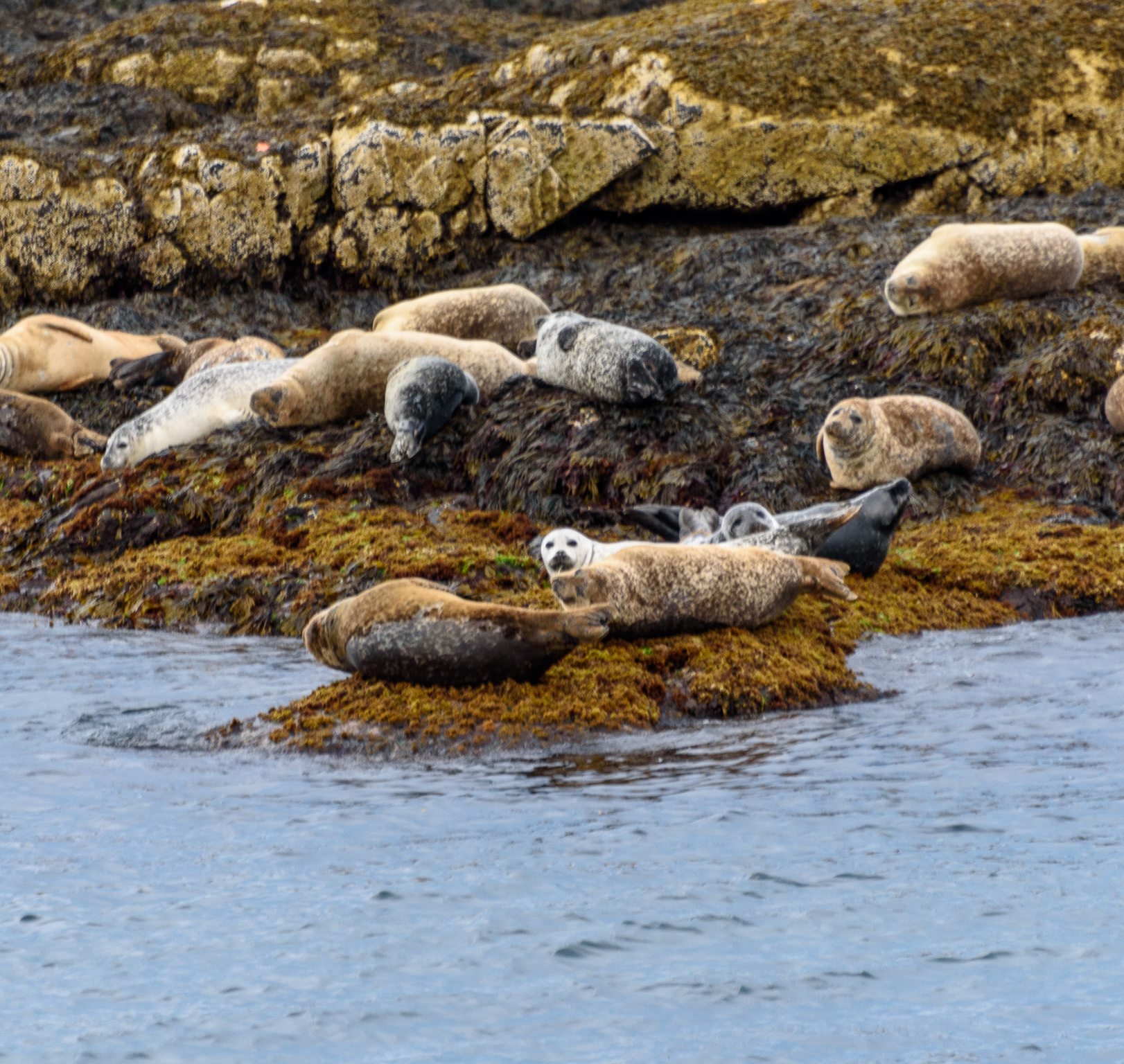
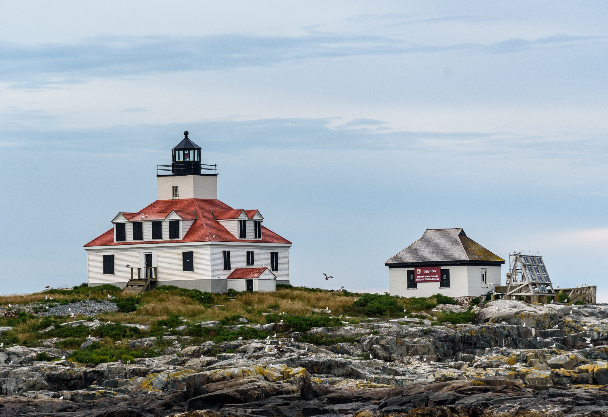
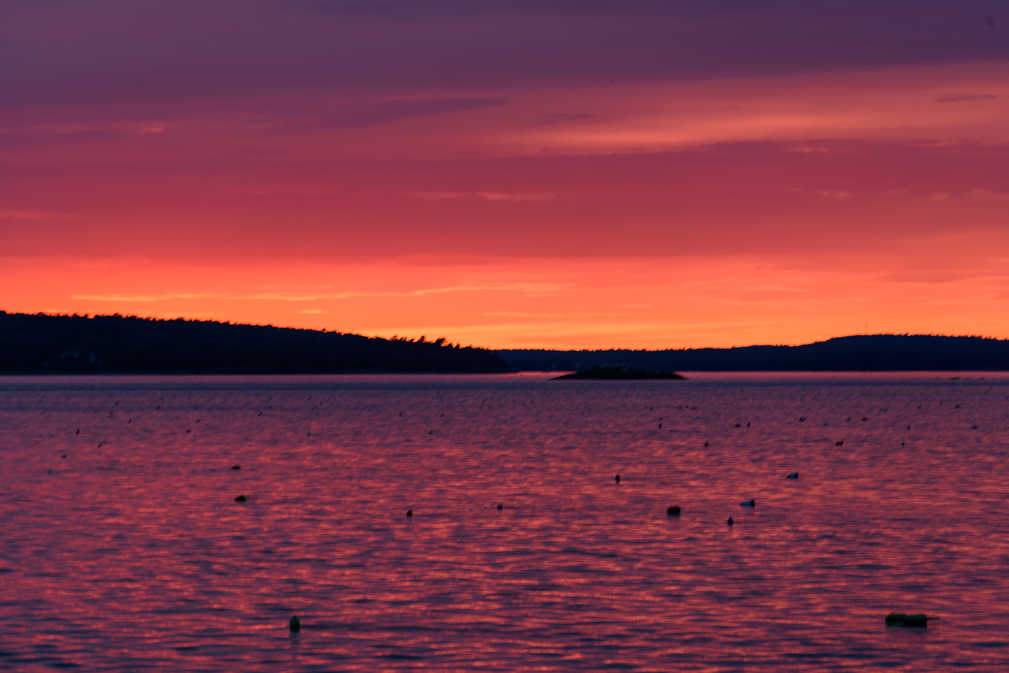
Later that day we had reservations for a sunset cruise with Acadian Nature Cruises. The clouds were low and threatening and we almost canceled but decided to chance it. As it turned out we had a great time. Our guide was excellent and spotted lots of harbor purposes, an eagle, and numerous seals. The captain expertly navigated the boat near Egg Rock Lighthouse and some of the smaller inhabited islands. Miraculously, the sun appeared just below the clouds in time to provide a beautiful sunset. The perfect ending to a fun day.
Witch Hole Pond
At the start of the following week we drove to the Hulls Cove Visitors Center to park and hike the nearby Witch Hole Pond carriage trail. This was an easy 5.5 mile hike.
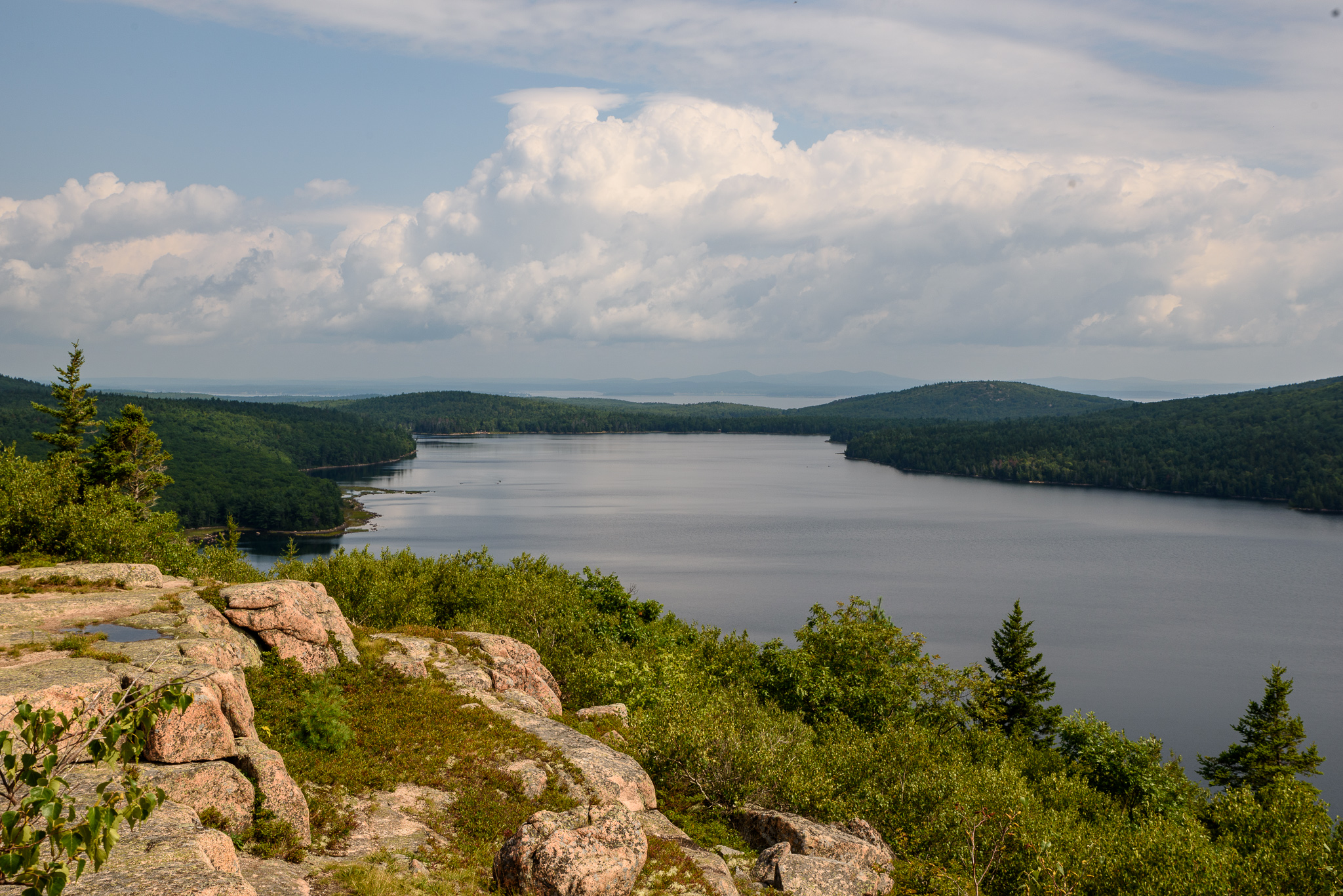
Eagle Lake
On Thursday morning we left the camper early so that we could find a parking place for the 6.5 mile carriage road hike around Eagle Lake. Bill took a side trail that provided an overlook of Eagle Lake while I continued on the carriage road.
Final Thoughts
Acadia National Park was one of our favorite spots on this trip and we’d love to visit again sometime. Next time will be in the spring or fall when the area is not as crowded.