August 29 – September 7, 2020
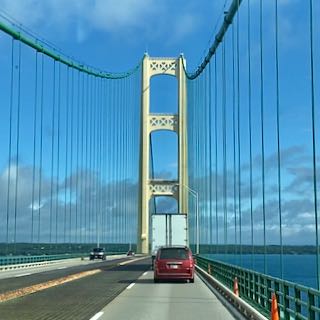
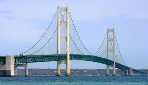
During our 2018 summer trip, we made day trips to the Upper Peninsula (UP) from our base in Mackinac City. This time we decided to spend more time and actually drive across the UP. This meant taking the rig across the Straits of Mackinac via the Mighty Mac (Mackinac Bridge). Opened in 1957, the 26,372-foot-long Mackinac Bridge connects the city of St. Ignace on the north with the village of Mackinac City on the south.
We were a bit apprehensive about driving the rig across the bridge especially with high winds predicted for later in the day. Our solution was to leave Traverse City early in the morning and cross the bridge before noon. Luckily the winds were in our favor and we had no issues crossing on what proved to be a beautiful partly cloudy day.
Our campground of choice for this portion of the UP was Lakeshore Park Campground in Saint Ignace, Michigan. This campground, located on the shoreline of Lake Michigan, offers a great view of the lake especially from the front row sites. Unfortunately without a wind break, these sites take the full brunt of the winds coming off the lake. Our spacious site was further back from the lake but we could still feel the winds buffet the RV. With the wind came lower temperatures so we had to break out the sweatpants and shirts and turn on the fireplace and heat.


Saint Ignace
Located on the shore of Lake Huron, Saint Ignace serves as the gateway to the UP for travelers coming from the lower peninsula. This is the second oldest city founded by Europeans in Michigan. Prior to the first exploration by French colonists, this area had been inhabited for thousands of years by various cultures of Native Americans including Ojibwe, Iroquois, Ottawa, and Potawatomi. In 1671, the French explorer and priest Jacques Marquette founded the Saint Ignace Mission (named for Saint Ignatius of Loyola, founder of the Jesuit religious order) on this site. Originally part of New France, the British took possession following their victory over France in the Seven Years’ War. Then, in 1783, the village became part of the new United States after the Revolutionary War. Once an important fur trading site, Saint Ignace declined following the War of 1812 partly because the United States prohibited British Canadian traders from operating across the border. The construction of the Detroit, Mackinac, and Marquette Railroad in 1882 brought new life to the area as there was now an easier way of getting produce, iron-ore, and lumber to major markets. In the late 19th century, the area was recognized as a summer resort with a connection to the popular Mackinac Island.
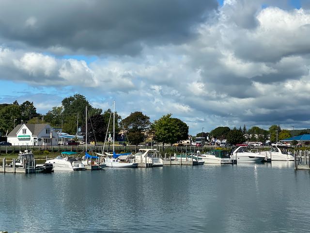
The city has a beautiful boardwalk (Huron Boardwalk) that affords a leisurely stroll along the banks of Lake Huron past the marina and Wawatam Lighthouse.
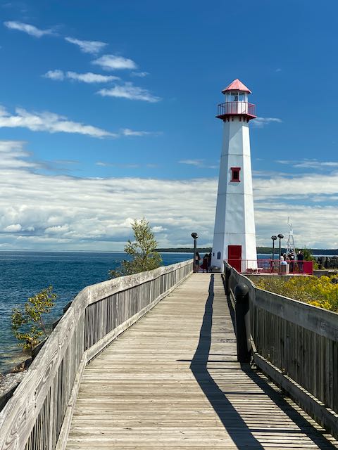
The Wawatam Lighthouse was originally built in 1998 as an architectural folly at the Monroe Welcome Center on Interstate 75 near Monroe, Michigan in the southeastern corner of the state near the Ohio border. It was a functional lighthouse structure that was constructed far away from navigational waters as an element of the tourist heritage of the state. In 2004, the Michigan Department of Transportation decided to renovate the center and declared the structure obsolete. It was scheduled to be demolished. After concerns were raised about this decision, the state government agreed that the structure should be dismantled and moved to a location where it would be useful. Serendipitously, while attending a conference for municipal officials, St. Ignace civic leaders learned of its availability.
They successfully applied to serve as the location of the small tower, and the lighthouse was disassembled into five pieces and trucked more than 330 miles (530 km) from Monroe to East Moran Bay in St. Ignace.
Wikipedia
Mackinac Island
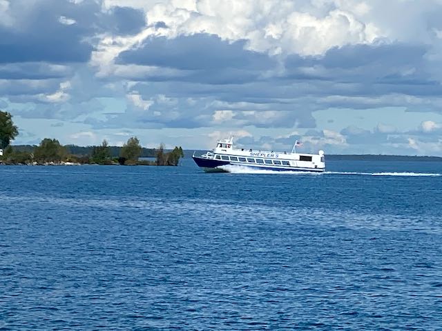
Since St. Ignace provided such ready access to Mackinac Island, we couldn’t resist the urge to hop onto a Shepler’s Ferry (one of two lines that service the island) and visit the island for a second time. (Our first visit was in the summer of 2018.) Although we could have arranged for the ferry service to transport us directly from the campground to the ferry dock, we chose to drive. We arrived just in time to catch a sailing that actually went under the Mackinac Bridge for an up-close look.
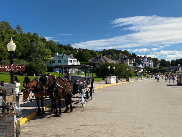
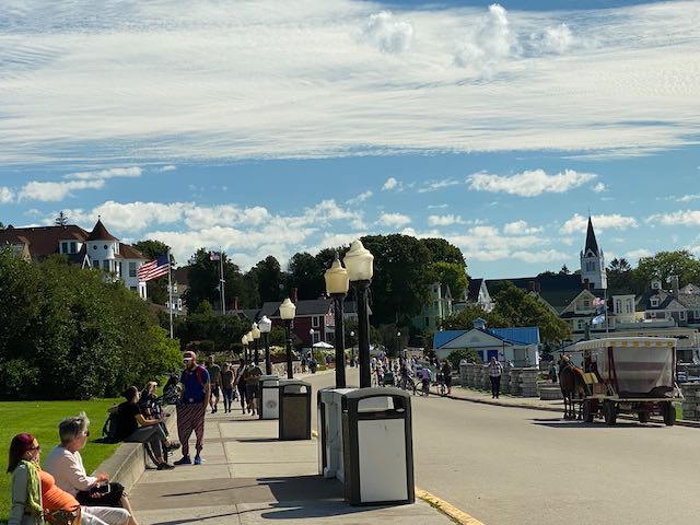
The first thing you notice when you step off the ferry onto Mackinac Island is the lack of motor vehicles which were restricted at the end of the 19th century. The restriction was due to safety concerns for residents and horses after carriage drivers complained that the vehicles startled their horses. Instead of cars and trucks, you see horse-drawn carriages and wagons, bicycles, and lots of pedestrians. You feel as though you stepped back “Somewhere in Time“.
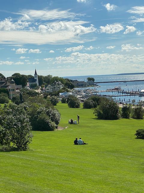
On this visit, we decided to visit Fort Mackinac since we missed it before. The fort is situated on the bluff and requires a bit of a hike up the ramp. The fort itself and the view from the top were definitely worth the effort.
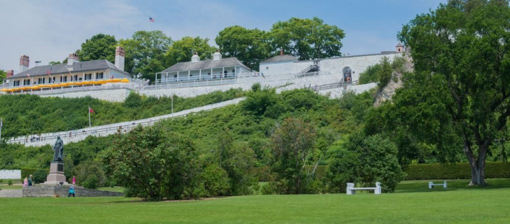
Situated on 150-foot bluffs above the Straits of Mackinac, this is one of the few surviving American Revolutionary War forts and one of the most complete early forts in the country. In 2015, Fort Mackinac celebrated 235 years standing guard over Mackinac Island.
Fort Mackinac is a former British and American military outpost garrisoned from the late 18th century to the late 19th century in the city of Mackinac Island, Michigan, on Mackinac Island. The British built the fort during the American Revolutionary War to control the strategic Straits of Mackinac between Lake Michigan and Lake Huron, and by extension the fur trade on the Great Lakes. The British did not relinquish the fort until fifteen years after American independence.
Fort Mackinac later became the scene of two strategic battles for control of the Great Lakes during the War of 1812. During most of the 19th century, it served as an outpost of the United States Army. Closed in 1895, the fort has been adapted as a museum on the grounds of Mackinac Island State Park.
Wikipedia
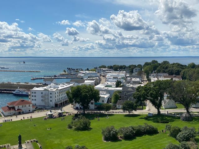
We toured most of the 14 buildings at the fort and watched a rifle firing demonstration before making the trek down to the main shopping area. We enjoyed exploring the various shops before stopping for lunch at Horn’s Gaslight Bar and Restaurant. After a fun-filled day on the island, we boarded the ferry for the 30 minute ride back to St. Ignace.
Ishpeming
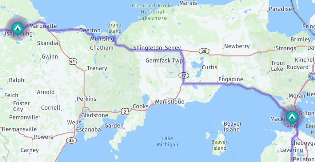
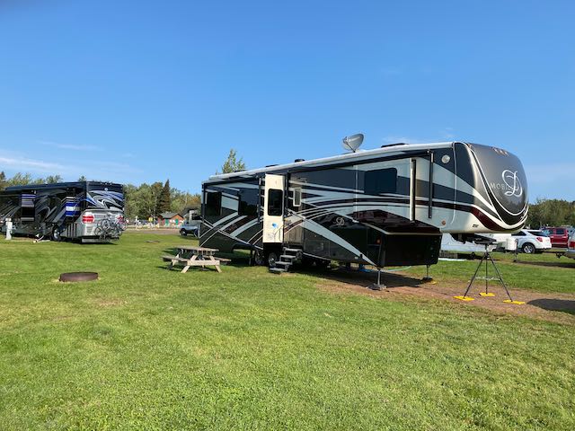
To continue our investigation of the UP, we moved from St. Ignace to Ishpeming on Sept. 4th. We were actually supposed to change campgrounds the day before but elected to stay put for another night to avoid some of the expected winds. Without knowing much about this area of the UP, we originally selected Ishpeming as a convenient waypoint on the way to our next destination. As it turned out, this was a great decision. Not only did we find a great campground at Country Village RV Park, we also found a lot to do.
Marquette
25 minutes away from Ishpeming is Marquette, Michigan.
The city of Marquette Michigan was founded by Amos Harlow and explorer Peter White in 1849. The first name for the town was Worcester, after Harlow’s hometown in Massachusetts. The town was renamed Marquette in 1850. Marquette comes from the French Explorer Jacques Marquette. Marquette held a large mass on the shores of Laker Superior in 1671 and so now has the area surrounding this named after him. Marquette also founded the first European settlement in Michigan, Sault Ste. Marie. The Upper Peninsula, along with Marquette, was added to Michigan as a result of the Toledo War between the Michigan and Ohio territories.
The early history of Marquette revolves around Iron. Iron was discovered in the Upper Peninsula (U.P) in 1854 by William Burt. As Marquette becomes more and more developed, this allows the iron ore industry to develop as well. Beginning in 1854 roads are developed to transport iron and three years after the Iron Mountain Railroad is completed. Frequent and regular shipments were made from Marquette. As the iron industry thrives so does the city of Marquette.
Early Marquette – Michigan History
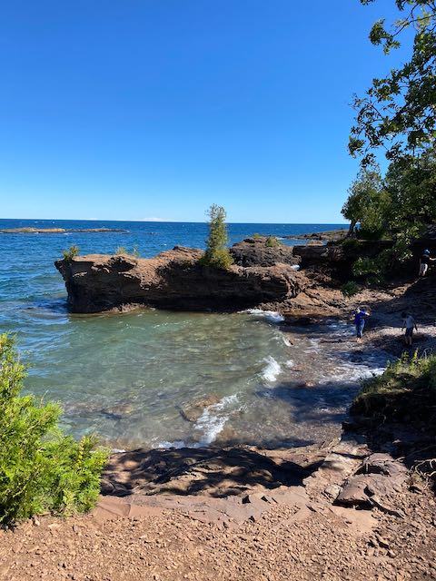
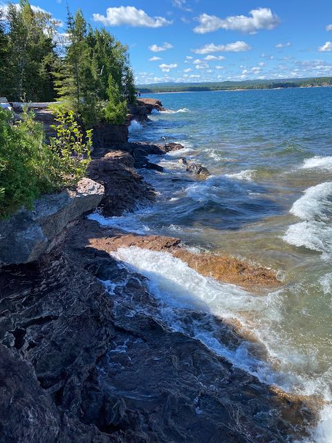
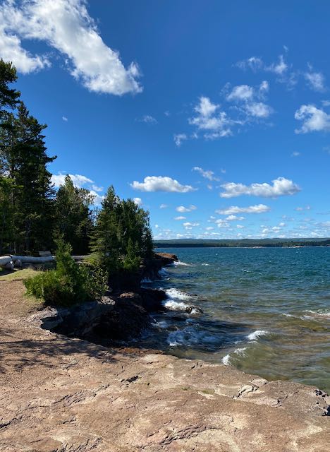
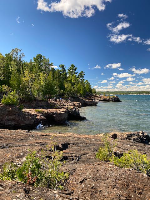
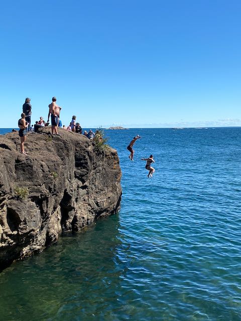
On the way to Marquette, we stopped to investigate Presque Isle Park – a 323 acre public park located on an oval-shaped peninsula. The east end of the park sits high atop sandstone cliffs offering great vantage points for watching the waves of Lake Superior carve coves far below. On the west end is Sunset Point a great spot to watch the sun set. Connecting the two is a two mile scenic roadway.
After completing the scenic roadway, we parked near McCarty’s Cove and walked out to catch a view of the Marquette Harbor Lighthouse. The original lighthouse was built in 1853 but the living quarters and tower were replaced in 1866 due to poor construction.
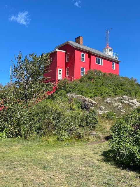
The 1866 Marquette Lighthouse was a story and a half brick structure with attached 40-foot square brick tower housing a fourth order Fresnel lens. An identical lens is on display in the Marquette Maritime Museum. The original lens showed an arc of 180 degrees. In 1870 it was increased to 270 degrees.
The keeper and his family lived in the lighthouse. As long as the keeper’s job was only to maintain the light, one keeper was able to do the work. However, when the light at the end of the breakwater was later added and a two whistle signal system installed at the end of the point, the work was more than one person could do and an assistant keeper was hired. The new assistant needed housing, a problem solved in 1898 when a barn behind the lighthouse was converted into living quarters.
In 1909 a more permanent solution was reached by adding a second story to the lighthouse. Later additions such as a covered staircase were completed in the 1950s, and the lighthouse was painted red in 1965. These additions made the lighthouse unique on the Great Lakes. No other similar lighthouse was so altered.
mqtmaritimemuseum.com
Our final stop in Marquette was the downtown area where we checked out some of the shops. We finally stopped for a late lunch on the patio overlooking the water at Sol Azteca. Our walk back to the truck took us near an abandoned ore dock – a large structure used for loading iron ore from railroad cars onto ships.
Sol Azetca Patio 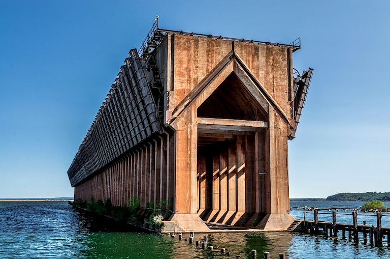
Ore Dock
Goodbye to the UP
All too soon our ten days on the UP were up and it was time to leave this beautiful area and move on to our next destination. Check back soon to see where we went next.