July 10 – 17, 2021
From Redcrest we had a gorgeous 2 hour drive along US 101 through redwoods and along the California Coast to our next destination.
Klamath
Redwoods, salmon, and California’s largest tribe all thrive in this small North Coast town. Klamath is so far north that many people assume this tiny town is in Oregon, not California. Set along its namesake river 40 miles south of the state line, Klamath is a community strongly connected to the wilds of the North Coast, with towering old-growth redwood forests, world-class salmon fishing, and a gorgeous stretch of the Pacific all within minutes of town.
visitcalifornia
For our home base here we selected the Klamath River RV Park located on the banks of the Klamath River. Getting into the campground was a bit dicey as there is a hairpin downhill entry but Bill handled it with ease. Some of the sites are riverfront but we selected one further back. Our site was a long but rather narrow grassy site. We didn’t have a neighbor for the first couple of days which we really enjoyed as that gave us a nice living space. Unfortunately, that changed in the middle of the night when a fifth wheel squeezed in next to us.
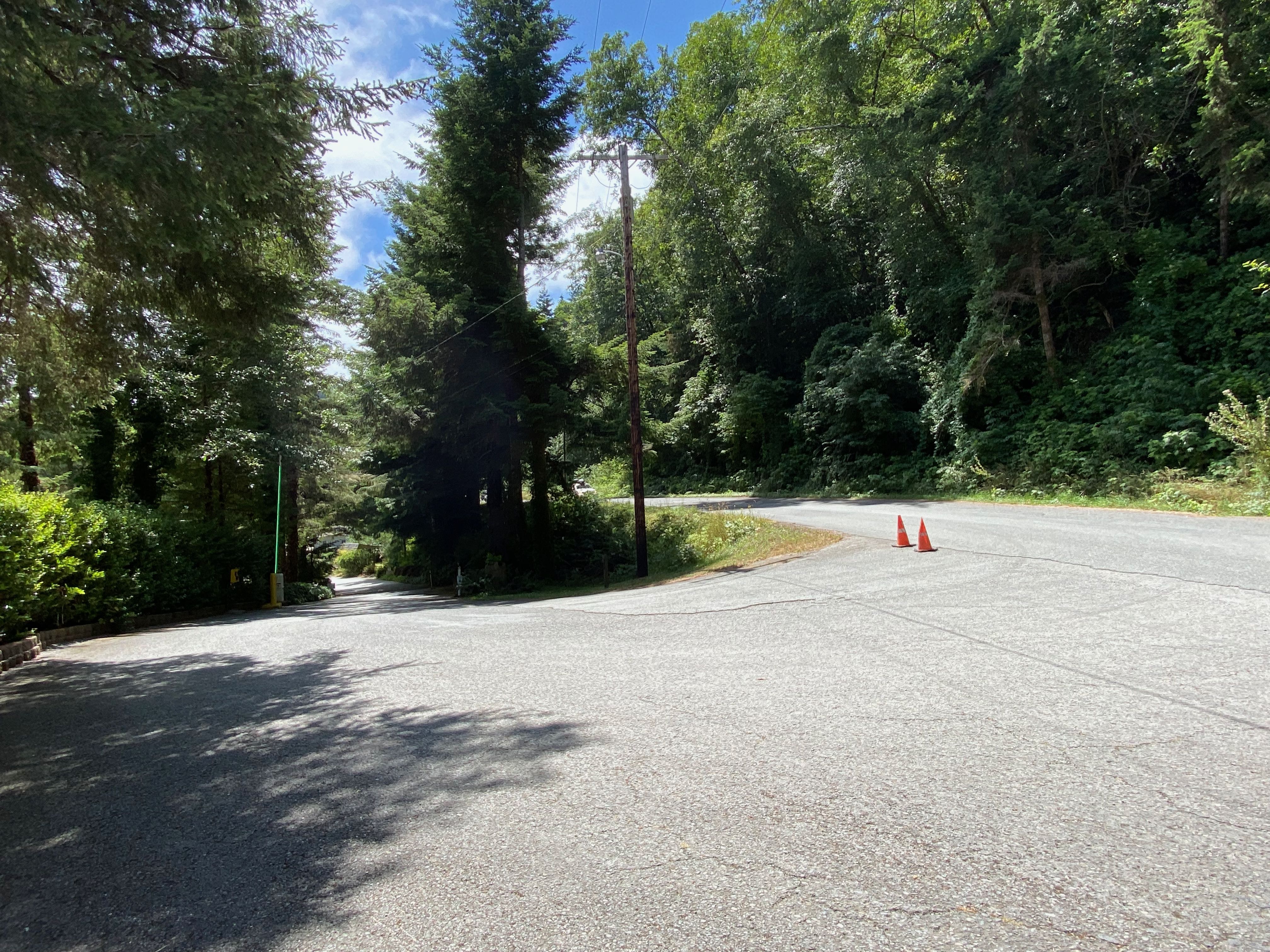
Campground Entrance
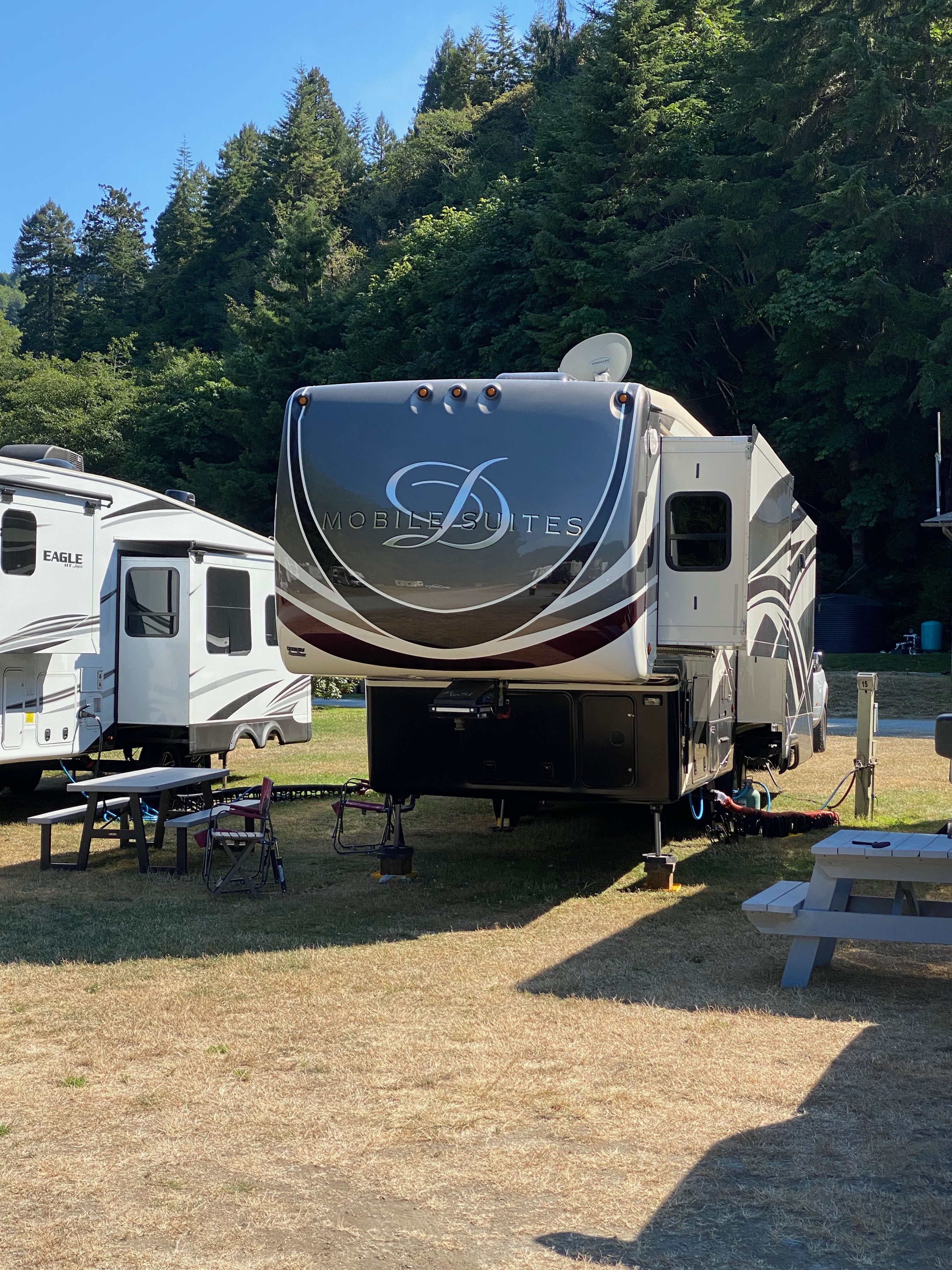
Our site 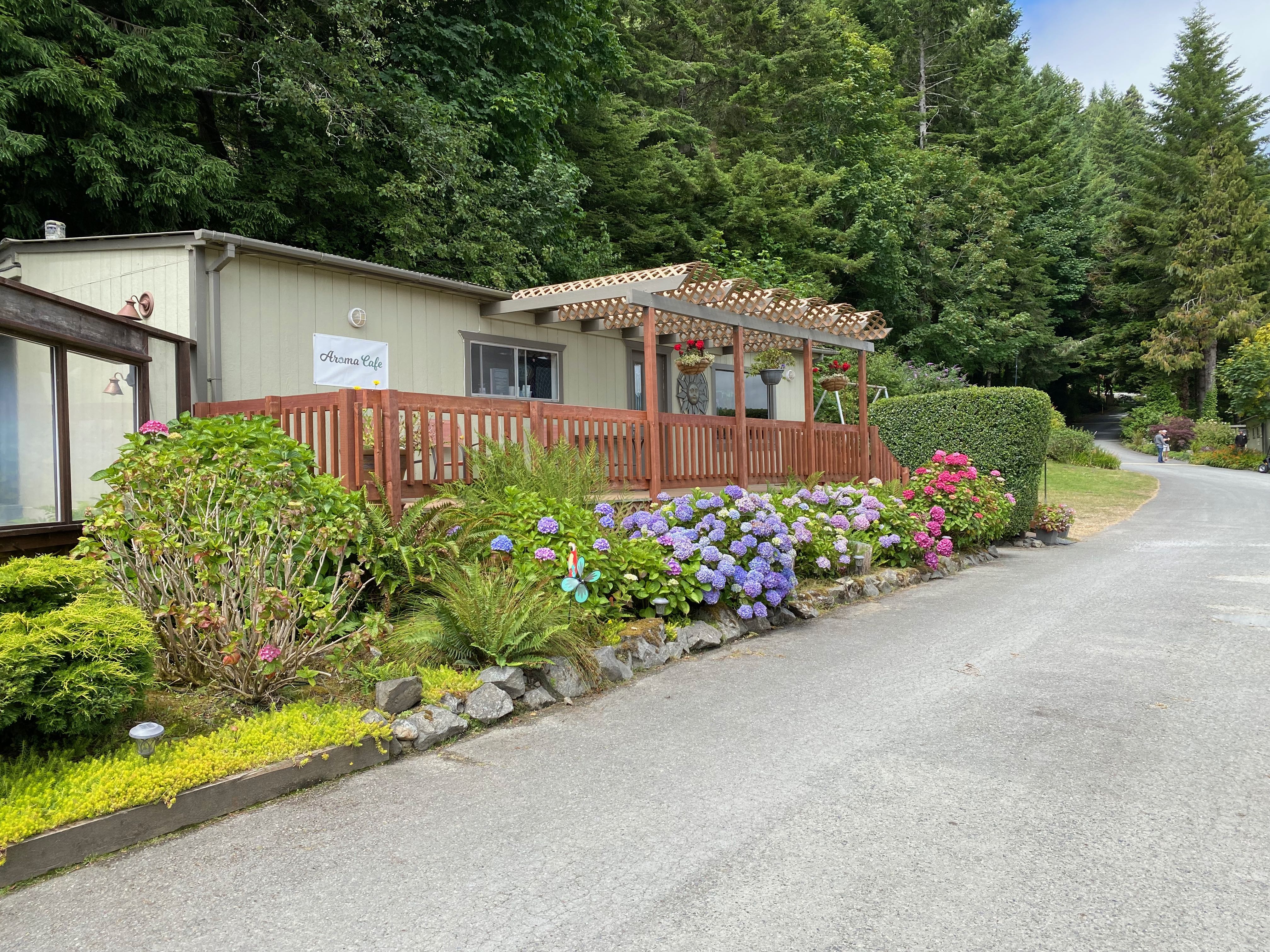
Campground Cafe 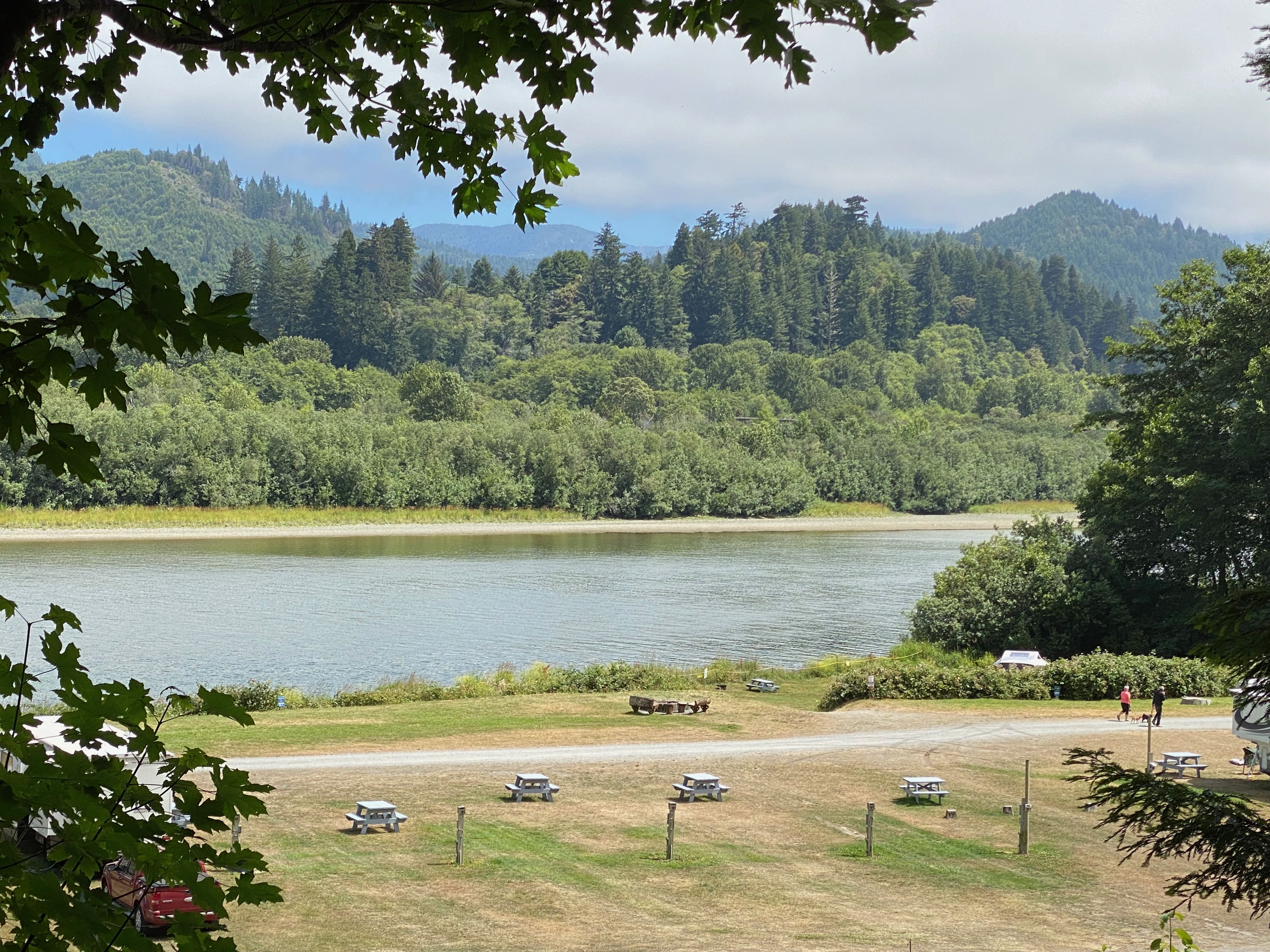
Overlooking campground 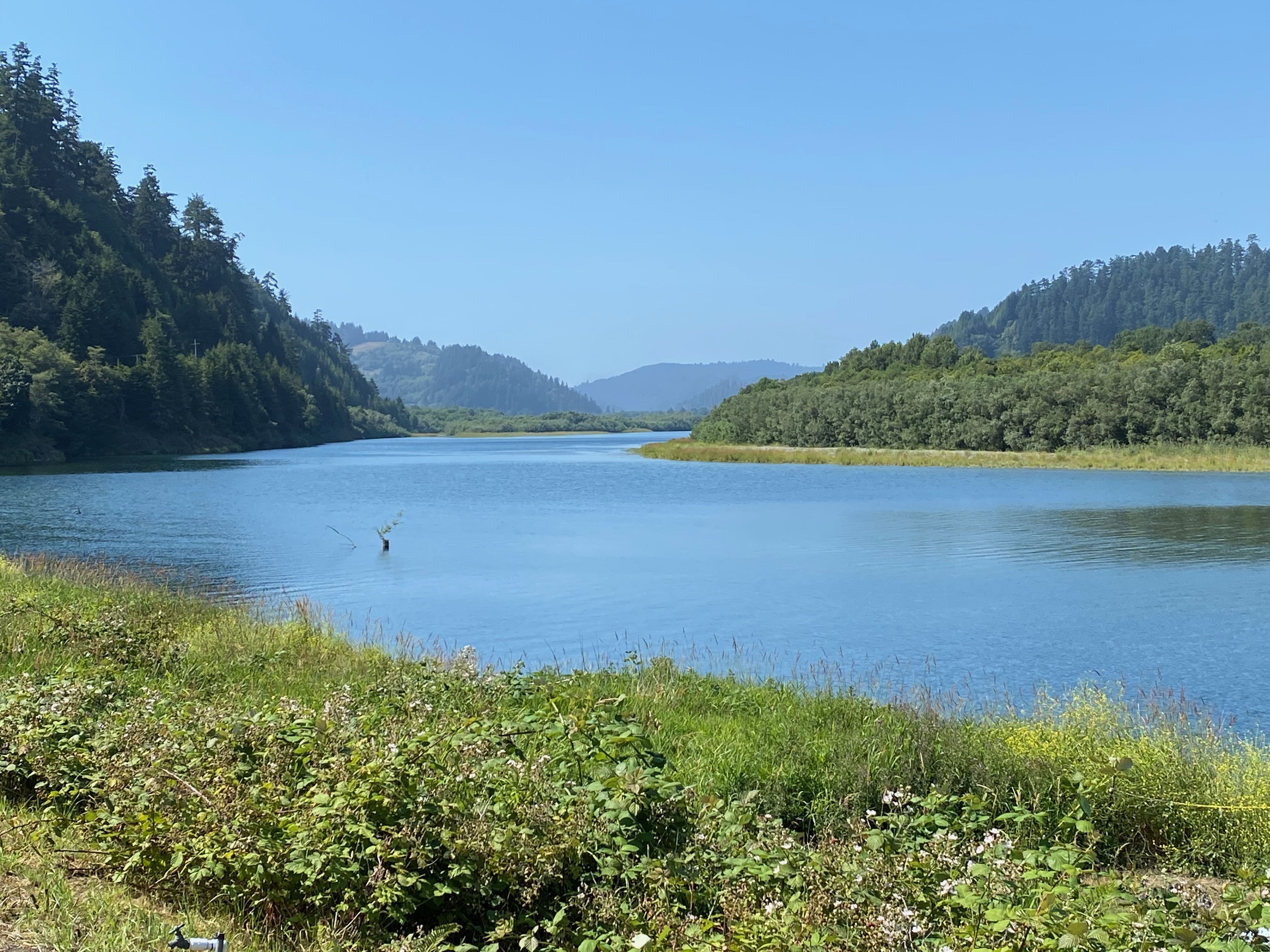
Klamath River 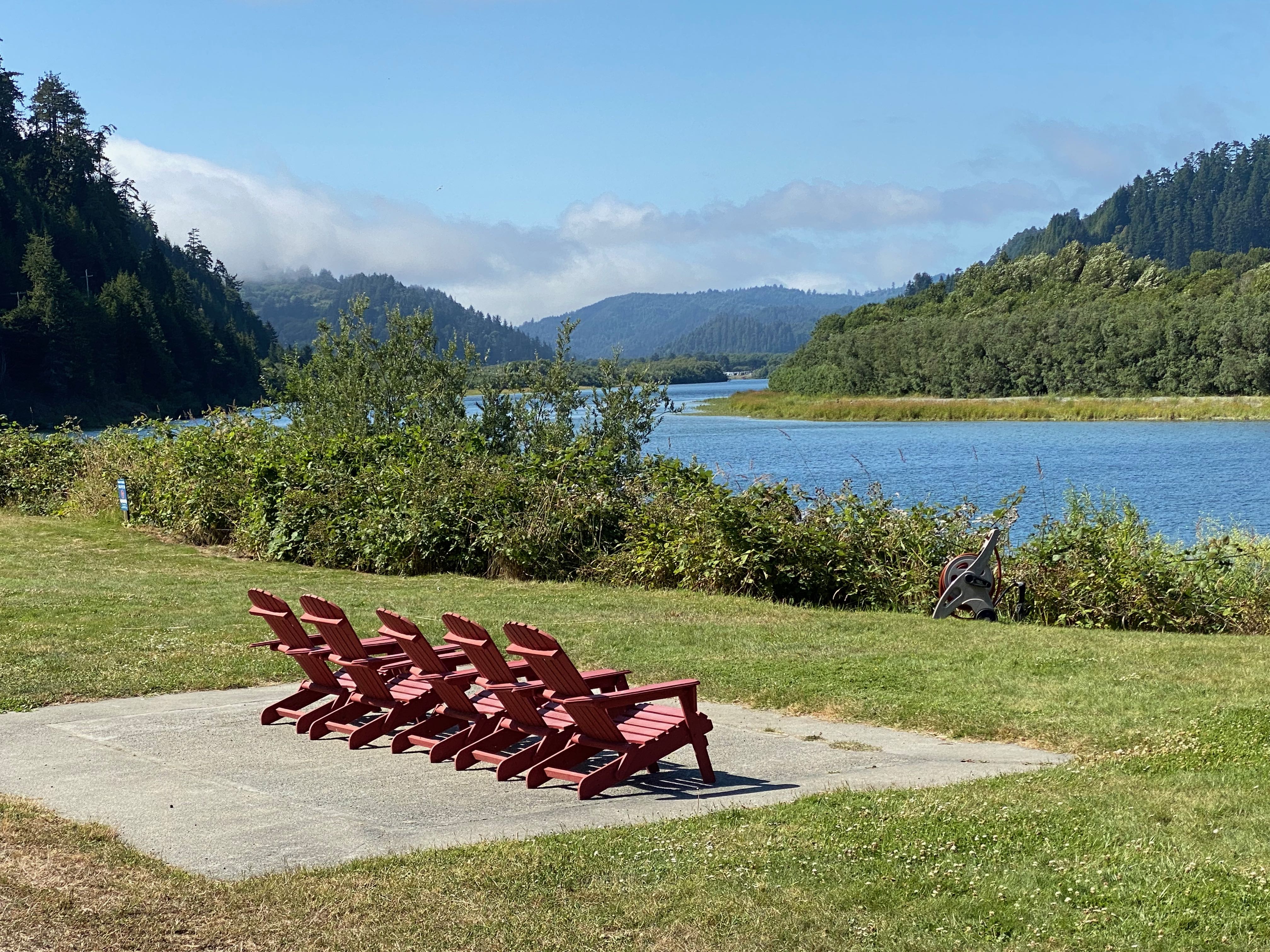
Sit back and relax
Cell phone coverage here was non-existent and limited blocks of internet usage was provided for each device.
Every morning we awoke to chilly temperatures and a heavy marine/fog layer that would normally burn off before noon. Sitting out in the afternoon was usually comfortable until the wind shifted around 5 p.m. and the sun fell below the surrounding hills. Campfires were abundant.
Crescent City
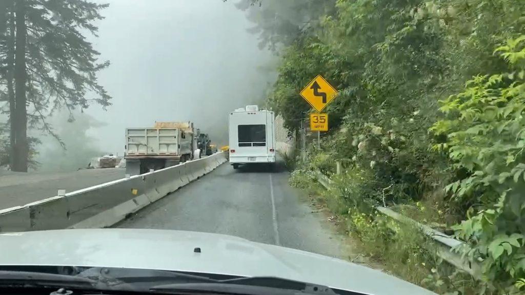
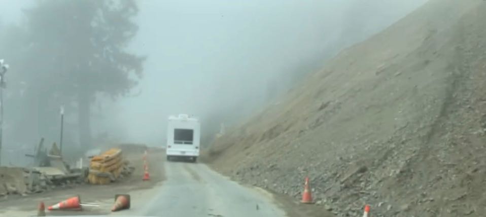
The next morning we decided to drive north on US 101 to Crescent City. Not only did we want to investigate Crescent City and run some errands, we also wanted to preview the road just north of Klamath prior to driving the RV through the following weekend. A rock slide at Last Chance Grade on Jan. 12, 2021 had closed US 101. At this time, crews were still working to fully reopen the road. Only one lane was open with alternating traffic on weekends and during weekday openings. Monday through Thursday the road was completely closed from 8 – 12 and 3 – 7. On Friday it was closed from 8 – 12. We ended up waiting 20 minutes on the south side that morning.
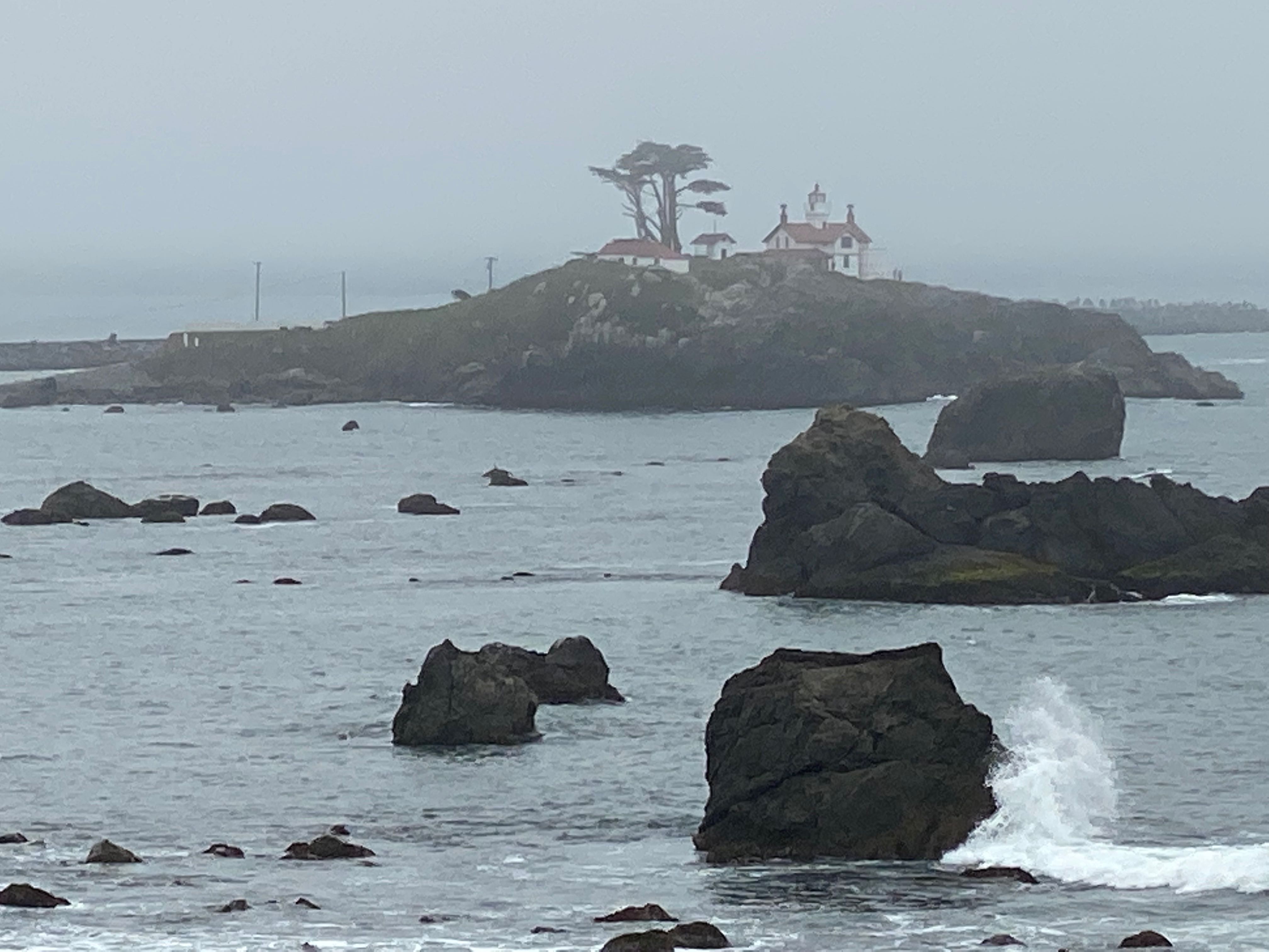
Our first stop in Crescent City was at the Battery Point Lighthouse.
Battery Point Lighthouse is perhaps the most visited structure in all of Del Norte County in spite of the fact it is only accessible at low tide. The rest of the day it is an island located just offshore of Crescent City at the foot of Front Street.
The first oil lamp was lit on December 10, 1856. The Lighthouse still serves as a private aid to navigation, kept and maintained by the Del Norte County Historical Society which staffs the Lighthouse with keepers year round. Tours include a climb to the lighthouse tower where a Fifth Order Drumm lens, still operational and maintained by our keepers, is in use. The tour of the residence includes looks into each of the residence rooms where original furniture often crafted by keepers many years ago is still in use. Most of the artifacts on display are from Battery Point Lighthouse’s over 150-year history.
delnortehistory
Unfortunately we didn’t plan well and although we saw others braving the tide, we decided to view from afar.
Battery Point Light 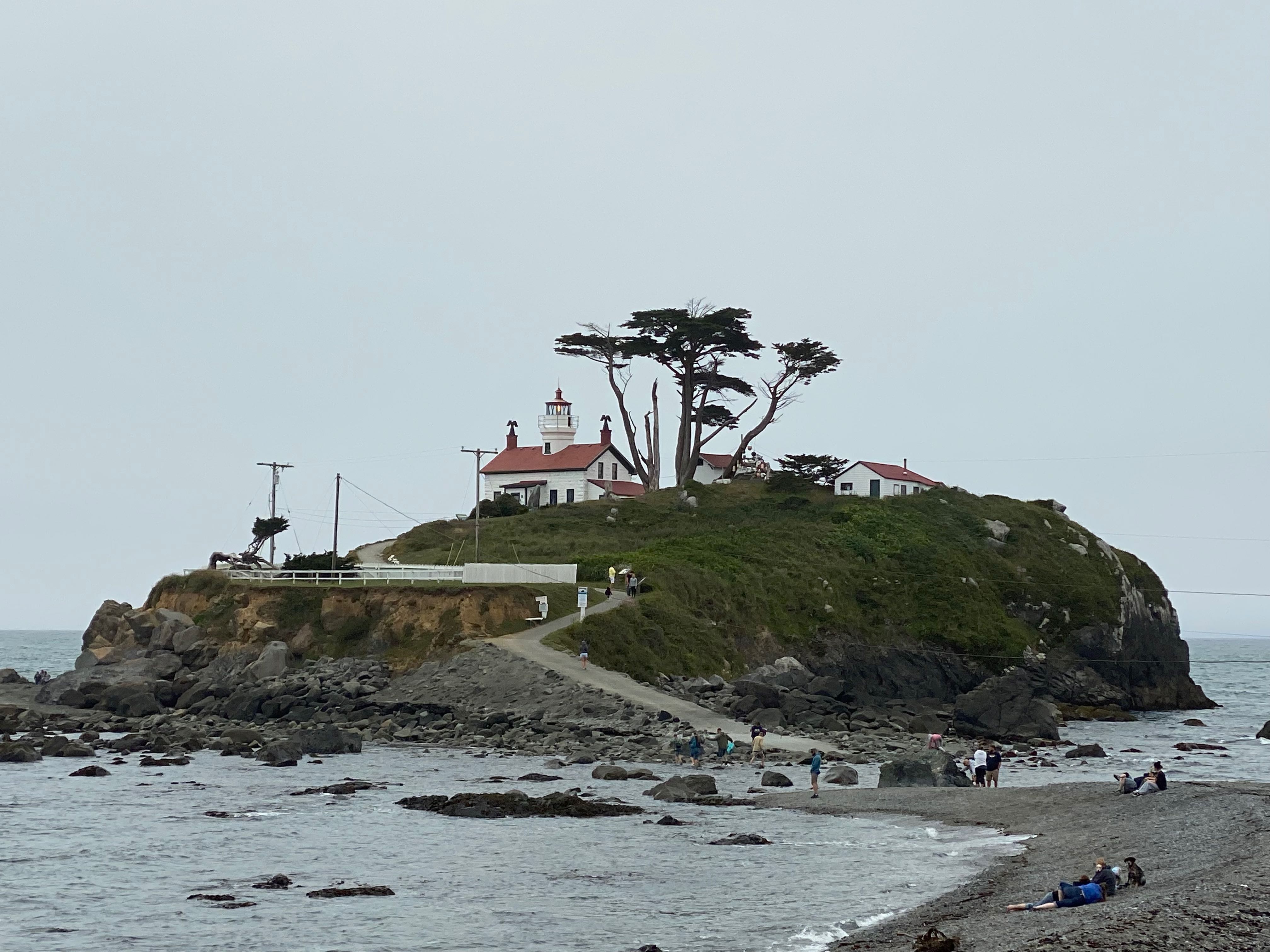
Battery Point Light
From Battery Point we continued driving along the coast via Pebble Beach Drive.
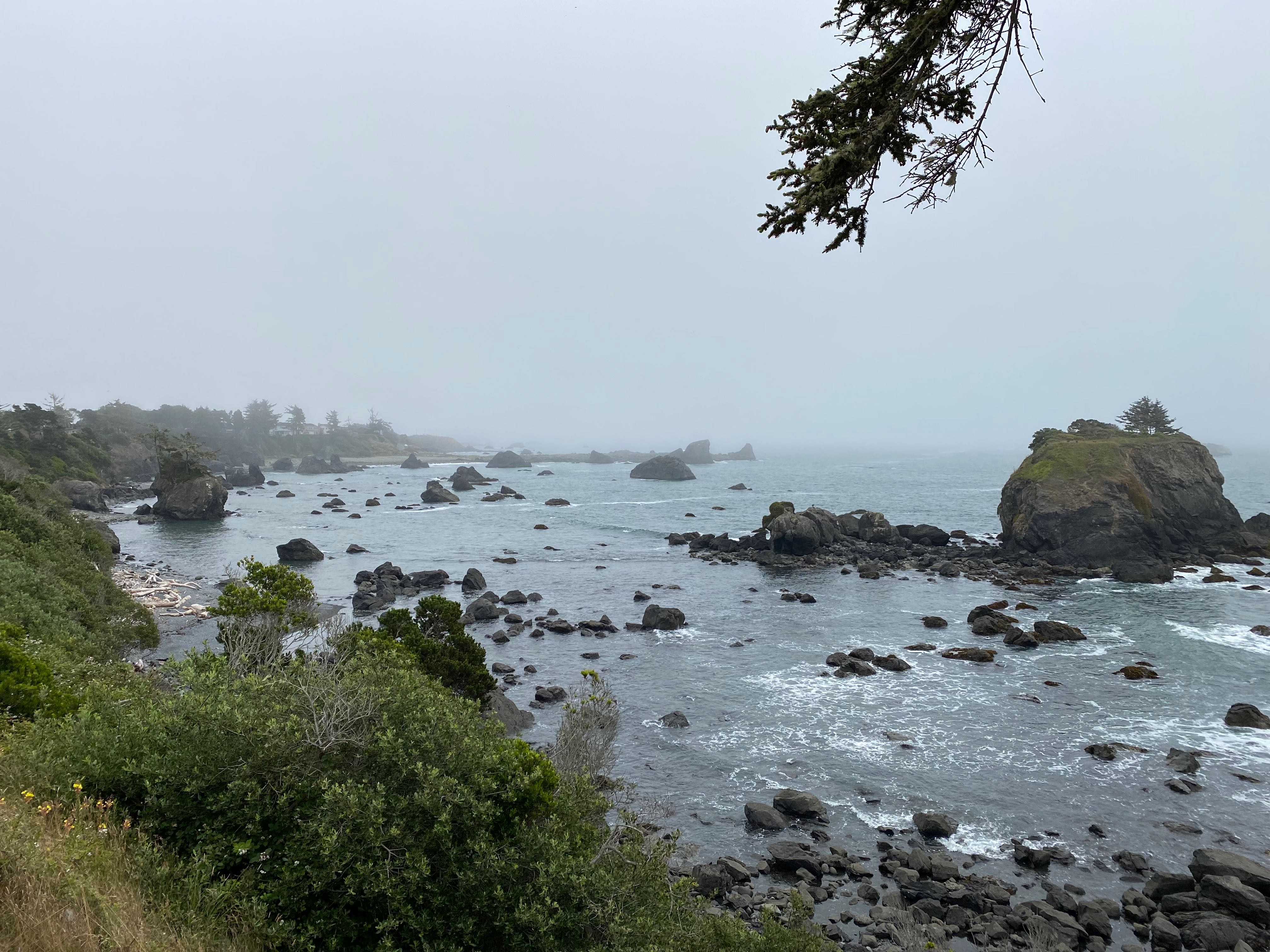
Coastal Overlook 
Pebble Beach
We did drive briefly into Jedediah Smith Redwoods State Park so that I could get a National Parks Passport stamp.
Our next stops were much more mundane – Walmart and Safeway – as Klamath didn’t have a grocery store. By the time we had had lunch and run our errands in the “big city” the marine fog layer had burned off which gave us some magnificent coastal views on the way back to Klamath.
Along the coast
Trillium Falls Trail
A few days later we attempted to go to the Prairie Creek Redwoods State Park for another Passport stamp and a hike along one of the trails near the Visitor Center but the parking lot was full. Instead we found parking in Elk Meadow and hiked the Trillium Falls Trail – about 3 miles total but very pretty and quite different than other walks we had done.
Trillium Falls
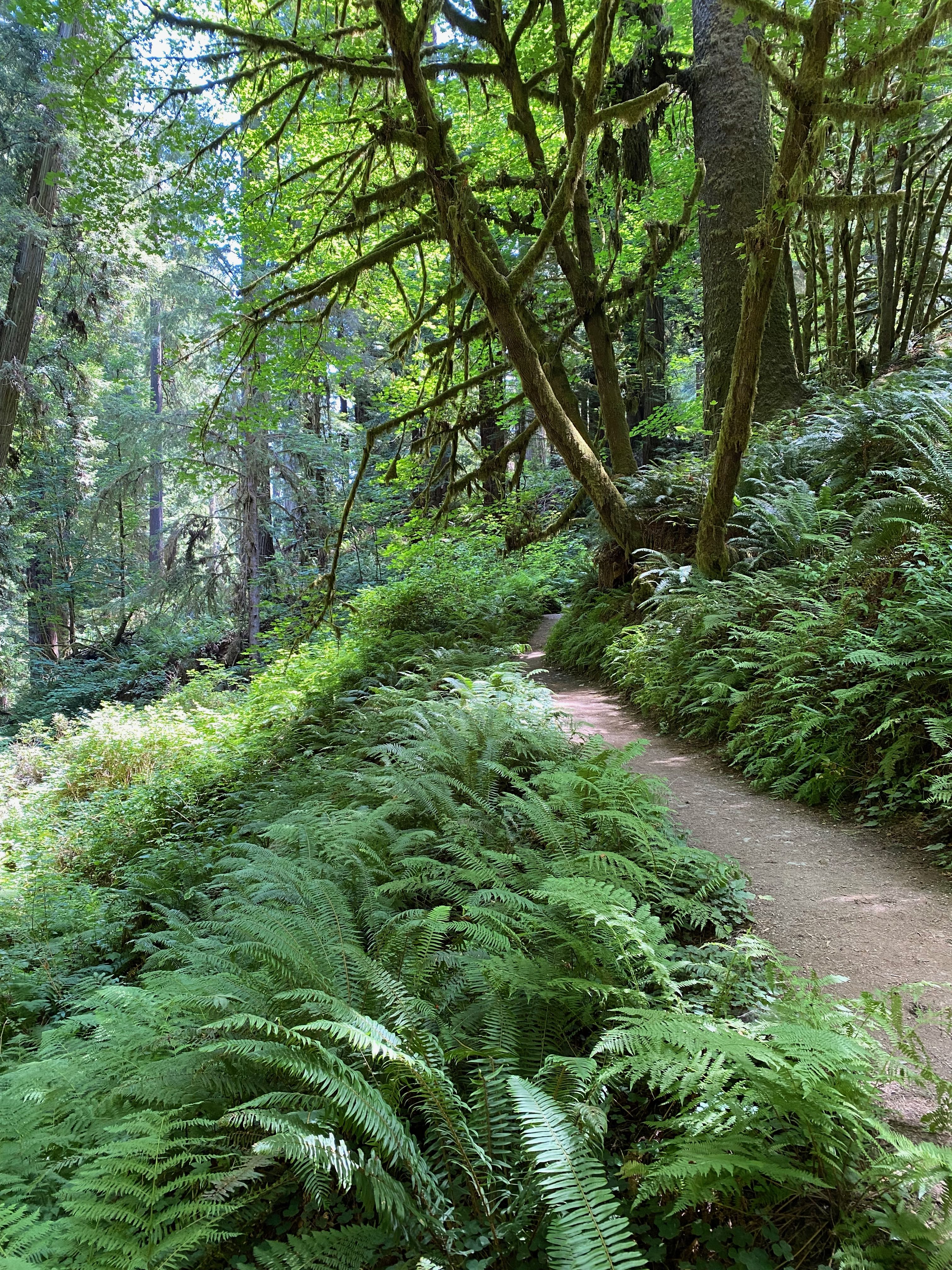
Trillium Falls Trail 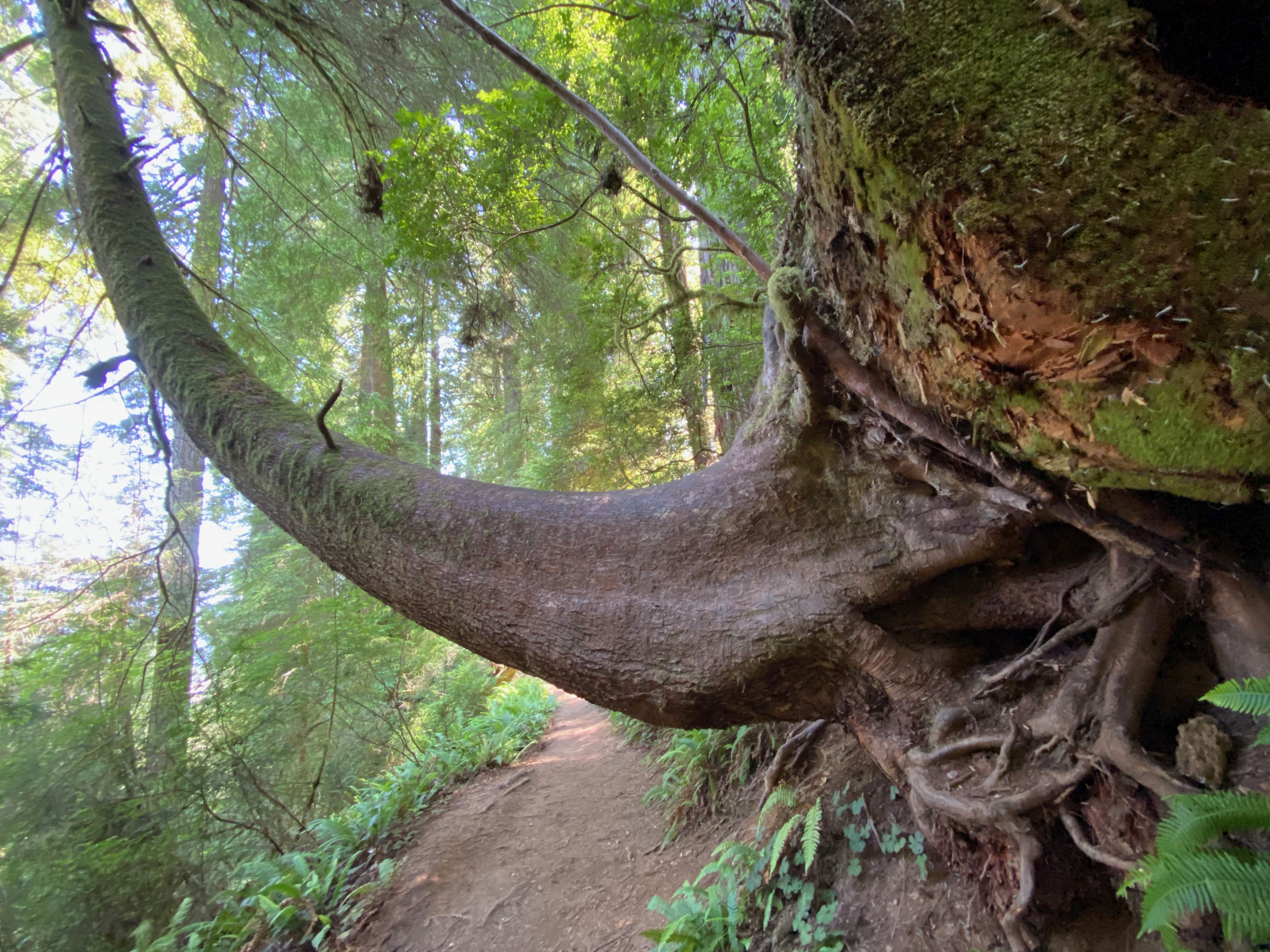
Be sure to duck
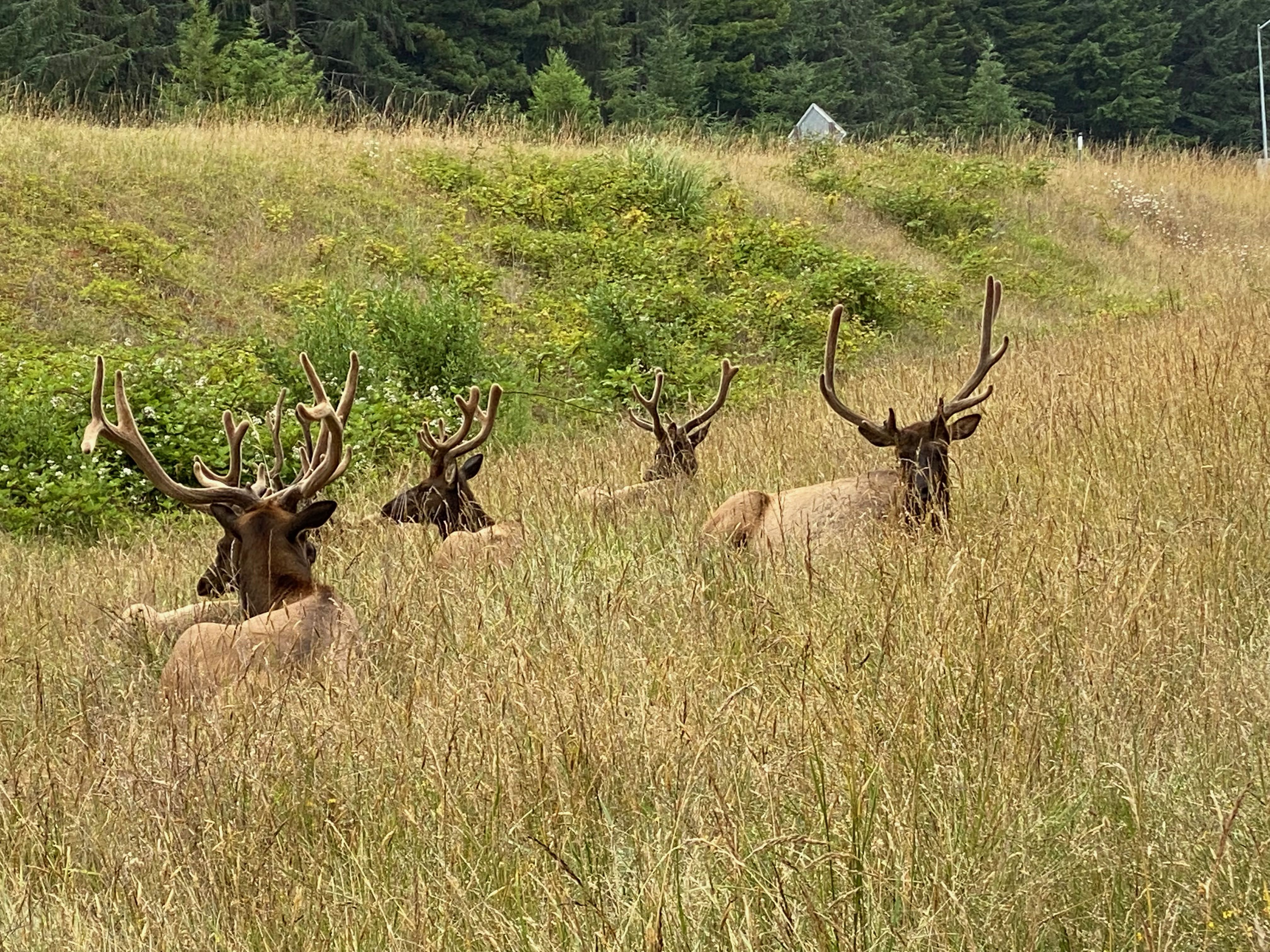
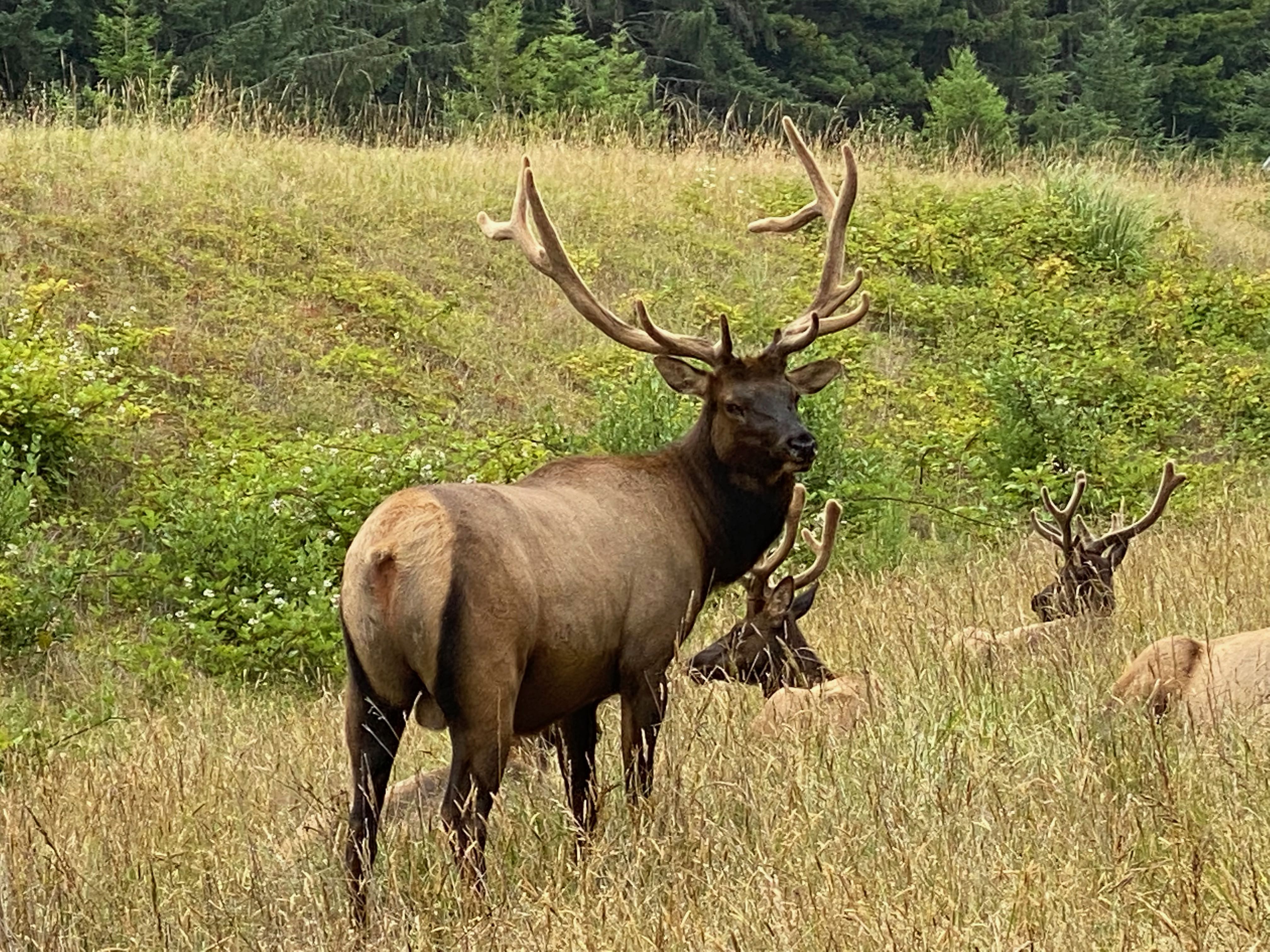
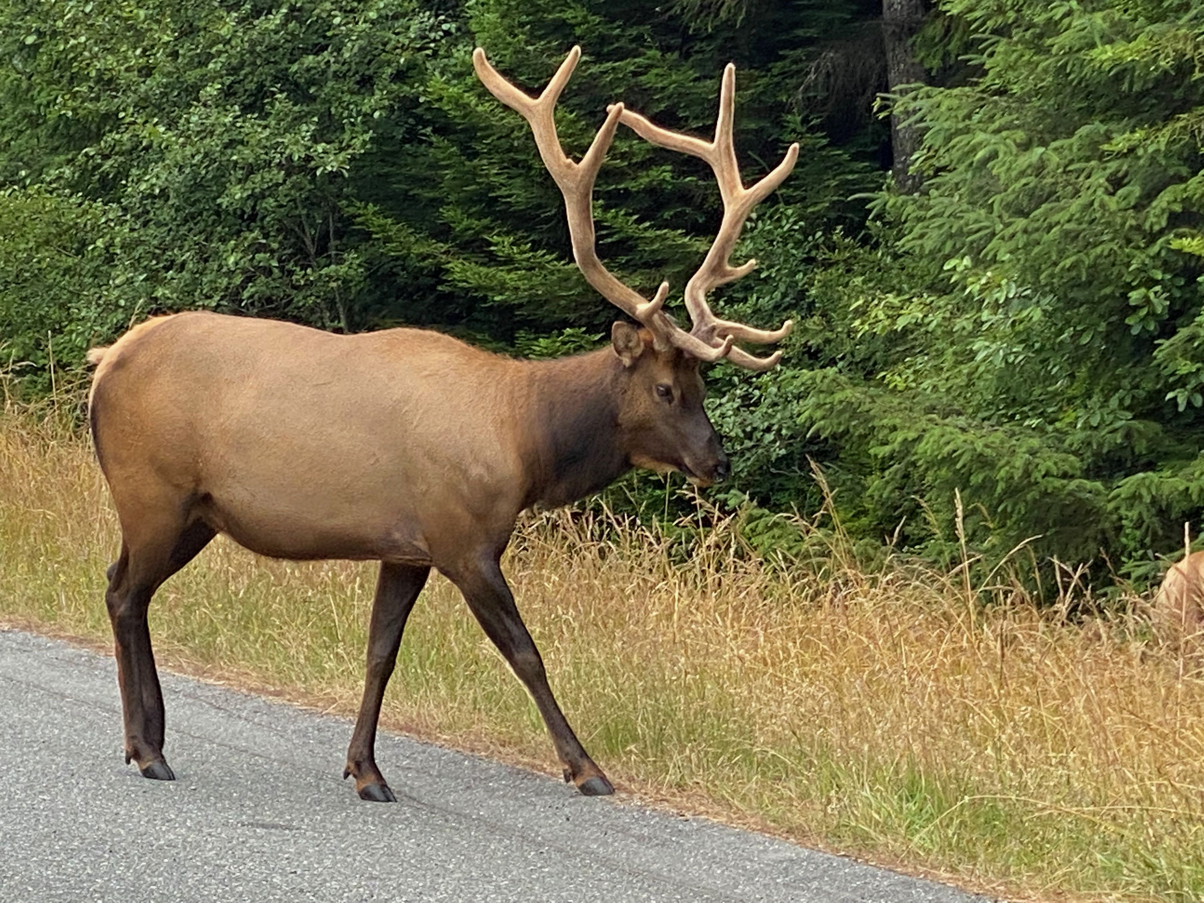
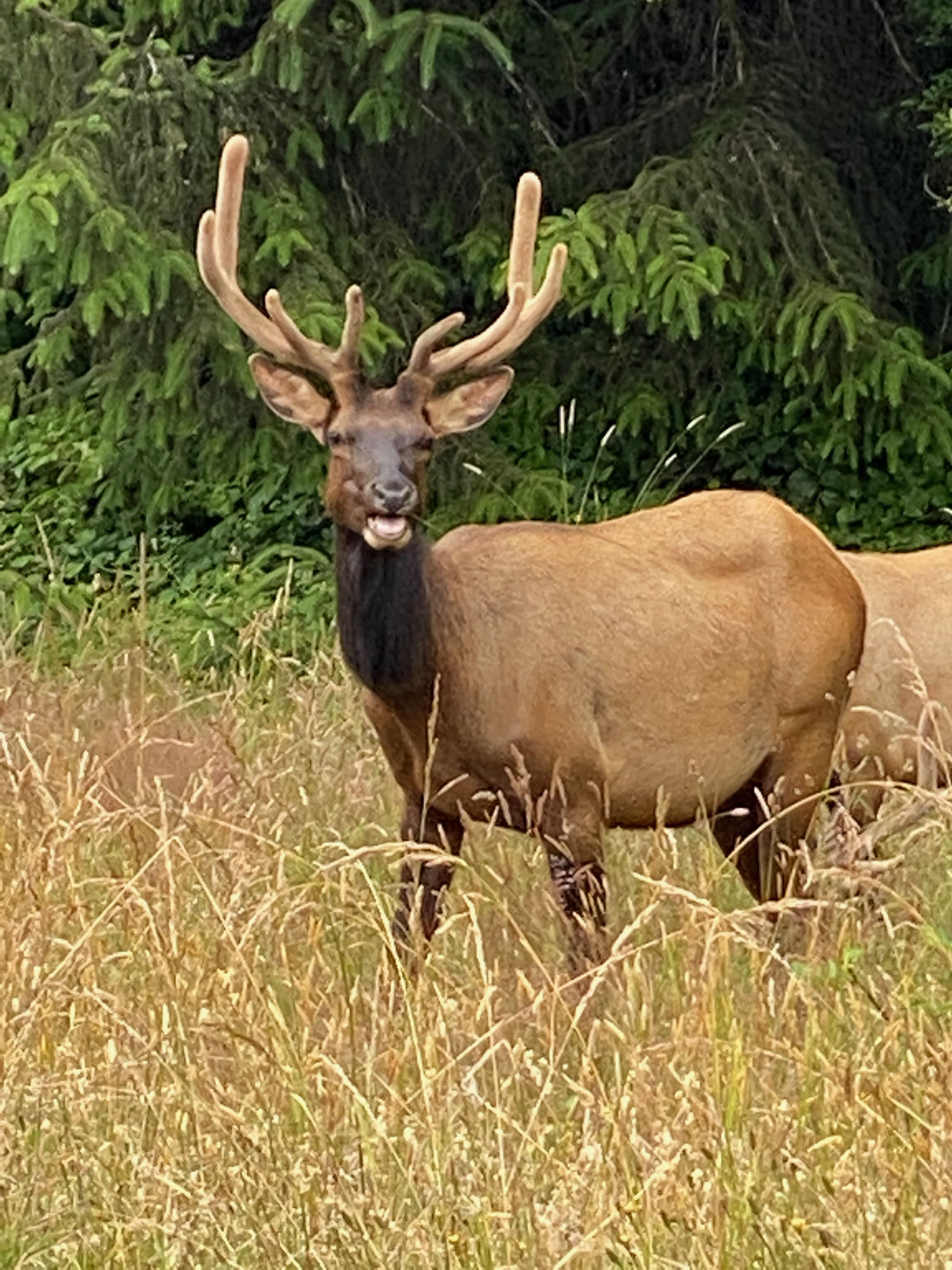
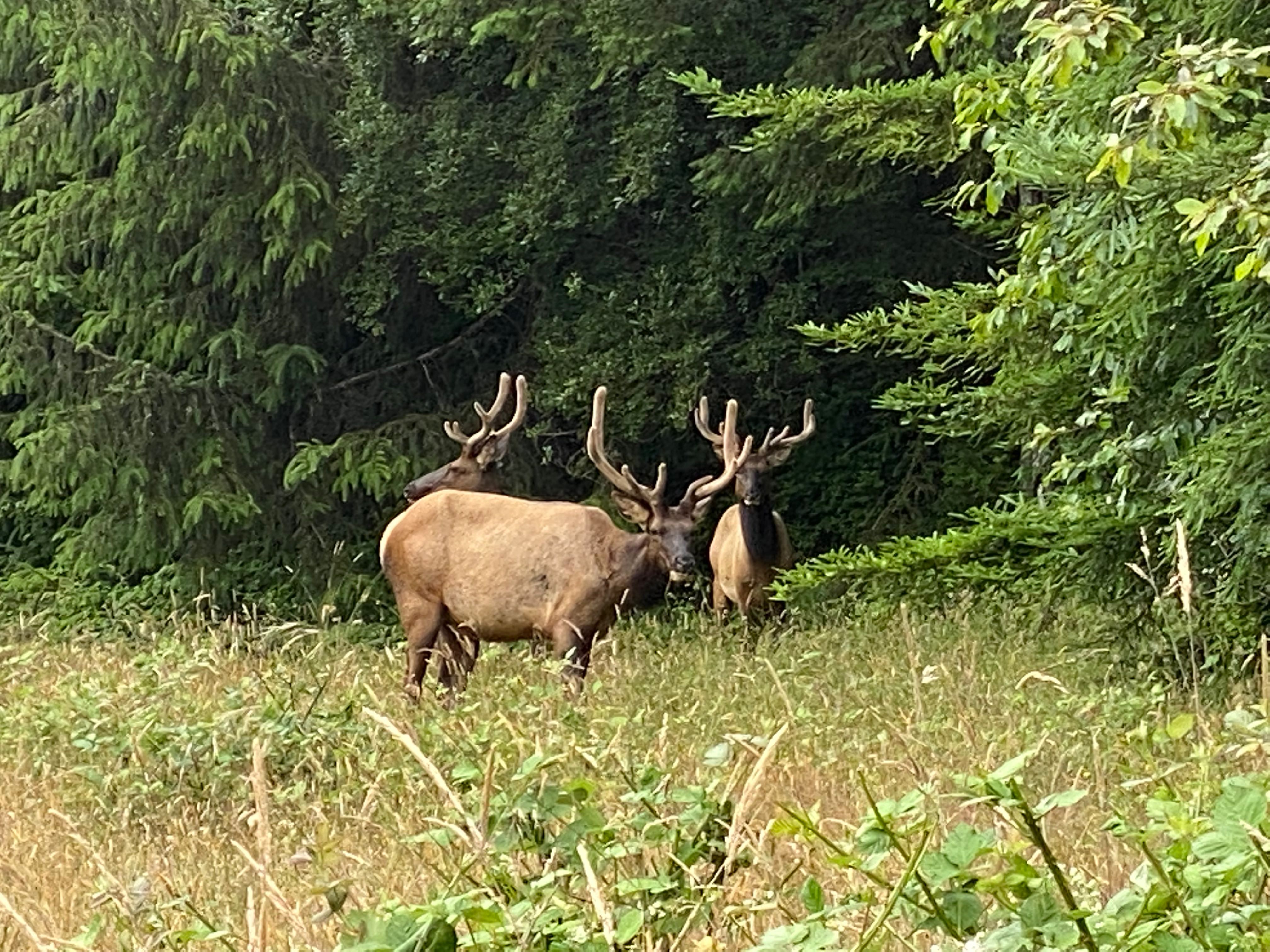
Elk “Hunting”
The next day was a bit unusual as the coastal fog didn’t lift in the morning. On a lark since it was still chilly, we decided to head down to Prairie Creek and the elk viewing area hoping to find elk. We didn’t get that far as we found some just off the highway!! These are Roosevelt elk.
The Roosevelt elk (Cervus elaphus roosevelti), is the largest of the six recognized subspecies of elk in North America; they once occurred from southern British Columbia south to Sonoma County, California. Today Roosevelt elk in California persist only in Humboldt and Del Norte Counties, and western Siskiyou County.
nps.gov
Forest of Racks 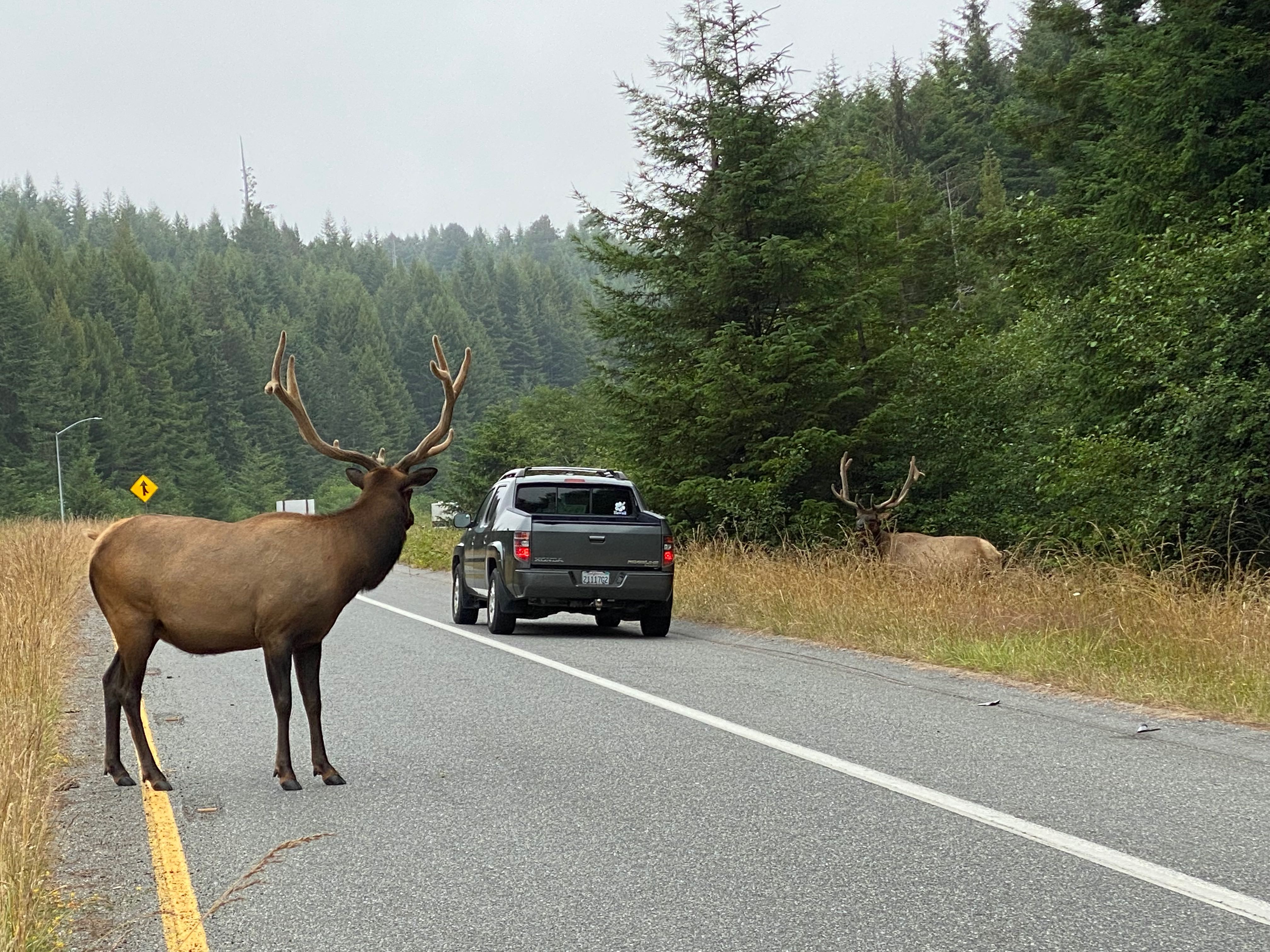
I’m watching you
Newton B. Drury Scenic Parkway
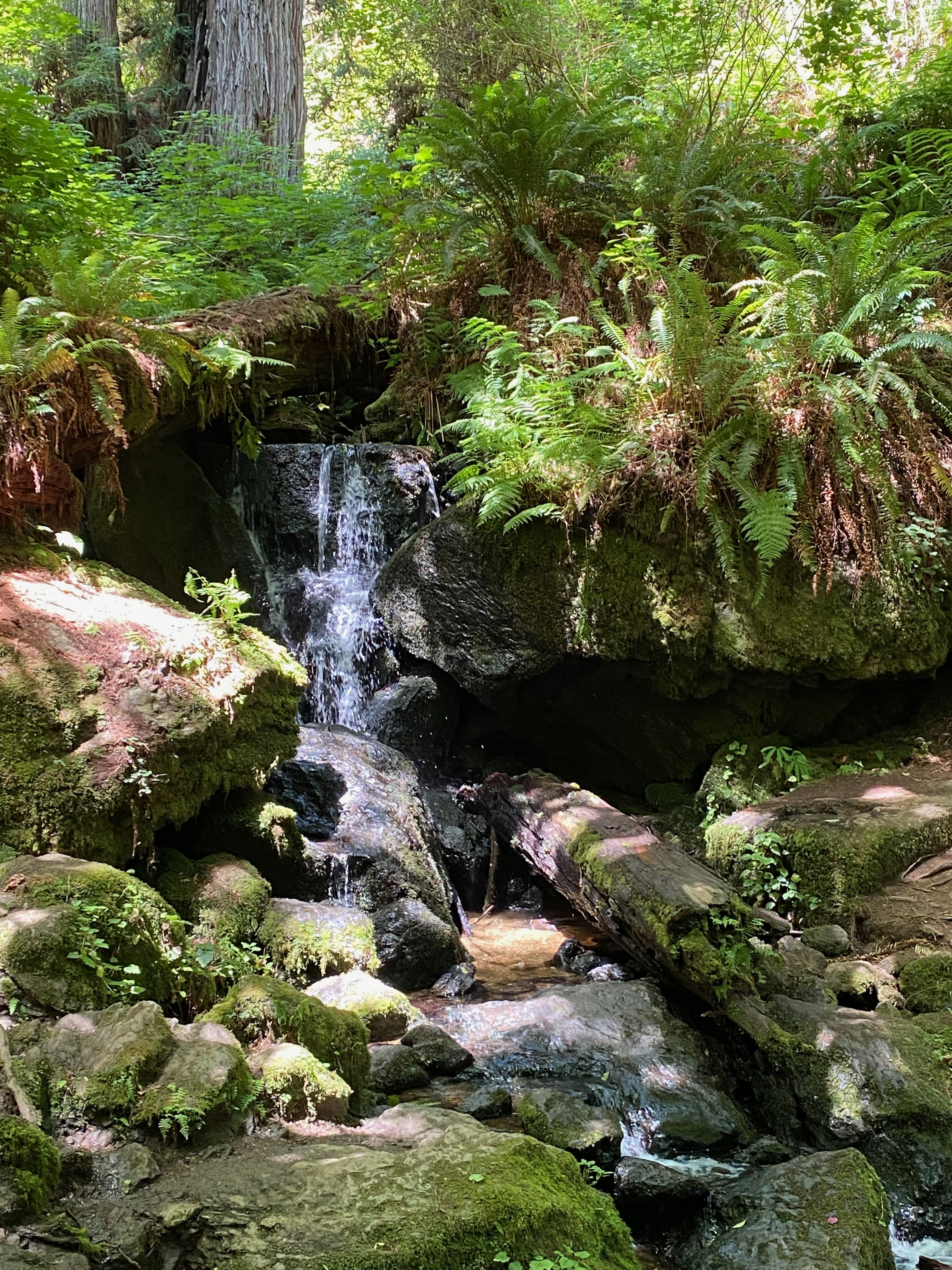
After elk viewing we were able to stop at Prairie Creek Visitor Center and I did get my Passport stamped. Then we took the Newton B. Drury Scenic Parkway where we stopped at the Corkscrew Tree and walked along the stream.
If you have only one chance to see redwoods, then don’t miss this! Any vehicle of any size can be on this road.
Found in the southern third of the parks, the ten miles of the Newton B. Drury Scenic Parkway will likely be one of the most stunning drives, or rides of your life. Allow for at least 20-minutes without stopping to drive the length of this.
Make sure you get off HWY 101 to see miles of big trees – you won’t find too many redwoods anymore along HWY 101.
Located in the heart of Prairie Creek State Park, the road gently takes you past thousands of acres of old-growth redwood forests. If you want to step out of your vehicle for a few minutes (or days) to explore, there are plenty of well-marked trails and pullouts for vehicles of all sizes along the parkway. The Prairie Creek Visitor Center is located towards the southern (lower) end of the parkway.
With 95% of the world’s redwood trees having been logged in the last century, old-growth redwood groves are now only found in smaller, isolated places. Except for Avenue of the Giants (a similar road 100-miles to our south), there is nowhere else in the world a driver of any vehicle can have this kind of experience.
nps.gov
Corkscrew Tree 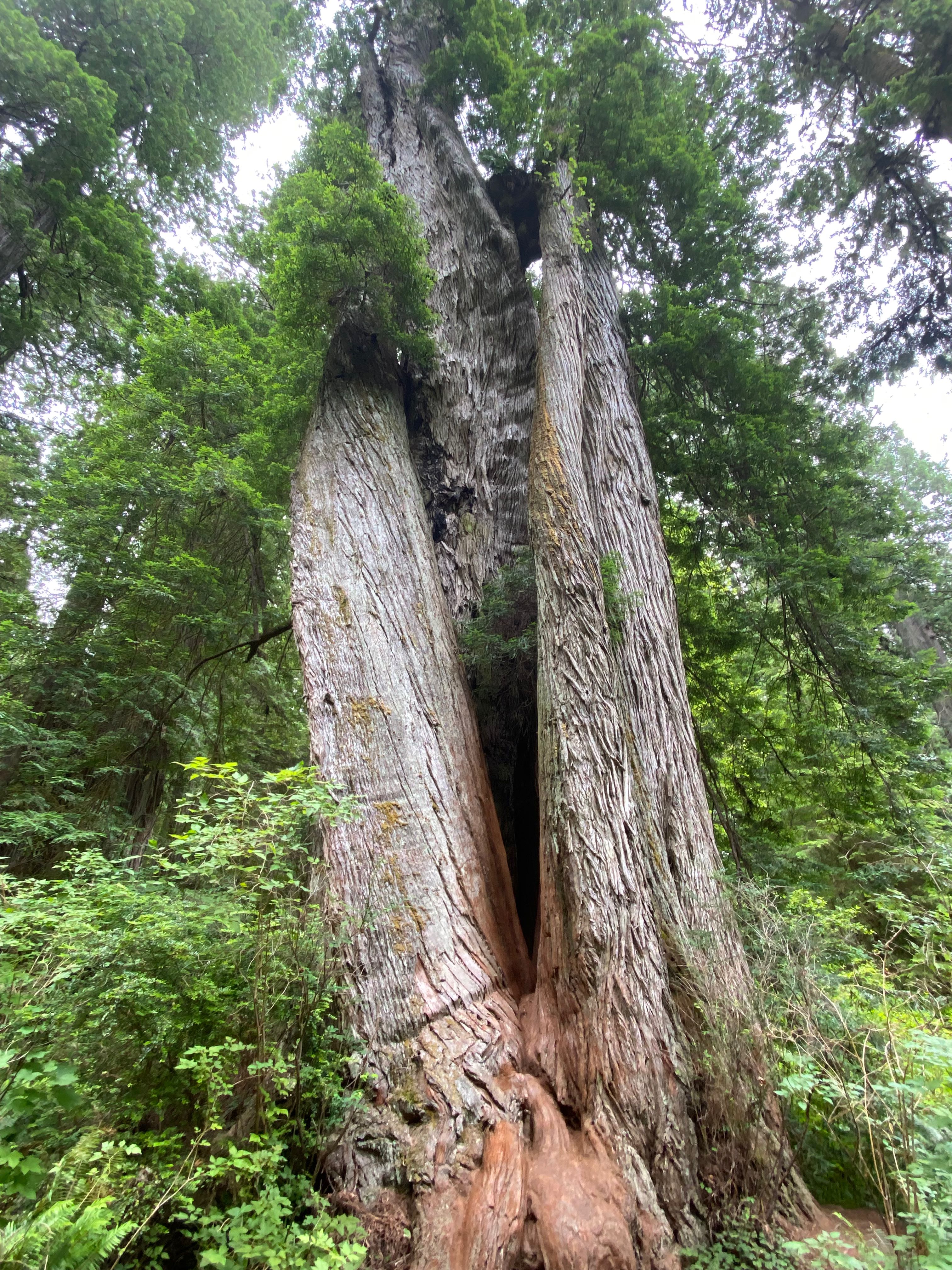
Corkscrew Tree 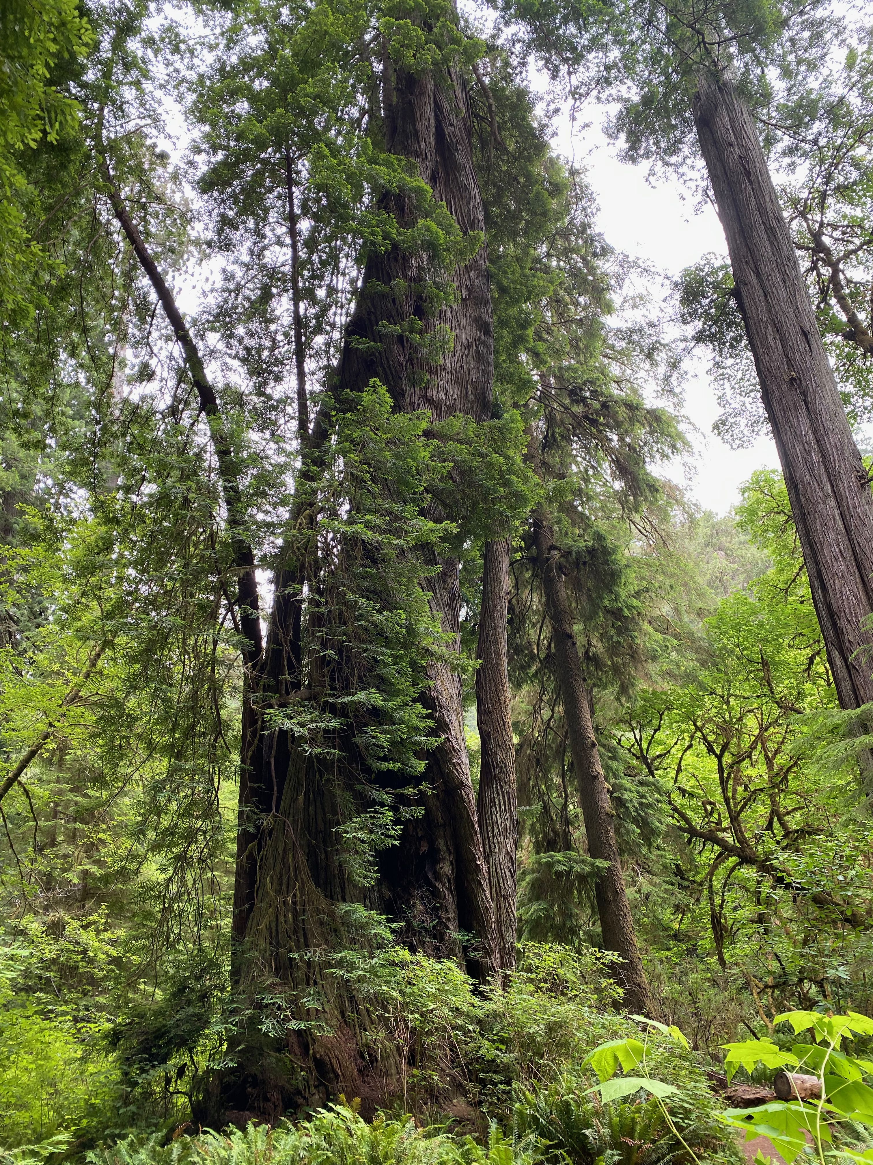
Corkscrew Tree 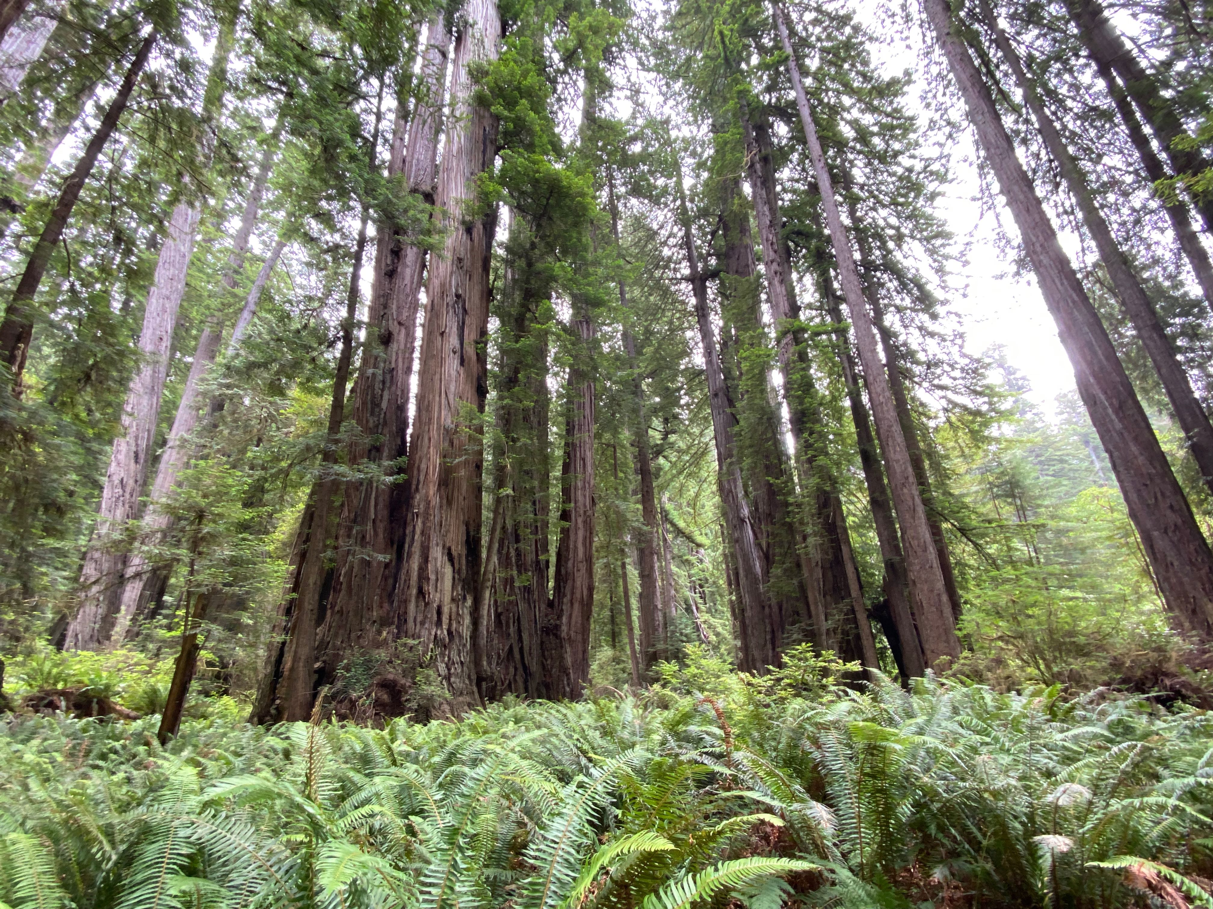
Redwoods 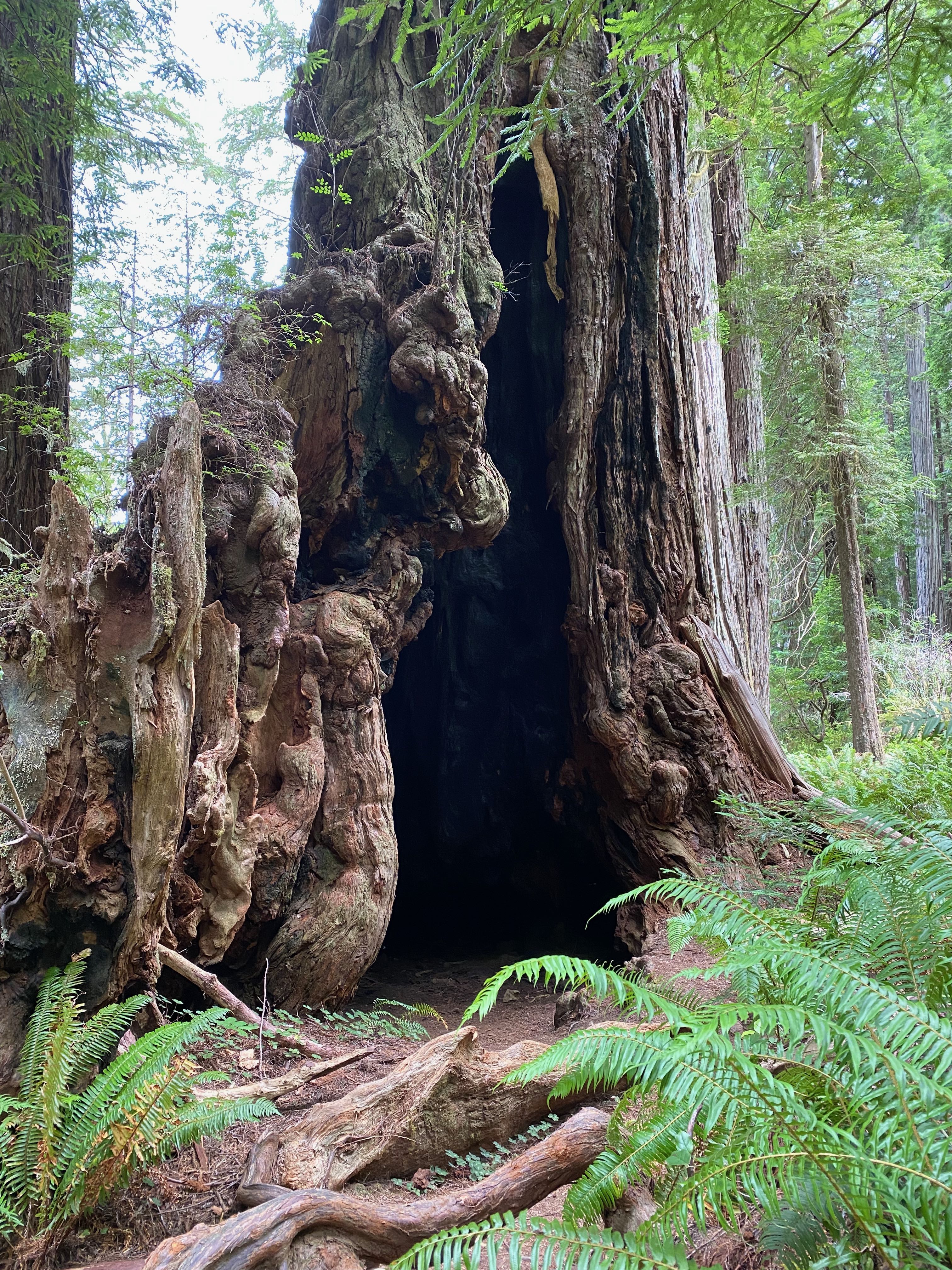
Space to live 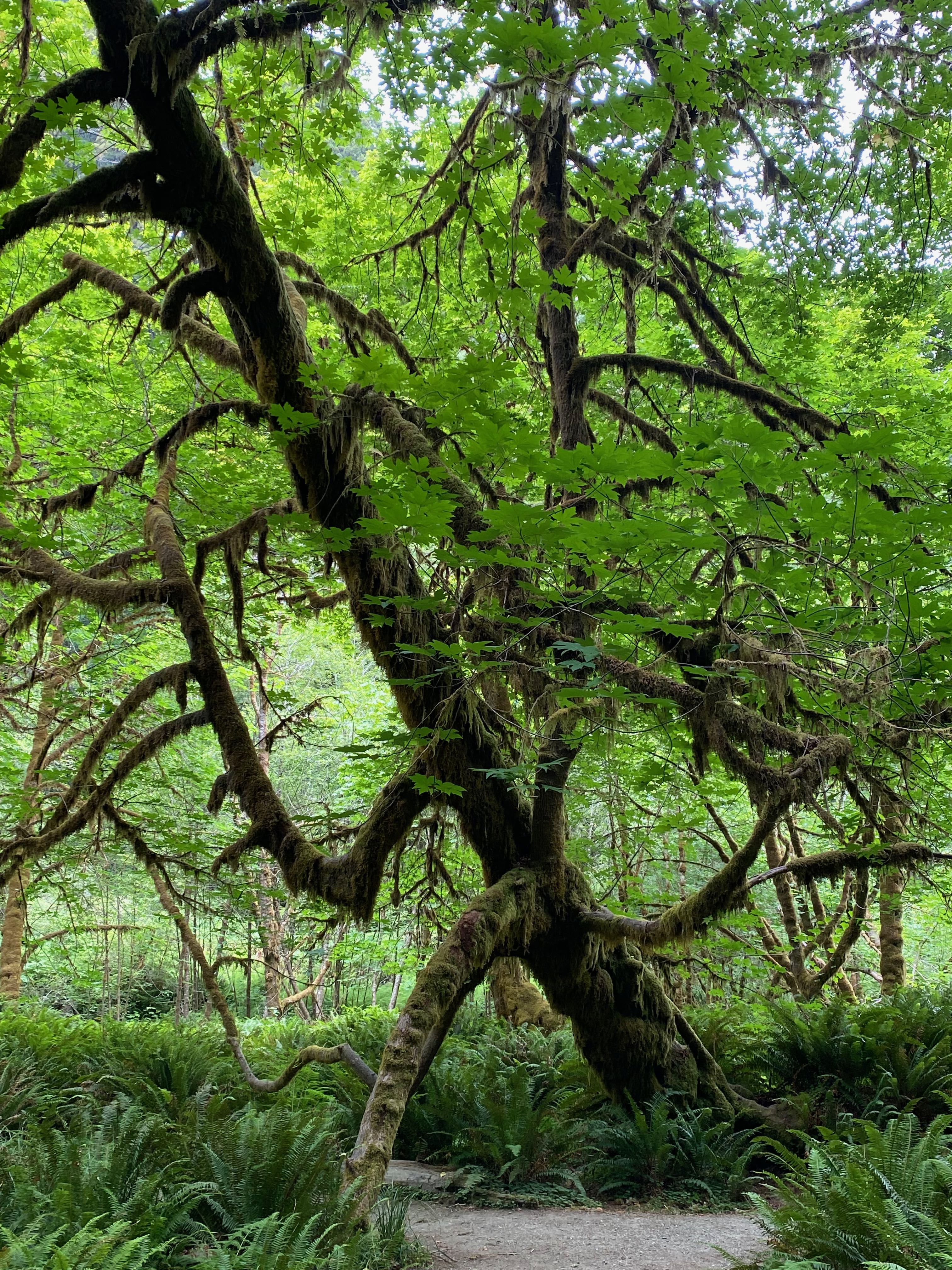
Near the stream
Coastal Trail Road
After our drive along the Scenic Parkway we backtracked a bit to the Klamath Beach Road going past the campground. Less than a mile from the campground we stopped at the Old Douglas Memorial Bridge Site.
The Great Christmas Flood of 1964 was a doozy, if judged by the number of Redwood Highway tourist attractions still proudly displaying high water marks on surviving structures and trees. A series of storms battered the Pacific Coast and hit northern California starting Dec. 21, 1964. The torrent dumped 24 inches of warm rain on recently accumulated mountain snow pack, causing the Eel and Klamath Rivers to rise precipitously.
The deluge destroyed 98% of the riverbank town of Klamath. The Douglas Memorial Bridge, a 1926 arch bridge along US Highway 101, was in the path of the rising Klamath River. Debris piling against its otherwise sturdy supports helped smash it.
The town of Klamath was eventually rebuilt — on higher ground — and US Hwy 101 was rerouted to a spot with a higher span and better tolerance for biblical-scale calamity. The modern bridge features four California bear statues, similar to the ones that bracketed the destroyed bridge, and most drivers whizz across (no doubt thinking about beating the crowds to a drive thru tree).
More leisurely travelers can pay their respects at remains of the old Douglas Bridge. The western stub was preserved, with its pair of concrete 8-ton California bear statues, as a memorial to the “The Thousand Year Flood.”
RoadsideAmerica
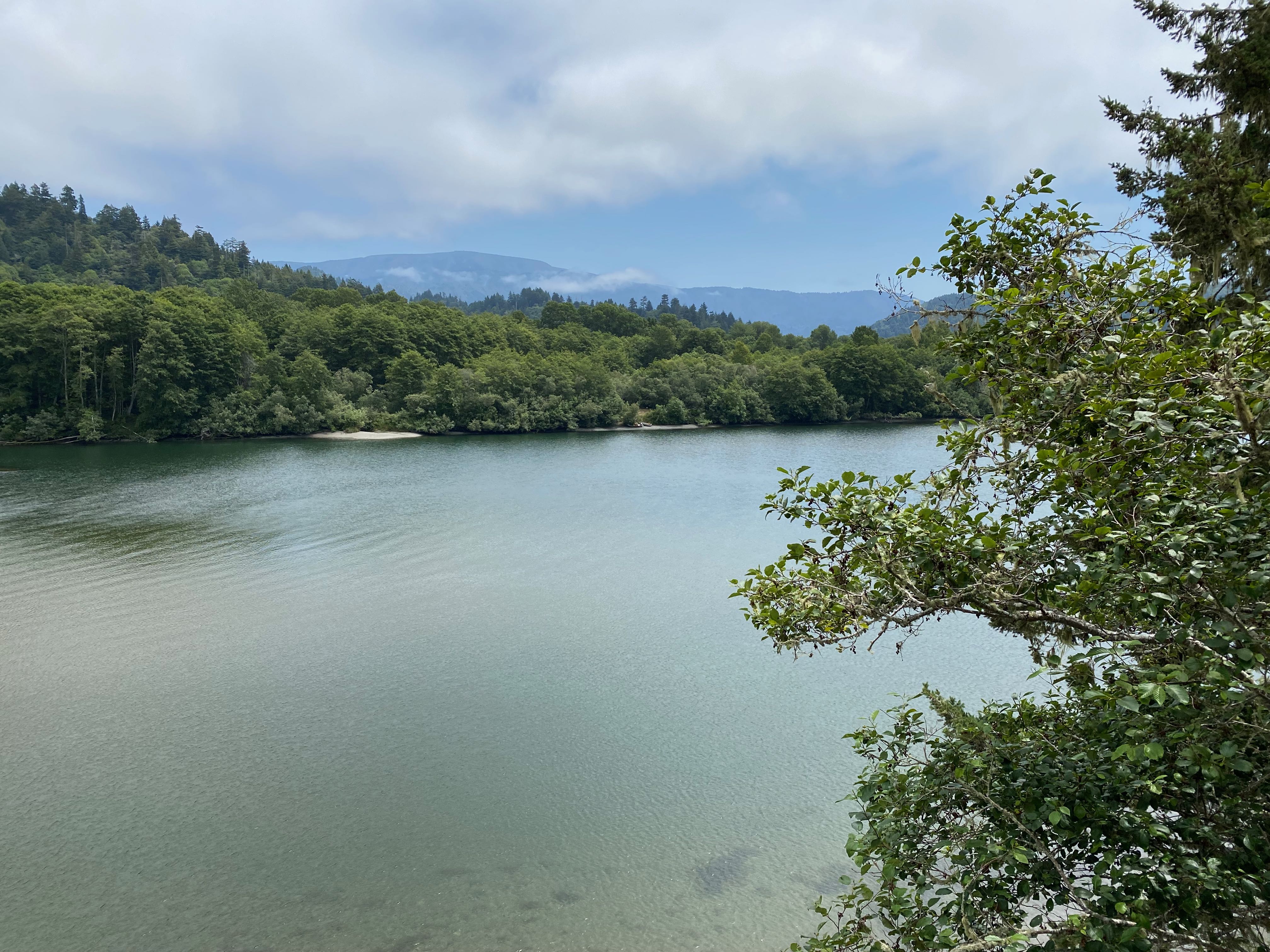
Klamath River 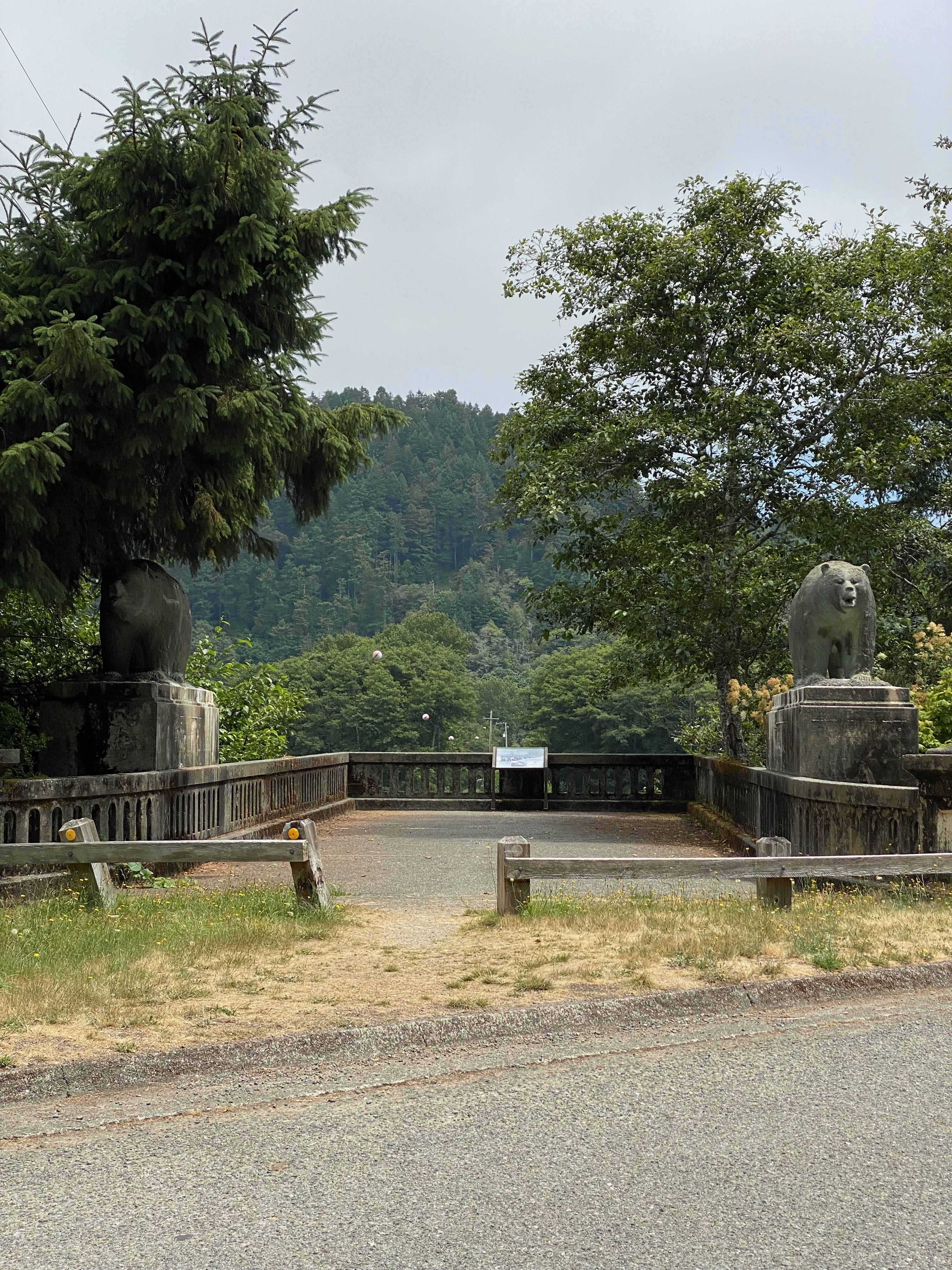
Douglas Memorial Bridge Site
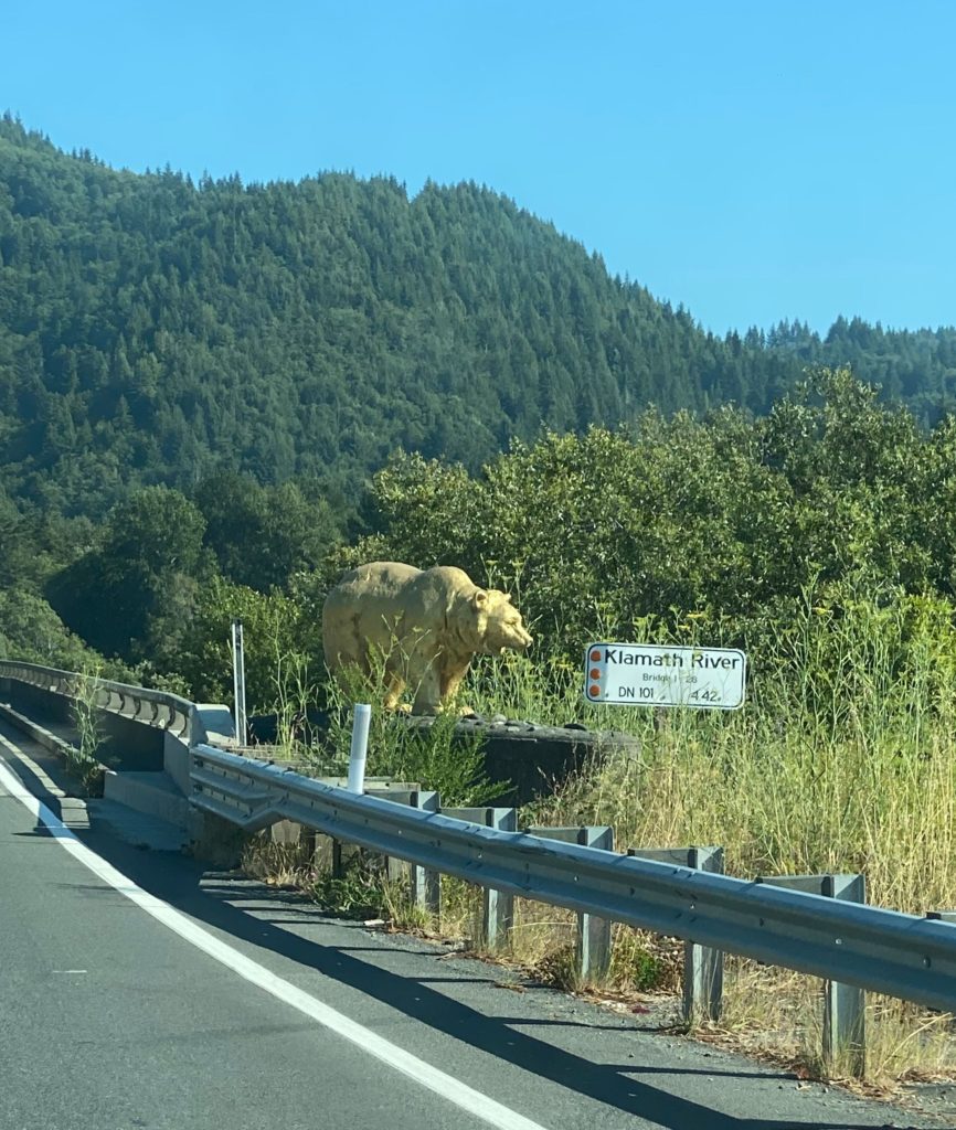
Golden Bear on New Bridge 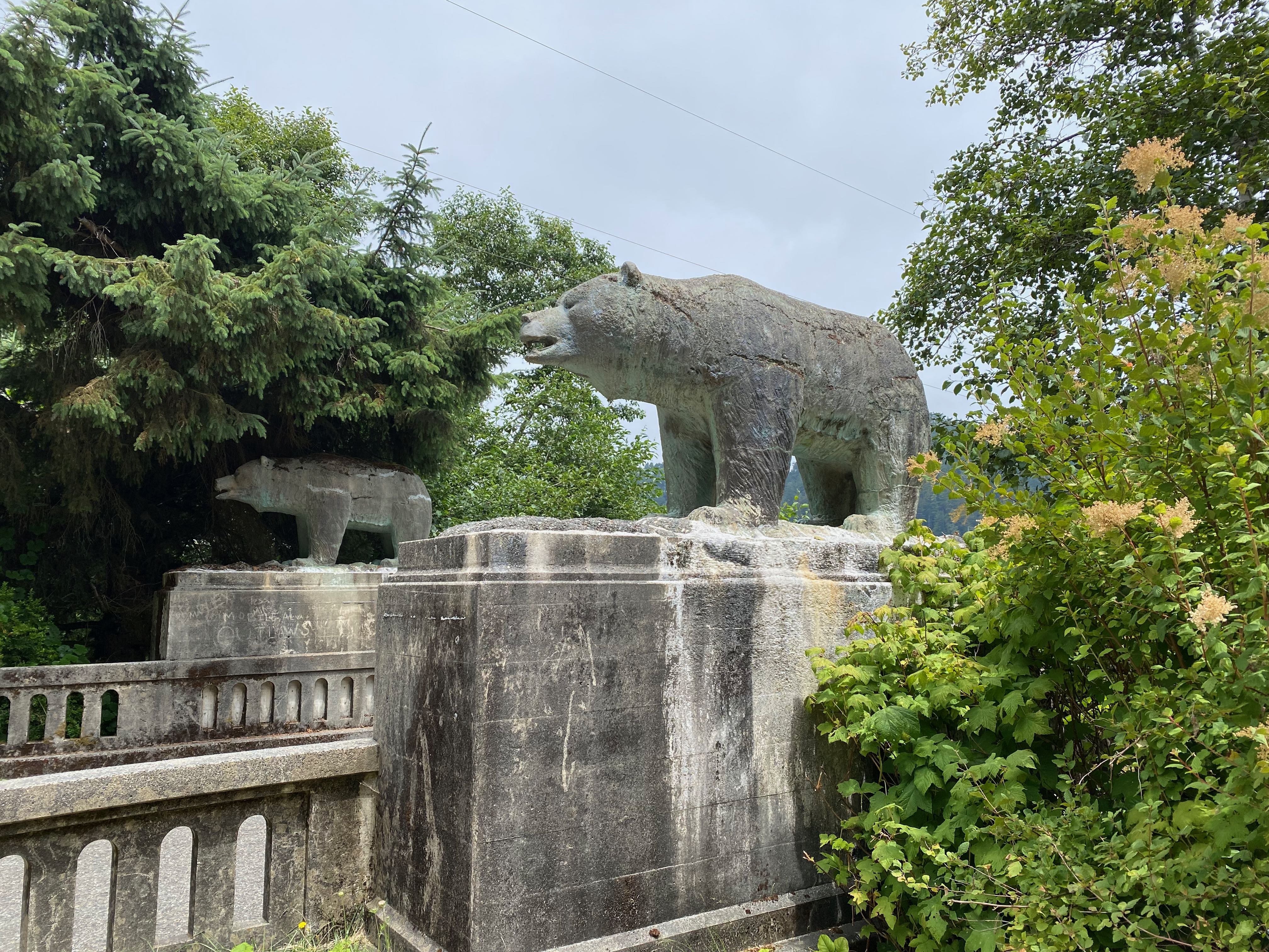
Concrete Bear from Old Bridge
From the Douglas Memorial Bridge Site we turned onto Coastal Drive. We stopped to enjoy the view from the High Bluff Overlook where it was very windy and chilly. You can still see the fog layer and rough surf below.

Overlook 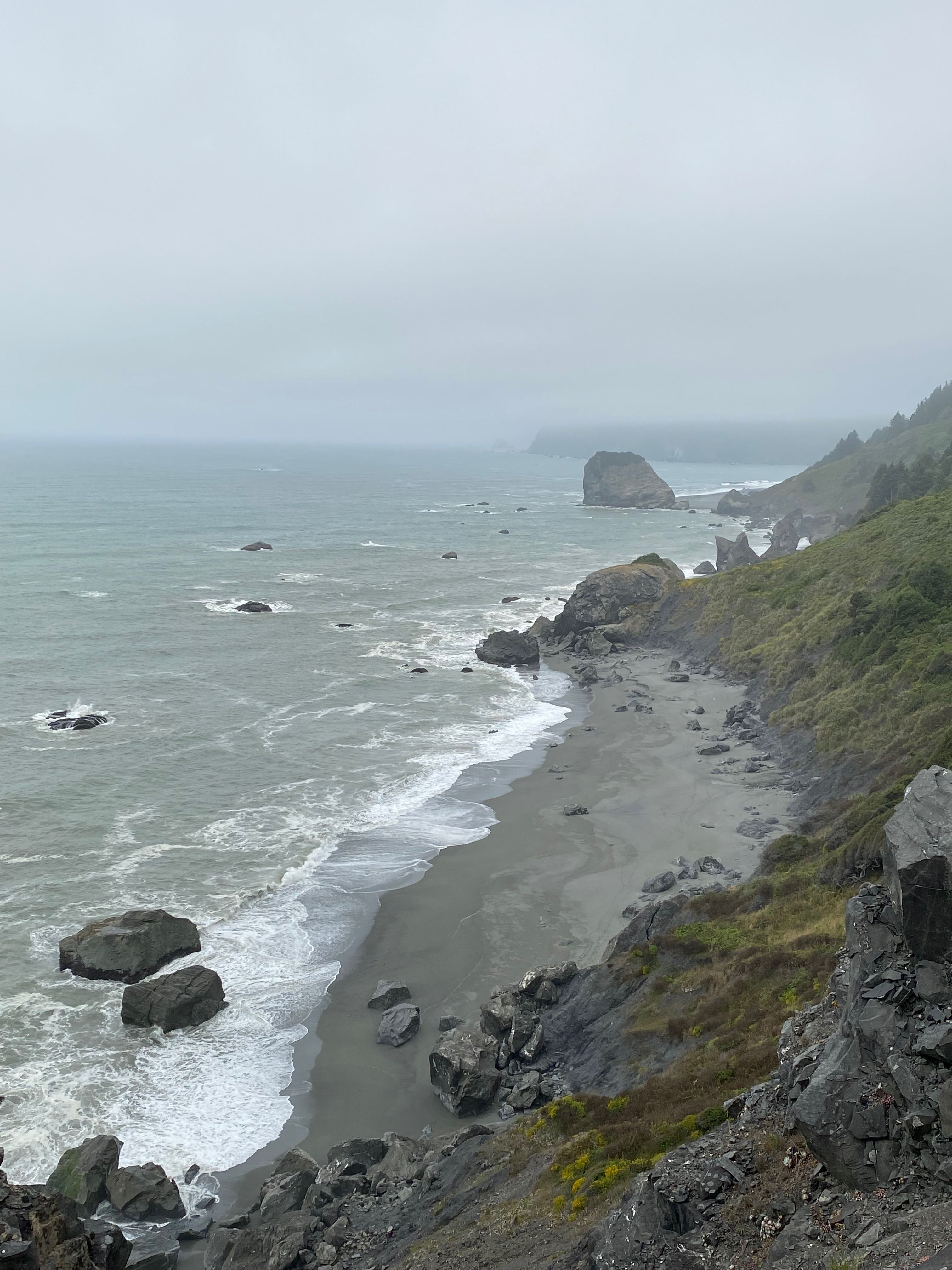
Overlook
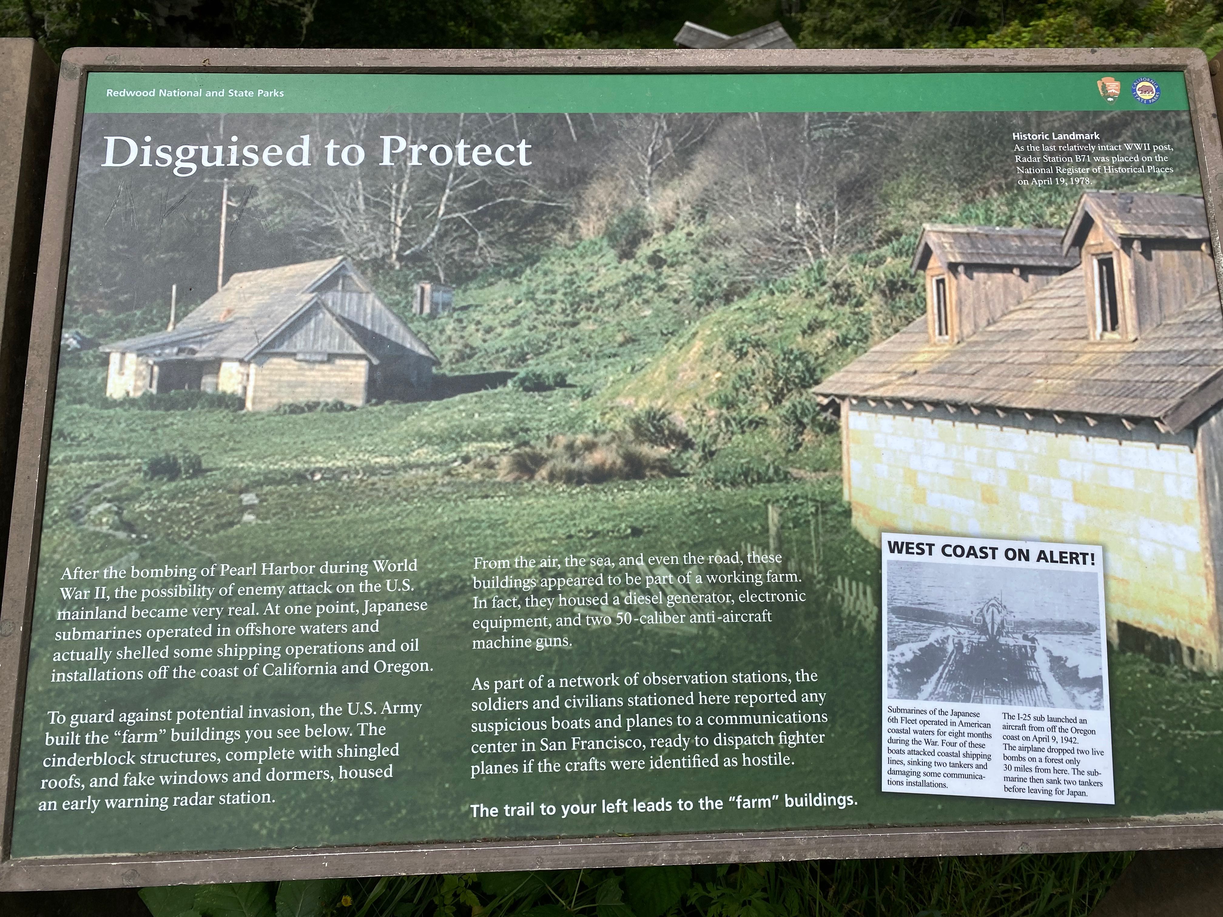
Continuing on the Coastal Drive our next stop was the B-71 Radar Station. Unfortunately the terrain and the trees prevented us from getting any reasonable photos.
The Klamath River Radar Station B-71 is a rare, surviving World War II early-warning radar station. This kind of radar station was the first step towards a more sophisticated and pioneering early-warning radar defense network.
The Klamath station was designated by memorandum dated November 6, 1942 as Station B-71, named “Trinidad.” It was also referred to as the “Klamath River” station. The complex included a Power Building, Operations Building, a privy and anti aircraft guns. The radar station was built immediately adjacent to, if not partly on, the historic old Trinidad-Crescent City wagon road.
Rather than using camouflage materials, the buildings of Radar Station B-71 were constructed to resemble farm buildings to disguise their true purpose. The station consisted of three buildings: a power building disguised as a farmhouse, an operations building disguised as a barn and a functional wood frame two-stall privy or outhouse.
nps.gov
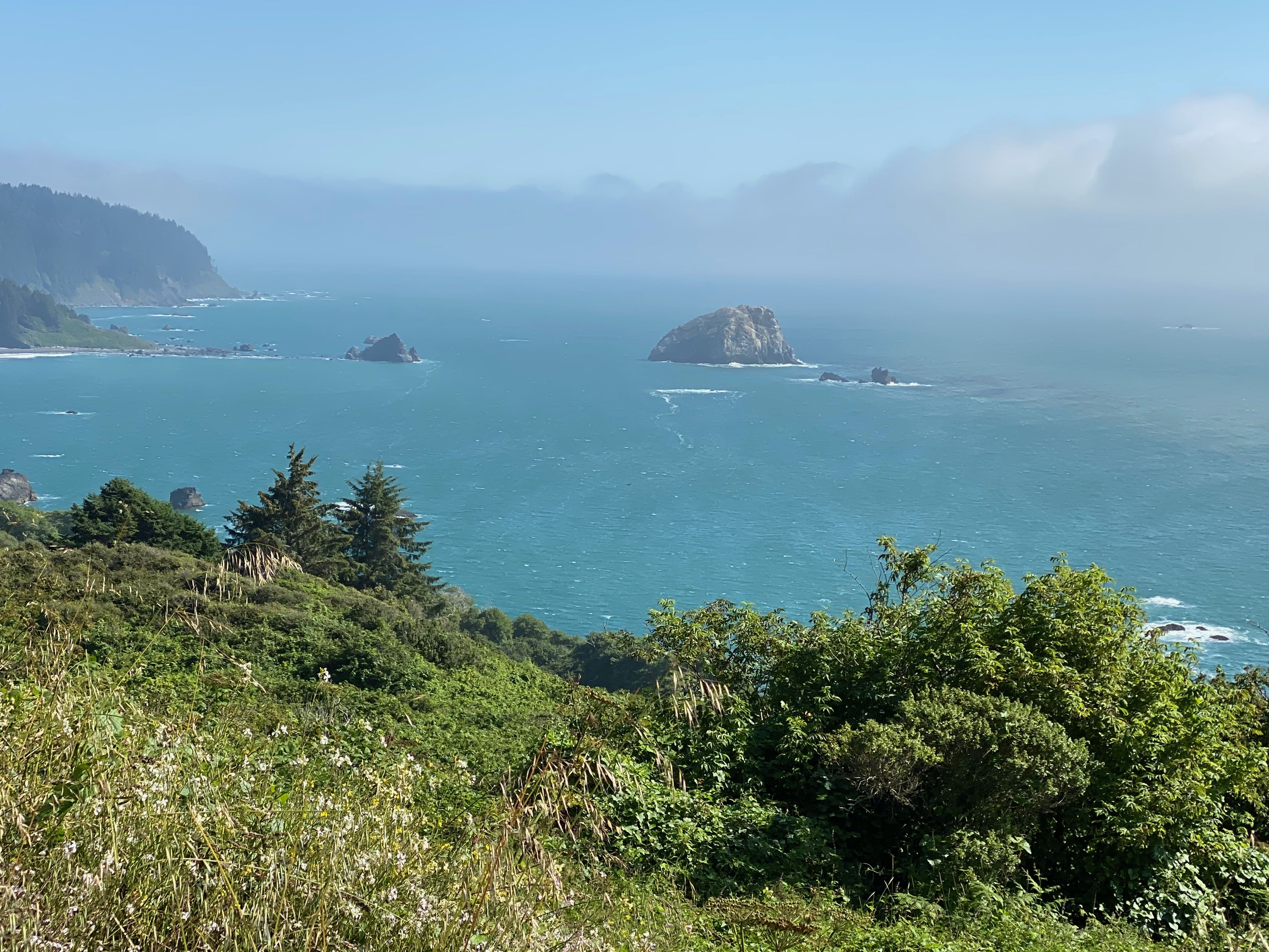
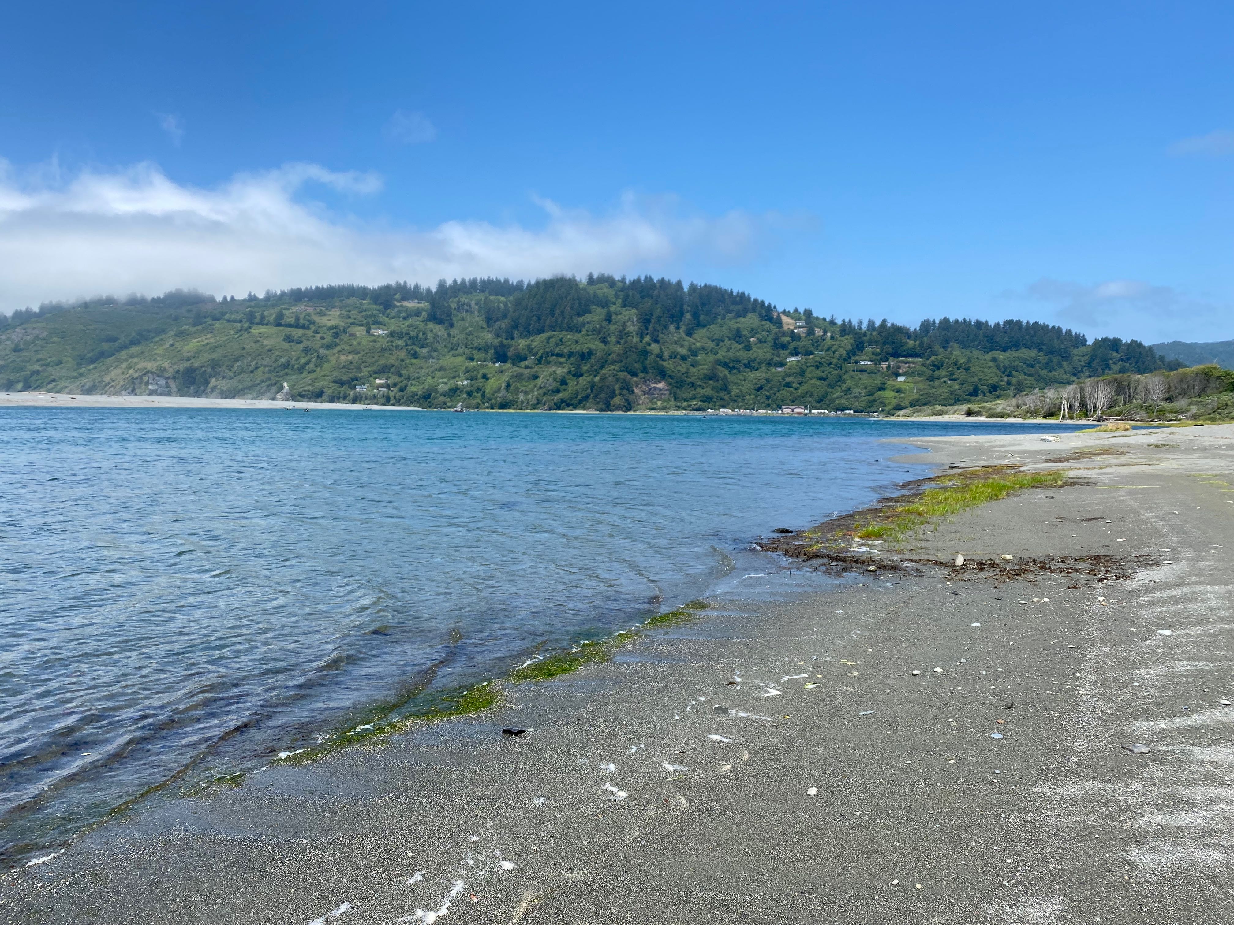
Our final stop on this drive was the point at which the Klamath River empties into the Pacific Ocean.
The river flows 257 miles through Oregon and Northern California – the second largest river in California after the Sacramento River. Unlike most rivers, the Klamath begins in the high desert and flows toward the mountains – carving its way through the rugged Cascade Range and Klamath Mountains before reaching the sea.
The Klamath is the most important North American river south of the Columbia River for fish migration. Its salmon, steelhead and rainbow trout have adapted to unusually high water temperatures and acidity levels relative to other rivers in the Pacific Northwest.
wikipedia
Near the mouth 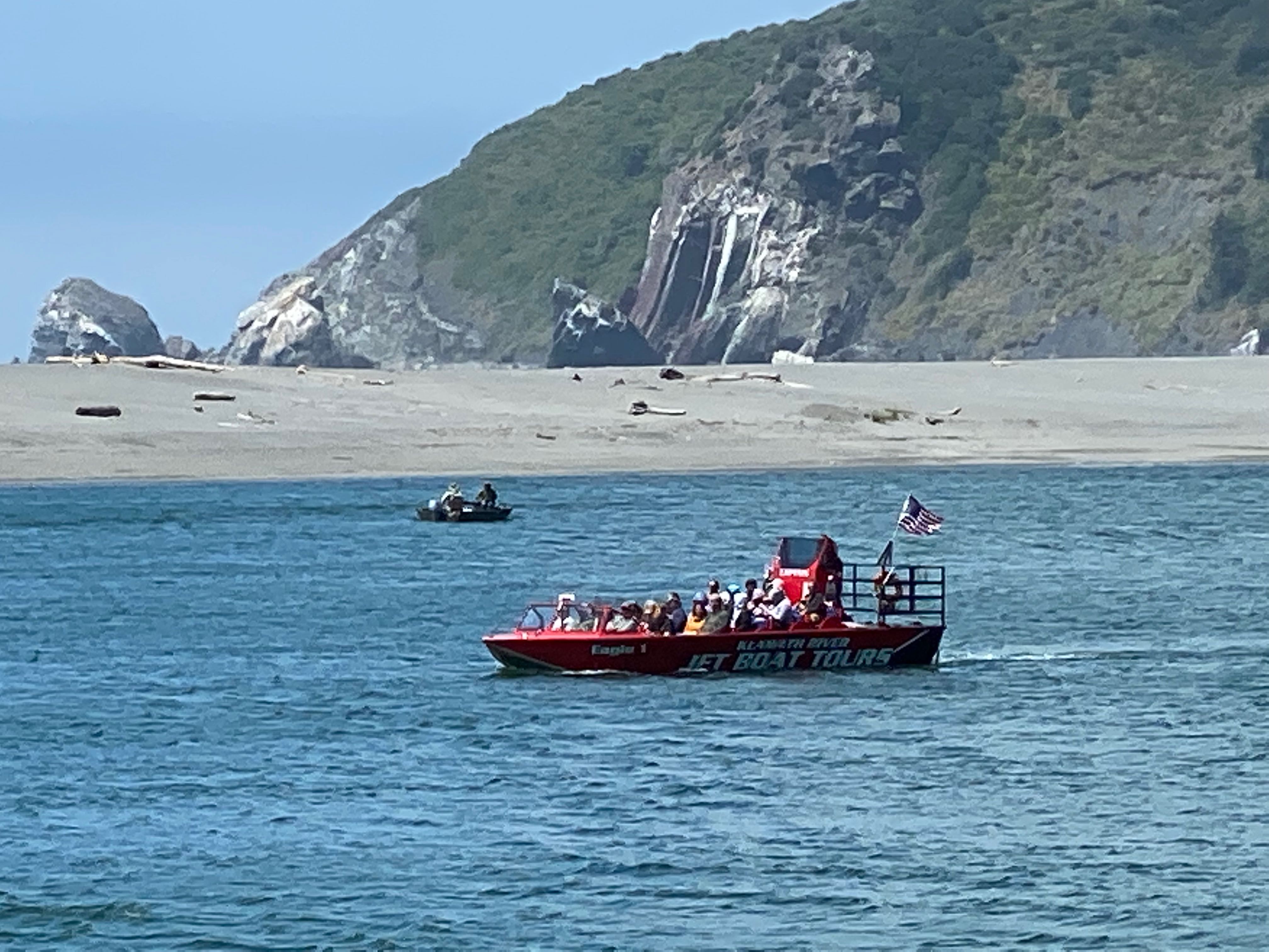
Jet Boat Tour
Trees of Mystery
For our final adventure in this area, we went completely “tourist” at the Trees of Mystery nature theme park just north of the Klamath. A 49 foot Paul Bunyan and 35 foot Blue ox greeted us as we walked to the entrance of the park.
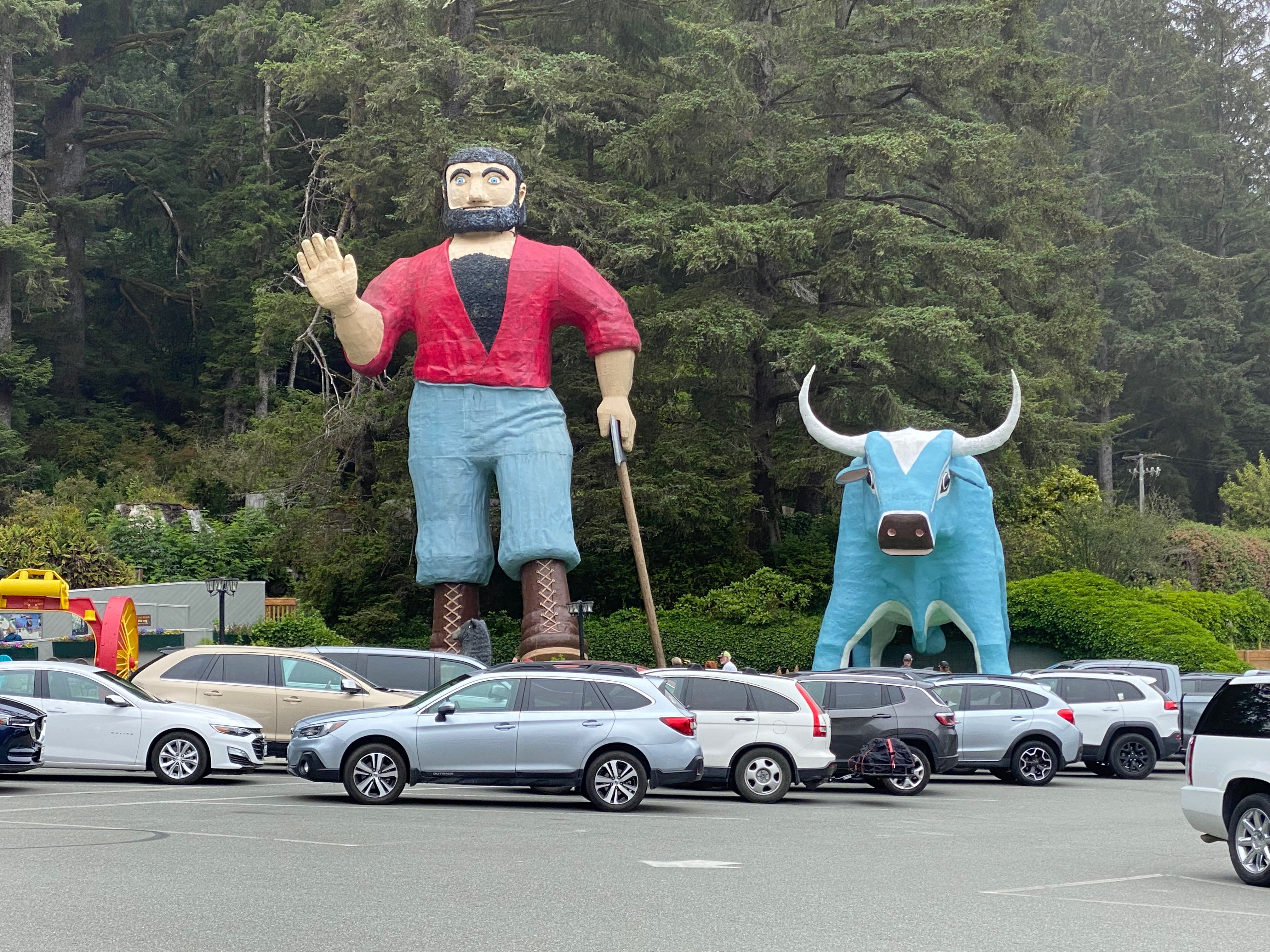
Paul Bunyan Welcome
The park includes a mile long groomed interpretive trail through the redwoods. Sites along the trail include the
- Brotherhood Tree, named in hope for the brotherhood of man. It is over 2000 years old, 19 feet in diameter, 60 feet in circumference and 297 feet tall.
- Cathedral Tree, a group of nine trees growing together as one. Approximately 800 to 1000 years ago a very large tree stood in the middle of this formation. When it fell it didn’t die. The roots and burls of the stump sprouted and these nine trees happened to grow together in a circle around the original mother tree’s stump, which has long since rotted away. This is also called a fairy ring.
- Elephant Tree, a fallen Redwood that sent shoots up as new trees. This one is a unique specimen because of the open space underneath.
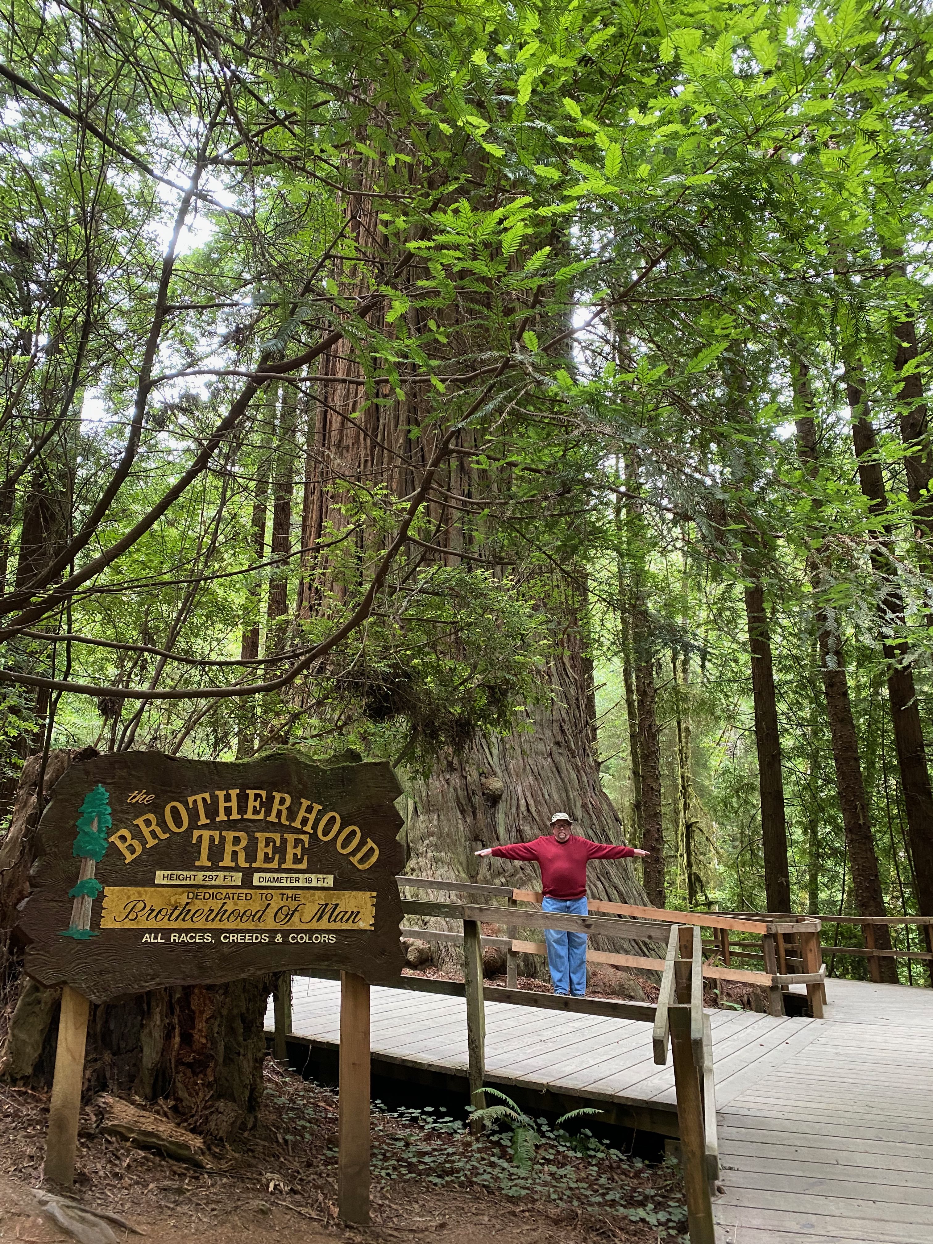
Brotherhood Tree 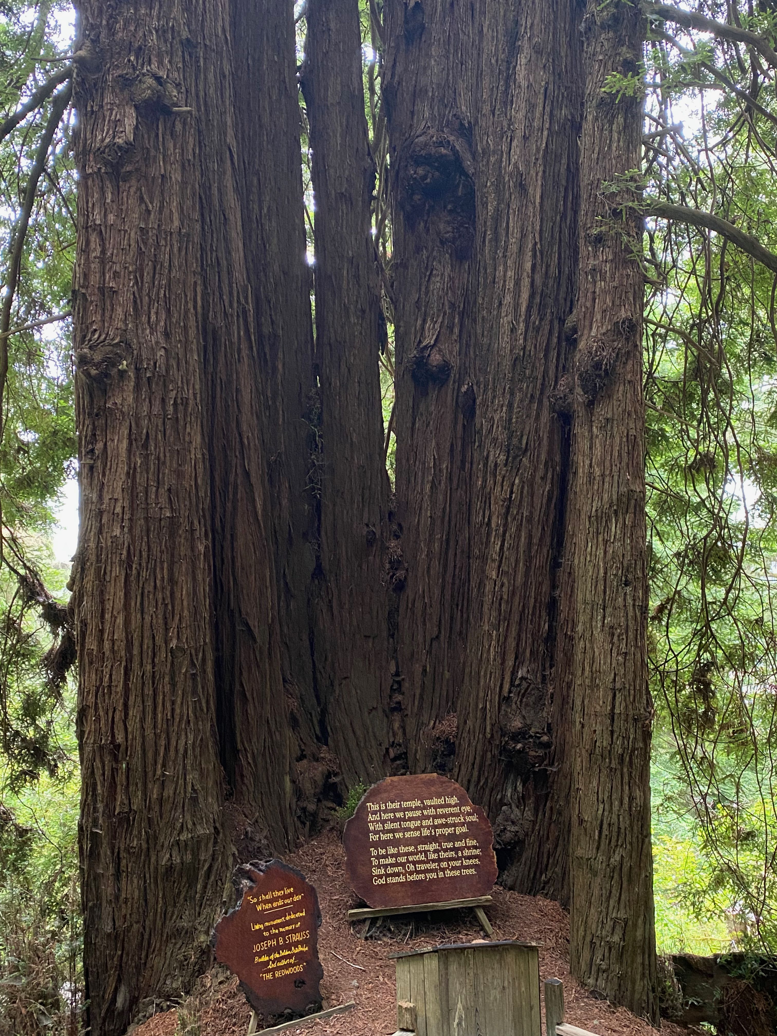
Cathedral Tree 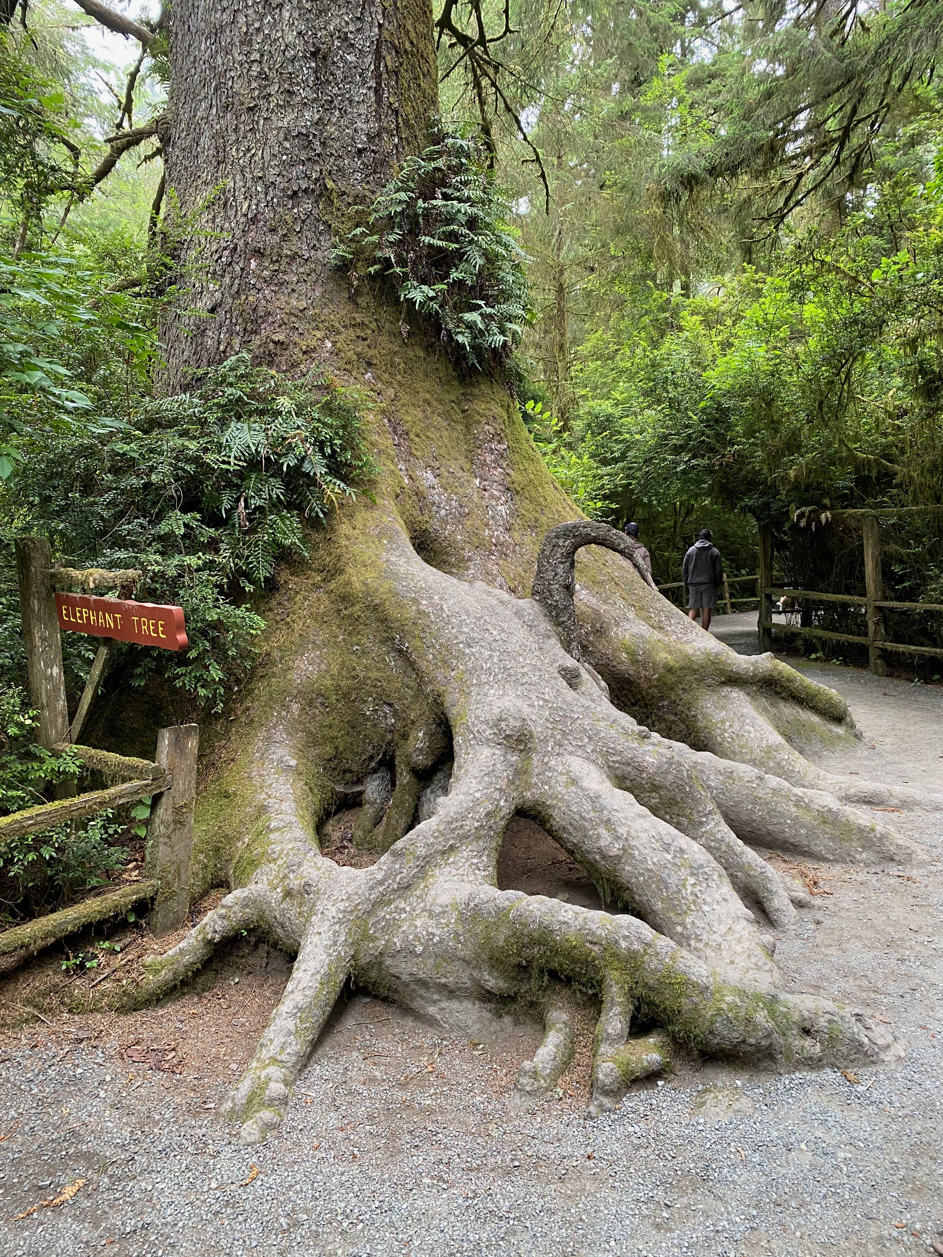
Elephant Tree
All of our earlier redwood hikes had been on the ground where the actual height of the trees is so difficult to capture. We were looking forward to getting a sense of height by walking the Redwood Canopy Trail – an aerial series of suspension bridges through the redwoods at mid canopy level with viewing platforms from 50-100 feet high in the trees. There are 10 platforms, 2 of which are connected by a spiral staircase, and 8 suspension bridges. Bill found an interesting face on one of the stairs going up.
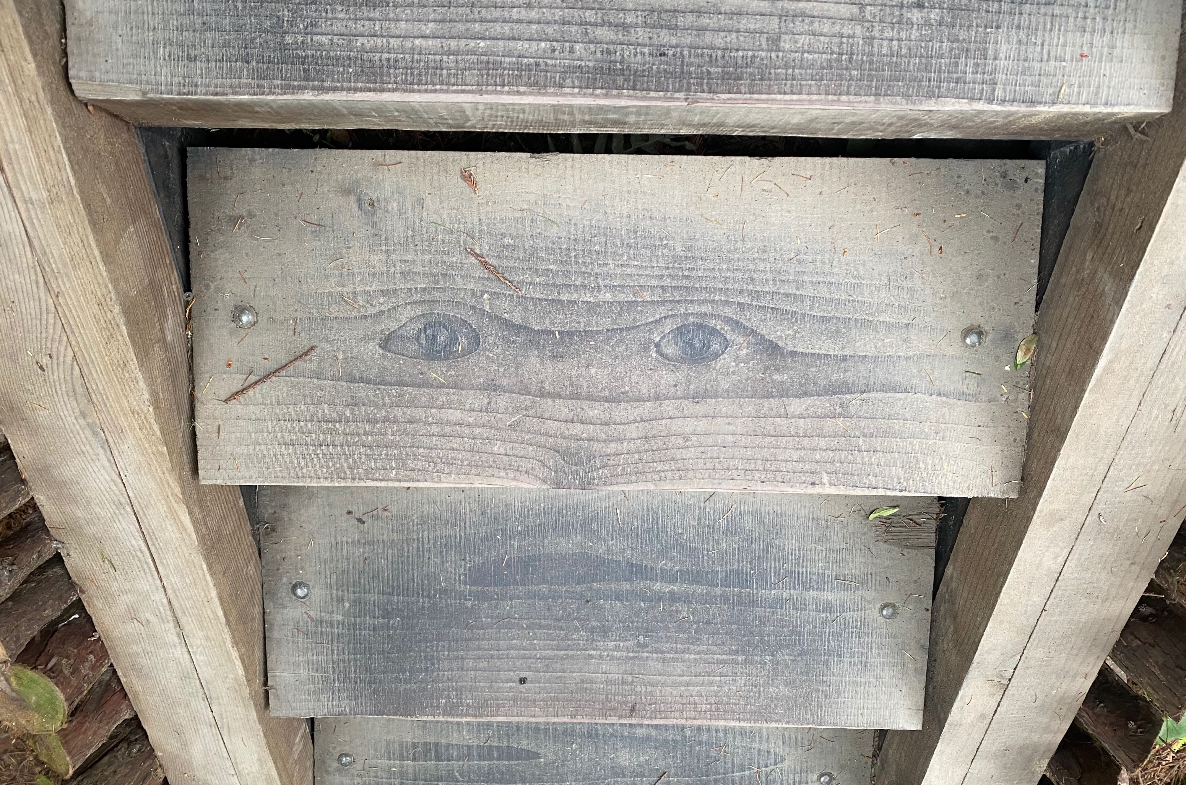
Stair-ing at you 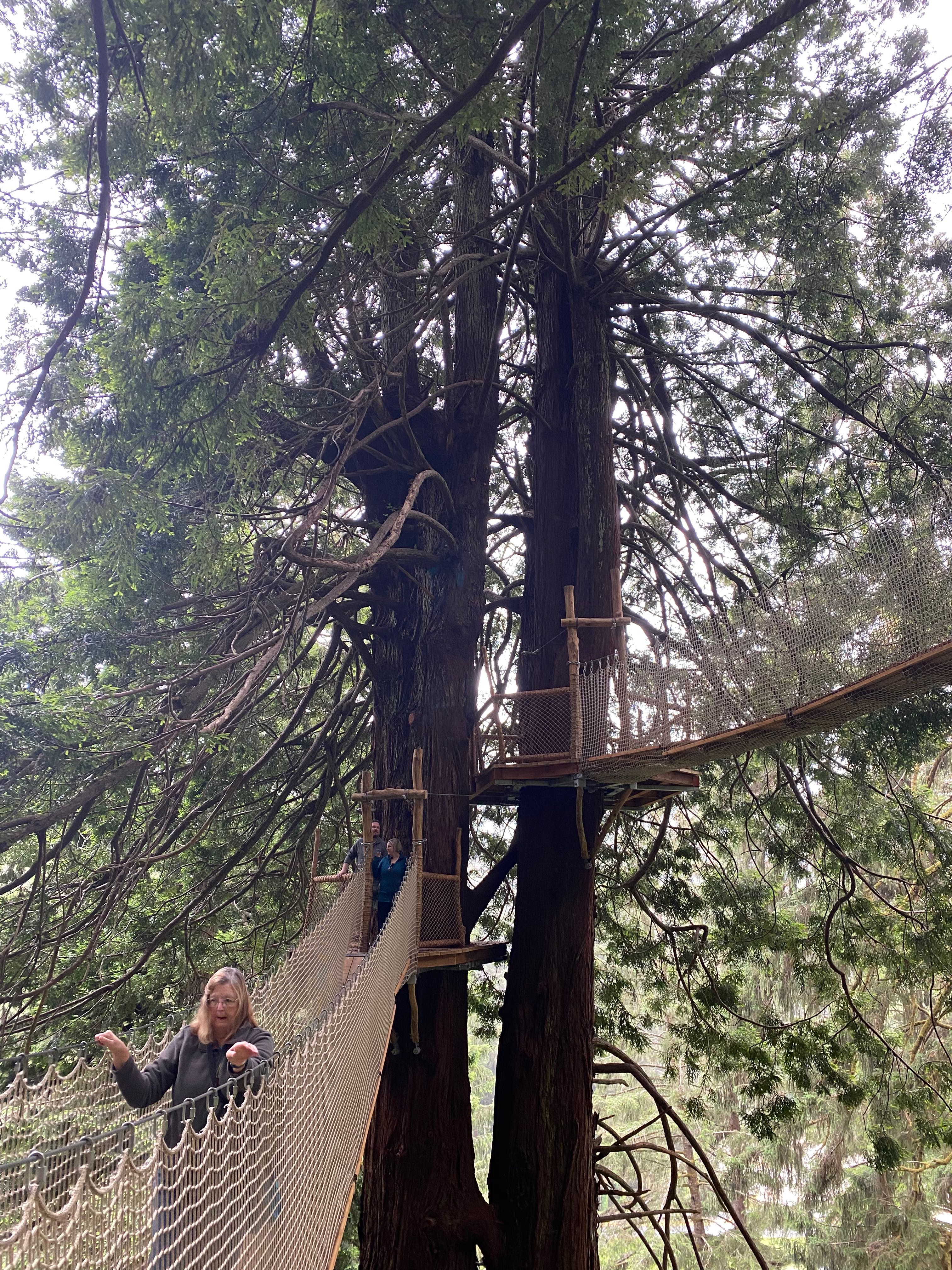
I’m not holding on – really! 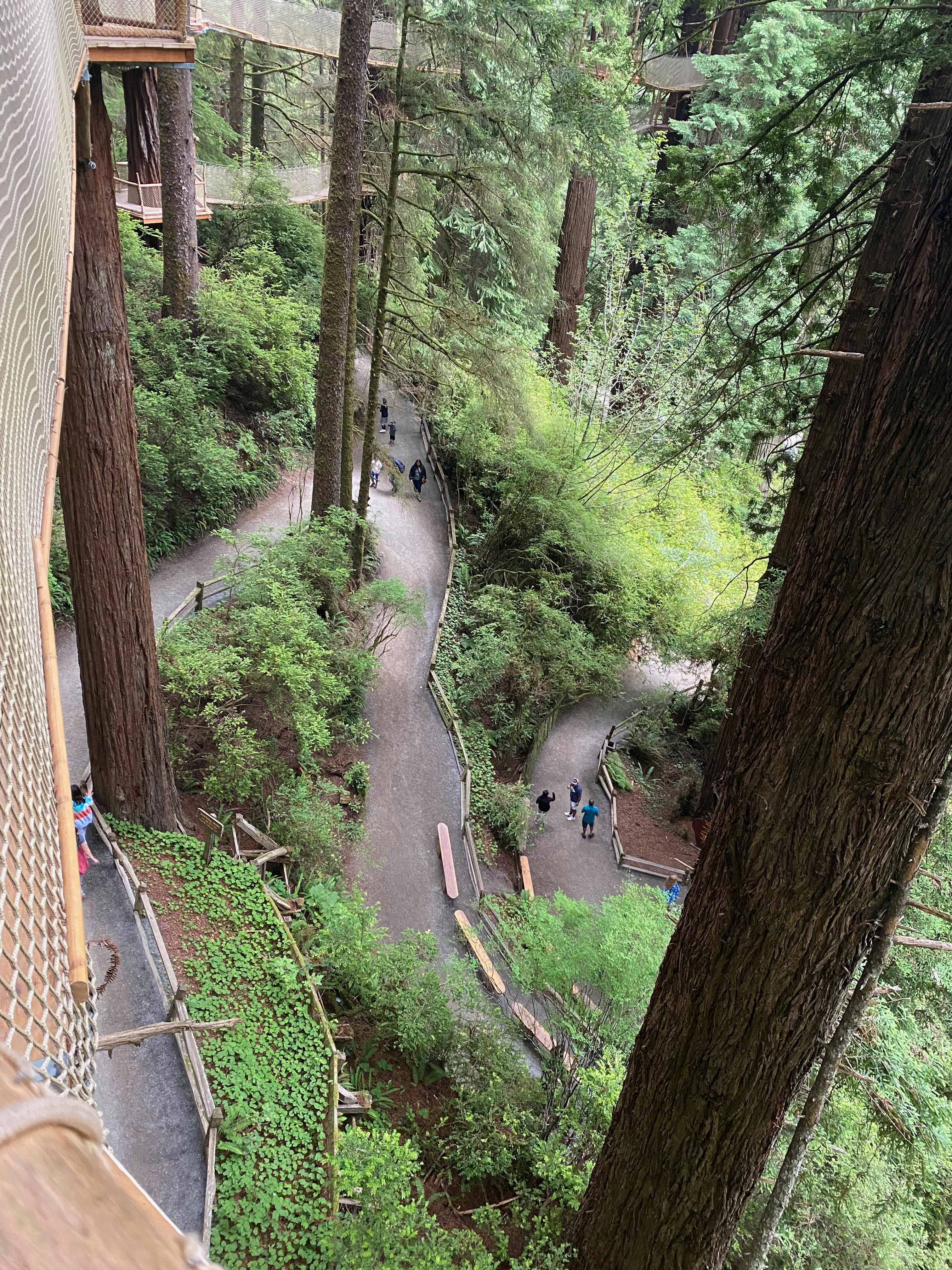
Long way down 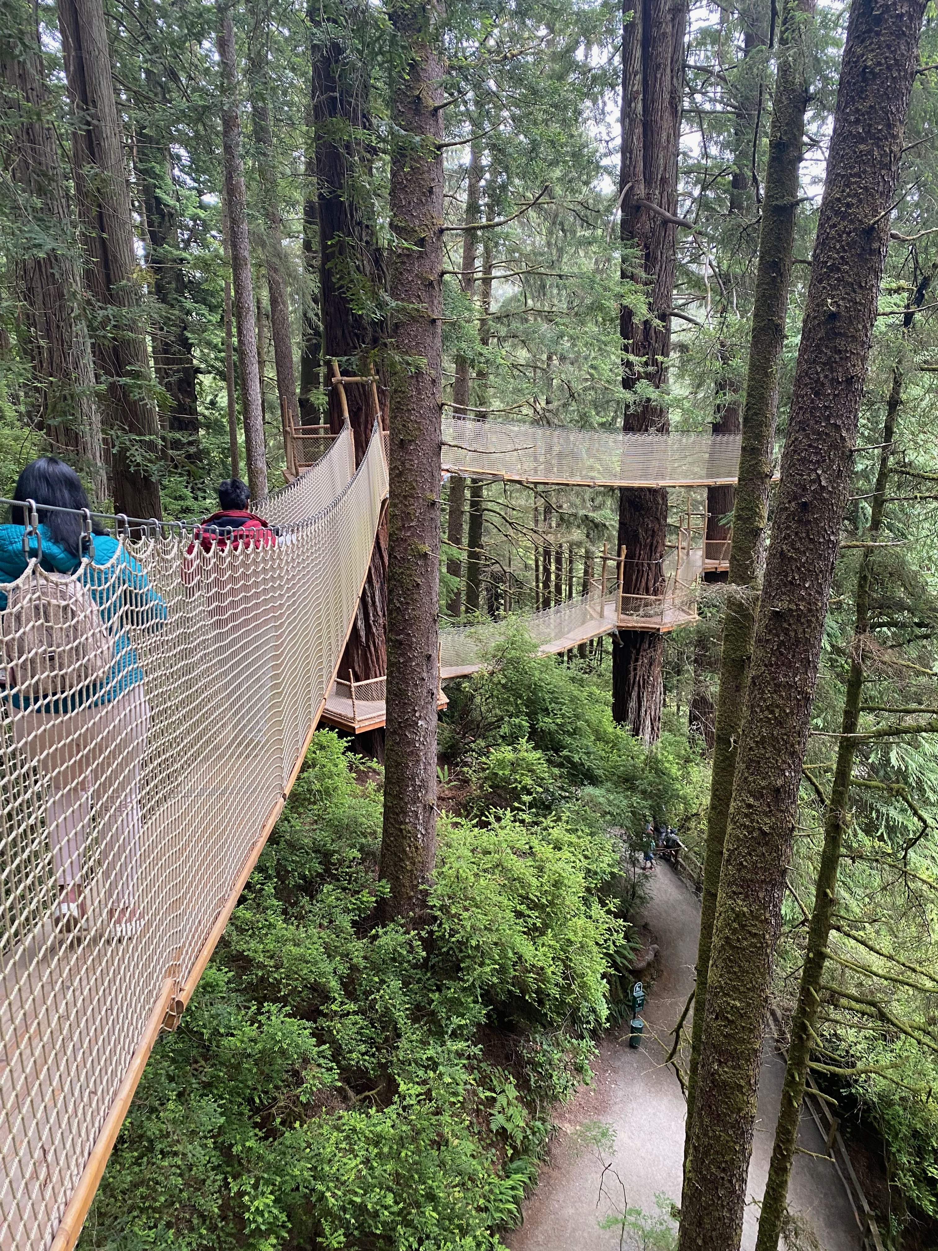
Suspended bridges
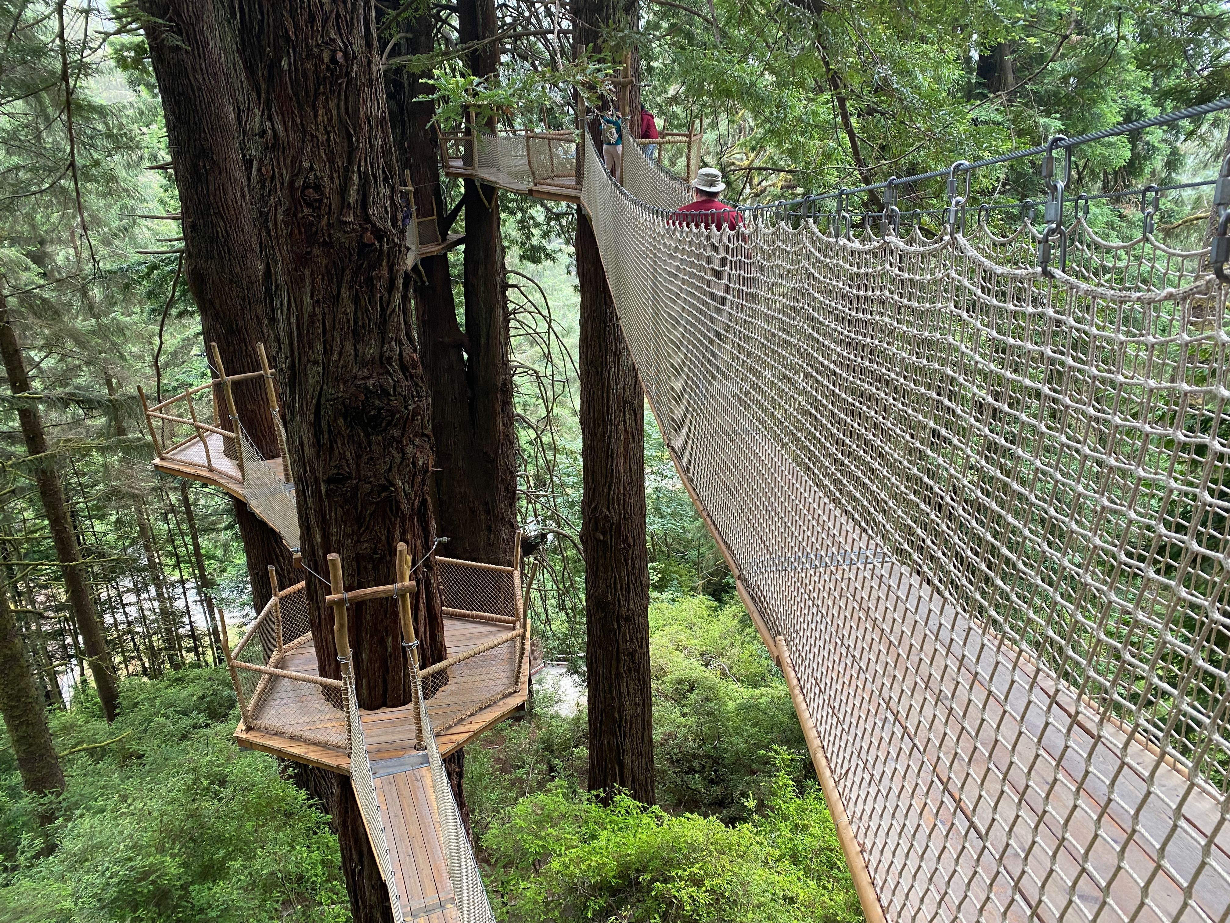
Bridges and Platforms
We were also looking forward to riding the SkyTrail, a 1/3 mile gondola ride through the tree tops to Ted’s Ridge. At Ted’s Ridge we were hoping to get a good view of the Klamath back country and the Pacific Ocean. Unfortunately all we could see from the top was fog. Bill recorded a brief video to give a sense of the gondola ride up.
Before leaving the park, Bill paused with his good friend for a last photo op.
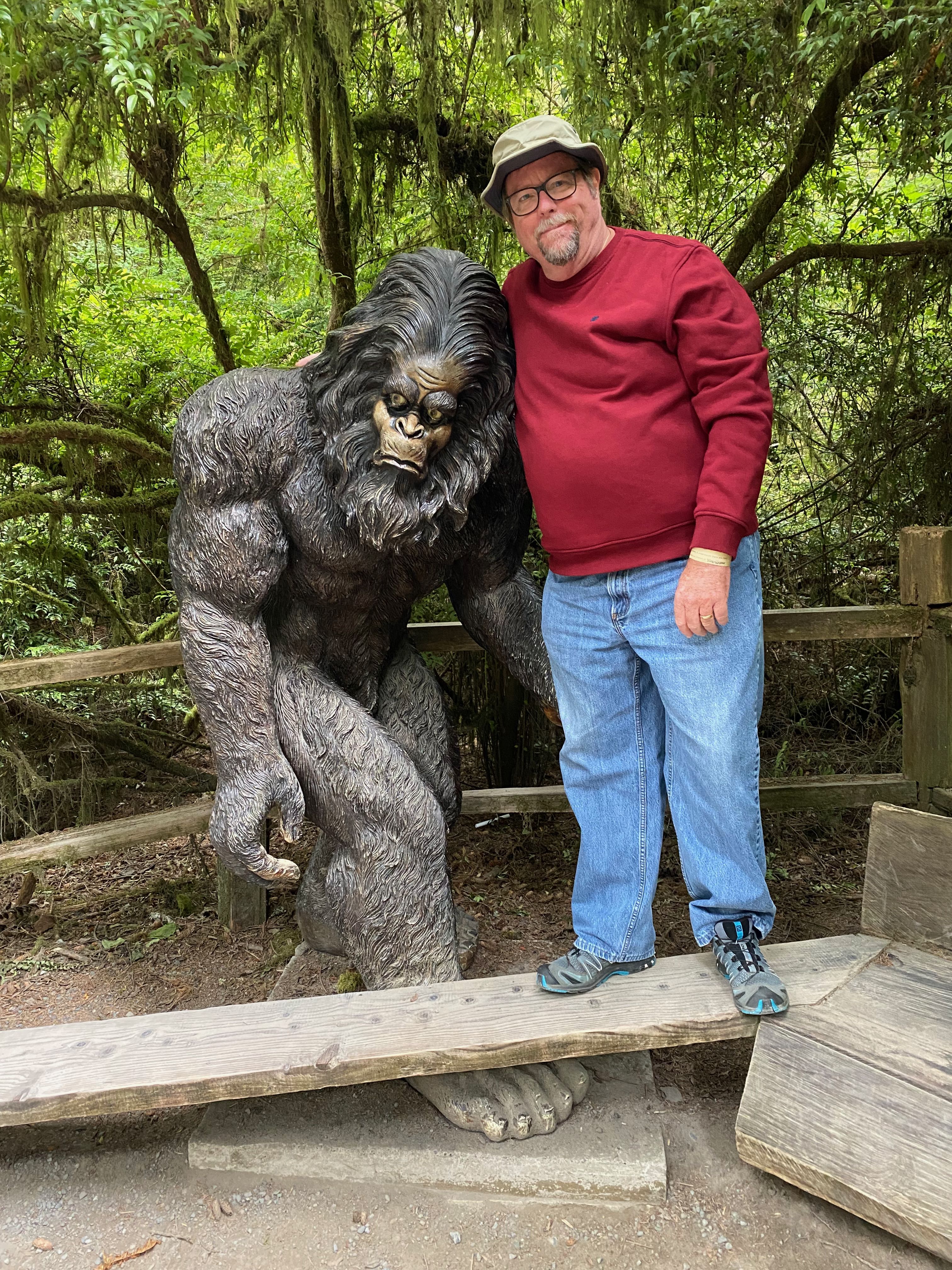
Bill with Big Foot
Leaving the Golden State
Wow! We’ve really had some enjoyable adventures here in Northern California. We’ll definitely be returning to the area sometime in the future. For now though, we’re moving on to the Beaver State. Be sure to join us there!
All I can say is that you saw some parts of this great Nation thatany of us will never see and you are braves soles taking that drive.