July 30 – August 6, 2023
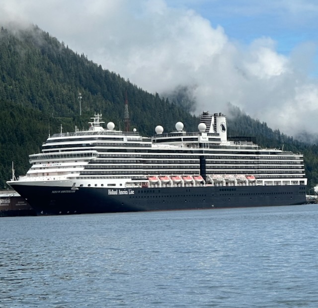
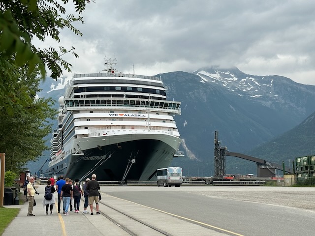
Our last post left off with us piling into a taxi in Vancouver. We were headed for the cruise terminal at Canada Place where Holland America Line’s (HAL) Nieuw Amsterdam awaited to take us on a 7 day Alaska cruise. The Nieuw Amsterdam is the second ship in Holland America’s Signature class ships. It was built in 2010 and refurbished in 2017. The ship accommodates 2106 guests, is 936 feet long and 105.8 feet wide. We had previously cruised on HAL’s Noordam (Vista class) and Koningsdam (Pinnacle class) but this was the first time on Nieuw Amsterdam.
The taxi driver took us to the luggage drop off under Canada Place where we surrendered our three wheeled suitcases (marked with identification tags, cruise and stateroom information). Bill and I then made our way through the check-in process, which was actually fairly quick as we had an early time slot. We didn’t have long to wait in the waiting area until our group was called to board.
Our cabin was not ready yet, so we wandered around the ship for a bit, stopped by the spa to confirm our appointments for the next day, and then found a nice spot to sit by the pool. A bar waiter soon came by and asked if we wanted anything – sure, why not, we’re on vacation. After a while, an announcement stated that guests could now go to their cabins.
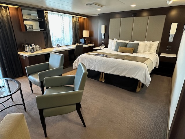
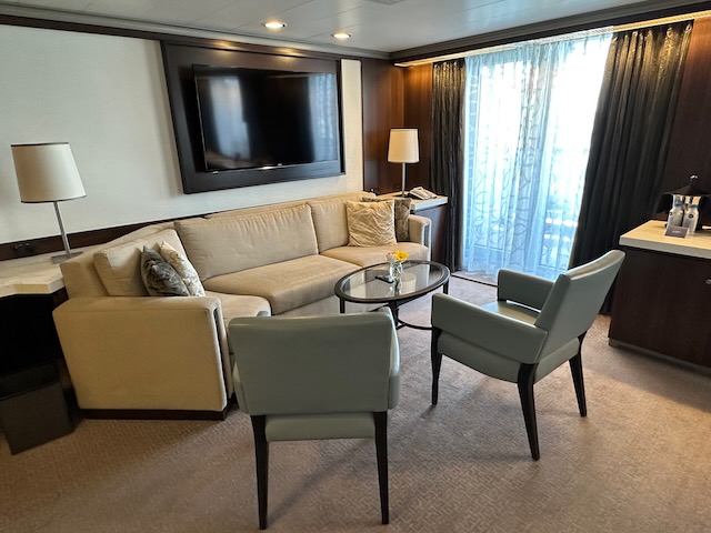
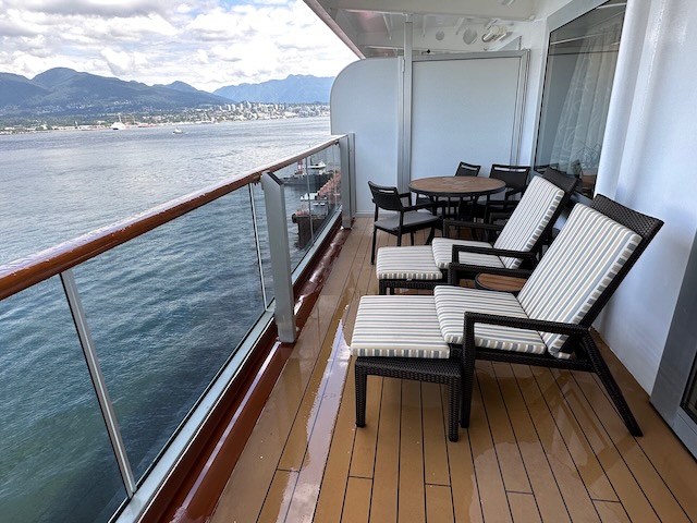
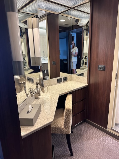
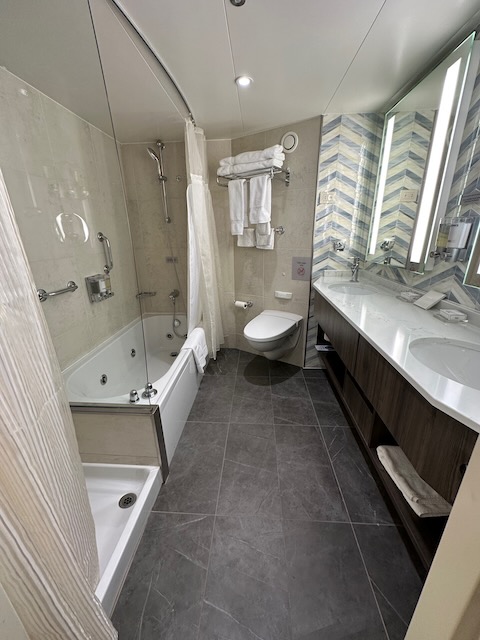
We had booked a Neptune Suite with a private veranda, sitting area, and access to the Neptune Lounge. When we entered, we were actually quite amazed at the size of the suite.
Our stewards – Adit and Rikon – soon stopped by to introduce themselves. We presented each with a gift card to Starbucks as we know how hard these guys work.
Soon, two of our three suitcases arrived. Bill’s bag was still on the dock (according to the AirTag). As the afternoon progressed and his bag still had not been delivered, he contacted the concierge in the Neptune Lounge and asked him to look into it. As it turned out, for whatever reason, that one bag was in the very last group of bags to be loaded. But it finally made it to our suite. Whew!
The ship set sail around 4 p.m. bound for Alaska.
Fully unpacked and settled into the suite, we dressed for dinner and took off for our reservation in the Pinnacle Grill – steaks and seafood – one of three specialty restaurants. There Omar, the manager/host, seated us at “the best table” which was a great table by the window.
The next day was a relaxing day at sea as we cruised the Inside Passage. For breakfast we took advantage of the Pinnacle Grill breakfast (available only to Suite guests) where Omar again led us to “the best table”. Then we each had a massage in the Greenhouse Spa and spent time enjoying the heated ceramic loungers and hydro pool in the Thermal Suite. Dinner that evening was in the Tamarind (Asian), another of the specialty restaurants, which we really enjoyed. Our waitress, Fransissca, was awesome and we made sure to ask for her section on subsequent visits.
We did have one issue with our cabin. The room was freezing (we even added extra blankets to the bed for the first night) and no amount of adjustment to the thermostat seemed to help. We reported the problem to our cabin stewards in morning and, failing resolution, to the Neptune Lounge concierge in the afternoon. By that evening, the problem had been fixed. (The staff continued to monitor the temperature for a few days, often confirming with us that we were satisfied. The concierge even sent a complimentary bottle of wine for our trouble.) What great service!!
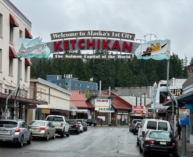
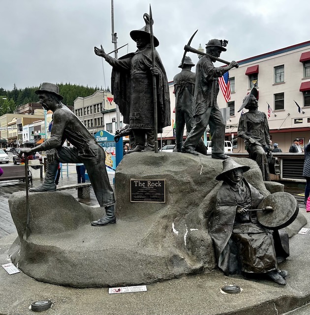
Ketchikan
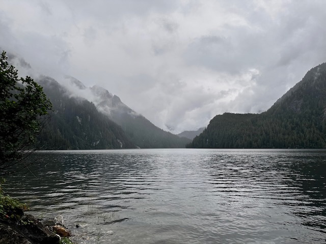
Our first port of call was Ketchikan where we docked at 7 a.m. How fun is it to pull back the curtains and discover that a town had appeared outside our veranda while we slept? After the wonderful weather that we had enjoyed in Vancouver, it was somewhat of a letdown to see wet streets and gray skies. However, the residents were happy as they really needed the rain. We really only encountered a mild morning drizzle.
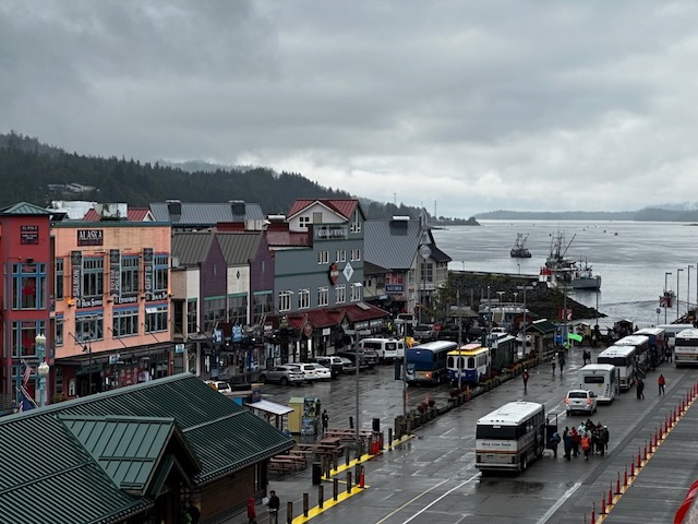
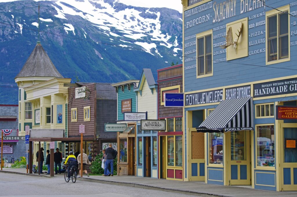
We could see as we looked out over the town that Ketchikan had an interesting story to tell.
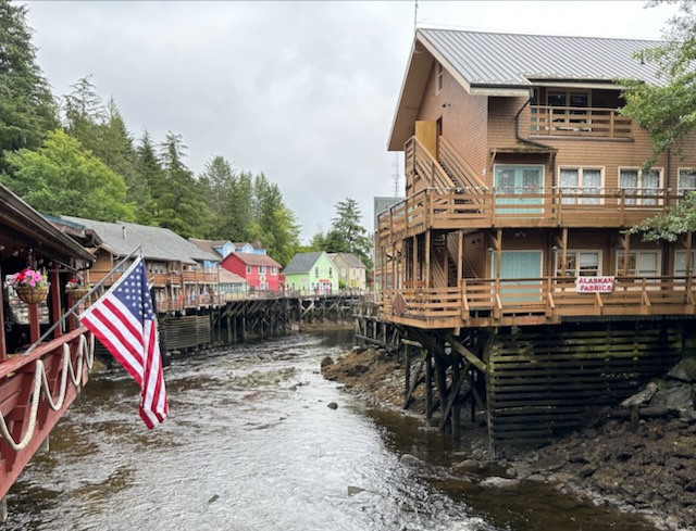
Ketchikan’s history goes back ages. For millennia, humans have used the mouth of Ketchikan Creek as their base of summer operations, mostly as a Tlingit fishing camp. Each summer, they would make a canoe journey from their winter villages to harvest, dry, and smoke the pink, coho, chum, and king salmon returning to their natal streams. In relatively recent history, these salmon runs attracted the attention of commercial canning interests, and a man named Mike Martin. In 1885, he purchased 160 acres at the mouth of the creek from the land’s Tlingit owners to start a saltery. This attracted other businesses and settlers who established a year-round presence on the creek. In 1900, Ketchikan was incorporated as a City, with Martin as its first mayor.
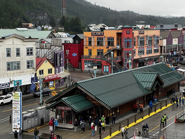
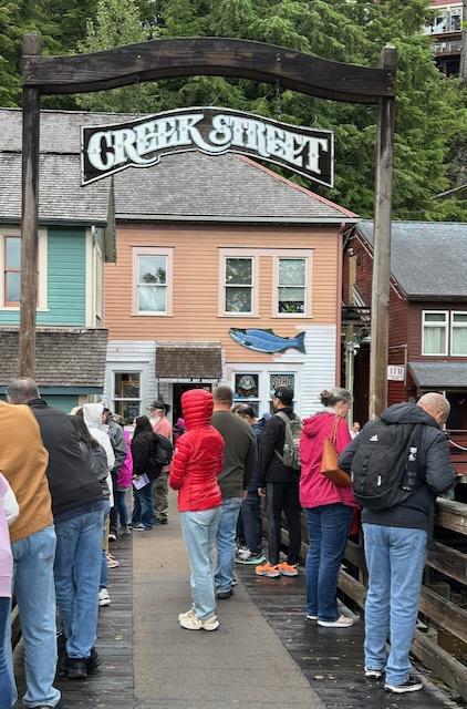
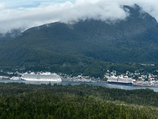
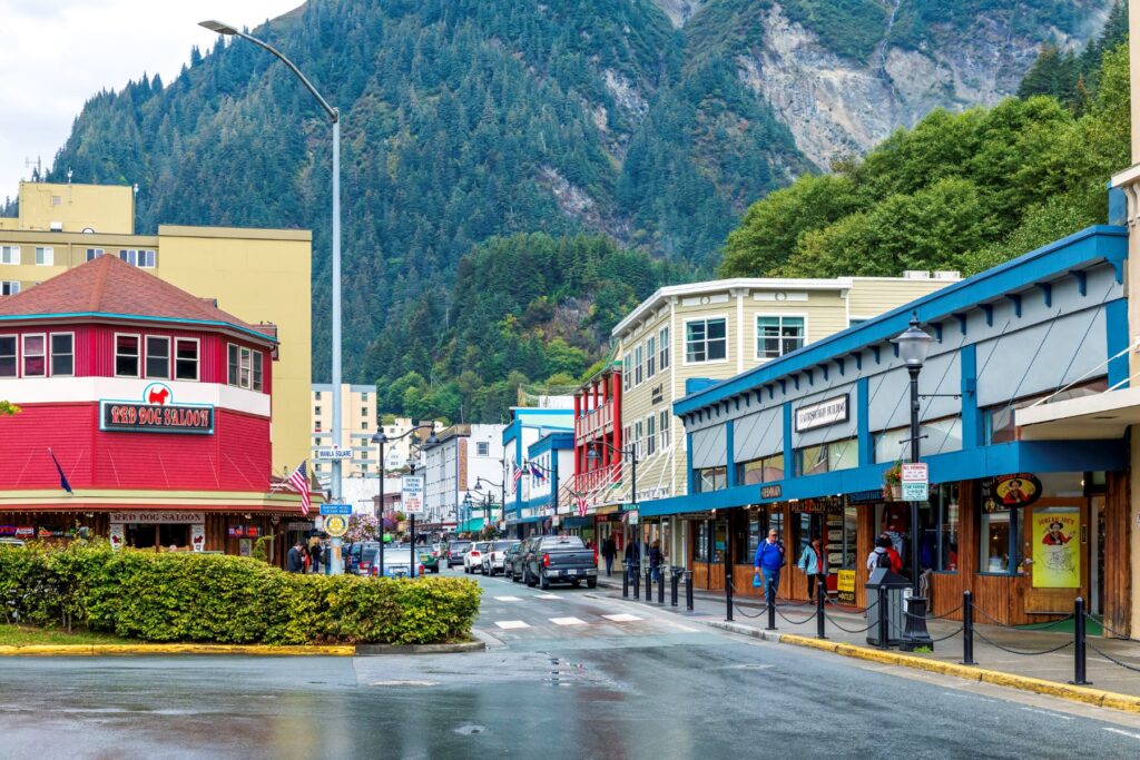
Like much of the United States, Ketchikan boomed in the 1920s rapidly growing into one of the largest cities in Alaska. The rapidly expanding economy brought miners, loggers, and fishermen who spent the earnings of their labor on Creek Street. This was Ketchikan’s infamous red light district that lined the banks of the creek with bordellos, gambling, and dance halls. Illegal liquor, brought in by enterprising rum runners through trap doors at high tide, flowed freely in the creekside establishments. Acting as monuments to Ketchikan’s colorful history, these historic buildings on pilings are now colorful shops and homes standing brightly painted against the emerald, forested hillside. From Thomas Basin, the harbor at the mouth of the creek, the town spreads narrowly along the shoreline, with fish processing, float plane operators, cruise ship docks, and other commercial interests dominating the waterfront while residential homes cling to the steep mountainside above them.
Ketchikan
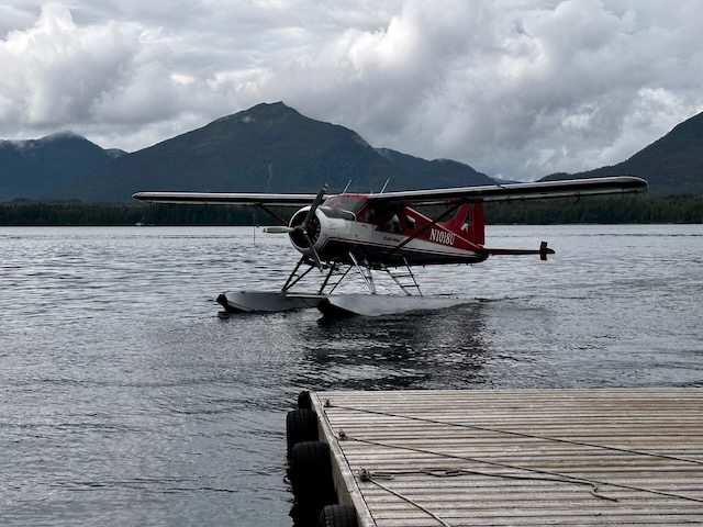
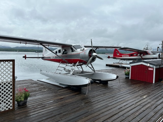
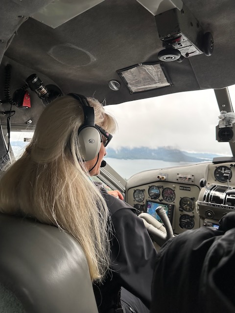
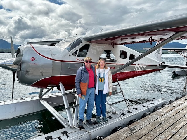
We had arranged an independent excursion – Misty Fjords National Monument Flightseeing Tour – with Island Wings Air Service. After breakfast in the cabin, we went ashore to meet our transportation at the Rain Gauge. From there, we were driven to the Island Wings office where we met owner and pilot Michelle. Unfortunately, the weather in the fjords was not cooperating, and since we didn’t have to be back aboard our ship until 2:30, she suggested that we reconvene at noon.
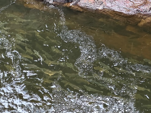
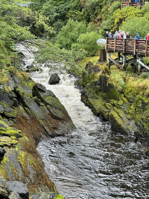
We were given a ride back to town where we investigated a few of the shops along Main Street before making our way to historic Creek Street. Looking down from the bridge crossing the creek, we could see lots of salmon just hanging out. To our left was a salmon ladder but due to the lack of rain (which helps the salmon via smell determine the exact stream in which to spawn), they were not jumping. We continued our trek, checking out the various shops along the way.
Soon it was time to made our way back to the Rain Gauge to meet our driver. Along the way we grabbed a Monte Cristo Crepe (ham, turkey, Swiss, raspberry preserves, and powdered sugar) to split at the Alaska Crepe Company. It was quite yummy.
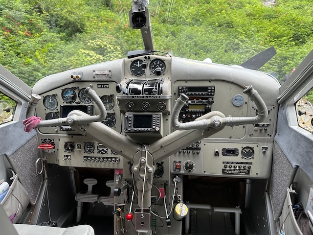
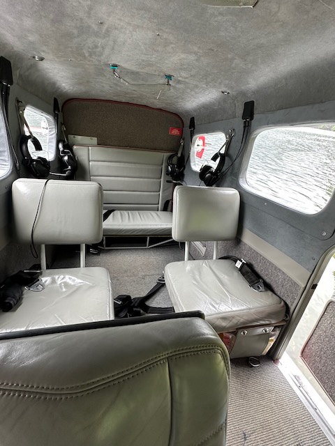
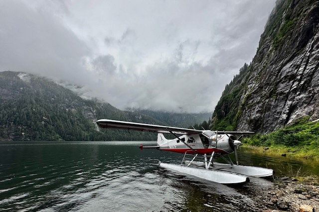
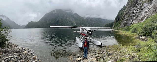
Back at Island Wings, Michelle told us that our tour was a go. She loaded us (along with 4 others) into her 1959 DeHavailland Beaver (named the Lady Esther) where we each donned a headset so that we could communicate and we took off.
Tongass National Forest is the largest, intact coastal rainforest in America. Misty Fjords is a piece of this treasure and is set aside for all visitors – now and in the future.
In 1978, President Jimmy Carter proclaimed over 2,200,000 acres as the Misty Fjords National Monument. In 1980, this acreage got reduced to 2,142,243 acres but was now congressionally designated as Misty Fjords National Monument Wilderness and still remains the largest wilderness area on the Tongass National Forest. Due to this designation, it is now strategically managed to continue the preservation of this undeveloped, enduring ecosystem for the enjoyment of present and future generations.
There are thirteen public recreation cabins, five three-sided shelters, and ten trails that provide altogether twenty miles of hiking activity.
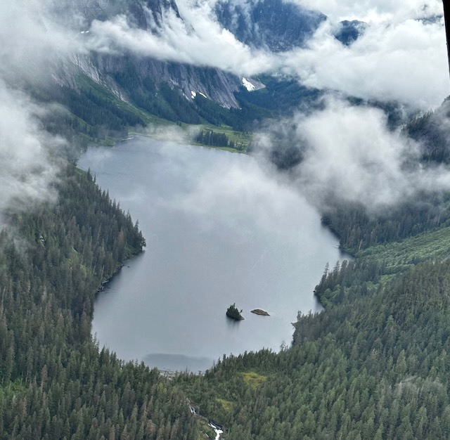
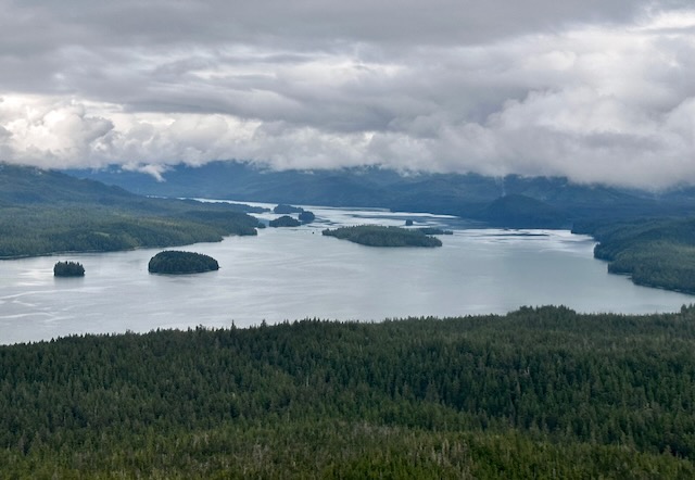
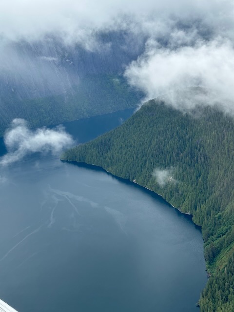
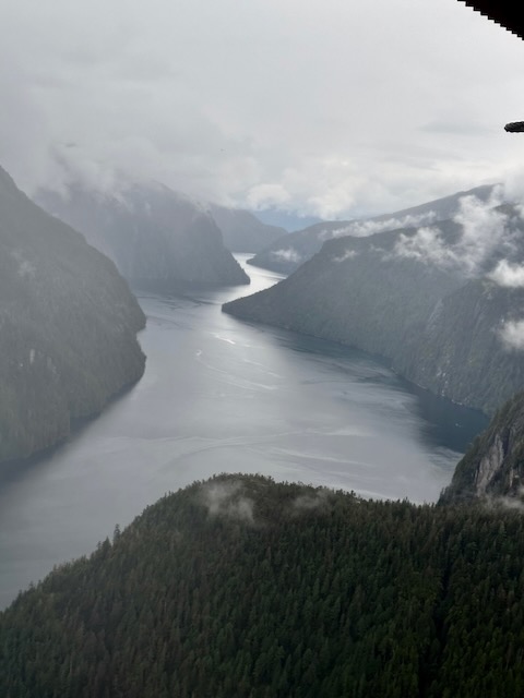
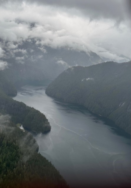
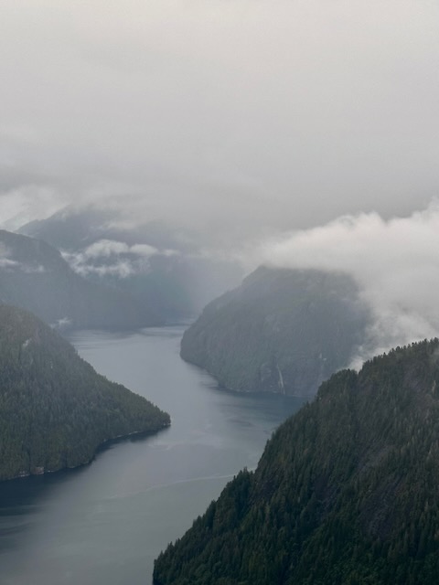
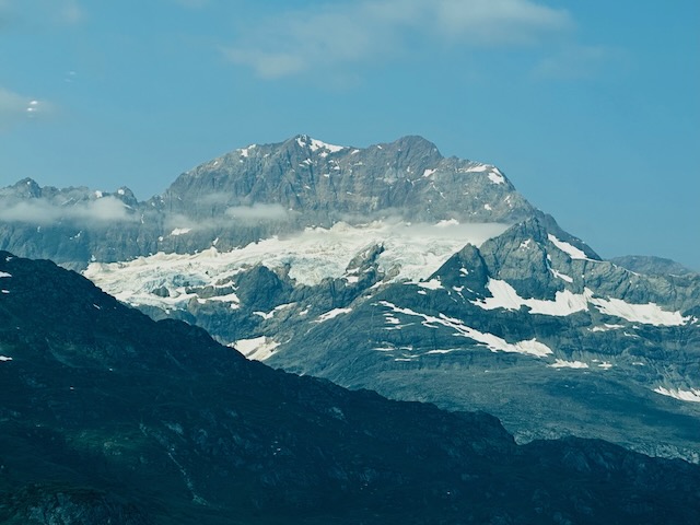
Misty Fjords
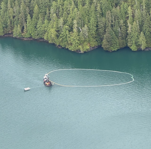
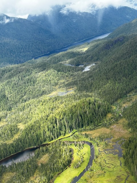
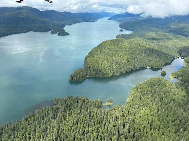
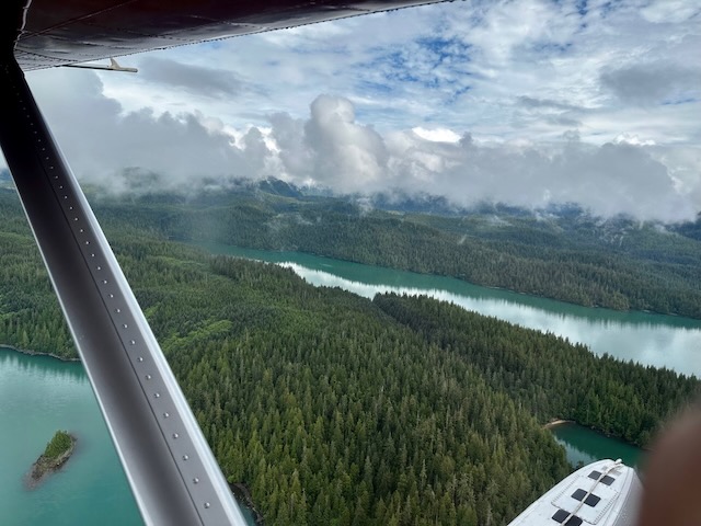
The views from the plane as we flew through the fjords were gorgeous. A new vista unfolded around every bend of the landscape. We even witnessed some circle fishing.
More dramatic than the Grand Canyon, the fjords are steep walled inlets of the sea. Created by glacial gouging long ago, snow capped granite cliffs, dramatically rising 3,500 feet from the sea, are ribboned with sensational waterfalls plummeting thousands of feet back to the ocean. Nestled within the steep walled canyons lie pristine bowl-shaped alpine lakes suspended at many different elevations. Fed by more than 150 inches of misty rain annually, the lush rain forest comprises giant stands of spruce, hemlock and cedar cling to the rugged terrain. Wildlife abounds with mountain goats and harbor seals being the most frequently sighted animals.
Island Wings
One thing Island Wings does that other flight seeing companies do not is land on one of the alpine lakes and let passengers get out of the aircraft to enjoy the fresh air and silence of the wilderness.
The photos below really do not begin to do the flight justice but hopefully will give you some idea of the experience.
Following our flight, the van took us back to the ship in plenty of time for the “all aboard”. The ship set sail at 3 p.m.
We had reservations in the Canaletto (Italian) for dinner that night. This proved to be our least favorite of the specialty restaurants due to the food selection and ambiance (minimally separated from the Lido Marketplace buffet).
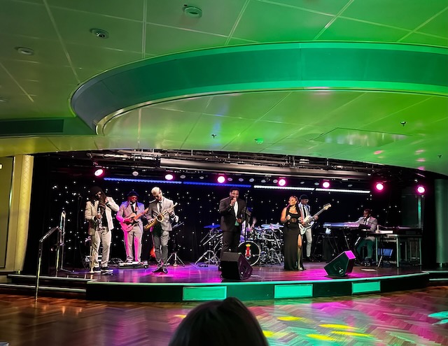
After dinner we listened to the band in the B.B. King Lounge (one of various music venues available) who were quite good.
Juneau
Our second port of call was Juneau – the capital city of Alaska and reachable only by boat or plane. At 3,255 square miles total, including 928 square miles of ice cap and 704 square miles of water, Juneau is the largest city (in area) in the U.S.
The area was a fish camp for the indigenous Tlingit Indians. In 1880, nearly 20 years before the gold rushes to the Klondike and Nome, Joe Juneau and Richard Harris were lead to Gold Creek by Chief Kowee of the Auk Tribe. They found mother lode deposits upstream, staked their mining claims, and developed a 160 acre incorporated city they called Harrisburg, which brought many prospectors to the area. The state capital was transferred from Sitka to Juneau in 1906 while Alaska was a U.S. Territory. The Treadwell and Ready Bullion mines across the channel on Douglas Island became world-scale mines, operating from 1882 to 1917. In 1916, the Alaska-Juneau gold mine was built on the mainland, and became the largest operation of its kind in the world. In 1917, a cave-in and flood closed the Treadwell mine on Douglas. It produced $66 million in gold in its 35 years of operation. Fishing, canneries, transportation and trading services, and a sawmill contributed to Juneau’s growth through the early 1900s. Mining declined by the 1930s, and the A-J Mine closed in 1944 when it was declared a nonessential wartime activity. The A-J produced over $80 million in gold. Alaska became the 49th state in 1959.
Juneau
Since we were not scheduled to dock until 10 a.m., we had time for a leisurely breakfast at “the best table” in the Pinnacle Grill again. After breakfast, we went ashore where we had a few minutes to wander around prior to meeting our guide for an independent whale watching tour with Jayleen’s Alaska. At the marina, we were joined by two other couples as we boarded a small 6 passenger boat for our tour. Jayleen guarantees whale sightings and our boat captain, Jim, delivered. Not only did we see whales and harbor seals, we also caught a glimpse of the Mendenhall Glacier.


Try out the short videos below:
Following our whale watching we returned to town for more shopping before stopping to eat at Twisted Fish. Bill really enjoyed his salmon dinner.


What a wonderful day in Juneau! The ship sailed away at 10 p.m.
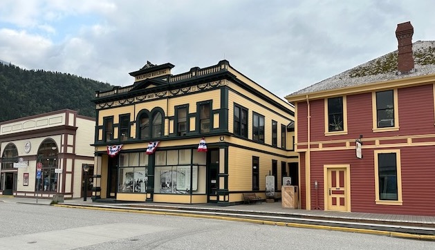
Skagway
Our final port of call was Skagway.
Skagway has one of the most colorful histories of any place in Alaska. In 1896, gold was found in the Klondike region of Canada’s Yukon Territory. Beginning in the summer of 1897, thousands of hopeful miners poured in to the new town and prepared for the 500-mile journey to the gold fields in Canada. This journey began for many when they climbed the mountains over the White Pass above the town and onward across the Canada border to the Lake Bennett, or one of its neighboring lakes, where they built barges and floated down the Yukon River to the gold fields around Dawson City. Others disembarked at nearby Dyea, northwest of Skagway, and crossed northward on the Chilkoot Pass, an existing Tlingit trade route to reach the lakes. Some prospectors also realized how difficult the trek would be that lay ahead on the route and chose to stay behind to supply goods and services to miners. Within a year, stores, saloons, and offices lined the muddy streets of Skagway. The population was estimated at 8,000 residents during the spring of 1898 with approximately 1,000 prospective miners passing through town each week. By June 1898, with a population between 8,000 and 10,000, Skagway was the largest city in Alaska.
The Skagway area today is home to the Klondike Gold Rush National Historical Park and White Pass and Chilkoot Trails. Skagway has a historic district of about 100 buildings from the gold rush era. It receives about 3/4 million tourists annually, most of whom come on cruise ships. The White Pass and Yukon Route railway still operates its narrow-gauge train around Skagway during the summer months. Skagway is now also served by the Klondike Highway, completed in 1978, which connects it to the Alaska Highway.
Skagway
The ship docked in Skagway around 7 a.m. so we again discovered land outside our veranda when we opened the curtains that morning. We had an interesting view of the rock slide that occurred in 2022 and destroyed one of the cruise ship docks.
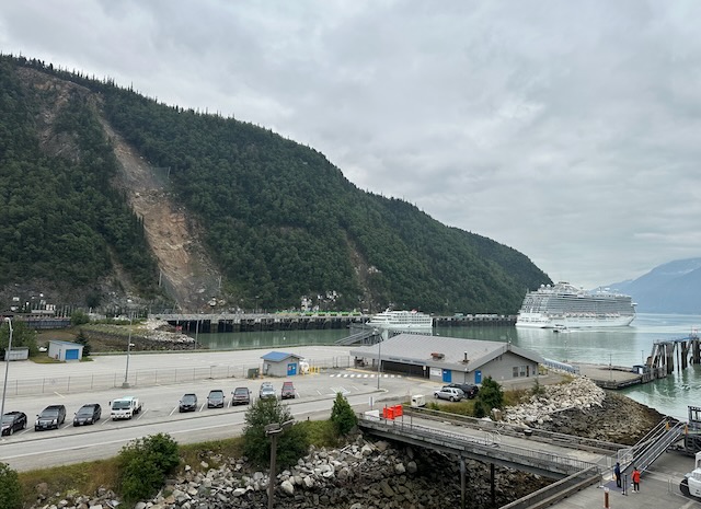
Walking ashore after an early breakfast afforded us a view looking across the harbor and one of our ship.
We had a bit of a hike to the meeting point for our excursion – a 6.5 hour mini-bus tour along the Klondike Highway with Frontier Excusions.
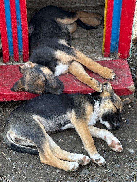
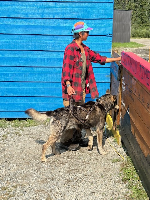
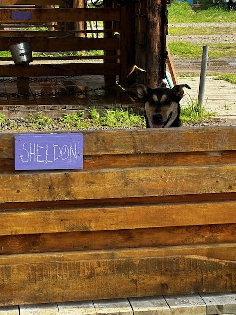
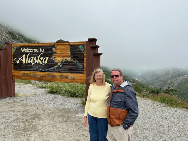
The tour route paralleled the 1898 Gold Rush Trail to the White Pass summit at 3292 feet with views of waterfalls, a coastal rainforest, and stops at the Welcome to Alaska sign, Summit Lake, and Tormented Valley. We had to show our passports as we entered into the Canadian Yukon Territory where the weather changed from misty to sunny due to the mountains. We also stopped at the Yukon sign, Emerald Lake, and Carcross Desert (that’s right, a sand desert). Our lunch stop was at Caribou Crossing where we had BBQ chicken, roasted potatoes, coleslaw, rolls, and fresh donuts. In addition to a gift shop, the facility also housed a wildlife gallery of over 100 Arctic and Yukon taxidermy animals. There was also a Sled Dog camp where we could view the dogs and puppies.


The tour returned to Skagway on the same route which was a bit of a disappointment. We had opted to do this independent excursion instead of the included White Pass Railroad excursion since we thought it would be more comfortable and we would see more than riding a train. After talking with folks that rode the train, I’m not sure this was the better option.
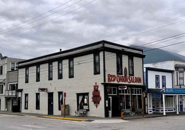
Since the ship was not leaving port until 9 p.m. Bill and I elected to wonder the town which really felt like a Wild West town with its storefronts and wooden sidewalks. We had planned to go to the Skagway Brewing Company for dinner but discovered they had closed early for an employee appreciation event. Our second choice – the Red Onion Saloon and Brothel – proved to be a winner with great pizza and adult beverages.
Back on board after dinner we enjoyed a comedian in the Showroom at Sea.
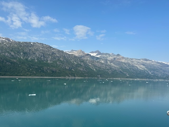
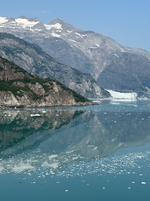
Glacier Bay
Next up was a major highlight of the cruise – a day cruising through Glacier Bay!
Covering 3.3 million acres of rugged mountains, dynamic glaciers, temperate rainforest, wild coastlines and deep sheltered fjords, Glacier Bay National Park is a highlight of Alaska’s Inside Passage and part of a 25-million acre World Heritage Site—one of the world’s largest international protected areas. From sea to summit, Glacier Bay offers limitless opportunities for adventure and inspiration.
From the bottom of the deepest glacial fjord to the summit of its highest peak, Glacier Bay encompasses some of our continent’s most amazing scenery and wildness. It is a land reborn, a world returning to life, a living lesson in resilience. If ever we needed a place to intrigue and inspire us, this is it. Glacier Bay is a homeland, a living laboratory, a national park, a designated wilderness, a biosphere reserve, and a world heritage site. It’s a marine park, where great adventure awaits by boating into inlets, coves and hideaway harbors. It’s also a land park, with its snow-capped mountains, spectacular glaciers, and emerald–green forests. From the summit to sea, Glacier Bay’s wildness is remote, dynamic and intact.
Glacier Bay
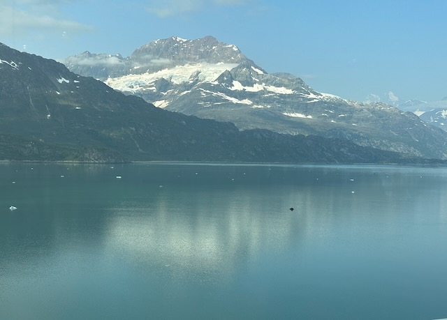
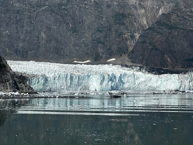
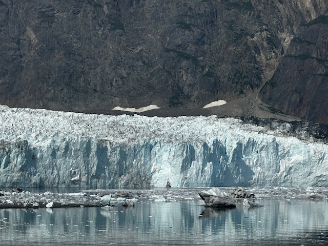
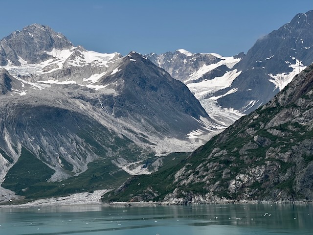
Only two cruise ships per day are permitted in the Bay. Our ship started the journey at 6 a.m. Along the way some park rangers came aboard (delivered by boat and facilitated by rope ladder). They offered commentary, answered questions, and provided park literature and merchandise. The bow of the ship was opened to allow guests great (albeit chilly) views of the mountains and glaciers. Of course, the best indoor spots were crowded. Bill and I found spots along the railing of some of the more protected outside decks. As we approached Margerie Glacier, the captain stopped the ship and then slowly spun it for about an hour so all could get a good view.
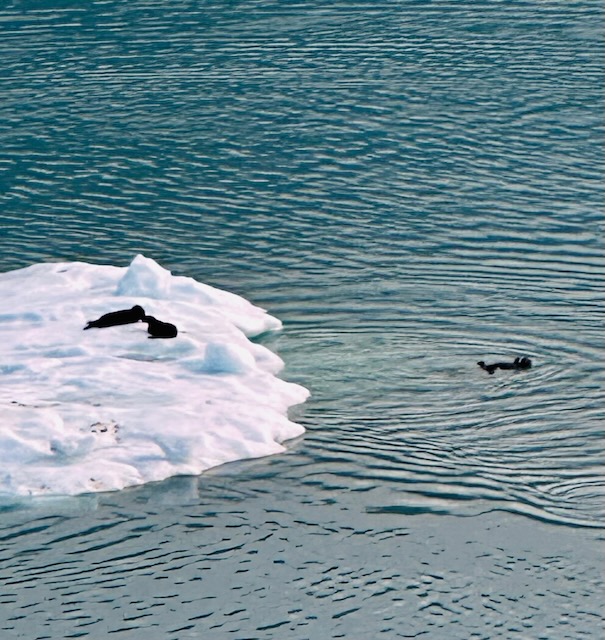
Margerie Glacier is found at the furthest reaches of Glacier Bay waterway, at the northern reach of Tarr Inlet. The glacier is picturesque in setting, carving a steep valley through towering mountain peaks, and ending dramatically at the edge of the sea. Since it reaches all the way to ocean water, Margerie Glacier is referred to as a tidewater glacier, defined as a glacier that interacts with ocean saltwater. Margerie glacier is about 21 miles long, originating in the Fairweather Mountain Range at elevations exceeding 9000 feet. Due to the abundance of snow in the mountains and the steepness of slope, the ice of Margerie Glacier flows relatively quickly, estimated to flow about 2000 feet per year, or about 6 feet per day. The glacier does not expand out into the fjord since it rests on an underwater ledge, so the ice falls into the ocean in a process called calving, breaking into icebergs. The icebergs become resting spots for harbor seals, sea otters, black-legged kittiwake gulls and other birds.
Margerie Glacier
Shortly after our arrival, the glacier calved. Unfortunately neither Bill or I had our phones ready. We couldn’t believe the sound of the cracking and the resulting thunder as the ice fell into the water. It’s hard to believe that this glacier is over 200 feet tall – much taller than our ship! We also saw the Reid Glacier and the John Hopkins Glacier during our 6 hour cruise through Glacier Bay.
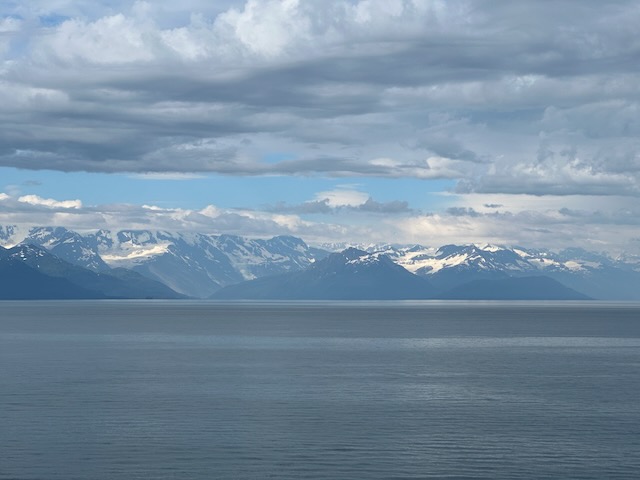
College Fjord
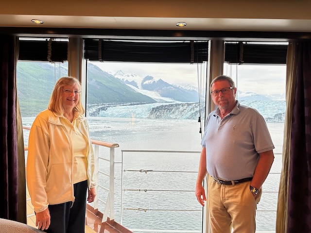
The next day was another cruising day. This time to College Fjord in the evening. We had time today for another relaxing massage and spa time. For a late lunch we grabbed some charcuterie items from the Lido Marketplace and enjoyed them with our complimentary bottle of wine. We also had to begin packing our suitcases – bummer.
We returned to the Tamarind Restaurant for dinner one last time where we were seated by the rear window. We were concerned that we were missing the sites in College Fjord but our waitress assured us we would not. The captain once again spun the ship so we had a great view.
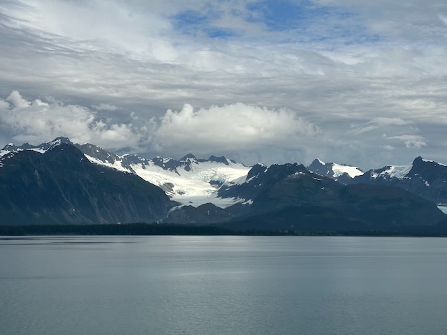
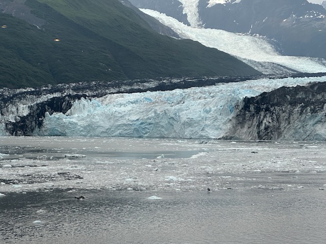
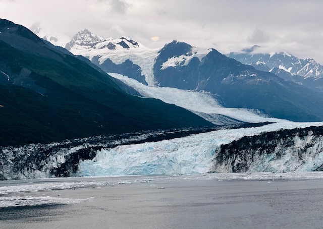
Out of all Alaska fjords, College Fjord is the most storied. The Harriman Expedition of 1899 with John Muir and other notable scientists traversed the College Fjord aboard the George W. Elder, funded by Ivy League colleges. All of the glaciers were named for various schools. As you travel into College Fjord, the glaciers on the left are named for women’s colleges and those on the right are named for men’s colleges. The names are Amherst, Barnard, Bryn Mawr, Harvard, Smith, Vassar, and Yale).
Harvard Glacier is the biggest – its face is a mile and a half across. In case you’re wondering, it is rumored that the scientists snubbed Princeton.
College Fjord
We returned to our cabin after dinner where we finished packing our bags which we put in the hallway prior to retiring for the night – our last night aboard.
Whittier
Sometime in the middle of the night, the ship arrived in Whittier. We awoke to a dark, rainy day which somewhat mirrored our mood as we knew our cruise had reached its conclusion. We had breakfast in the Pinnacle Grill one last time, then retrieved our backpacks from the cabin and moved to a public space where we waited for our disembarkation time. When our group was called, we trudged down the gangway as a new group of fresh passengers boarded.
The cruise had ended but our Alaskan adventure had not. Stay tuned ….