May 31 – June 13, 2018
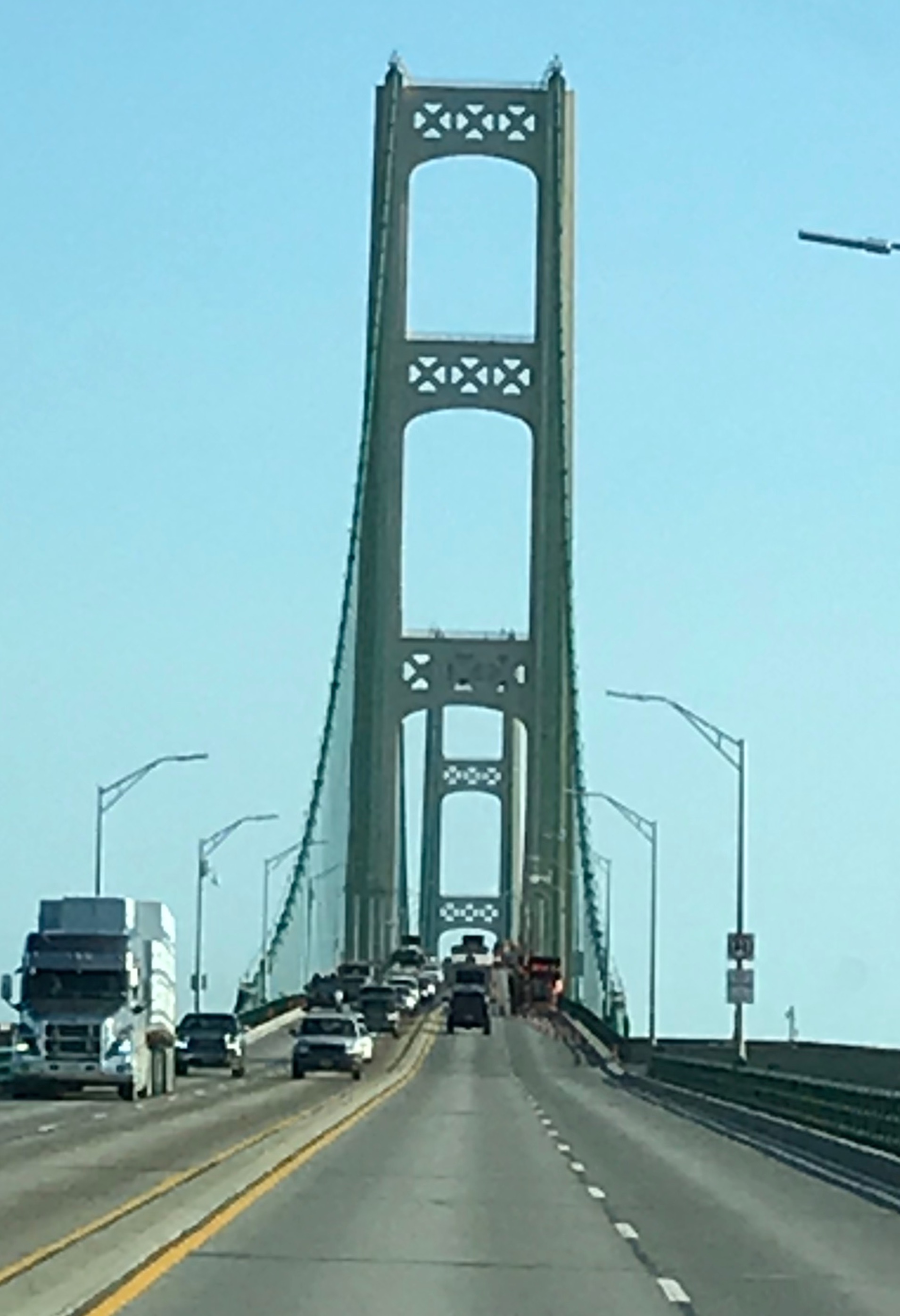
Our trip to Michigan could not be complete without a trip (or two) across the Mackinac Bridge into the Upper Peninsula.
Early one morning we cross the Mackinac Bridge on our way to Tahquamenon (rhymes with phenomenon) Falls State Park.
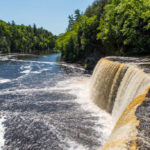
Tahquamenon Falls State Park
This is the land of Longfellow’s Hiawatha – “by the rushing Tahquamenaw” Hiawatha built his canoe. Long before the white man set eyes on the river, the abundance of fish in its waters and animals along its shores attracted the Ojibwa Indians, who camped, farmed, fished and trapped along its banks. In the late 1800’s came the lumber barons and the river carried their logs by the millions to the mills. Lumberjacks, who harvested the tall timber, were among the first permanent white settlers in the area.
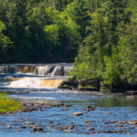
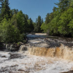
Rising from springs north of McMillan, the Tahquamenon River drains the watershed of an area of more than 790 square miles. From its source, it meanders 94 miles before emptying into Whitefish Bay. The amber color of the water is caused by tannins leached from the cedar, spruce and hemlock in the swamps drained by the river. The extremely soft water churned by the action of the falls causes the large amounts of foam, which has been the trademark of the Tahquamenon since the days of the voyager. — michigandnr.com
The centerpiece of the park is the Upper and Lower Falls. The Upper Falls is one of the largest east of the Mississippi with a width of 200 feet and a drop of 50 feet. The Lower Falls is a series of 5 smaller falls around an island.
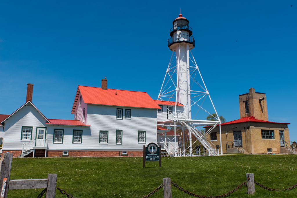
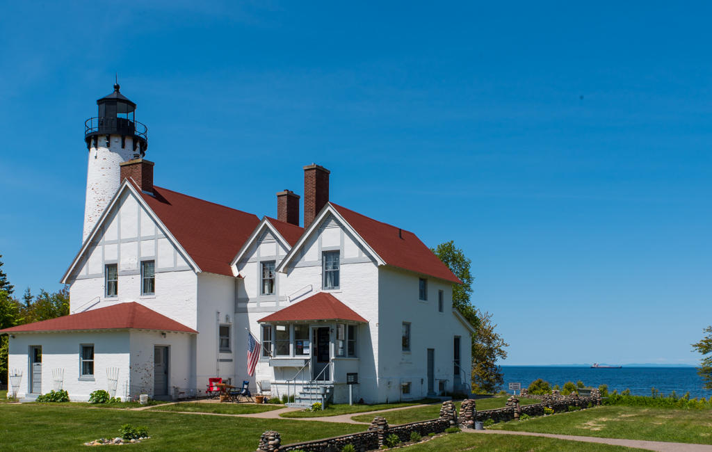
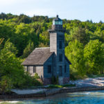
Our next stop was Whitefish Point Lighthouse – one of the first lights on Lake Superior. It overlooks the Graveyard of Ships as more vessels have been lost here than any other part of the lake, including the Edmund Fitzgerald. The bell from the Fitzgerald resides in the Great Lakes Shipwreck Museum on the premises.
From Whitefish we headed for Sault Ste. Marie, MI. stopping briefly at Point Iroquois Lighthouse along the way.
Sault Ste. Marie, MI
One of our goals in Sault Ste. Marie was to view the famous Soo Locks from the Observation Tower. The Soo Locks are the busiest lock system in the world by cargo tonnage. 90% of the worlds iron ore moves through these locks. The locks can accommodate ships of 1000 feet in length. We watch as one freighter makes it’s way through and another lines up to transit the opposite direction.
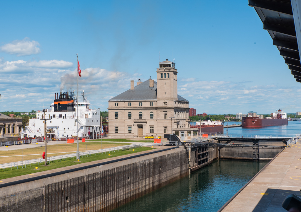
After watching the activity through the locks, we investigate some of the nearby shops and then have dinner at the Lockview Restaurant. Finally it’s time to head back south to the camper.
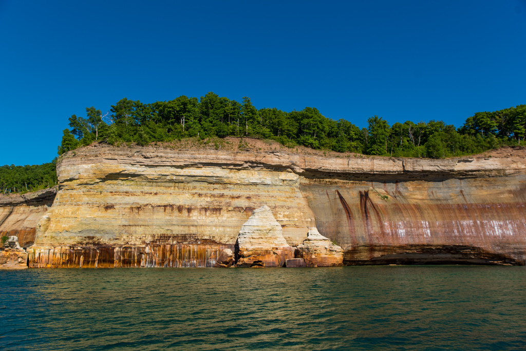
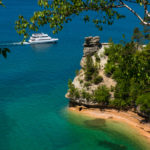
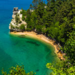
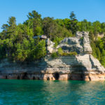
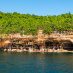
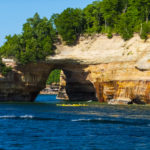
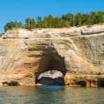
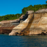
Pictured Rocks National Lakeshore
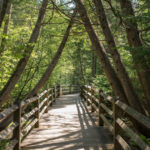
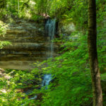
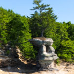
For another day long adventure, we left the camper about 11 a.m. headed for Pictured Rocks National Lakeshore (some 2 hours away on the UP). We had reservations for the 5 p.m. boat tour and thought this departure time would give us time to explore the park. We stopped at the Visitor Center upon arrival but it was closed due to renovation. The park ranger had a table outside the building where I was able to get my National Park Passport stamped. There are a number of hikes throughout the park. Bill and I elected to do two of the shorter ones – Munising Falls which leads to a 50 foot waterfall and Miners Castle Overlook for a view of Miners Castle and Lake Superior.

Soon it was time to drive into town for a bite to eat before the cruise.
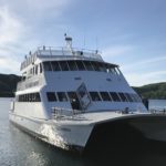
We started our cruise with Pictured Rock Cruises at Munising City Dock. The route took us past some amazing scenery that can only be viewed from the water.


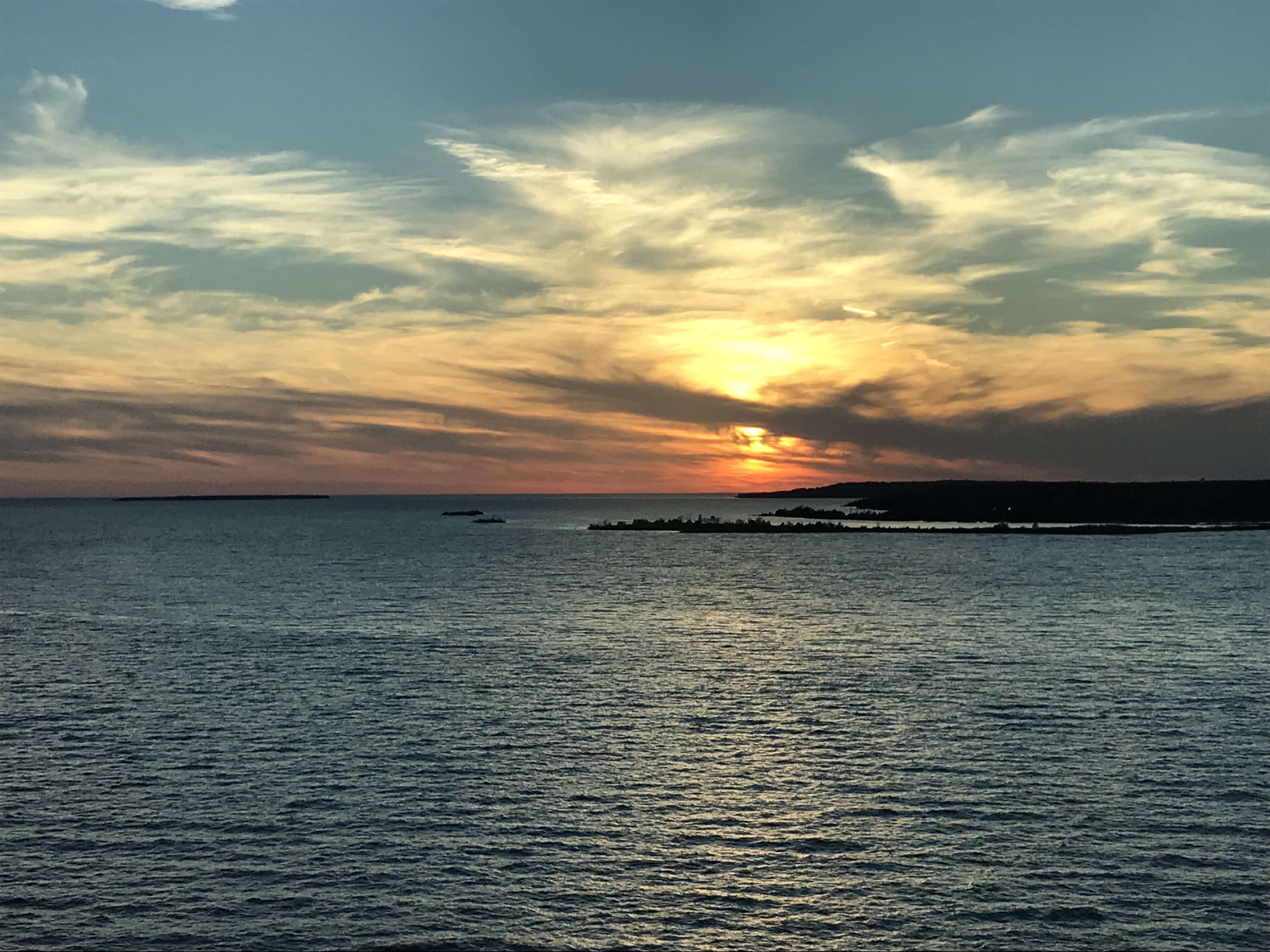
At the conclusion of the cruise, we headed south on our way to the campground. We crossed the Mackinac Bridge just as the sun was setting – a fitting end to our Michigan adventure.
Such beautiful photos!! I’d love to see this area sometime!