May 31 – June 13, 2018
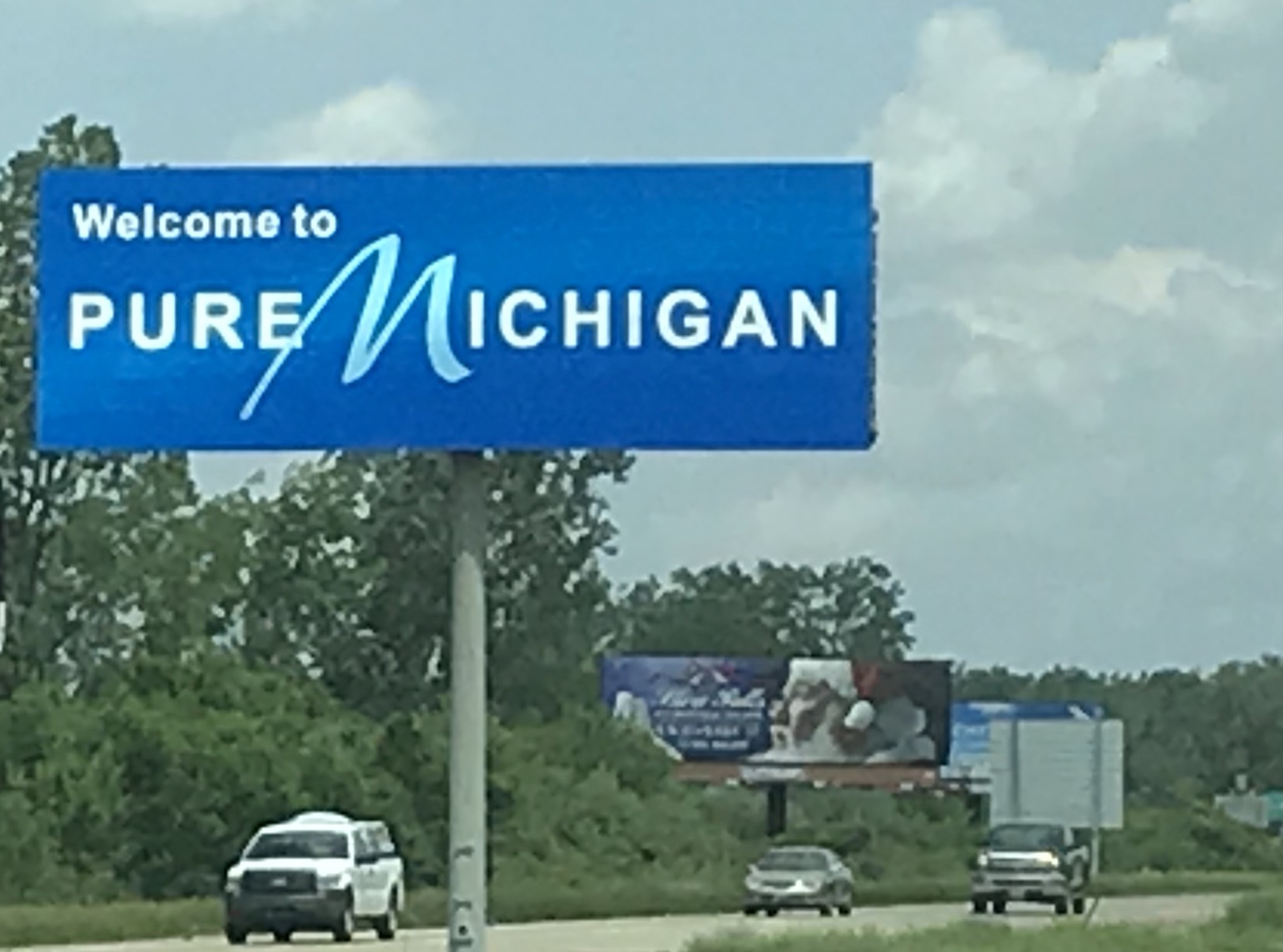
We left Travelers Rest on Wednesday, May 30 and headed north, stopping at a KOA in Lebanon, Ohio for the night. The following day we crossed the border into Michigan on our way to Mackinaw City. Yes, they did allow a die-hard Buckeye into “that state up north”.
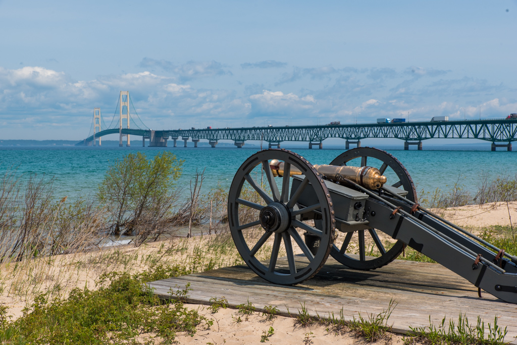
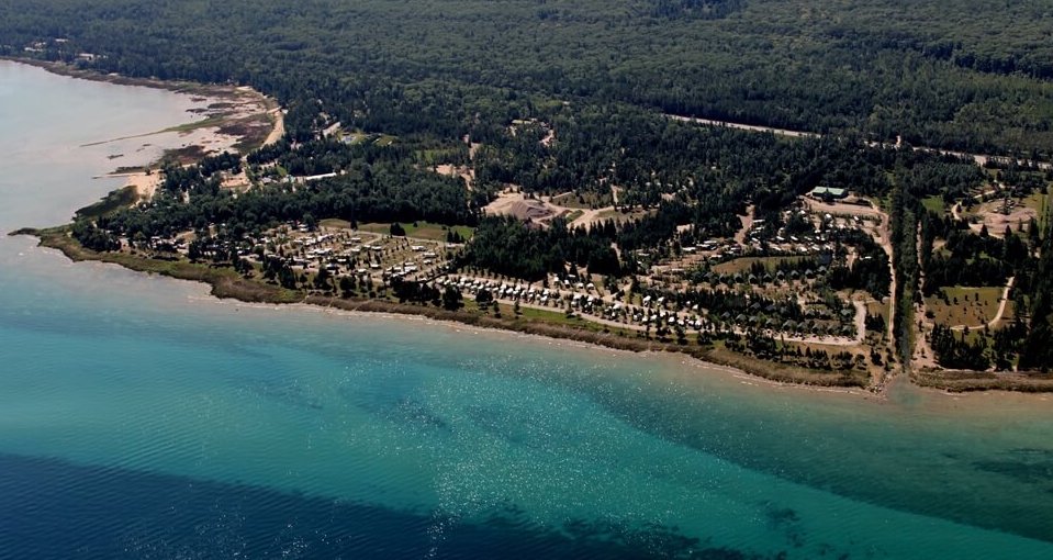
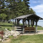
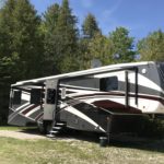
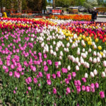
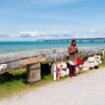
We chose Mackinaw Mill Creek Camping as our base camp from which to explore the “tip of the mitt”. The campground is huge with over 600 sites situated in 200 acres of woods with a mile of shoreline overlooking the Straits of Mackinac and the Mackinac Bridge. Campsites vary from tent to cabin rental to full hookup RV sites large enough for the biggest rig. All sites are natural settings with indigenous plants and wildflowers. Unfortunately the natural setting and the nearby shoreline encourages lots of bugs – especially midges, similar to our blind mosquitos in Florida.
We had a few days of wet, cool weather so we attempted to plan our activities accordingly. For our first outing we explored nearby Mackinaw City where it seemed every downtown block contained a fudge shop. We didn’t purchase any fudge but we did pick up some chocolate covered almonds and double dipped peanuts before trying out Taste of Asia for dinner – be sure to ask for mild spice.

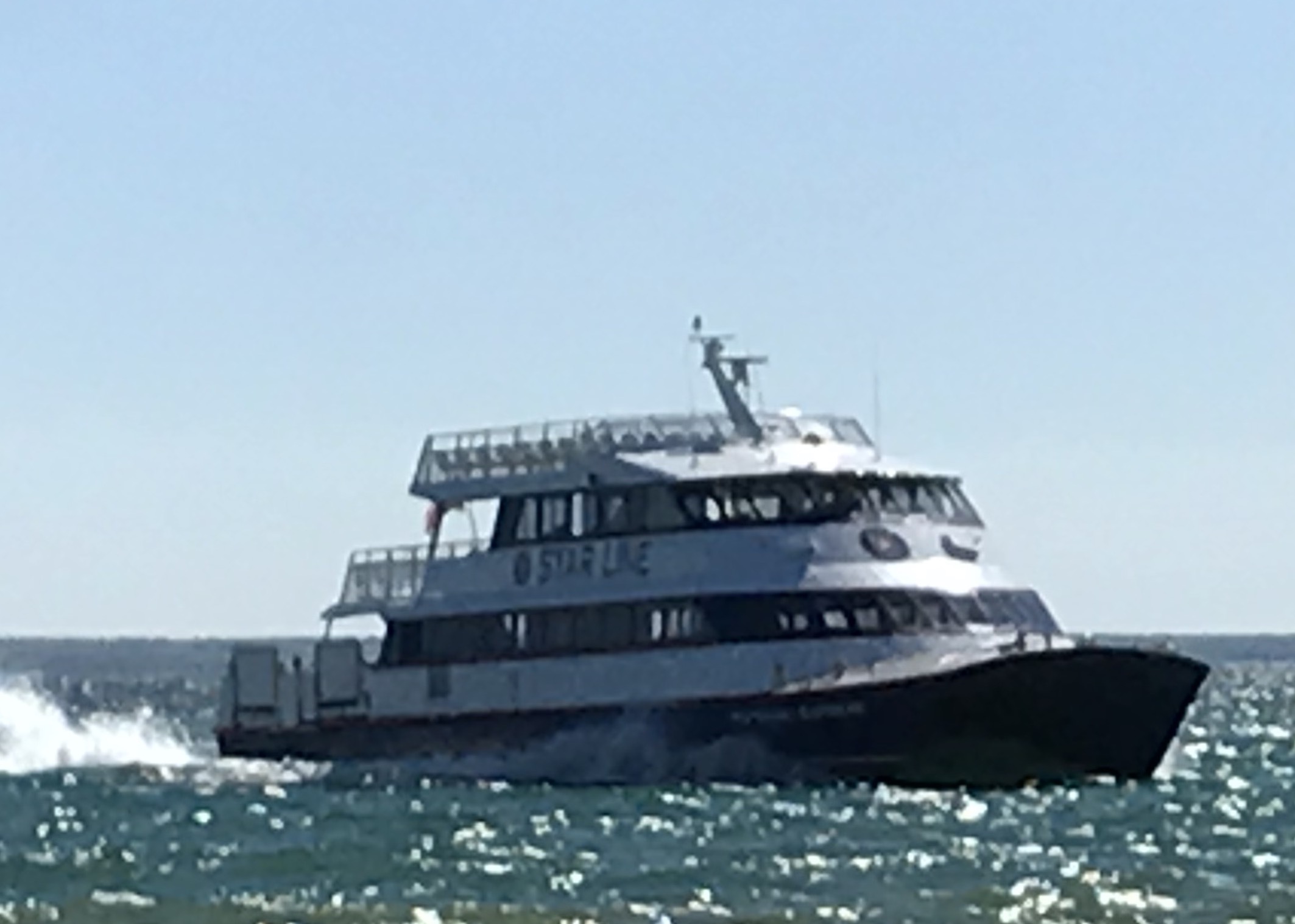
For our first sunny day we headed to Mackinac Island via the Star Line Mackinac Island Ferry. The trip to the island took about 18 minutes.
Mackinac Island
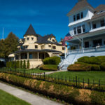
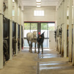
Mackinac Island sits in Lake Huron between Michigan’s upper and lower peninsula. The high bluffs are easily visible from the mainland. The aboriginal natives thought the bluffs resembled a big turtle which they named “mish-la-mack-in-naw”. Mackinac Island became one of the nations most favored summer resorts during the Victorian era. Vacationers traveled by large lake excursion boats from Buffalo, Cleveland, Chicago and Detroit to the cooler climes of Mackinac Island. Boat and railroad companies built summer hotels like the Grand Hotel to accommodate overnight guests. In the 1890’s wealthy Midwestern industrialists who wanted to spend more than a few nights on Mackinac built their own summer cottages on the east and west bluffs. Thus began a lifestyle of tennis, hiking, bicycling, golfing, and enjoying nature. Motorized vehicles were banned on the island in the late 1890’s and the ban became a law in the 1920’s except for emergency vehicles. Without cars, the main modes of transportation are by horse or by bicycle. During tourist season there are about 600 horses on the island but most are transported back to the mainland during the winter. Most of the horses come from the Amish.
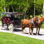
There are several options for seeing the island by horse. You can rent a riding horse, rent your own horse and buggy, or take an organized tour via horse-drawn carriage. We opted for the latter and shared a private tour with another couple.
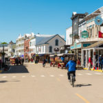
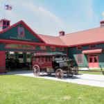
The tour took us into the historic downtown filled with shops, restaurants, pedestrians, bicycles, and carriages. As we continued out of town, we passed several of the beautiful summer cottages before making our way to the Grand Hotel.
The Grand Hotel first opened in 1887. In the 1890’s the hotel’s front porch (longest in the world) became “the” meeting place. In 1947 the movie “This Time for Keeps” with Jimmy Durante and Esther Williams was filmed at the hotel. The hotel swimming pool was built especially for the movie. “Somewhere in Time” with Christopher Reeve, Jane Seymour, and Christopher Plummer was filmed at the hotel in 1987.
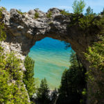
Continuing on we stopped at Arch Rock (a natural limestone formation that stands over 15 stories tall) and the Grand Hotel Livery.
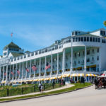
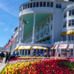
Following the tour, we stopped for lunch at the Seabiscuit Cafe, wandered around downtown, and returned to the Grand Hotel to check out the inside (for a $10 per person entrance fee) and sample some ice cream from Sadie’s Ice Cream Parlor (named after Sadie, the Scottish Terrier owned by hotel Chairman R.D, Musser who won Best In Show at the 2010 Westminster Kennel Club Dog Show). Finally, we returned via ferry to Mackinaw City.
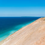
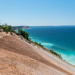
Sleeping Bear Dunes National Lakeshore
On another beautiful day we decided to head south to Sleeping Bear Dunes National Lakeshore. Along the way we drove past Petoskey where there is a highly rated motor coach resort but since we don’t travel in a motor coach, we didn’t stop. Instead we continued on to Elk Rapids to check out Honcho Rest Campground as a potential summer destination but found it a bit cramped. From there we drove to Empire and toured Indigo Bluffs (which we really liked – especially the resort section). We finally arrived at Sleeping Bear Dunes in the late morning.
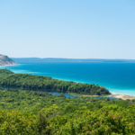
The most prominent features, and those for which the park is named, are the perched dunes above Lake Michigan. These immense sand dunes are “perched” atop the already towering headlands that are glacial moraines. The dune overlooks at the Sleeping Bear, Empire and Pyramid Point bluffs are about 400 feet above Lake Michigan. With 65 miles of Lake Michigan shoreline and numerous inland lakes and streams, the park is wonderfully water oriented. — nps.gov
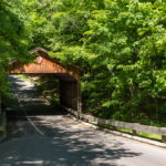
One of the easiest ways to see the park is to follow the Pierce Stocking Scenic Drive – a 7.4 mile loop through the forest and sand dunes. The road was built by Pierce Stocking who wanted to share the beautiful scenery with the public. The drive includes many scenic overlooks and a covered bridge that bears the National Park Service arrowhead.

After touring the park we drove to the Visitor Center in Empire so that I could get my National Parks Passport stamp.
As we headed back to the north we decided to check out Traverse City. We stopped for a late lunch at North Peak Brewing Company. Since Michigan is famous for it’s cherries, we had to check out Cherry Republic and get some cherry pie for later.
Our final stop on this outing was Vista Green, another RV resort. We really liked everything about the resort except the location. It’s a bit remote.
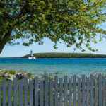
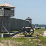
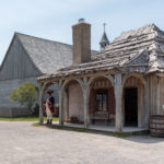
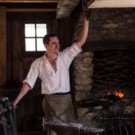
Colonial Michilimackinac and Old Mackinac Point Lighthouse
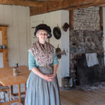
For a day of local sightseeing, we headed to Colonial Michilimackinac at the base of the Mackinac Bridge.
French soldiers constructed the fortified community of Michilimackinac on the south side of the Straits of Mackinac in 1715. The community grew and prospered over the coming years as Michilimackinac became an important center of the Great Lakes fur trade. Every summer, thousands of Native Americans and French-Canadian voyageurs gathered at the post, which served as transfer station for furs trapped in the western Great Lakes and trade goods shipped in from eastern cities such as Montreal and Quebec. Michilimackinac came under British control in 1761, but the fur trade and community life remained relatively unchanged. Fearful that the post was vulnerable to attack by American rebels, the British disassembled the fort and community and moved it to Mackinac Island in 1779-81. The Mackinac Island State Park Commission acquired the site of Michilimackinac in 1909, creating Michigan’s second state park. Archaeological excavation and reconstruction of the site began in 1959, and still continue today. The fort and community are being reconstructed to their appearance in the mid-1770s, and interpreters depict the British soldiers, Native Americans, French-Canadian voyageurs, merchants and their families, and others who called Michilimackinac home. — mackinacparks.com
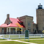
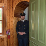
Within the same park is the Old Mackinac Point Lighthouse.
With maritime traffic in the Straits of Mackinac steadily increasing, Congress authorized the construction of a light station at Old Mackinac Point in 1889. The new station was to replace an existing light at McGulpin Point, two miles to the west, which was not visible to vessels sailing on Lake Huron. A fog signal went into operation at Old Mackinac Point in 1890, and the lighthouse itself was completed and lit for the first time in 1892. A storage barn and oil house completed the station. Old Mackinac Point’s flashing red light, shining atop a stately stone tower and castle-like keepers’ quarters, was visible for 16 miles, guiding sailors through the sometimes treacherous waters of the Straits of Mackinac. For 65 years the keepers of Old Mackinac Point stood watch every night to monitor the station’s equipment. The Old Mackinac Point light station was decommissioned in 1957, replaced by navigational aids mounted on the newly-constructed Mackinac Bridge. The Mackinac Island State Park Commission acquired the light station in 1960, and opened it to the public as the center of the Michilimackinac Maritime Park in 1972. After closing in the 1990s, the light station reopened to the public in 2004. Today, the site is being restored to its appearance around 1910, and historic interpreters are on hand to greet visitors and lead them on tours up the tower. — mackinacparks.com
As you can tell, we’ve been busy touring the lower peninsula but our visit to Michigan is far from complete. Stay tuned for our adventures in the UP.