May 16 – 18, 2021
While planning our trip, Bill added an overnight stop in Gallup, New Mexico to break up the travel time between Albuquerque and our next destination. When our waiter at High Noon in Albuquerque told us about the Painted Desert/Petrified Forest near Gallup, we decided to make this a two night stop instead. Luckily we were able to extend our reservation from one night to two.
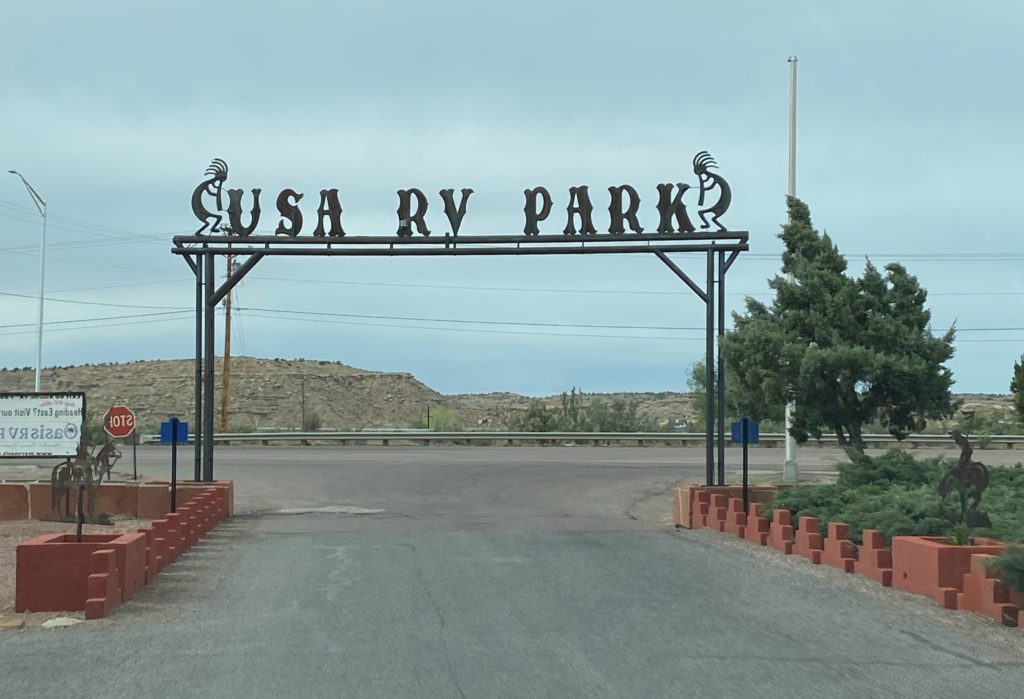
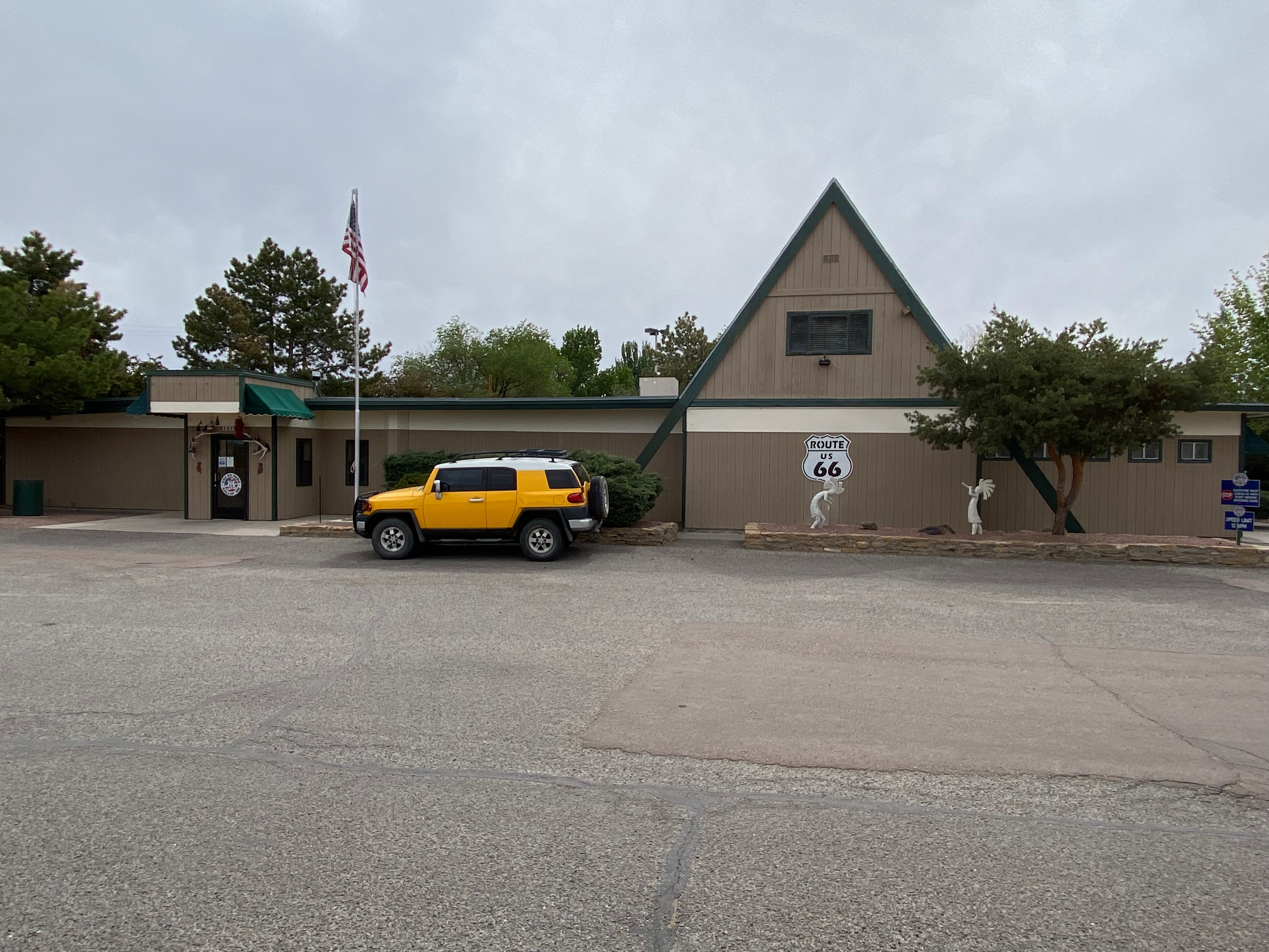
USA RV Park
Our home base was the USA RV Park on Route 66. Centrally located on historic Route 66, the park was a short distance from many national and tribal parks including Mesa Verde (2 hours), El Morro (1 hour), Window Rock (1/2 hour), Zuni (45 minutes), Four Corners (2 hours), Monument Valley (3 hours), and the Petrified Forest (1 hour).
Petrified Forest National Park
We started out early the next morning driving west on I-40 to the north entrance of the Petrified Forest National Park.
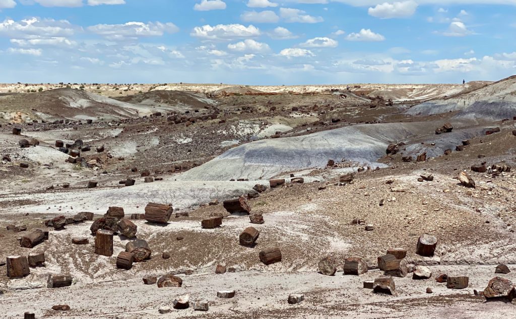
Petrified Forest National Park is an American national park in Navajo and Apache counties in northeastern Arizona. Named for its large deposits of petrified wood, the park covers about 346 square miles (900 square kilometers), encompassing semi-desert shrub steppe as well as highly eroded and colorful badlands. The park’s headquarters is about 26 miles (42 km) east of Holbrook along Interstate 40 (I-40), which parallels the BNSF Railway’s Southern Transcon, the Puerco River, and historic U.S. Route 66, all crossing the park roughly east–west. The site, the northern part of which extends into the Painted Desert, was declared a national monument in 1906 and a national park in 1962.
wikipedia
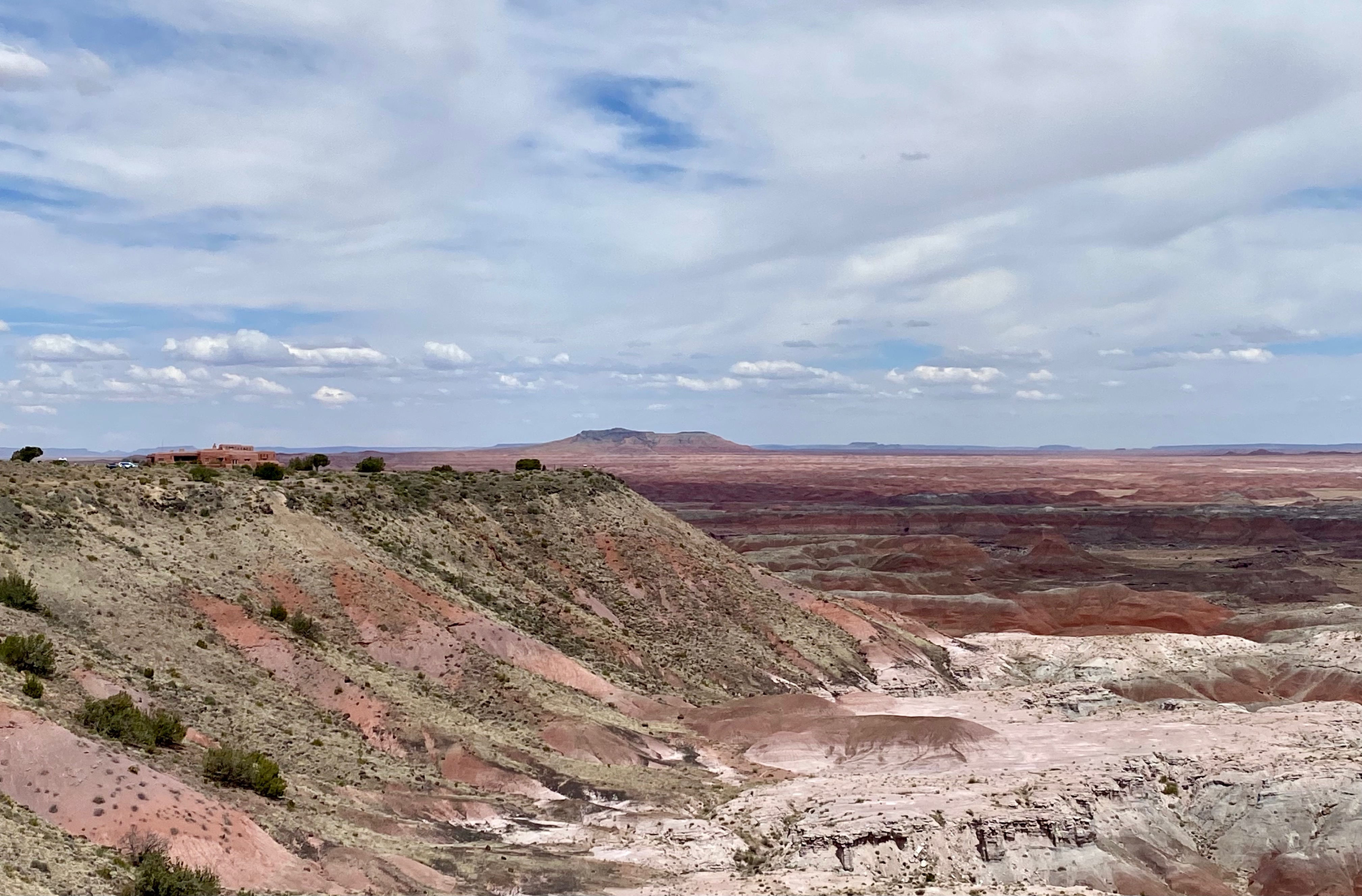
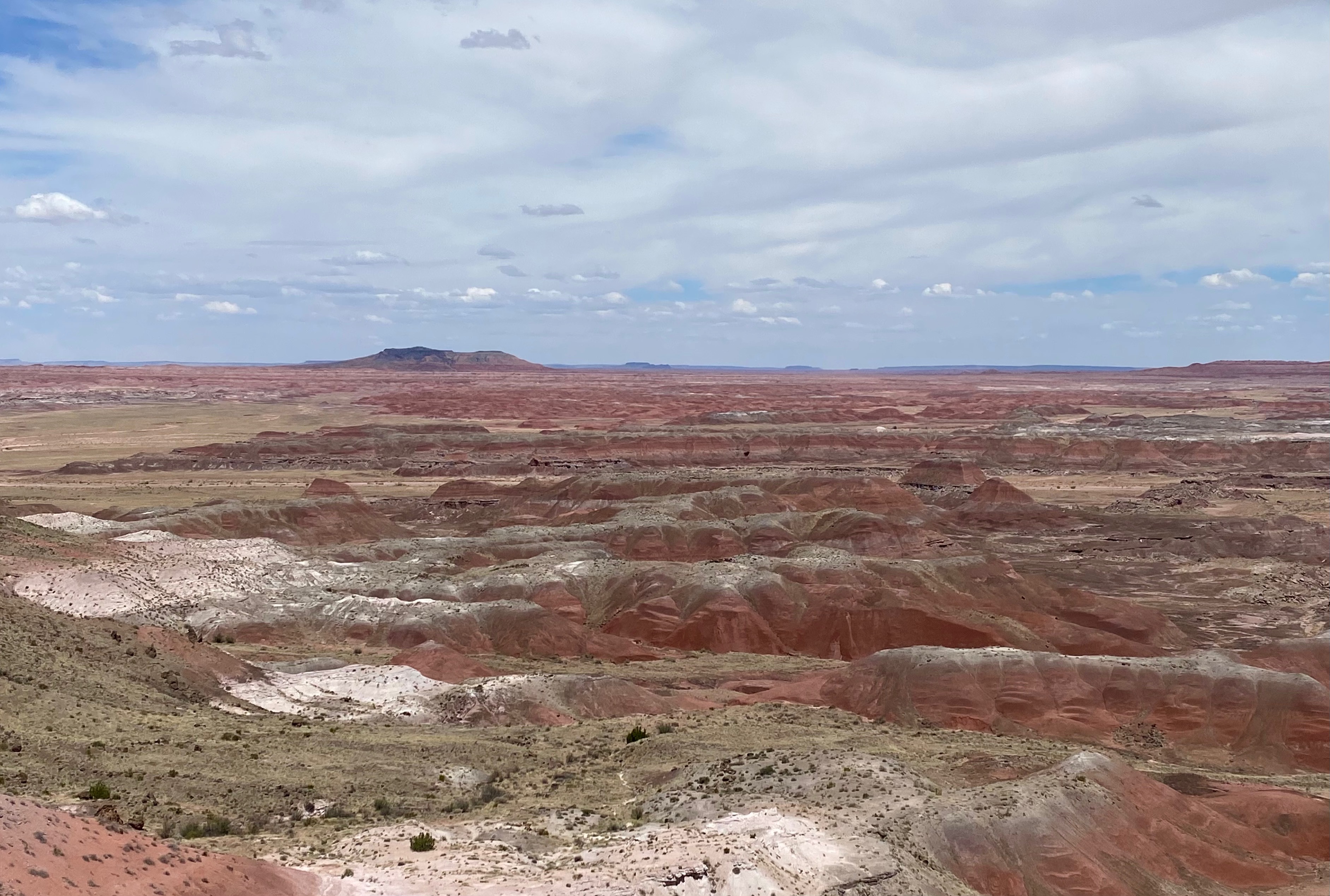
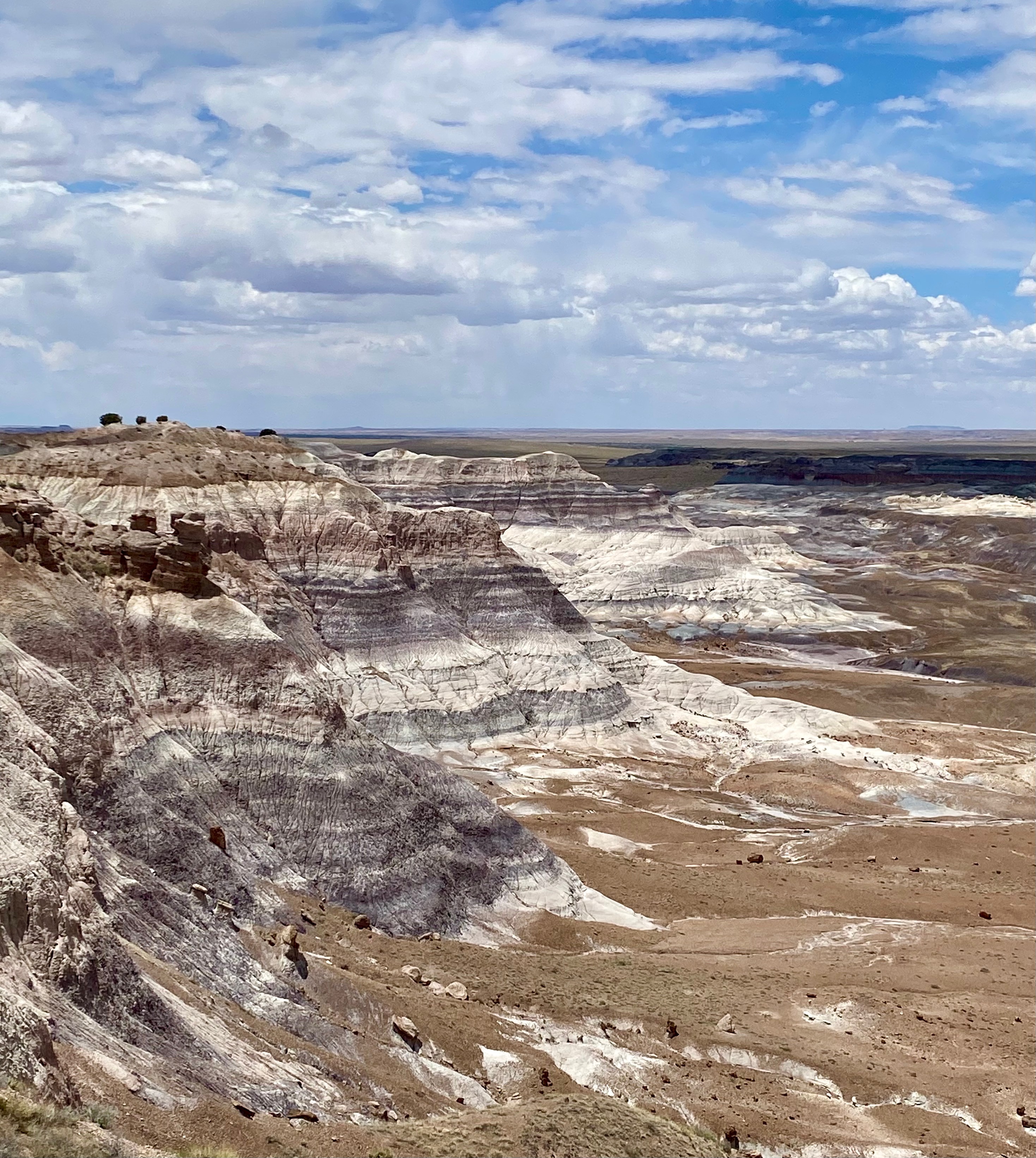
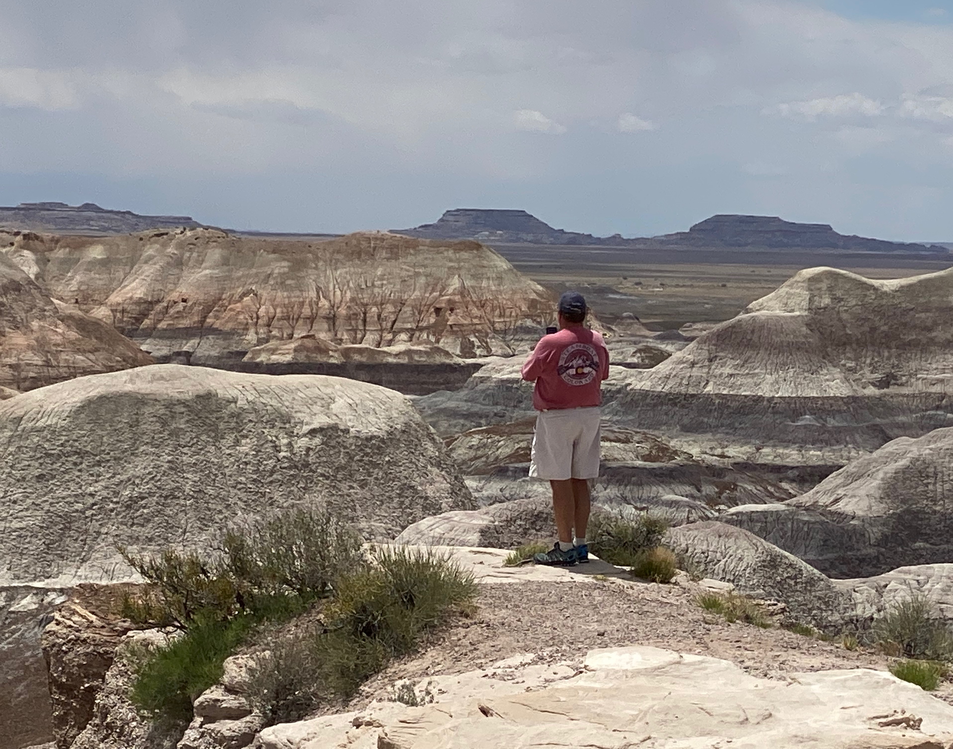
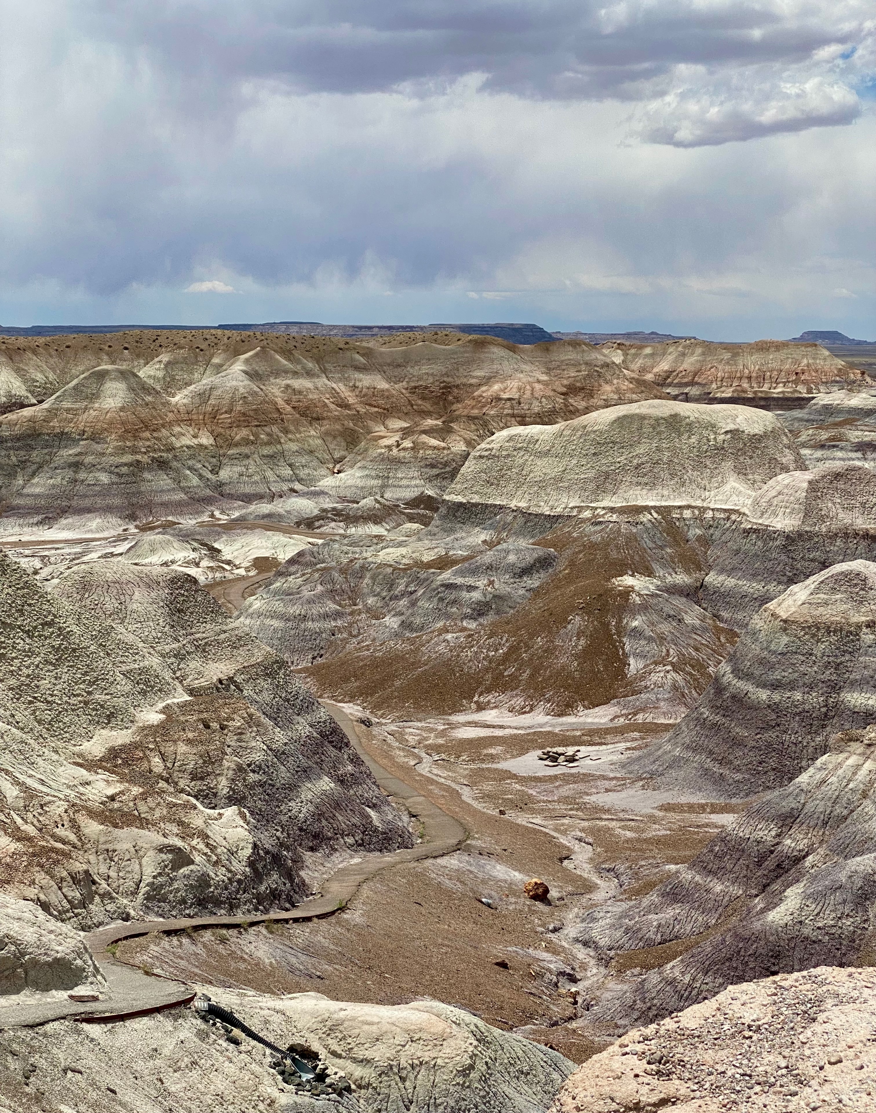
After stopping at the Painted Desert Visitor Center, we proceeded to follow the Petrified Forest Road, stopping at the various overlooks to take in the spectacular scenery. Our first glimpse of the desert at Tiponi Point took our breath away.
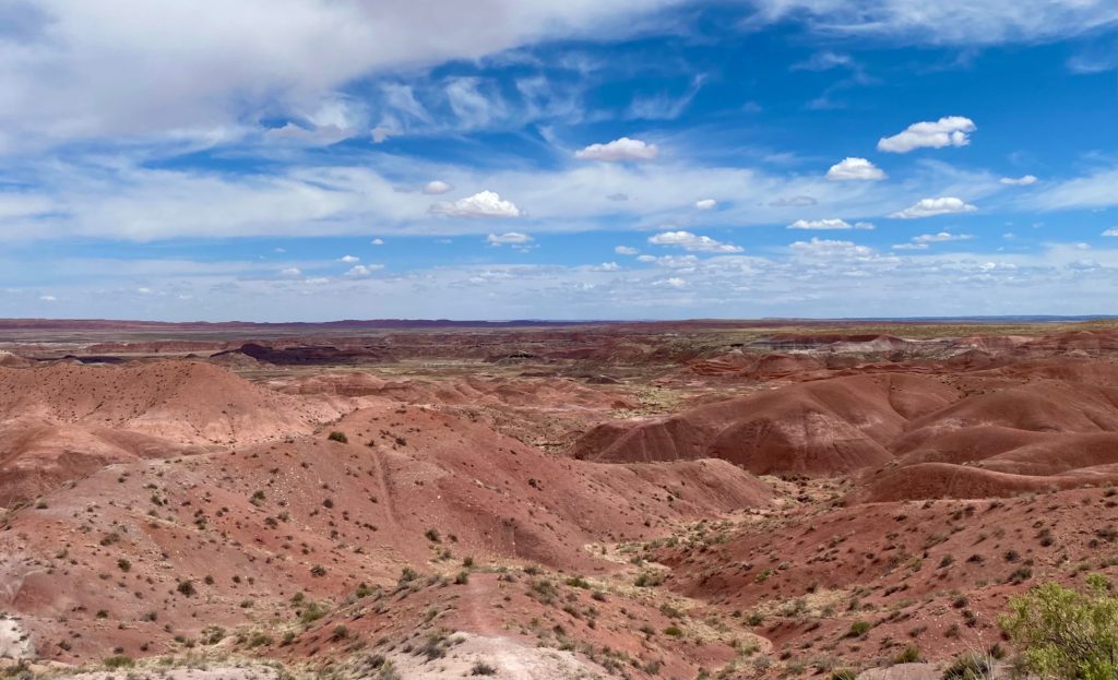
The next overlook at Tawa Point provided a view of the Painted Desert Inn in the distance.
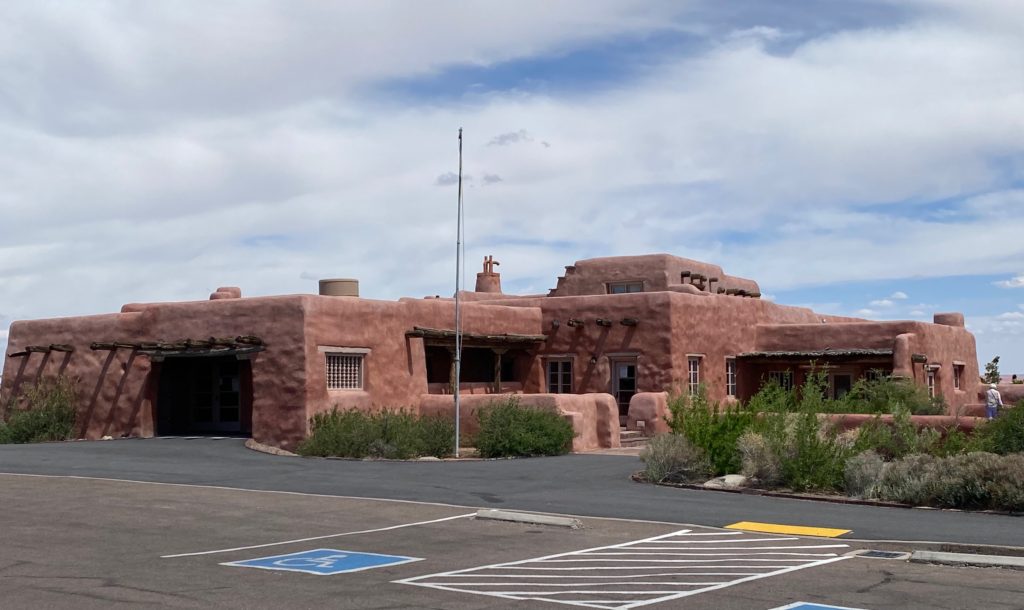
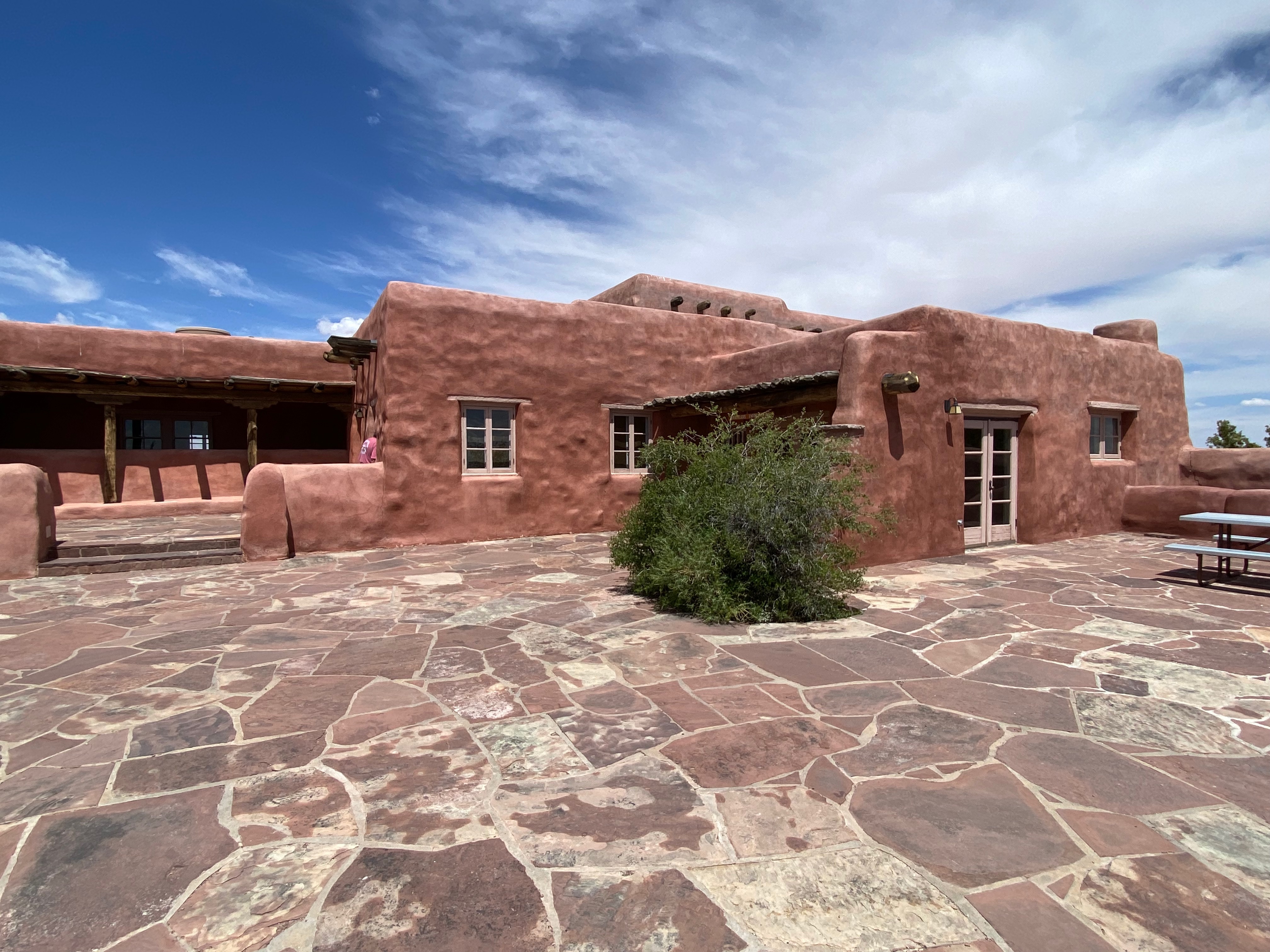
Our next stop was at the Painted Desert Inn Historical Landmark which unfortunately was closed.
In its almost 100 years overlooking the Painted Desert, the inn has undergone many changes. The original building from the early 1920s was made of petrified wood. Today’s adobe facade dates to the 1930s renovation of the Painted Desert Inn.
The national historic landmark functions only as a museum now, with no overnight accommodation and food service. Displays inside highlight the building’s history, Route 66, and the Civilian Conservation Corps.
nps.gov
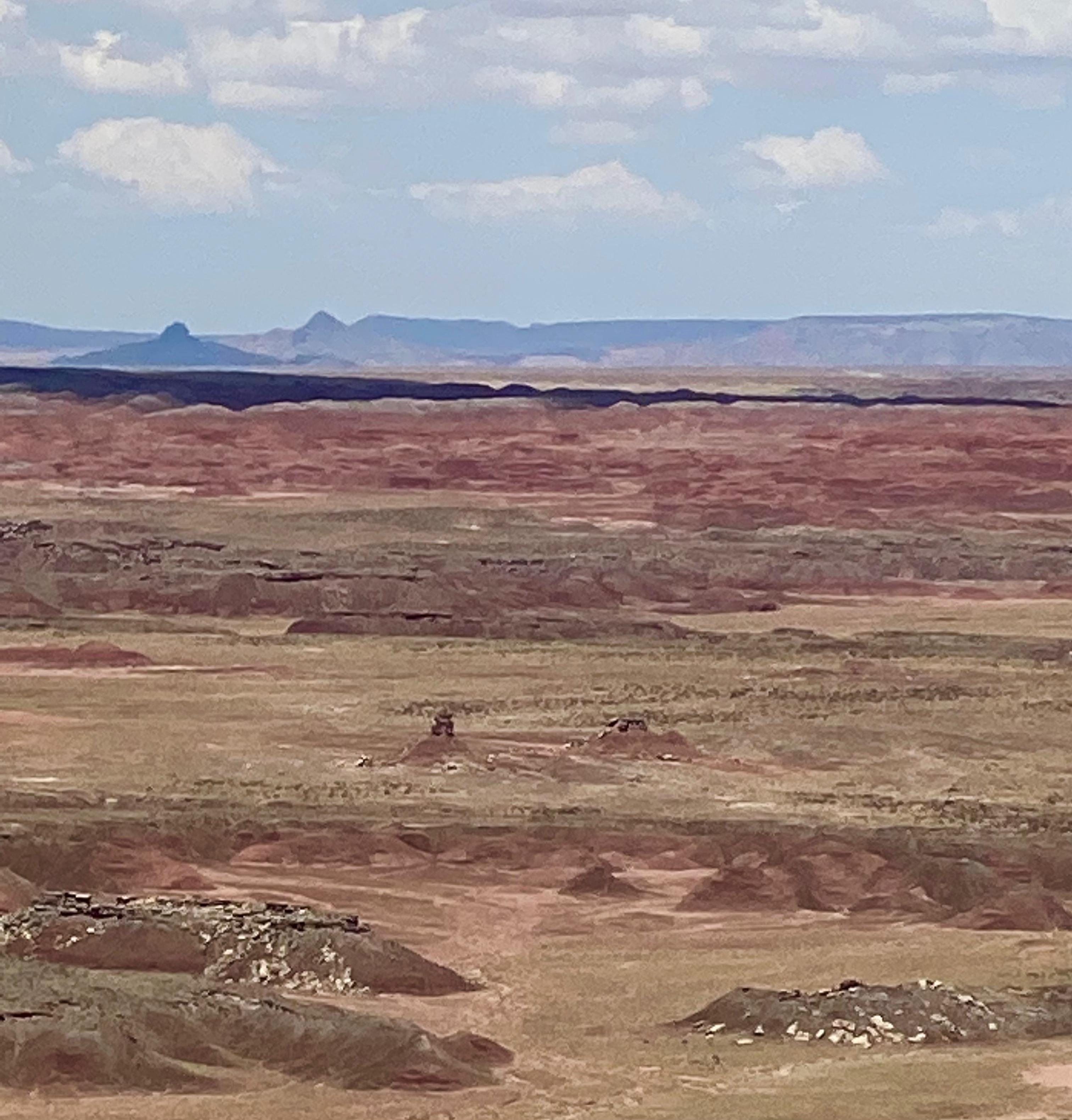
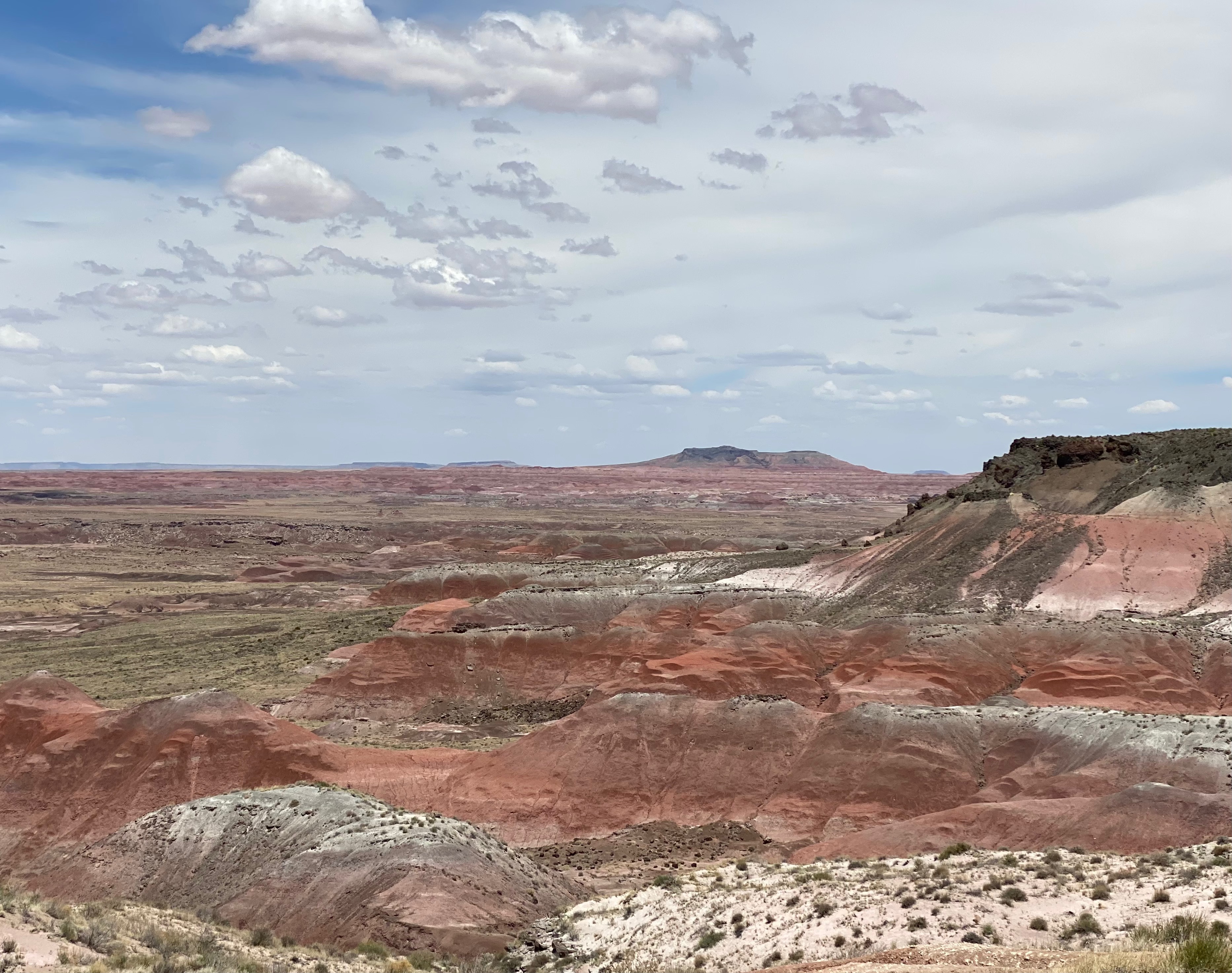
Continuing on the road, we stopped to enjoy the views from Chinde Point and Lacey Point.
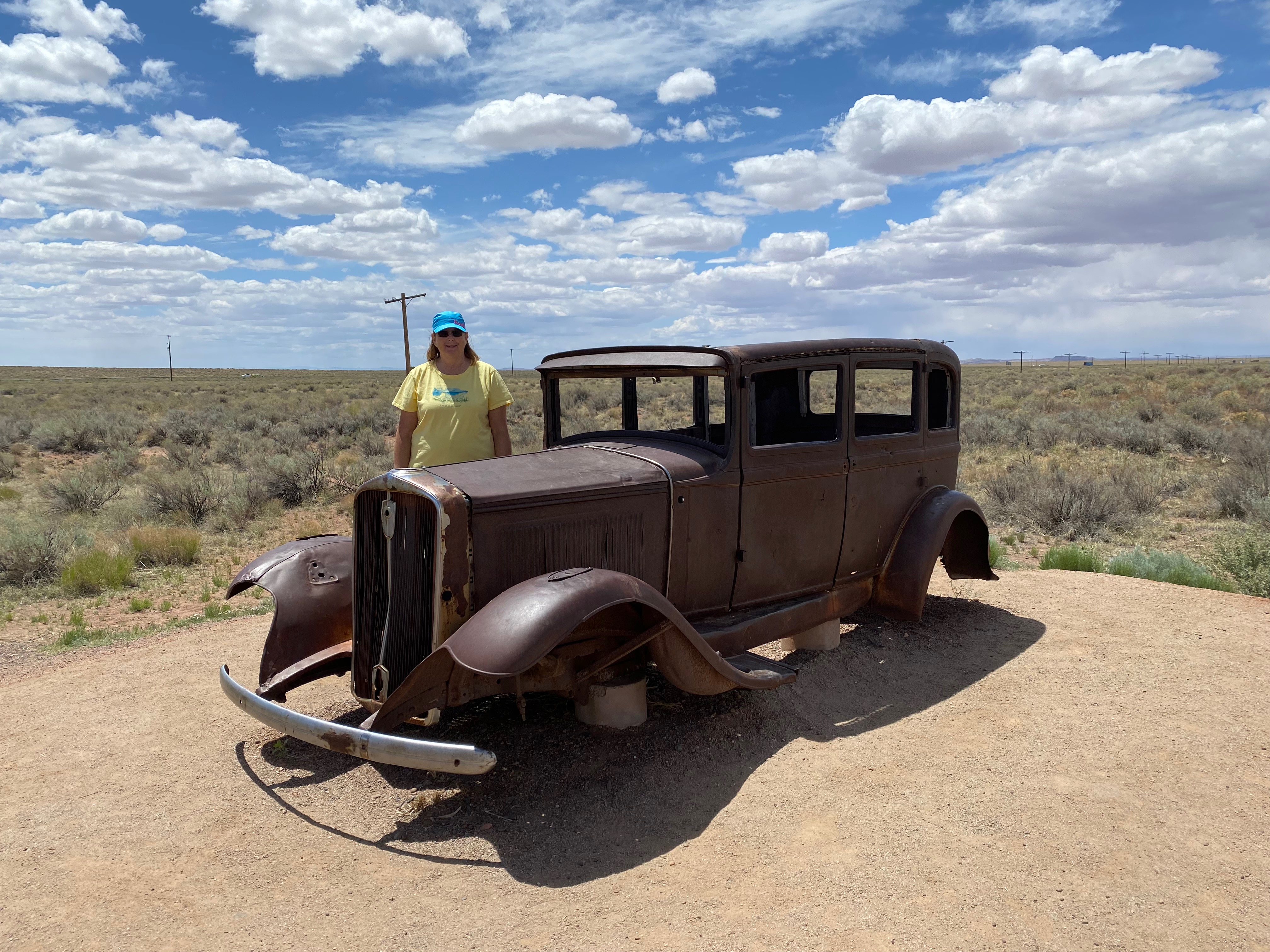
In 2006, a new paved pull-out was added along the park road within Petrified Forest National Park.
This new pull-out showcases a section of the old Route 66 trace that passes through the park. From the vantage point that the pull-out offers, visitors can view the roadbed and a line of historic telephone poles. The roadbed and telephone poles mark the path of the famous “Main Street of America” as it passed through Petrified Forest National Park. From Chicago to Los Angeles, this heavily traveled highway was not only a road. It stood as a symbol of opportunity, adventure, and discovery. Petrified Forest National Park is the only National Park that contains a section of the old highway.
In addition to the new pull-out, a 1932 Studebaker exhibit has been installed adjacent to the newly developed area. The car was donated to the National Park Service by Frank and Rhonda Dobell, owners of Arizona Automotive Service in Holbrook, Arizona.
nps.gov
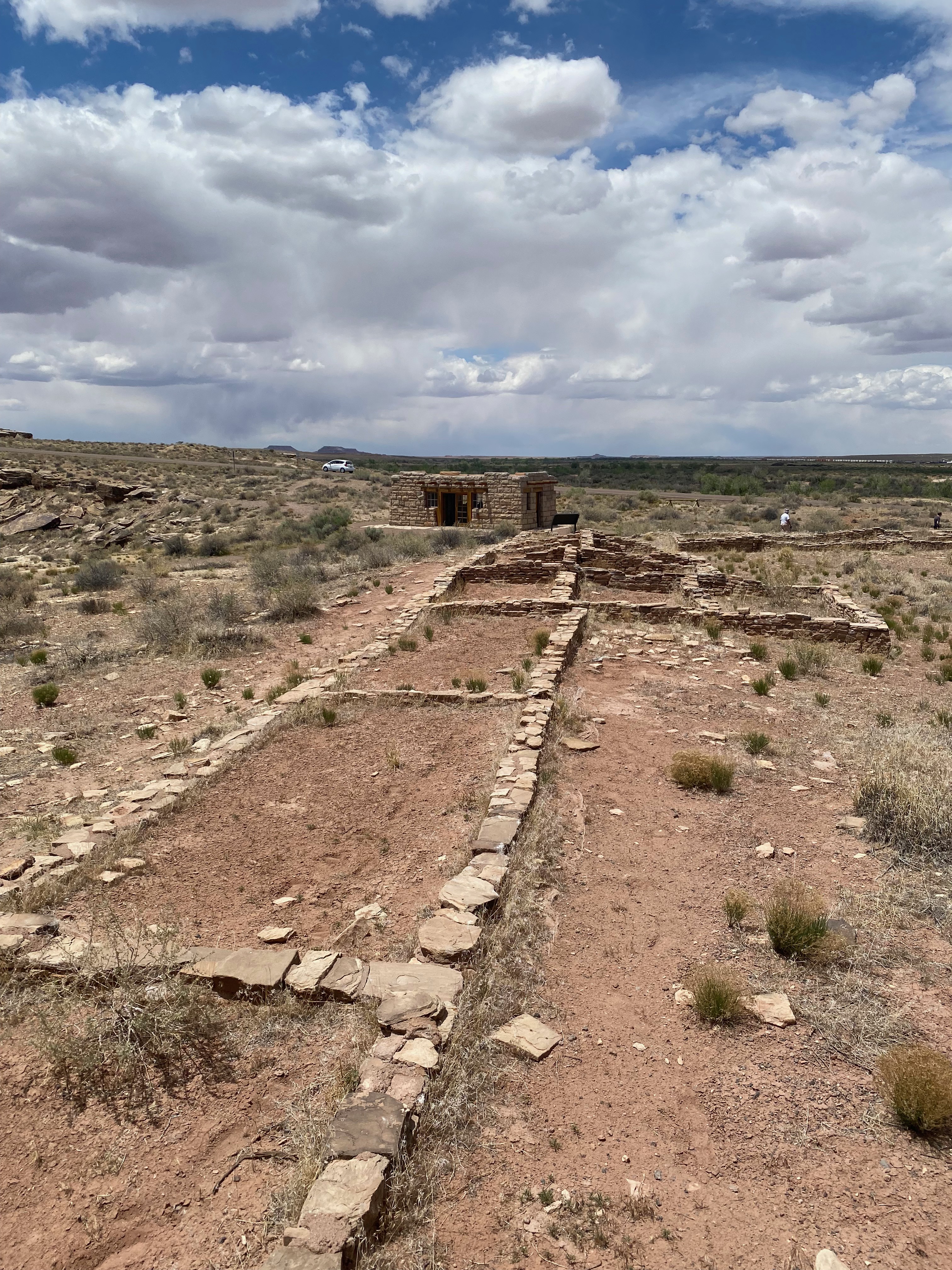
The next stop along the route was the Puerco Pueblo ruins and petroglyphs.
A series of droughts in the 1200s, during the Pueblo IV period, led ancestral Puebloan people to move away from small, scattered hamlets and instead build large pueblo communities. The Village on the Rio Puerco (or Puerco Pueblo, for short) is a 100+ room pueblo site located near the Puerco River, a major drainage that bisects the park. The river would have been a reliable source of water for crops. Farming of corn, beans, and squash took place on the floodplains and terraces along the river. The river also made a natural travel corridor, meaning travelers and traders frequented Puerco Pueblo, carrying new ideas as well as goods.
At its largest size, around 1300, Puerco Pueblo may have been home to about 200 people. The one-story high village of hand-shaped sandstone blocks was built around a rectangular plaza. The rooms were living quarters and storage, but most activity, like cooking and craftmaking, took place in the plaza. There were also several underground rooms, called kivas, where ceremonial practices took place. There were no doors or windows in the plaster-covered exterior walls of the pueblo. Entry into the village was by ladders over the wall and across the log, brush, and mud roofs of the room blocks.
Unable to adapt to the climate change of the late 1300s, the inhabitants of Puerco Pueblo systematically abandoned the pueblo in search of a more suitable area. It was all but empty by 1380. Only the sandstone bricks, potsherds, stone tools, petroglyphs, and other artifacts and features remain to tell the tale of these ancient people.
nps.gov
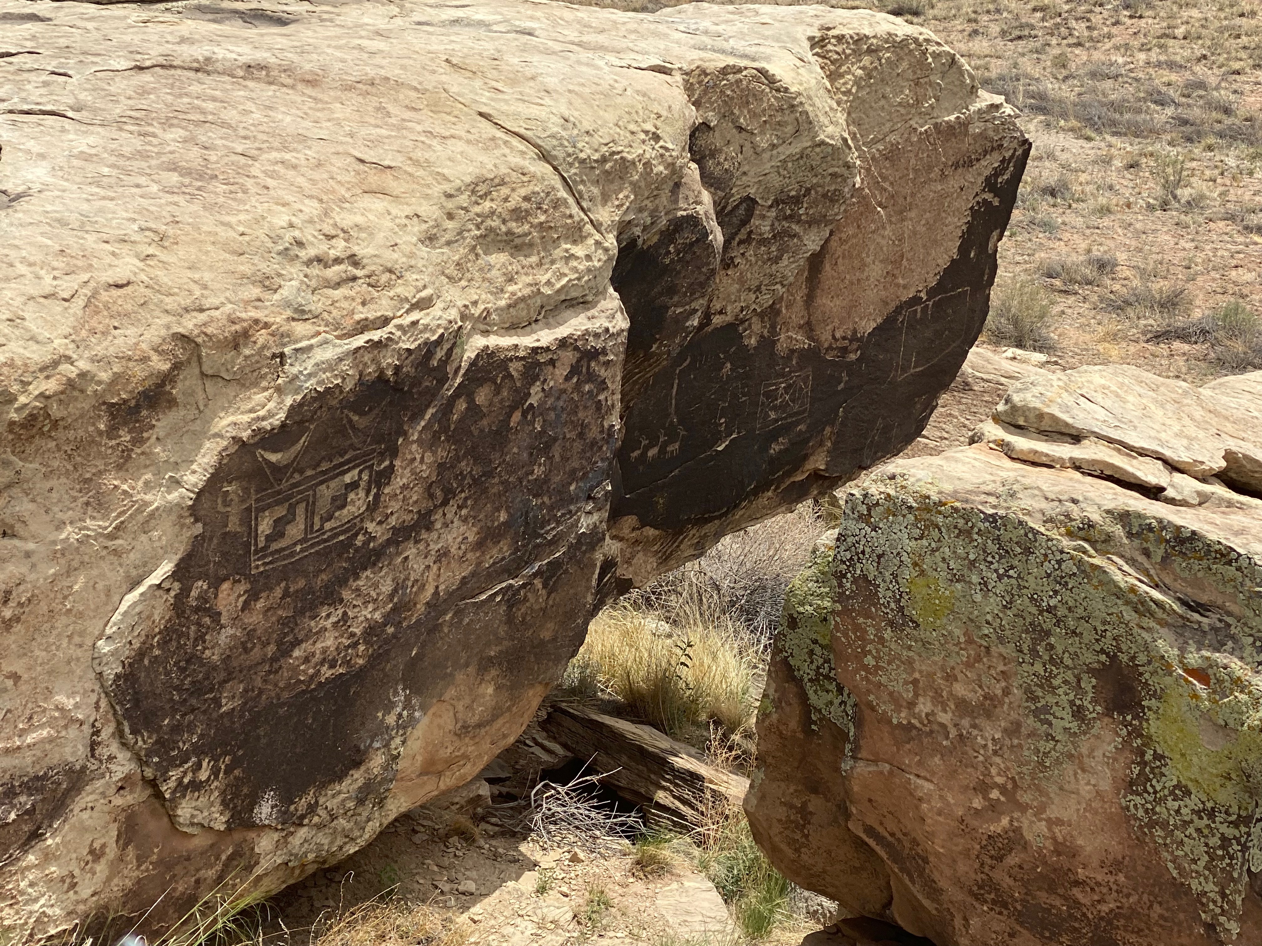
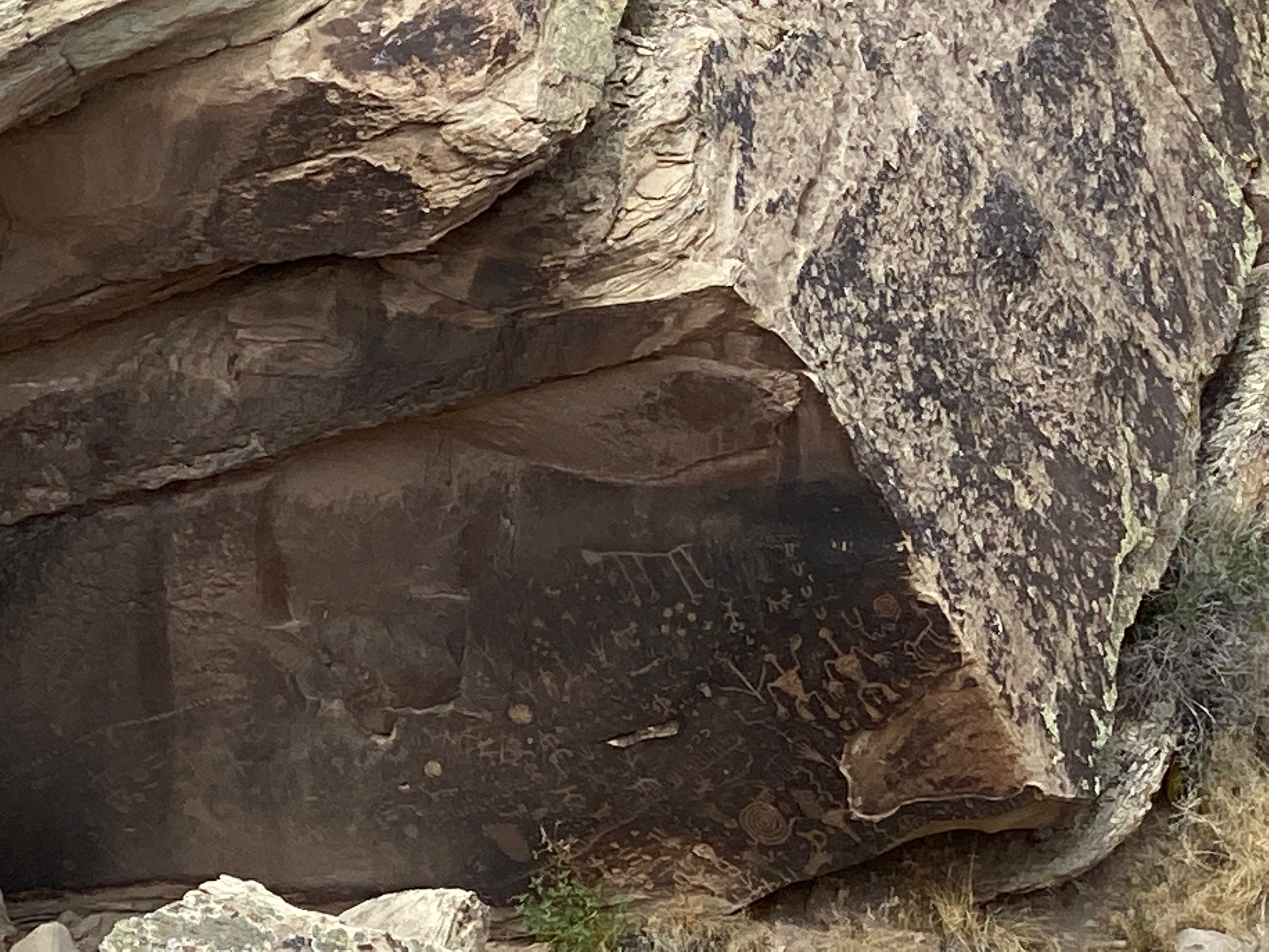
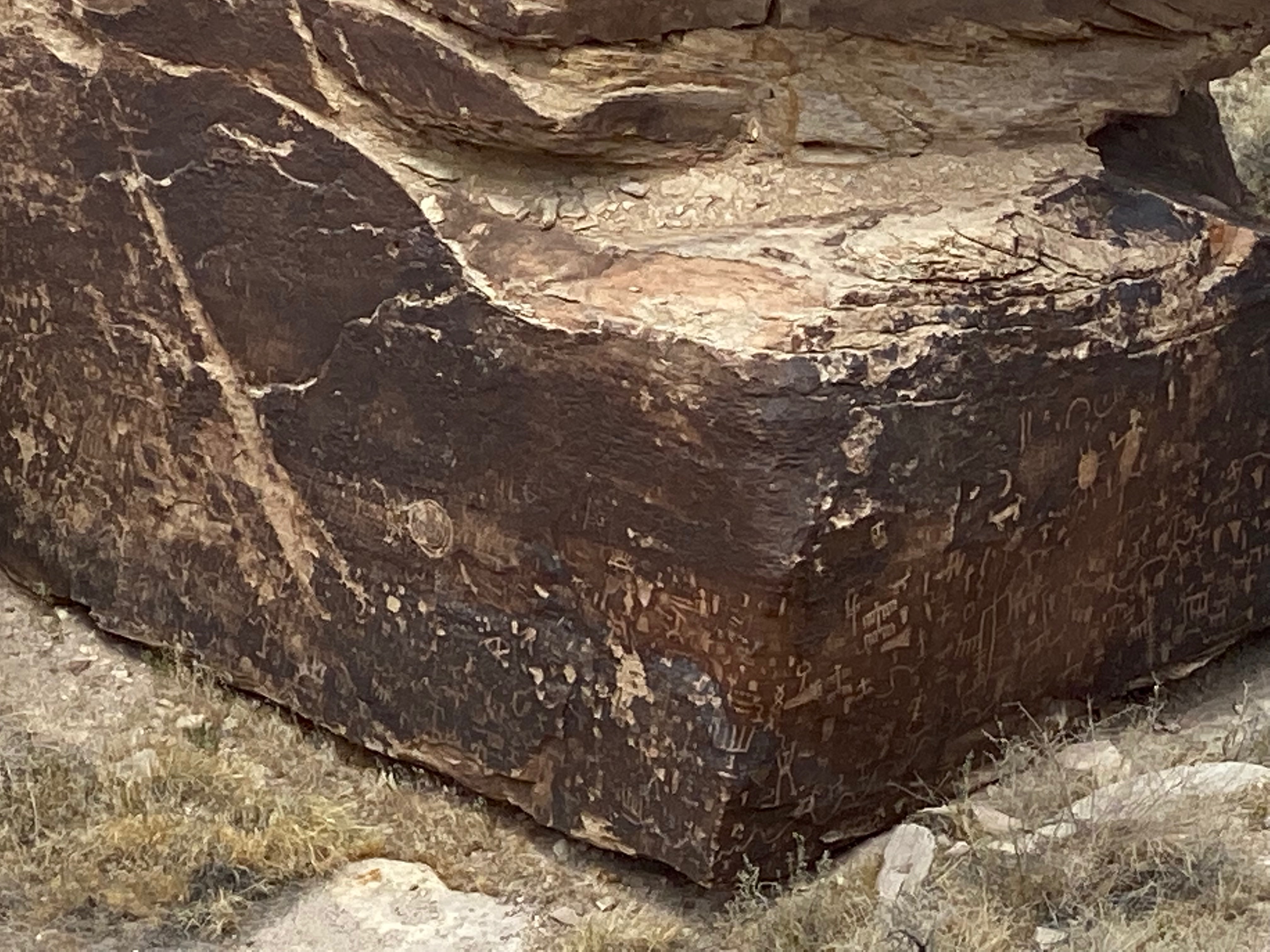
Next up was a stop at Newspaper Rock.
The archeological site known as Newspaper Rock is neither a newspaper nor a single rock. The site boasts over 650 petroglyphs covering a group of rockfaces within a small area. High concentrations of petroglyphs like this mark a place as hugely significant. Many generations of people saw these markings and contributed their own. The petroglyphs were created by ancestral Puebloan people living, farming, and hunting along the Puerco River between 650 and 2,000 years ago. Some of the ancient artists may have lived at Puerco Pueblo, located less than one mile north of this site.
nps.gov
From the main road, we drove the Blue Mesa loop but bypassed the one mile steep trail down to the canyon floor. The views from the top were sufficient for us.
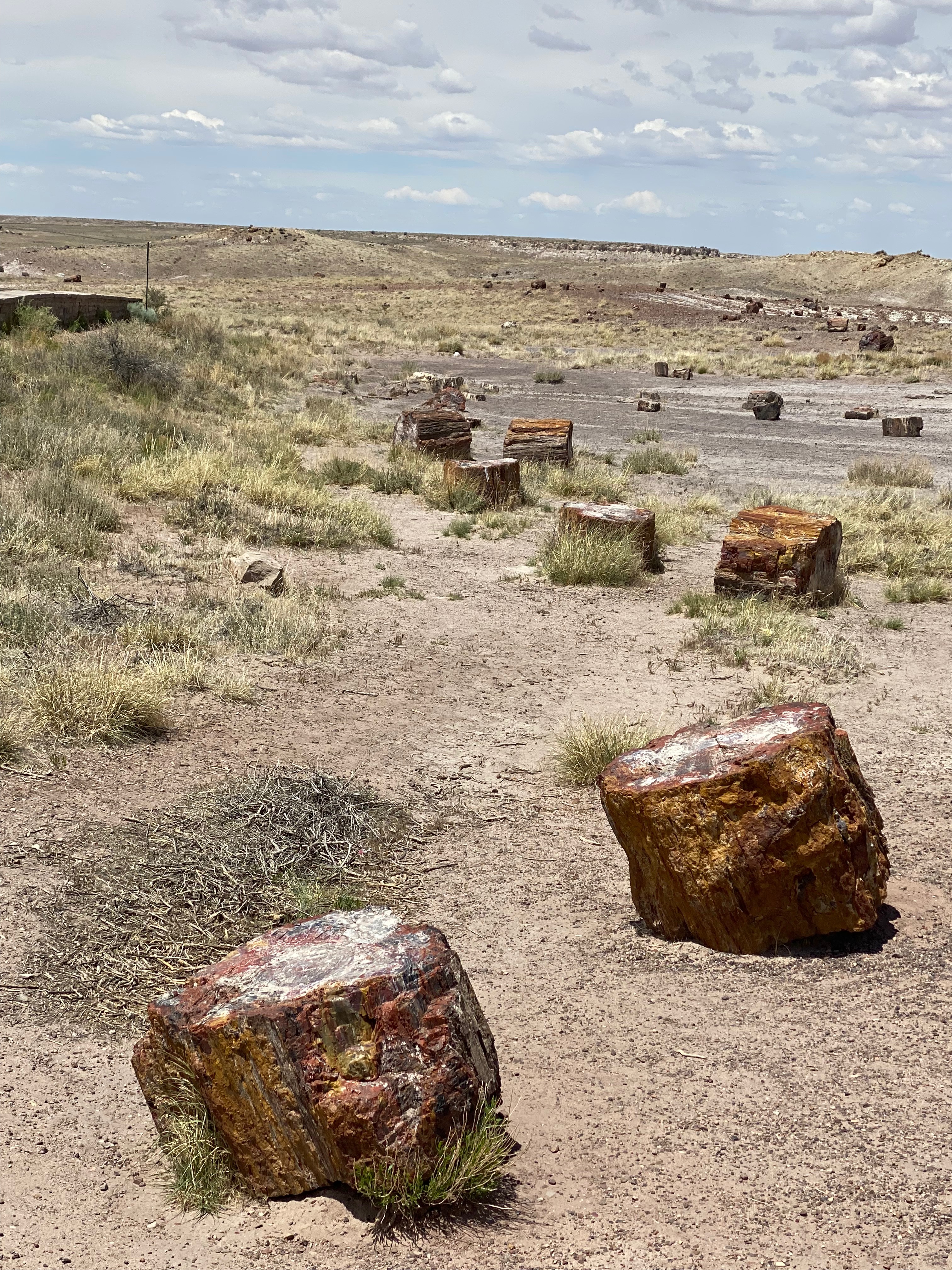
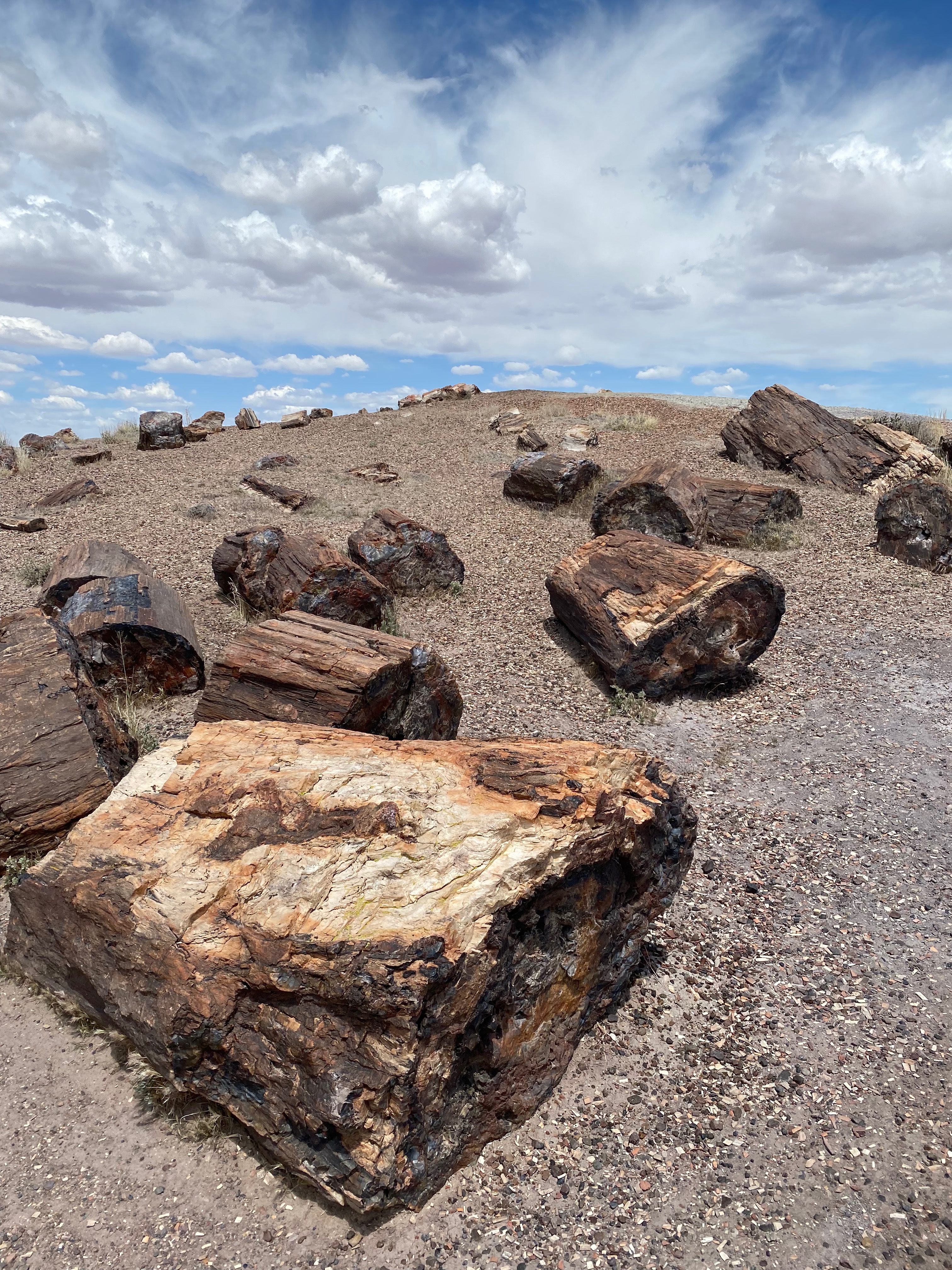
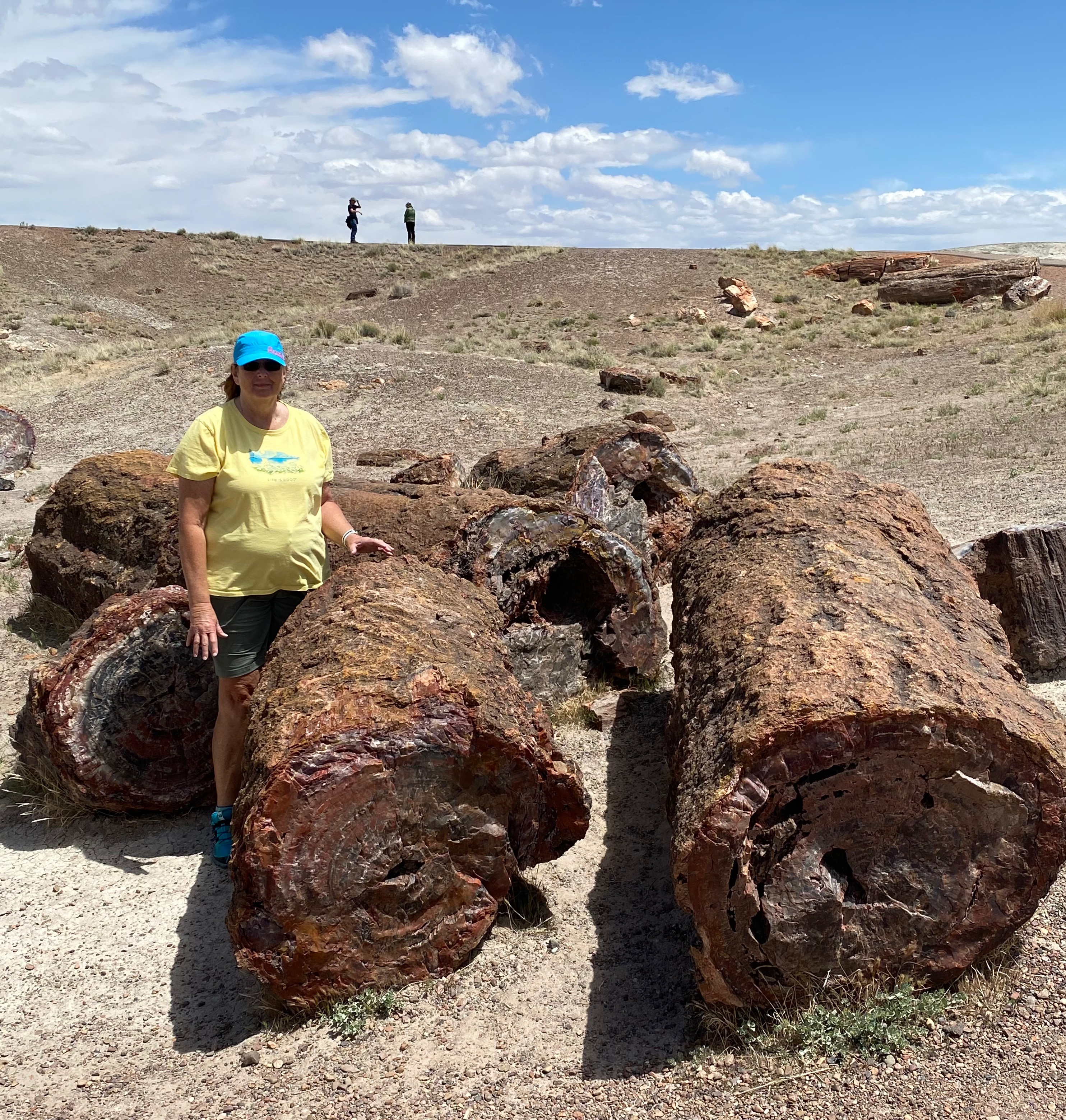
Our final stops were at Jasper Forest and Crystal Forest for up-close views of petrified wood.
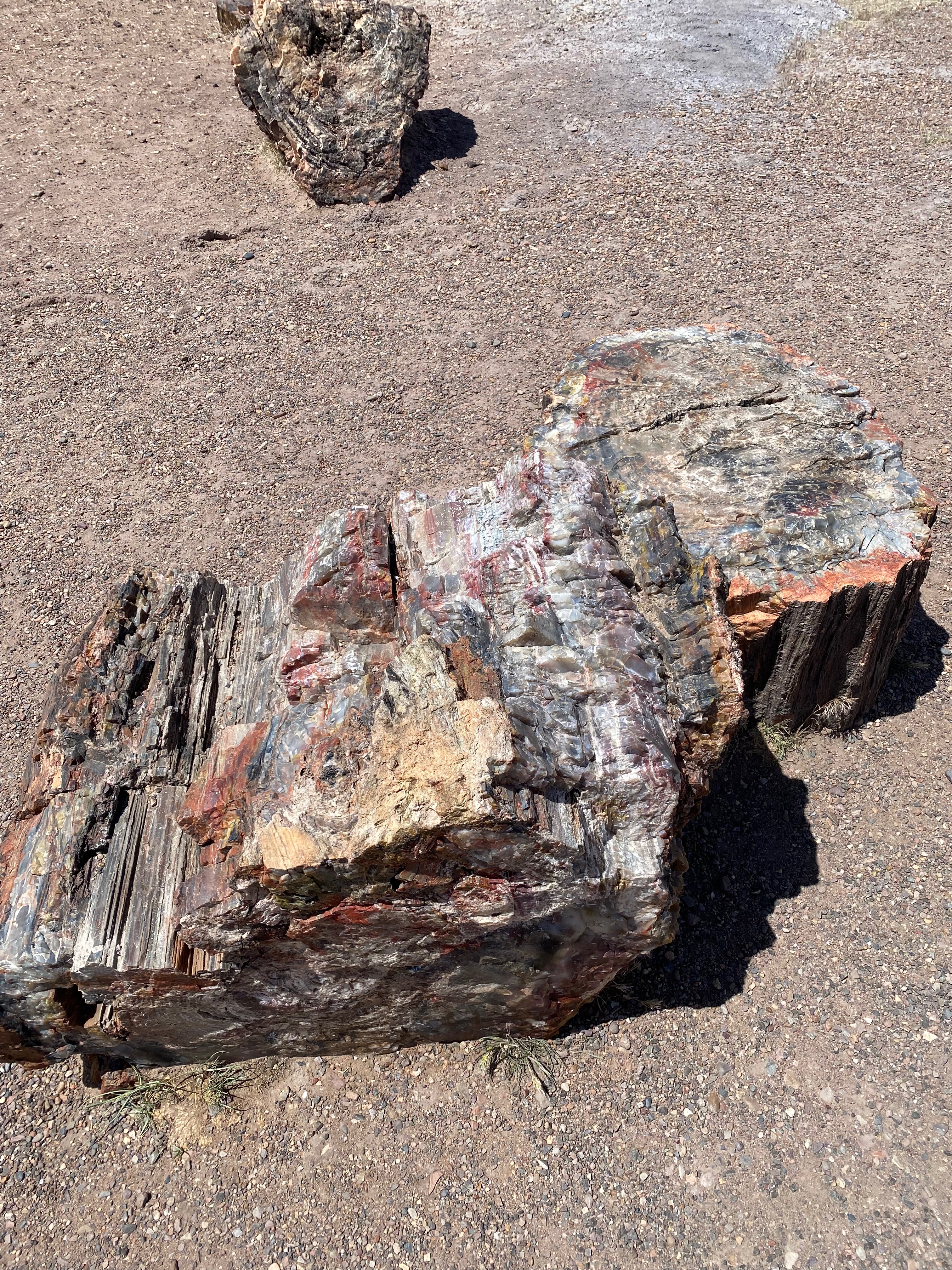
Petrified wood found in the park and the surrounding region is made up of almost solid quartz. Each piece is like a giant crystal, often sparkling in the sunlight as if covered by glitter. The rainbow of colors is produced by impurities in the quartz, such as iron, carbon, and manganese.
Over 200 million years ago, the logs washed into an ancient river system and were buried quick enough and deep enough by massive amounts of sediment and debris also carried in the water, that oxygen was cut off and decay slowed to a process that would now take centuries.
Minerals, including silica dissolved from volcanic ash, absorbed into the porous wood over hundreds and thousands of years crystallized within the cellular structure, replacing the organic material as it broke down over time. Sometimes crushing or decay left cracks in the logs. Here large jewel-like crystals of clear quartz, purple amethyst, yellow citrine, and smoky quartz formed.
nps.gov
We really wanted to continue on to the Long Logs and Agate House trailhead but it was getting late and that would make a long drive back to Gallup. Instead, we retraced our route back to the north entrance and headed for home. Tomorrow, we’re moving on.